This earthquake is a odd one. But it is rare that earthquakes happens in this are of Iceland. But it is not unheard of. As there have even been small earthquake swarm in this area few years ago (2 or 3 years ago I think). This area is part of Skagafjörður rift zone (pdf file) (also known as Skagafjörður Volcanic zone), but that is believed to be a failed rift zone that formed in about 1.7 million years ago. Just around when current eastern rift zone started to form in Iceland.

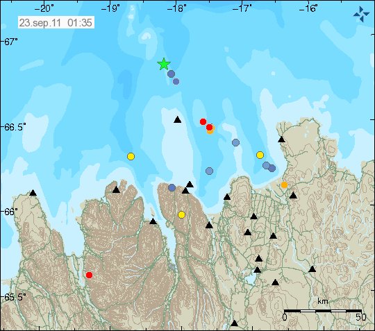
The ML2.7 earthquake is the left corner of this image, a bit far away from TFZ earthquake zone. Copyright of this image belongs to Icelandic Met Office.

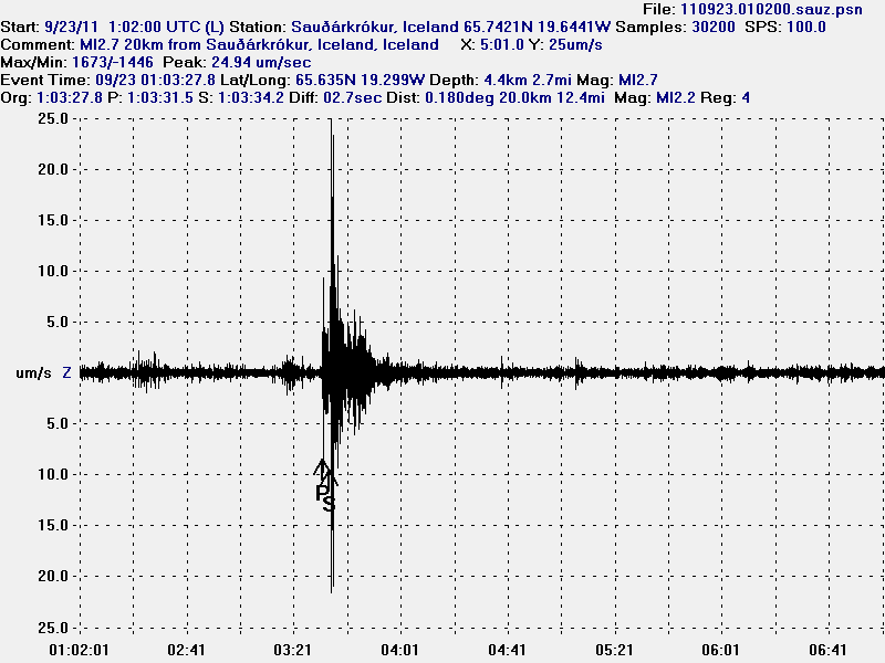
The ML2.7 earthquake seen from Sauðárkrókur geophone that I am going to run until December 2011. Sadly, no live gif image of it due to network issues. Please note that this geophone is in a noisy location. This picture is released under Creative Commons Licence. See licence web page for more details.

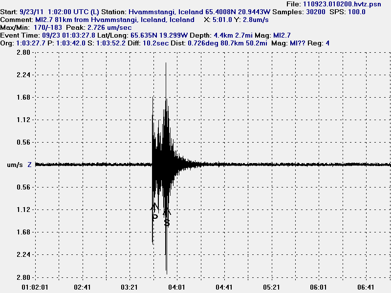
The ML2.7 seen on Hvammstangi geophone. Sadly, no live gif image of it due to network issues. This picture is released under Creative Commons Licence. See licence web page for more details.
I do not know if there are going to be more earthquakes in this area. But it seems that this earthquake has happened in a area with known faults from post-glacial times (they are on my geological map of Iceland). So for now all that can be done is to wait and see what happens next this this area. But I am not expecting anything special in terms of more earthquake activity. There are no active volcanoes in this area.

Good morning all.
Thank you for the new Blog Jon. I would have missed this quake and not realised it was particularly interesting.
We have ” frequent” (One or more per year but most not felt) quakes here in North West England mostly due to movements of faults. We have no Volcanoes. The last one caused some damage to our house. So just to stop anyone reading more into this I back up Jon’s comments that probably nothing more will happen it is just a release of strain from an ancient fault .
Having said that I really am surprised that being so near to the MAR the North West area does not have more quakes, even little ones.
The UK as a whole seems to have more quakes per annum than this area.
This quote from the BGS ‘s annual report for 2010
http://www.earthquakes.bgs.ac.uk/publications/annual_reports/2010_21st_annual_report.pdf
“There were 86 local earthquakes located
by the monitoring network during the year,
with 26 having magnitudes of 2.0 ML or
greater, and six having magnitudes of 3.0
ML or greater. Eleven events with a
magnitude of 2.0 ML or greater were
reported felt, together with a further six
smaller ones, bringing the total to
seventeen felt earthquakes in 2009. ”
Can anyone explain why this area in Iceland is so stable? How far from a spreading Zone rift does the crust become more likely to experience very few earthquakes?
The fact that this “Half” of Iceland is so inactive , to me is more fascinating than the activity in the south. Is the East coast as inactive?
If you look at this picture http://commons.wikimedia.org/wiki/File:Iceland_Mid-Atlantic_Ridge_Fig16.gif?uselang=de you can see a (rather rough and simplified) image of the Icelandic rift zones and the continental plate movement in the area. The plates are a bit like two conveyor belts placed in front of each other and transporting material (magma) in opposite directions to fill in the cap between them. By this movement the no (more) active parts of the rift zone or older rift zones are pushed to the west resp. to the east. Therefore, yes, the east of Iceland, e.g. Borgarfjördur eystri is as inactive as the west – most so the Westfjords – as far as we know (there are not a lot of seismometers there, a fact that is a point of concern to people living in Snaefellsnes like the geologist Haraldur Sigurdsson, because this is an exception being a volcanically active lateral zone).
Rather big quake at Katla…..
Katla 2.9 EQ showing on the Hekla-helicorder:
http://www.simnet.is/jonfr500/earthquake/tremoren.htm
Looks magmatic.. Already followed by some other quakes too..
Sander
Adjusted to 3.2
Upa!!! 😀
It seems to be a strong “Good morning!”
Hope not to be transfomed in a roar 😀
Anyhow may Jon will write about this new swarm
Friday
23.09.2011 06:57:21 63.693 -19.223 0.7 km 2.9 90.01 6.0 km NNE of Goðabunga
Hastily lowered and confirmed. IMO are watching closely it seems. Interestingly there is a definite spike at Haukadalur
http://hraun.vedur.is/ja/oroi/hau.gif
It took some time before the southern SILs showed the spike. I was about to ask why they weren’t showing.
Nice movement:
Friday
23.09.2011 07:00:06 63.666 -19.170 0.7 km 2.2 65.5 4.9 km NE of Goðabunga
Friday
23.09.2011 06:58:44 63.659 -19.163 2.7 km 1.5 90.03 4.8 km ENE of Goðabunga
Friday
23.09.2011 06:57:21 63.693 -19.223 0.7 km 2.9 90.01 6.0 km NNE of Goðabunga
Friday
23.09.2011 06:57:20 63.661 -19.168 1.1 km 3.2 90.05 4.7 km ENE of Goðabunga
I wonder if are to be trusted and to change.
Seem like a column admision.
Oh! It’s all change again. now 3.2 verified and a 2.9 almost at the same time
Our friends at the IMO are being kept busy this morning.
They get paid enough for it 😛
Strange for me to see a big spread of these 3+ EQ’S in the last few months, they seem to cover all the area’s for either a past eruption or a current hot spot under the ice. They are taking less time between the 3’s and swarm is clustered too. For me its all pointing to something for me.
They are actually reviewing the quake data, since the initial one was downgraded to 2,4, the depth was adjusted to 5km.
And its obviously not easy to interpret the data right. The initial quake at 6.57h was moved to 2.2 and a depth of 2.3km.
One more thing: The media report the observation of a farmer, who smelled sulphur, when he crossed the Múlaksvísl river near Vík this morning. This was before the quakes happened.
Can a volcano be religious? Katla seems to wake up for Friday prayers 🙂
Nope, Katla is not a muslim, she is a heathen. So she is waiting for the Särimner pig to be ready and the mead-kedd opened for the friday binging.
OT …Well I learn something new every day on here. i had to look up Särimner pig. Definitely not Muslim.
I love Friday nights though tonight I will be eating home made Lancashire Hot Pot. Made with Lamb not revitalised pig. Hot Pot is a local dish and my husband hates it, so whilst he is away…….
Not sure I will binge, just one glass of red wine suffices.
I was looking at a Swedish variety of apple today, katja. I need to grow hardy varieties up here.
Back to Katla. She is simmering quietly and there seems to be a harmonic tremor at Slysaalda
http://hraun.vedur.is/ja/oroi/sly.gif
I am still not sure about spotting these so forgive me if I am wrong.
I think Katla looks a bit spooky today…
Spooky? No, just low-hanging clouds. Nothing unusual.
But still a bit spooky, although I know they are just clouds 😉 Maybe it’s my female instinct 😉
New blog post is up about Katla volcano. 🙂
@ Diana
If you can get the maps from Stanfords, the geological shows the extreme east/west/north of iceland to have the oldest rocks at the surface, and with the ridge expansion are furthest from the seismically active zone -I hope(!)
The maps are c30″x40″ and are really detailed the more one looks! The tectonic is a cracker!
What I don’t understand is what happens to the EISZ to the south of Iceland. Google earth shows a sub-sea, east-west linear feature some 25 miles south of Surtsey; is this a fault/transform or my imagination from bathymetry? Also what happens to the WISZ north of Thingvellir, som maps show a connection to EISZ around Askja, but where are the faults? OK you don’t need faults to connect, but there seems little seismic activity -at the moment.
What is special about the year 871 as a lava datum?
Friday activity: ‘cos Carl’s away and he has programmed ’em to be naughty!!
The year 871 is the year of the so-called tephra Landnám (=settlement). It is implied that around this year (viking) settlement started in Iceland and at the same time there was a more or less simultanous volcanic eruption in Torfajökull and Vatnaöldur (Bárdarbunga) systems. This tephra layer has special caracteristics, like the one from around 1480 (Torfajökull / Veidivötn), it is black (Bárdarbunga – basalt) and pink/beige (Torfajökull – rhyolite) mixted up. Being rather easily recognizable it is used a lot in tephracronology.
Takk!!
Thank you Alan. I will try to budget to get hold of them. At the moment any spare money is being used to save up for a wheel barrow and other essentials for my new allotment. The maps sound extremely interesting and I would dearly love to get them but….. Like most of us these days, finances are tight and I have to prioritise. 🙂