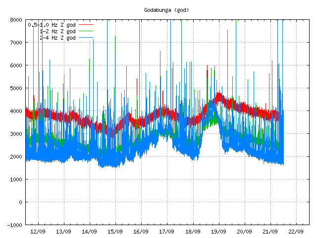
This is a special blog post about the volcano El Hierro in the Canary Islands. The resons for this blog posts are those that this activity is interesting and there is not a lot happening at the moment in Iceland due to bad weather (nothing gets recorded in this bad weather).
Currently El Hierro volcano is a phase that I personally call a magma intrusion phase (I have no other word for it). But that means that magma is currently coming from a depth, that is more then 20 km below the volcano and up the crust directly below the volcano. It is impossible to know how long this phase is going to last. As a example this phase for Eyjafjallajökull volcano lasted for good part of 17 years (with some breaks). When the pressure is high enough in the sill that is now forming in El Hierro the magma is going to break up the surface.
This pattern can clearly be seen on this image here.
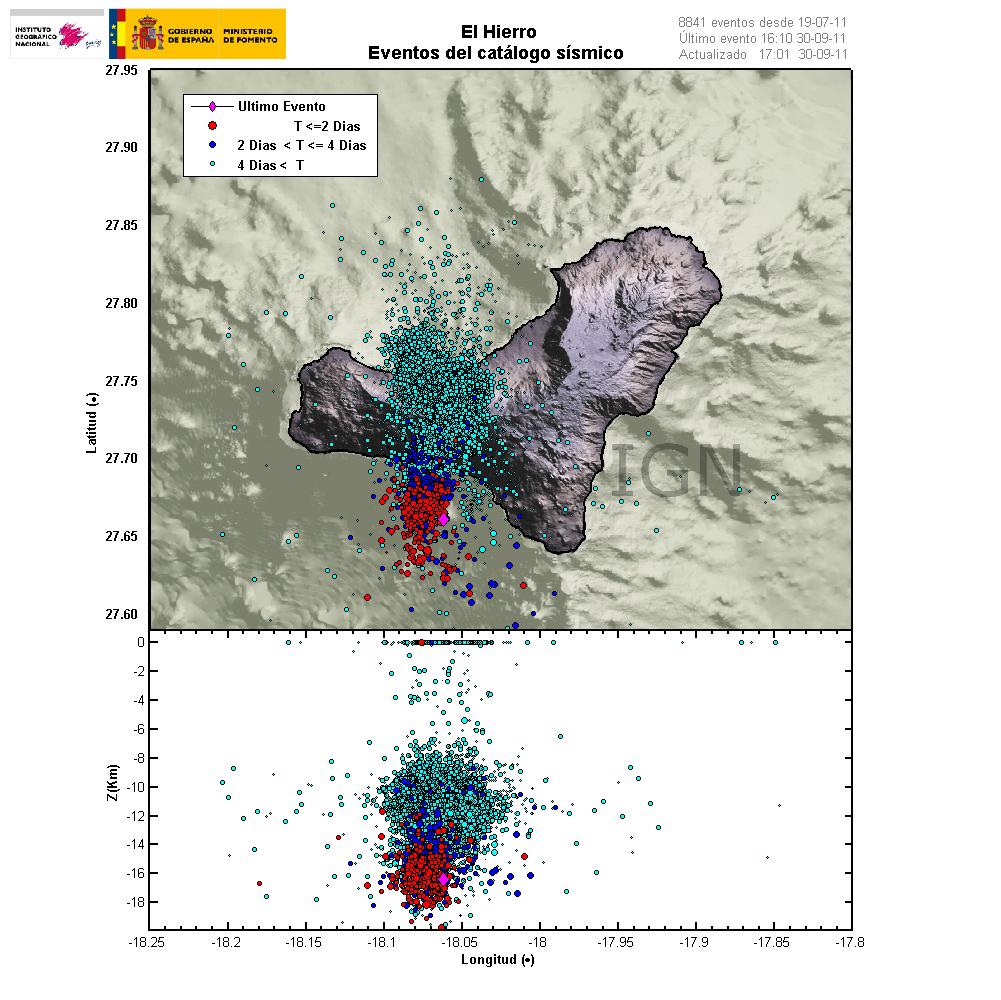
The magma is flowing up into the volcano at around 30 degree angle from the depth of more then 20 km. When a new magma injection starts, a new earthquake swarm starts in El Hierro. This magma injections are different in size and length. But as more magma collects into the bedrock in El Hierro the stronger earthquakes are going to take place. But this increases the pressure on the rock and inside the magma chamber that is now forming and can clearly been seen with the earthquake pattern. Copyright of this picture belongs to Instituto Geográfico Nacional.
I did see a picture that was made on Eruptions blog that did show his clearly, both the feeder channel of the magma and the magma chamber that is currently in the making. It seems that magma inflow into the new magma chamber or the sill in El Hierro is stable at the moment. But I base that view on the constant earthquakes that are currently taking place. But this magma inflow seems to have been stable since 16 July, 2011 when the magma started to push upwards into El Hierro.
Earthquakes that signal new inflow of magma do not need to be strong in size. But they are deep, with the most depth around 20 km. But the crust in this area is around 10 to 26 km thick. As this is a ocean crust in this area. But the Canary islands are the thickest crustal part in the area. But it is also important to notice that the magma chamber or the sill is expanding in all directions, not just upwards. That in it self is also going to create deep earthquakes. But those earthquakes should remain a bit outside the main area of the deep earthquakes that are currently taking place in the area.
I am expecting a lot more earthquake activity when or if El Hierro starts erupting. But when that might happen impossible to know for the moment. The only thing that can be done is too wait and see what happens.
Update 1: Here is the earthquake activity for today (30 September, 2011).
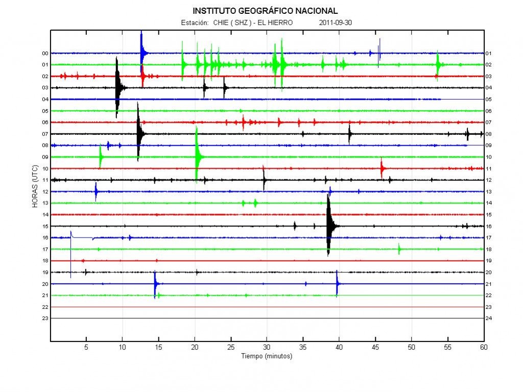
Earthquake activity of today (30 September, 2011). There is less earthquake activity today. This happens when magma flows into a volcano. This did also happen with Eyjafjallajökull volcano in the year 2010. If anyone has the direct link too this plot, please leave it in the comments. Thanks. Copyright of this picture belongs to Instituto Geográfico Nacional.
Update 2: Links too El Hierro information can be found here.
Update 3: The Spanish news channel Canal 24 can be found here and it is live.
Update 4: Here is a news in english about the evacuation of El Hierro. It is from 28 September, 2011. Evacuation of El Hierro begins as fears of volcanic eruption grow. Thanks to Dr. John v. Kampen that did send this to me with a email.
Note: There are new pictures of Eyjafjallajökull volcano, Fimmvörðuháls craters here. They show the difference from the year 2010 and in the year 2011. The text is in Icelandic.
Also. Please support my effort so I can buy two new geophones and add them to my monitoring network in Iceland. Thanks! 🙂
Blog post has been updated 30 September, 2011 at 22:12 UTC.
Blog post has been updated 30 September, 2011 at 22:25 UTC.
Blog post has been updated 30 September, 2011 at 23:08 UTC.
Blog post has been updated 1 October, 2011 at 14:48 UTC.

