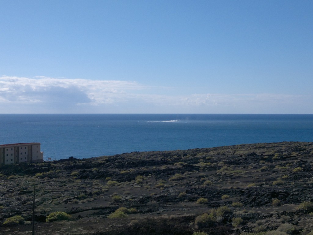
Short update on Bárðarbunga volcano at 02:12 UTC

This is a short update on Bárðarbunga volcano activity.

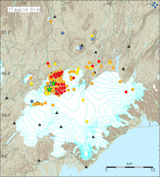
Earthquake activity continues in Bárðarbunga volcano and shows no signs of slowing down. Two swarms have appeared in Bárðarbunga volcano system. One is at location called Kistufell, while the second one is at the south-east part of the Bárðarbunga volcano. Increase in earthquake activity in south-east part of Bárðarbunga volcano seems to increase harmonic tremor. I am not sure why that is. As of now (when this is written) no eruption has been confirmed in Bárðarbunga volcano, the volcano is under glacier so confirmation is difficult at best.

140817_0140
Earthquake activity in Bárðarbunga volcano. The two groups of earthquake swarms are visible on this map. Copyright of this image belongs to Icelandic Met Office.

140817_0140_trace
Earthquake activity has been dense as can be seen here. Copyright of this image belongs to Icelandic Met Office.

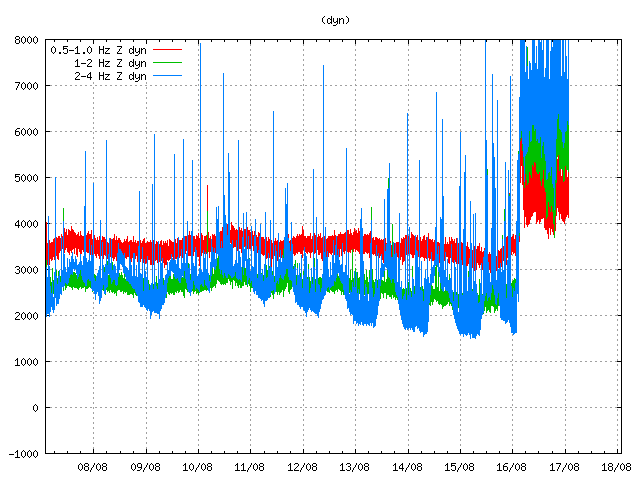
dyn.svd.17.08.2014.at.01.58.utc
Harmonic tremor remains high on the Dyngjuháls SIL station. Why that is not clear at the moment. Copyright of this image belongs to Icelandic Met Office.

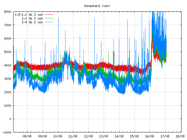
von.svd.17.08.2014.at.01.58.utc
Harmonic tremor remains high at Vonarskarð SIL station. It has dropped little during the day, but it remains constant at current time. Copyright of this image belongs to Icelandic Met Office.

So far no major eruption has started in Bárðarbunga volcano. That might change without warning as this activity continues. There is a risk of large earthquakes taking place before such eruption. Since the crust in this part of Iceland is thick (up to 40 km thick) and last eruption in Bárðarbunga volcano took place in the year 1794. The eruption in the year 1910 took place in a volcano named Hamarinn and is south-west of Bárðarbunga volcano. Fissure eruptions are also a feature that Bárðarbunga volcano has, if this activity is going to result in such eruption is something that is impossible to know at current time.

Current status changes fast. I post new information on this activity as needed and as things get more clearer on what is happening.

Short update Bárðarbunga volcano at 17:52 UTC

This is a short update on current status on Bárðarbunga volcano.

Uncertainty level has been declared on Bárðarbunga volcano and it status has been raised to yellow. There are fluxuation in earthquake activity, this is normal since earthquake activity in volcanoes is never close to constant in this type of situations. There is also a storm taking place in the area at the moment, that is lowering what is detected by the SIL stations that are close to Bárðarbunga volcano.
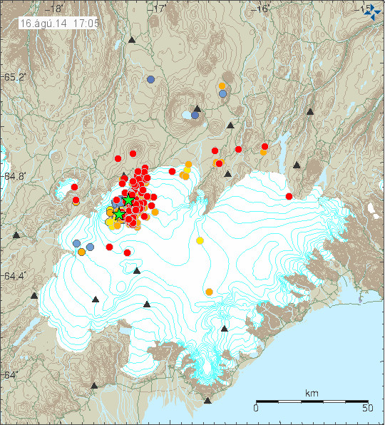
140816_1705
The earthquake activity in Bárðarbunga volcano. Green stars show earthquake larger than magnitude 3,0. Copyright of this image belongs to Icelandic Meteorological Office.

Largest earthquakes recorded so far have the magnitude of 3,1 and 3,5. There is a chance that more magnitude 3,0 have taken place but have not been reviewed yet by geologist at Icelandic Meteorological Office due the amount of earthquakes taking place at the moment.

140816_1710_trace
As can be seen here the earthquake swarm is dense. Copyright of this image belongs to Icelandic Meteorological Office.
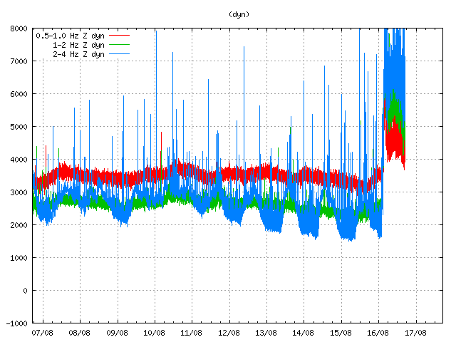
dyn.svd.16.08.2014.17.12.utc
Harmonic tremor in Dyngjuháls SIL station. It has been dropping in the past few hours. Copyright of this image belongs to Icelandic Meteorological Office.
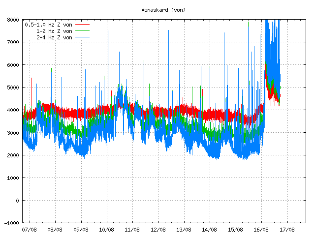
von.svd.16.08.2014.17.12.utc
Harmonic tremor in Vonarskarð SIL station. The drop in harmonic tremor also appears clearly here. Copyright of this image belongs to Icelandic Meteorological Office.
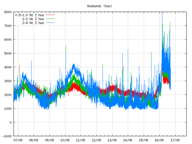
hus.svd.16.08.2014.17.13.utc
Harmonic tremor in Húsbóndi SIL station. The drop in harmonic tremor also appears here clearly. Copyright of this image belongs to Icelandic Meteorological Office.

In the past few hours the harmonic tremors around Bárðarbunga volcano have been dropping slowly. The drop in harmonic tremor has not been followed by drop in earthquake activity. At least that is not the case when this is written. This means that the magma that is on the move there still has not yet found a pathway to the surface, even if some small part of it has done so in possibly in one or two eruptions vents under the thick glacier. If the harmonic tremor stops completely without the earthquake activity stopping it means that magma is still on the move there and it might look for a new pathway to the surface. When and where that might happen is impossible to know at current time, but once the magma has clear path to the surface, even if it is under a glacier all earthquake activity is going to stop (for most part).

I am going to post more information when more details are available.

Unconfirmed eruption in Bárðarbunga volcano

This information is going to get outdated quickly as more information is collected on this activity.

During all last week (Week 33) there has been a minor earthquake swarm in Bárðarbunga volcano. No other activity followed this minor earthquake activity during the week until last night (16-August-2014). During the night (around 02:20 UTC) a harmonic tremor started to appear on SIL stations around Bárðarbunga volcano. Following the appearance of the harmonic tremor earthquake activity started around 03:30 UTC. Largest earthquakes in this swarm have magnitude around 3,0 so far. Depth is around 5 to 10 km. During the night the earthquake swarm moved around in the volcano and is now more east then it first started. According to Rúv news the glacier around this part of Vatnajökull glacier is around 700 meters thick, so it going to take a major eruption to break the ice. This however also means that when a glacier flood starts in this area there is a high risk that is going to be large.

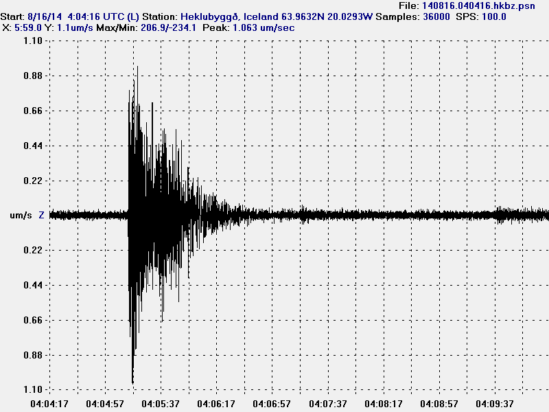
140816.040416.hkbz.psn
The largest earthquake that I did record during the night. This image is released under CC Licence. Please see CC Licence page for more details.

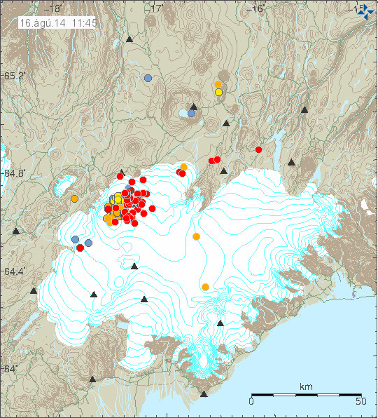
140816_1145
The earthquake swarm in Bárðarbunga volcano at 11:45 UTC. Copyright of this image belongs to Icelandic Meteorological Office.

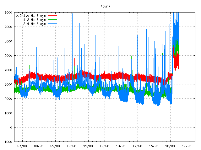
dyn.svd.16.08.2014.12.01.utc
Harmonic tremor on Dyngjuháls SIL station. This SIL stations is closest to the area of activity in Bárðarbunga volcano. Copyright of this image belongs to Icelandic Meteorological Office.

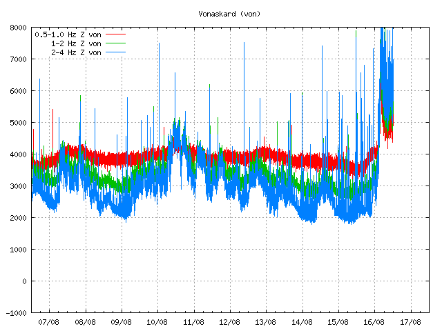
von.svd.16.08.2014.12.02.utc
Harmonic tremor on Vonaskarð SIL station. This is one of the SIL station that is closest to the area of activity in Bárðarbunga volcano. Copyright of this image belongs to Icelandic Meteorological Office.

Currently the activity in Bárðabunga volcano is not stable, it does fluctuate a little. Besides this minor fluctuation it seems stable. Based on harmonic tremor signal and its range this does not appear to be a large eruption so far. That might change without warning. I do however expect larger earthquakes before any major volcano eruption in Bárðarbunga volcano. What seems to have happened is that a dike intrusion got to the surface and started this eruption, even if it is just small one at current time.

I am going to post update soon as more information gets available. This situation is going to change quickly and without much warning.

Fossil of a tree found in road tunnel work

A long time a volcano erupted in Iceland. This volcano spewed out basalt lava field (Hawaii style). This lava did flow over a forest that was nearby and killing all the trees in it. Few weeks ago and several million years later and few kilometres down the remains of this forest was found. Since one of the tree did fossilize in the lava. As the tree was engulfed in the lava it did turn to charcoal that was later removed by water and leaving the empty imprint of the tree in the bedrock.

The remains of the tree are now clearly visible in the road construction tunnel. The hole after the tree is full of water and part of it has been removed by the tunnel digging. Picture of it along with news can be found in the link below.

Fossil of a tree found in tunnel construction

Far eftir trjábol í Vaðlaheiðargöngum (Rúv.is, Icelandic, Picture)

Harmonic tremor event in Hamarinn volcano

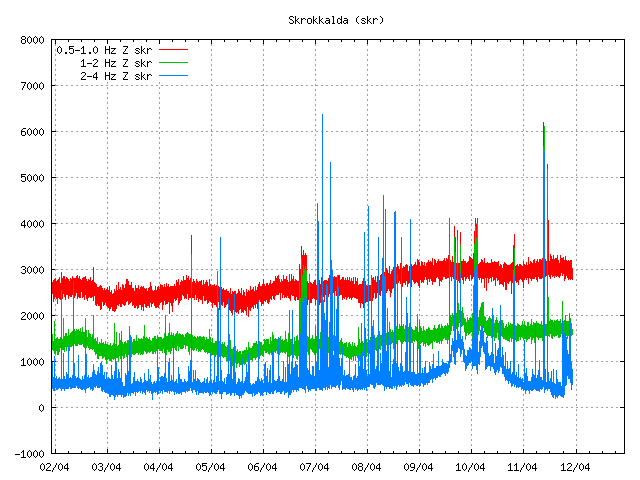
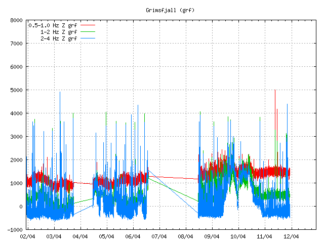
Tonight there was an small harmonic tremor event in Hamarinn volcano (Loki-Fögrufjöll, Bárðarbunga). This event was not big. But did appear on the Skrokkalda SIL station and on Grímsfjall SIL station. The pattern that is now appearing is the same one that did appear in July 2011 in the minor eruption in Hamarinn volcano. But that event took place week after Katla volcano minor eruption.


The harmonic tremor pulse on Skrokkalda SIL station. This is most likey from Hamarinn volcano. Copyright of this picture belongs to Iceland Meteorological Office.


The harmonic tremor pulse on Grímsfjall SIL station. This is most likey from Hamarinn volcano. Copyright of this picture belongs to Iceland Meteorological Office.

What gives clues that this Hamarinn volcano is that few days ago it had minor earthquake activity. But this area does not seem to need a lot of earthquake activity before a minor eruption takes place. Why that is I have no idea at present time.

I am going to update this blog post as event progress.

Eruption in Etna volcano

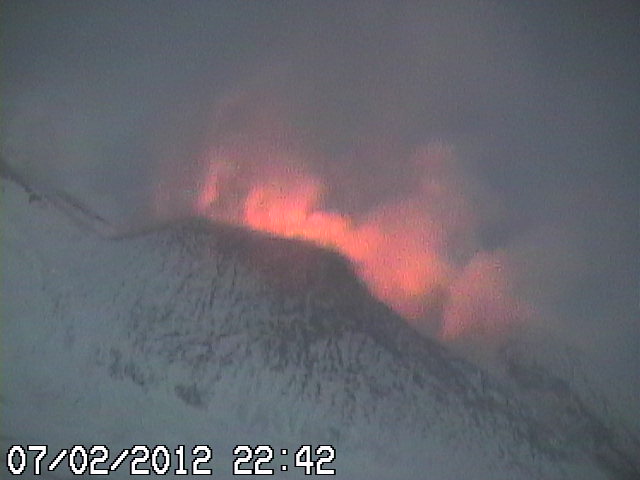
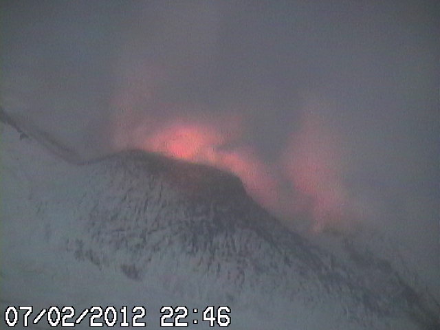
Tonight around 21:00 UTC an eruption started in Etna volcano. From the views of the web cameras that watch Etna volcano. This eruption seems to be rather small. I do not expect it to get any bigger.


Web camera picture of the eruption in Etna volcano. Copyright of this picture belongs to Radio Studio 7, Italy.


Web camera picture of the eruption in Etna volcano. Copyright of this picture belongs to Radio Studio 7, Italy.

Eruptions in Etna volcano are frequent, so this event is no surprise that it is currently taking place. Live web camera feed can be found here.

New earthquake swarm in El Hierro volcano

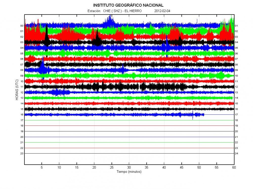
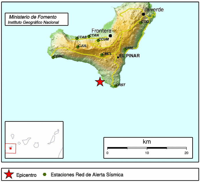
During the past few days there has been an earthquake swarm in El Hierro volcano in Canary Islands. Following this earthquake swarm there has been some increase in eruption activity. Resulting in some material reaching the surface of the ocean. The reason for this activity is that new magma is being injected into El Hierro volcano from depth. This magma is pushing the magma that is already there closer to the surface, creating dikes and sills in the rock along the way. This also increases the eruption in already open vents.


The harmonic tremor activity in El Hierro today. Copyright of this picture belongs to IGN.

The largest earthquakes in this swarm have had the size ML2.7 and ML3.4. They have been taking place at the depth of 12 to 15 km, based on early data from IGN.


The ML3.4 earthquake in El Hierro volcano that did happen during the night. Copyright of this picture belongs to IGN.

I am expecting this activity to continue for some time now. As it seems that more magma is coming up from depth. How long that progress is going to last is impossible to know. When it stops, it does so and only then the activity in El Hierro volcano is going to stop.

Random minor eruptions in El Hierro volcano

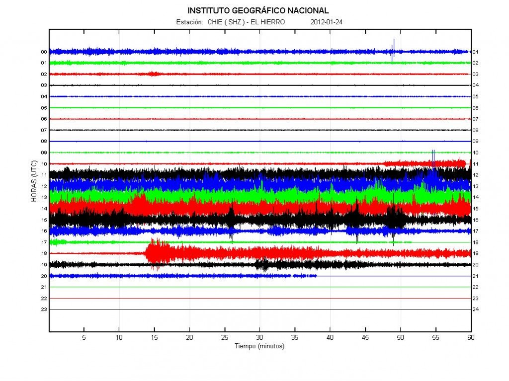
It seems that the main eruption is over in El Hierro volcano, for now anyway. For the moment there are minor eruptions taking place in El Hierro volcano. This minor eruptions happen at random times and between them nothing is happening. This is clear by the harmonic tremor data from the sensors that are on the El Hierro Island it self.

This type of behavior is not a big surprise. I fully expected this to happen when this eruption started. The main risk now is that new vents might open up in new places without any warning at all. This seems to have already have happened to some extend. As I have been getting unconfirmed reports that new vents have opened up in this new eruption episodes that have only lasted for few hours. So far this new vents have not opened up on land. But this pattern of eruption increases the risk of that significantly. As magma appears to looking for a way out. But does not find the way out that last, or does not have the pressure to maintain an new vent open for long period of time. The vent that erupted the longest is estimated to be around 125 meter below the surface. So it has been guessed that its above 750 meters high (this is unconfirmed).


Harmonic tremor and lows in El Hierro volcano today. Copyright of this picture belongs to IGN (Instituto Geográfico Nacional).


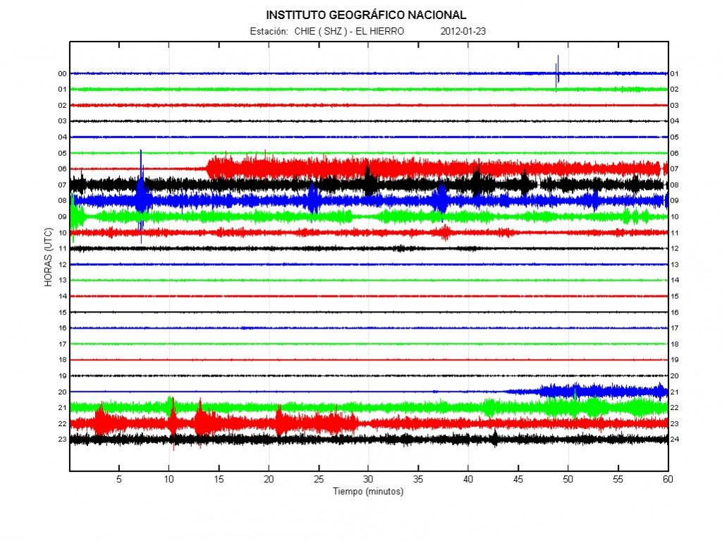
The harmonic tremor activity yesterday (23.01.2012). As can be seen the activity starts, then stops again. This means that new vents are opening up again. Or that the older vents are opening up and starting to erupt again before stopping. Copyright of this picture belongs to IGN (Instituto Geográfico Nacional).


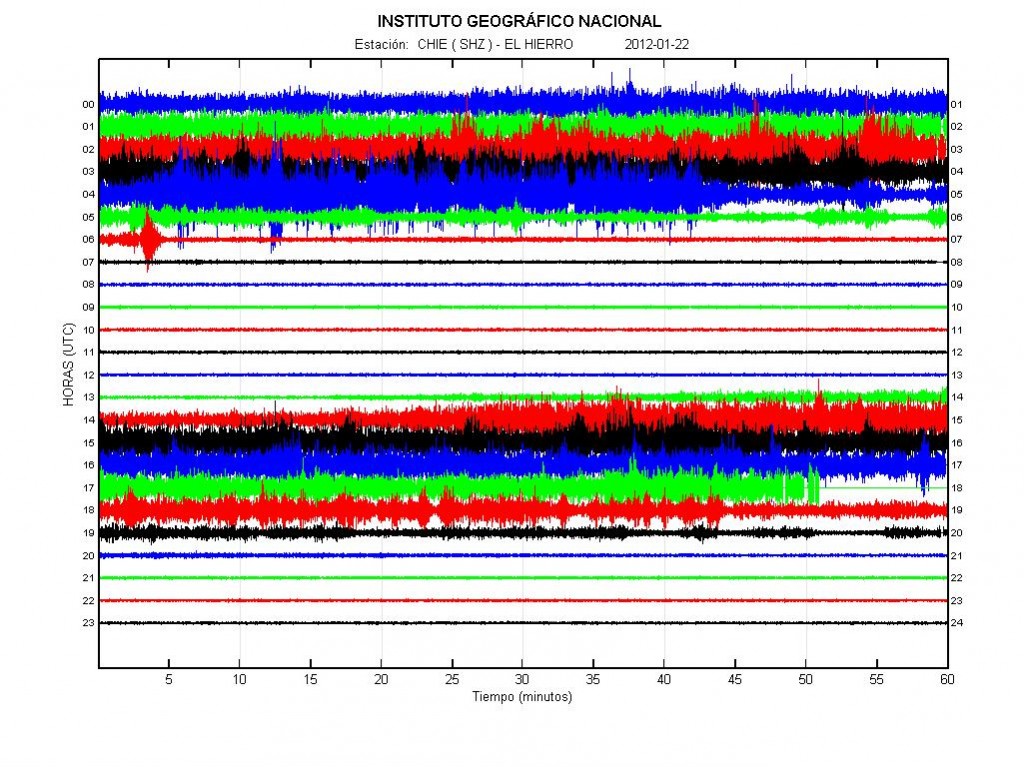
The activity on 22.01.2012. This as same in the past two days. Activity start before stopping again. Copyright of this picture belongs to IGN (Instituto Geográfico Nacional).

As for what happens in El Hierro volcano in the next weeks to months. It is close to impossible to know for sure what happens. As what happens next depends on the magma flowing into El Hierro volcano. It seems that this eruption is not over. Even if it continues with short breaks between eruption events.


Picture of the activity today (24.01.2012). I got this picture by email. Click on the picture for full size. Copyright holder of this picture wish to remain anonymous. Used with permission.

This picture clearly shows the active area today. There is also an highly active hydro-thermal area where the eruption took place, or have been taking place. There is also some chance of dike intrusions in this area creating new hydro-thermal areas. But dike intrusions can take place without any earthquake activity. If there is an earthquake activity, it does not need to have high amount of earthquake activity. Harmonic tremor can and often increases if an dike intrusion is taking place.