Strong Sulfur dioxide smell from Grænavatn lake and increased activity in hot springs in Krýsuvík

This is a short update.

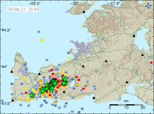
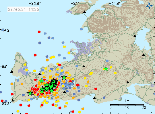
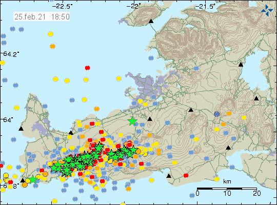
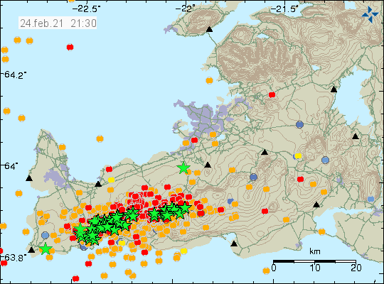
Reports from yesterday (22-October-2020) on Stöð 2 (Channel 2) report that there is a strong smell of Sulfur dioxide from Grænavatn lake. Some increase in one hots spring in Krýsuvík volcano has been reported. That might because of change in water pathways in the crust because of the earthquake on 20-October-2020. New cracks have also formed and the earthquake caused small landslides on the coastline closest to the earthquake. The cracks in the ground are dangerous and people should not go to the coastline in this area of Iceland now. A new earthquake can happen at any time without warning.

Automatic GPS data is suggesting that in Krýsuvík volcano there has been a fast inflation of magma. I don’t think this is displacement because of the earthquake based on other nearby GPS stations.

Icelandic News

Brún Krýsuvíkurbjargs sprungin og varasöm eftir jarðskjálftana (Stöð 2/Vísir.is, pictures, video)

Earthquake activity slowly reducing since Mw5,6 earthquake yesterday (20-October-2020)

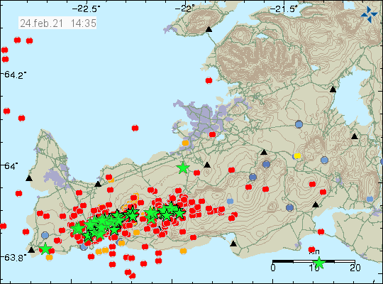
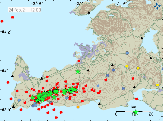
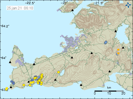
Since yesterday (20-October-2020) the earthquake activity on the Reykjanes peninsula in the volcano Reykjanes or Krýsuvík volcano has been slowly getting down after the Mw5,6 earthquake. There have been at the writing of this article 30 earthquakes with magnitude that are larger than Mw3,0 in this area, some of those earthquakes have been felt in nearby populated areas.


The earthquake activity slightly more than 1 day later on the Reykjanes peninsula. Copyright of this image belongs to Icelandic Met Office.

At the writing of this article the number of detected earthquakes in this swarm is getting close to 2000 earthquakes. The risk of stronger earthquake both west and east of the Mw5,6 earthquake that took place yesterday. Strongest possible earthquake in this part of Iceland can reach magnitude Mw6,5 to Mw6,7 depending on location and that is only east of current earthquake activity in Brennisteinsfjöll volcano area.

According to the news, the first injury because of the Mw5,6 earthquake has been reported along with damage to a viewing place in the mountain close the location of the earthquake yesterday.

Rotaðist þegar jörðin kippt­ist und­an (mbl.is, pictures, Icelandic)

I am going to post updates soon as possible if anything more happens in this activity on Reykjanes peninsula. At the writing of this article there has not been any sign of magma movement or any sign that an eruption has taken place in this area.

Reports of gas according to Icelandic Met Office close to Grænavatn lake after the earthquake yesterday (20-October-2020)

It was reported by Icelandic Met Office at 22:20 UTC that people had been noticing more gas smell close to a small lake called Grænavatn. This suggest that magma might be on the move in the crust. It is currently difficult to be sure at writing of this article. This would be inside the volcano of Reykjanes.


Grænavatn lake. Copyright of this image belongs to Google Earth / Google.


Earthquake activity on the Reykjanes peninsula at midnight 21-October-2020. Copyright of this image belongs to Icelandic Met Office.

At the writing of this article there has not been any change in harmonic tremor on nearby SIL stations. If magma is about to move that is possibly going to happen without much warning but this difficult to know for sure at the writing of this article.

Earthquake on the Reykjanes peninsula – update at 18:55 UTC

This is the last update for today (20-October-2020) on this earthquake unless something major happens.

This earthquake magnitude has been confirmed at Mw5,6 mostly. It might change in next few weeks as the data is better reviewed. More then 400 earthquakes have been felt after the large earthquake and at the writing of this article largest aftershock has automatic magnitude of Mw4,1.


Location of the largest earthquake. Copyright of this image belongs to Icelandic Met Office.

Currently the main earthquake activity is moving west or south-west and that might trigger more large earthquakes in next 24 – 48 hours. Minor damage has been reported following the largest earthquake. Items falling off shelves and in stores and homes, cracks forming in walls, floors and outside in few areas. Rock slides have also been reported and closed one road on Reykjanes peninsula close to Grindavík.

News reports with pictures and videos if the main earthquakes and the damage it created

Stór sprunga í gólfi flug­skóla Keil­is (mbl.is, picture)
Skjálftinn í myndum (frettabladid.is, pictures, videos)

Added: Vörur köstuðust til og maður í górillubúningi hljóp um (Rúv.is, Video, Icelandic)


Earthquake activity on Reykjanes peninsula


The earthquake activity at 18:45 UTC on Reykjanes peninsula. Copyright of this image belongs to Icelandic Met Office.

There have not been any clear sign or any sign of magma movement in this earthquake activity at the writing of this article. It is unclear of that is going to change since the magma that has been flowing into the crust in Reykjanes volcano simply might not be pressured enough to erupt for a while longer.

Donations

Please remember to support my work with donations. I’ve been broke in October and everything helps. Thanks for the support. 🙂

Article updated at 20:06 UTC.

Earthquake on Reykjanes peninsula – update at 14:26 UTC

This is a short update on the earthquake activity on Reykjanes peninsula. Early magnitude calculation give this earthquake a magnitude of Mw5,6 but this number might change. Large aftershock activity is expected during the next 24 hours.


The earthquake activity on Reykjanes peninsula. Copyright of this image belongs to Icelandic Met Office.

A video recording of the earthquake from Alþingi shows the effect of this earthquake.

I’ll post more details later today when I have them.

Earthquake activity increases in Reykjanes and Krýsuvík volcanoes

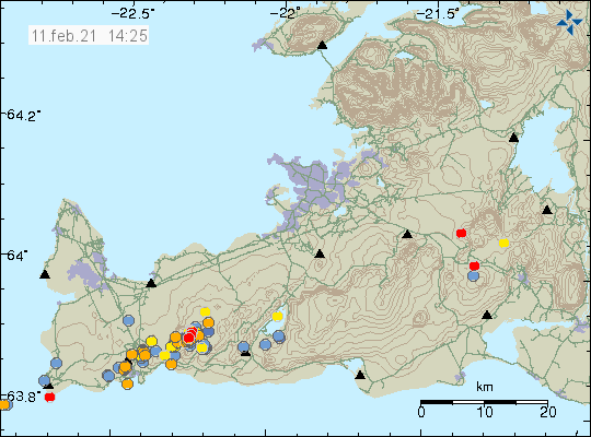
Since 15-October-2020 there has been a slow increase in small earthquakes in Reykjanes and Krýsuvík volcanoes. This earthquake activity has been followed by changes in GPS location. The GPS data can be viewed at Reykjanes CGPS website. All the earthquakes at the writing of this article are small in magnitude. Last few weeks have been quiet in Reykjanes and Krýsuvík volcanoes and that is normal for this type of volcanoes.


The earthquake activity in the volcanoes Reykjanes and Krýsuvík. Copyright of this image belongs to Icelandic Met Office.

It is not possible to know how this is going to develop since what happens depends on the amount of magma moving and what that does. It is unclear if this is inflation or deflation event taking place. It might take few days to see what that is.

Grímsfjall volcano moved to yellow warning for air traffic

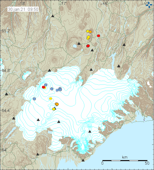
Today (30-September-2020) Icelandic Met Office moved Grímsfjall volcano to a yellow warning status for air traffic. This strongly suggests that Icelandic Met Office thinks that an eruption might happen in next few days to weeks. It is expected that an eruption might happen if a glacier flood happens from Grímsvötn glacier lake that is inside Grímsfjall volcano caldera.


Current status of Grímsfjöll volcano is yellow. Copyright of this image belongs to Icelandic Met Office.

It is difficult to know if this is going to be a large or small eruption until it happens. Best thing to do right now is to keep monitoring Grímsfjall volcano activity to see if anything is going on. Currently everything is quiet.

Donations

Please remember to support my work. It helps me to pay for things like hard drives, food and other necessary things. Thanks for the support. 🙂

Increasing hydrothermal activity and ground heat in Bárðarbunga volcano

It was reported in the news in Iceland few days ago that ground heat and hydrothermal activity in Bárðarbunga volcano is increasing and has been doing so for at least few months. Steam has been observed according to the news coming from one of the cauldron that is now in the rim of Bárðarbunga volcano caldera rim. It has also been observed that few areas that have been active for a long time are now expanding in size.

Current risk is large glacier floods from Bárðarbunga volcano as the heat is melting large amounts of glacier in this area and possible damage and danger from those glacier floods. This increase in ground heat suggests that magma is slowly pushing its way up in the caldera rim of Bárðarbunga volcano. It is not possible to know if this is the case in the caldera since that is full of glacier that is ~600 meters thick at the most deepest end. If it wasn’t for Vatnajökull glacier and the pressure it puts in Bárðarbunga volcano there would already be an eruption going on there today. It is only when the magma gets above the pressure of the glacier an eruption can happen and in the eruption of 2014 and 2015 that didn’t happen as the magma found a easier way out by forming a dyke that travelled ~46 km away from the main volcano before an eruption started. This option for the magma might be closed now since dyke like the that formed in 2014 and 2015 eruption normally only erupt once after the magma flow stops.

Icelandic News

Jarðhiti í Bárðarbungu sífellt að aukast (Rúv.is)

Donations

Please remember to support my work with donations. Thanks for the support. 🙂

Hard drive problems

I am currently dealing with failing hard drives in my main computer and that makes it really slow. This might slow down my response until Friday when I finally get replacement hard drives. I also had hard drive problems with my main earthquake computer but that issue has been resolved with new hard drives.

Strong earthquake in Bárðarbunga volcano

Today (27-September-2020) at 00:06 UTC an earthquake with magnitude of Mw4,8 took place in Bárðarbunga volcano. This earthquake is the strongest earthquake in Bárðarbunga volcano since April 2020 according to Icelandic Met Office.


Earthquake activity in Bárðarbunga volcano. Copyright of this image belongs to Icelandic Met Office. Used with permission.

This earthquake activity suggests that magma might be pushing up at this location but no data for now confirms this. This might just be the caldera pushing up after it dropped 60 meters in 2014 to 2015 eruption of Bárðarbunga volcano. There are no signs of possible eruption and after this earthquake took place there has only been minor earthquake activity in Bárðarbunga volcano and nearby areas.

Donations

Please remember to support my work with donations. Thanks for the support. 🙂

Earthquake activity in Hamarinn volcano (Loki-Fögrufjöll)

During the night (15-September-2020) an earthquake with magnitude of Mw3,1 took place in Hamarinn volcano (Loki-Fögrufjöll) (part of Bárðarbunga volcano). This earthquake is part of an activity that has been happening in this location for more than a week. It’s unclear what this activity means but it has been recorded that in 2011 few weeks before a minor eruption in volcano there was an increase in earthquake activity before the eruption took place. This earthquake activity is ongoing at the writing of this article.


The earthquake activity in Hamarinn volcano. Green star shows the main active area. Image used with permission and copyright belongs to Icelandic Met Office.

When this earthquake took place there was no change in harmonic tremor on nearby SIL stations. An eruption in Hamarinn volcano don’t seem to require a lot of earthquake activity before it starts. I don’t know why that is but that was the experience in the minor eruption in July 2011.

Donations

Please remember to support my work with donations. Thanks for the support. 🙂