Glacier flood confirmed from western Skaftárkatli cauldron

Today (30.08.2012) an glacier flood was confirmed from the western Skaftárkatli cauldron. This glacier flood is small as expected. But it did take several days longer to appear from Vatnajökull glacier then expected. Some hydro-thermal activity in Hamarinn volcano (Bárðarbunga volcano) seems to be currently taking place at the moment. But some harmonic tremor spikes have been taking place in the past two hours.


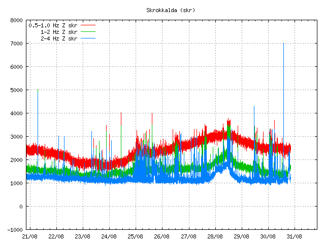
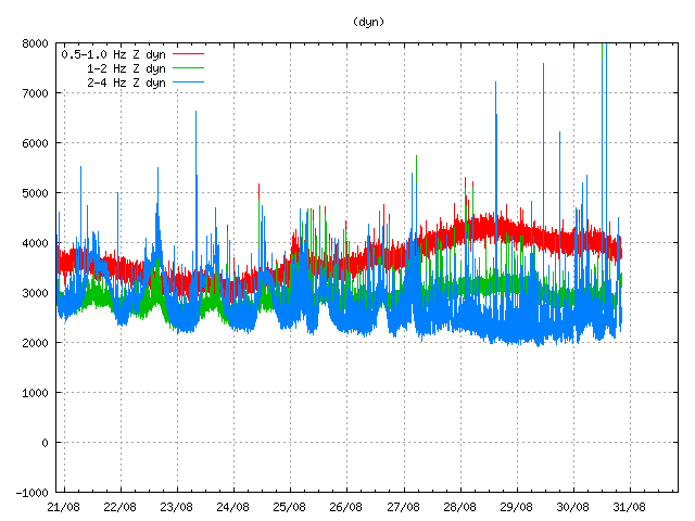
Harmonic tremor pulse can be seen at the end of this tremor plot from IMO. It only lasted for about 30 to 60 min. Copyright of this image belongs to Icelandic Meteorological Office.


Harmonic tremor pulse can be seen at the end of this tremor plot from IMO. It only lasted for about 30 to 60 min. Copyright of this image belongs to Icelandic Meteorological Office.


Harmonic tremor pulse can be seen at the end of this tremor plot from IMO. It only lasted for about 30 to 60 min. Copyright of this image belongs to Icelandic Meteorological Office.

It might be that this harmonic tremor signals are coming from other volcano system then Hamarinn volcano. This type of activity has been seen before in Hamarinn volcano and follows glacier floods from it. Given the activity last year. I cannot rule out volcano activity taking place now in Hamarinn volcano. New episode of harmonic tremor is now starting in Hamarinn volcano. Based on early observations . It seems that current activity is behaving in similar manner as did happen in July 2011 when an minor eruption took place in Hamarinn volcano. If that is the case now remains to be seen. But it should be clear in few hours what is exactly going on in Hamarinn volcano following this glacier flood.

Icelandic news about this glacier flood

Skaftárhlaup kom úr katlinum – myndband (Rúv.is, video)
Hlaupið kom úr vestari katlinum (mbl.is)

Two earthquakes in Jan Mayen today (30.08.2012)

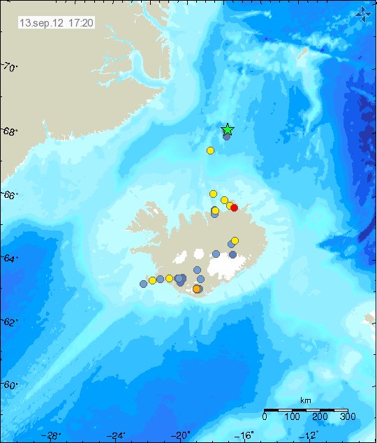
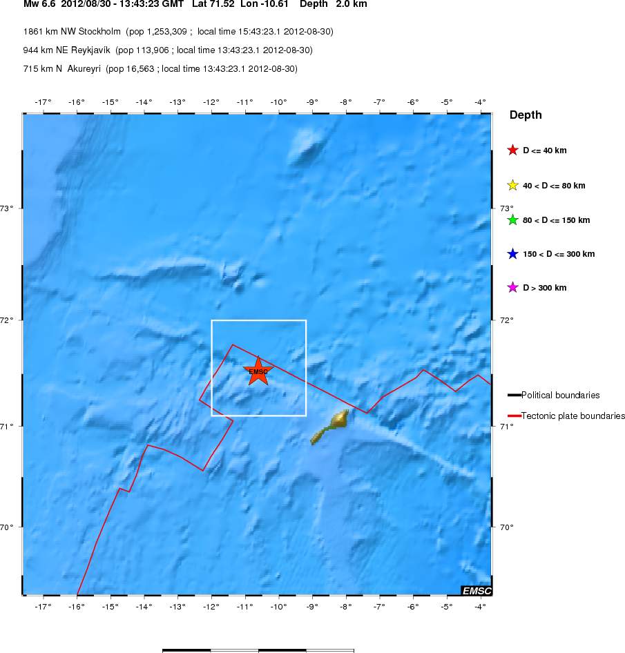
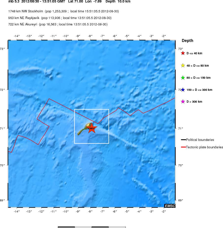
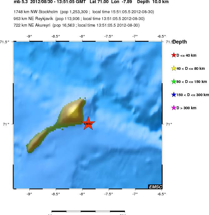
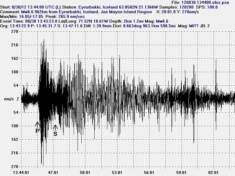
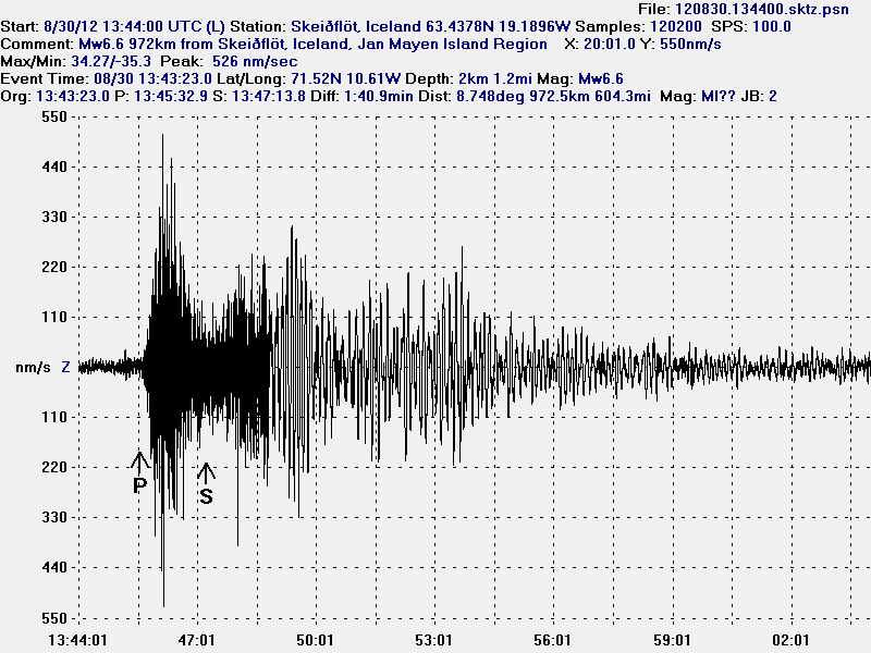
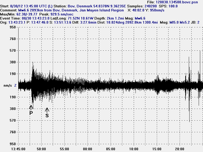
Today (30.08.2012) Jan Mayen was hit by two earthquakes. The second earthquake was not an aftershock of the first one. But it remains an question if it was triggered by the first earthquake. The first earthquake had the magnitude of Mw6.6 according to EMSC web site. The second earthquake had the magnitude of Mb5.3 according to EMSC. Both earthquakes where felt by Norwegian military and science staff that resides on Jan Mayen.


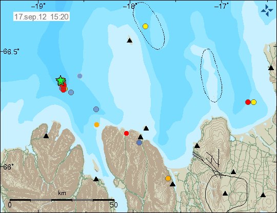
Location of the Mw6.6 earthquake off the coast of Jan Mayen. As can be seen. This earthquake took place far out in the ocean. Copyright of this image belongs to EMSC.

The second earthquake was less in magnitude. But was closer to the Jan Mayen Island. For that reason it was possibly felt better the first earthquake.


Large view of the second Jan Mayen earthquake. This earthquake had the magnitude of Mb5.3. Copyright of this image belongs to EMSC.


Close up view of the second Jan Mayen earthquake. Copyright of this image belongs to EMSC.


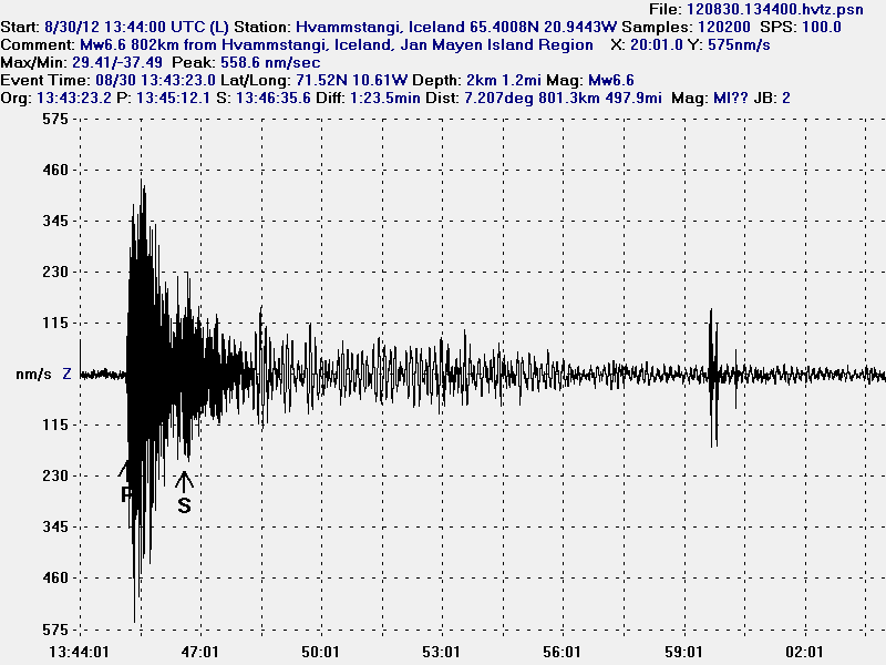
The Mw6.6 earthquake that took place in Jan Mayen. This geophone station is the closest to the earthquake in Jan Mayen. This image is released under CC licence. Please see CC licence page for more details.


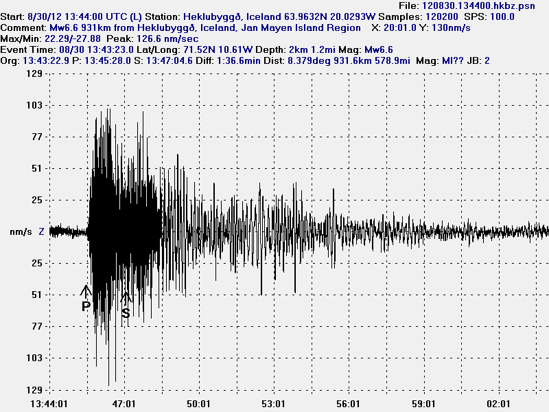
The Mw6.6 Jan Mayen earthquake as it was seen on Heklubyggð geophone station. This image is released under CC licence. Please see CC licence page for more details.


The Mw6.6 Jan Mayen earthquake as it was seen on Eyrarbakki geophone station. This image is released under CC licence. Please see CC licence page for more details.


The Mw6.6 Jan Mayen earthquake as it was seen on Skeiðflöt geophone station. The P-wave goes trough something that speeds up it’s arrival. Something that the software that I use cannot account for. That is why the P-wave is in the wrong location. As model vs reality do not match in this case. This happen frequently with my location data. This image is released under CC licence. Please see CC licence page for more details.


I did also record this earthquake in Denmark. Where I now live. This is the most distance that I did record this earthquake. But the distance was around 2000 km. The signal did appear. But I did not record any surface waves as I did in Iceland. Background noise is also higher here in Denmark then in most location in Iceland and it is more constant. This image is released under CC licence. Please see CC licence page for more details.

I did not record the Mb5.3 earthquakes on my geophones. It was just too small for my hardware to detect it. The waveform from the second earthquake was also lost in the surface waves from the first earthquake during this time period. At least when it comes to my hardware as it currently is.

Icelandic news about this earthquake

Jarðskjálfti við Jan Mayen – 6.6 stig (Vísir.is)
Almannavarnir: Ekki miklar líkur á flóðbylgju (Vísir.is)
Jarðskjálfti upp á 6,6 stig (mbl.is)

Norwegian and danish news about this earthquake

Kraftig jordskjelv utenfor Jan Mayen (NRK.no)
Skælv på 6,6 ryster Grønlands østkyst (DR.dk)

Earthquake in Brennisteinsfjöll volcano / SISZ earthquake zone

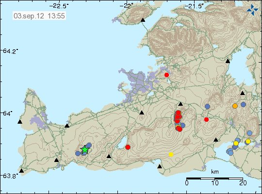
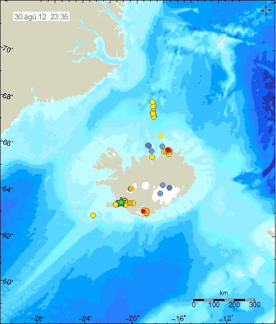
Today (30.08.2012) at 11:59 UTC there was an earthquake with the magnitude of ML3.8 (4.2Mw) in Brennisteinsfjöll volcano / SISZ. But SISZ overlaps this area to some extend. So large earthquakes do happen in this area of Iceland on regular basis. This earthquake was felt in Reykjavík area, south Iceland and some part of western Iceland.


The earthquake location and the following aftershocks. Copyright of this image belongs to Icelandic Meteorological Office.

In around 30 aftershocks have been detected in the area. More aftershock activity in this area cannot be ruled out. This earthquake did appear clearly on my geophones all over Iceland.


The earthquake at Eyrarbakki geophone station. This geophone is the closest to the earthquake. The most movement in this earthquake was on an N-S and E-W fault according to my geophones. This picture is released under CC Licence. See licence page for more details.


This is the earthquake as it was recorded on Heklubyggð geophone. It is the second closest geophone station to this earthquake. This picture is released under CC Licence. See licence page for more details.


Here is the earthquake as it did appear on Skeiðflöt geophone. This picture is released under CC Licence. See licence page for more details.


Here is the earthquake as it did appear on Hvammstangi geophone. This picture is released under CC Licence. See licence page for more details.

It is impossible to know for sure what this earthquake activity means. But earthquake activity in this area of Brennisteinsfjöll volcano did stop around 15:49 UTC. No aftershocks did go above 2.0 in magnitude. More earthquakes in this area should not be ruled out in the next few days to weeks.

Icelandic News about this earthquake

Alltaf von á eftirskjálftum (Rúv.is)
Skjálftinn á enda stórs misgengis (Rúv.is)
Verra ef safnið hefði skemmst (Rúv.is)
Skjálftinn hápunktur – ekki fyrirboði (Rúv.is)
Jörð skalf í dag (Rúv.is. Afternoon radio show about this earthquake in Icelandic)
Jarðskjálftasvæðið undir smásjá sérfræðinga (Vísir.is)
Má búast við nokkrum eftirskjálftum (Vísir.is)
Fólk hljóp á dyr í Litlu Kaffistofunni (Vísir.is)
Jarðskjálftinn var 4,6 stig (Vísir.is)
Á þriðja tug eftirskjálfta hefur mælst (mbl.is)
Jarðskjálfti upp á 4,6 stig (mbl.is)
Snarpur jarðskjálfti á höfuðborgarsvæðinu – Stærsti skjálftinn í 3 ár (Pressan.is)
Jarðskjálftafræðingur: Ekki búið að losa um neina spennu að ráði (Pressan.is)

Glacier flood has started from west Skaftárketill cauldron in Vatnajökull glacier

Yesterday an glacier flood started form west Skaftárketill cauldron. But that is an hydro-thermal area inside Hamarinn volcano (Bárðarbunga volcano system). The glacier flood is expected to be small. Last year in July there was also an glacier flood from this area of Vatnajökull glacier. But that was due to minor eruption in this area (it was poorly documented by scientists. I do not know why that is). But now it is melt-water from hydro-thermal area that is causing this glacier flood.

But glacier floods like this happen every 1 to 3 years from this area. Following this glacier flood an swarm of glacier-quakes have been detected in this part of Vatnajökull glacier. Flood in western Skaftárkatli might trigger a glacier flood in the eastern skaftárkatli cauldron. But it is not known if that is actually going to happen this time. It is not expected that current glacier flood is going to be a large one. But there is an risk of Hydrogen sulfide poisoning if people are close the glacier river during the glacier flood. So it is not recommend to go close to the glacier river due to this risk. The glacier flood is expected to appear from under Vatnajökull glacier in the next 5 to 6 hours. It is expected to last around 2 to 3 days at most.


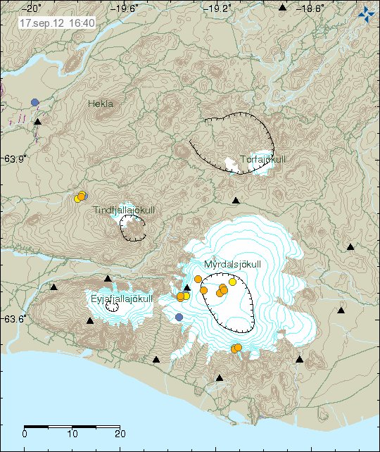
Glacier quakes in Vatnajökull glacier following this glacier flood. This glacier quakes are not strong and do not show up on automatic SIL system. Copyright of this picture belongs to Icelandic Meteorological Office.


Glacier quake activity as it appears on SIL seismometers around Vatnajökull glacier. Copyright of this picture belongs to Icelandic Meteorological Office.


Glacier quake activity as it appears on SIL seismometers around Vatnajökull glacier. Copyright of this picture belongs to Icelandic Meteorological Office.


Glacier quake activity as it appears on SIL seismometers around Vatnajökull glacier. Copyright of this picture belongs to Icelandic Meteorological Office.


Click on this image for full size. This plot here shows output from several SIL stations. This image was released by Icelandic Meteorological Office today. Copyright of this picture belongs to Icelandic Meteorological Office.

It is believed that sometimes following this type of glacier floods from this area in Vatnajökull glacier there are small eruptions, or steam events as the pressure on the hydro-thermal system drops . That in turns allows for some magma movement that is powering the hydro-thermal system in this area of Vatnajökull glacier. It is impossible to know for sure if that is going to happen now. But it is good idea to keep an eye-out for such events taking place in Hamarinn volcano. Given the minor eruption that took place there last year.

Here is an comparison of the events that took place last year compared to the events that are currently taking place in Hamarinn volcano.


Harmonic tremor subsiding from Hamarinn volcano on 13. July 2011. The following glacier flood appears clearly on this tremor plot from Icelandic Meteorological Office. Copyright of this picture belongs to Icelandic Meteorological Office.

I was seeing activity to November 2011 after the activity in July 2011.


One of the last harmonic tremor activity that I did see in Hamarinn volcano during the year 2011. But this took place on 7. November 2011. After this point it did go quiet. Copyright of this picture belongs to Icelandic Meteorological Office.

I do not expect any volcano eruption in Hamarinn volcano at this point. But such things are impossible to know for sure. As Hamarinn volcano has not been studied in details until after the year 2011 eruption.

Icelandic news about this glacier flood

Hlaup hafið í Skaftá (Rúv.is)
Verður væntanlega ekki mikið hlaup (Rúv.is)
Hlaup að hefjast í Skaftá (Vísir.is)
Aldrei verið jafnfljótir að sjá hlaupið (Vísir.is)
Skaftárhlaup hafið (mbl.is)

New earthquake swarm in Katla volcano

This morning at 07:03 UTC on 21. August 2012 an earthquake swarm started in Katla volcano. This earthquake swarm lasted for few minutes with the last earthquake taking place at 07:50 UTC. No harmonic tremor was detected following this earthquake swarm in Katla volcano. Update 1: The largest earthquake in this earthquake swarm had the magnitude of 2.6 at the depth of 0.1 km.


Earthquake activity in Katla volcano this morning. Copyright of this image belongs to Icelandic Meteorological Office.

It is impossible to know for sure what this activity means. But this might just be normal autumn activity in Katla volcano. I am expecting more earthquake activity in Katla volcano in next few days to weeks.

Icelandic news about this earthquake activity

Skjálfti í Mýrdalsjökli (Rúv.is, Icelandic)
Jarðskjálfti upp á 3,1 stig í Mýrdalsjökli (Vísir.is, Icelandic)
3,1 stigs skjálfti í Mýrdalsjökli (mbl.is, Icelandic)

Blog post updated at 15:18 UTC on 21.08.2012. I have not yet fully recovered from the heat wave. I forgot the important information about this swarm. They have now been added.

Earthquake swarm in progress in Krýsuvík volcano

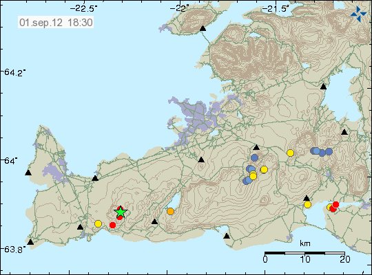
Today (18.08.2012) at 15:52 UTC an earthquake swarm did start in Krýsuvík volcano. So far this swarm is not big. With the largest earthquake having magnitude 1.8 according to automatic size. It is impossible to know at this point if this earthquake swarm is going to be strong, or has just ended. So far earthquake activity continues with minor earthquakes.


The earthquake swarm in Krýsuvík volcano. Copyright of this image belongs to Icelandic Meteorological Office.

If the earthquake activity picks up. I am going to do my best to update this blog. But I am on limited 3G internet connection. So it might be a while until update takes place.

Earthquake in Katla volcano today (17.08.2012)

Today at 15:48 UTC there was an magnitude 3.8, at the depth of 0.1 km in Katla volcano. This earthquake took place on the caldera rim in Katla volcano. No major harmonic tremor was detected following this earthquake. However some harmonic tremor was detected. But it was minor. This might have been hydro-thermal-activity or magma on the move. It is impossible to know for sure what is the case now. This earthquake did appear clearly on my geophone network. Mostly on the geophone station at Skeiðflöt and Heklubyggð.


The location of the earthquake in Katla volcano. It was located on the edge of Katla volcano caldera. Copyright of this image belongs to Iceland Meteorological Office.


Influence map of todays ML3.8 earthquake. This suggests that it was not felt in nearby populated areas. Copyright of this image belongs to Iceland Meteorological Office.


Tremor plot that clearly shows the earthquake of today. The spikes are the earthquakes that have been taking place in Katla volcano or close by areas. This is Alftagrof SIL station. Copyright of this image belongs to Iceland Meteorological Office.


This tremor plot shows some minor harmonic tremor following the earthquake in Katla volcano. The spikes show the earthquake from Katla volcano and areas close by. This is Austmannsbunga SIL station. Copyright of this image belongs to Iceland Meteorological Office.

It is impossible to know what this means exactly. But Katla volcano has been quiet since around middle of July. It remains to be seen if earthquake activity is picking up again or if this was just an single event.

Icelandic news about this earthquake

Jarðskjálfti í Mýrdalsjökli (Rúv.is, Icelandic)
Jarðskjálfti í Mýrdalsjökli (Vísir.is, Icelandic)
Jörð skalf við Austmannsbungu (mbl.is, Icelandic)

Blog post updated at 18.08.2012 at 11:51 UTC. Blog post title fixed for the future.

Earthquakes deep south on the Reykjanes Ridge [Updated]

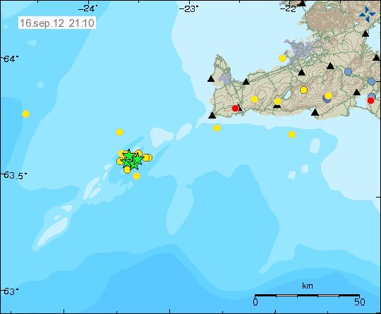
During last night there has been some earthquake activity deep south on Reykjanes Ridge. This earthquake activity is far from the south coast of Iceland so it has not been noticed by any people. It has only appeared on seismometers. The web page of EMSC has shows the current earthquake activity started at 00:21 UTC with two earthquakes. The largest earthquake recorded in following hours had the magnitude of Mb5.3 according to EMSC web page. But that is automatic size estimate and is subject to a change.


The location of the earthquake deep south on Reykjanes Ridge. Copyright of this image belongs to EMSC.

There most likely have been more earthquakes in this area then are registered by seismometer networks. It seems that earthquake activity in this area has quieted down again. For now at least. But this area is subject to strong earthquake swarms on regular basic.

Blog post updated at 21:33 UTC on 15.08.2012.

Minor earthquake swarm in Brennisteinsfjöll volcano system

When I was moving there was an small earthquake in Brennisteinsfjöll volcano. Because I was moving I was unable to track this earthquake swarm properly. But the largest earthquake was around ML1.5 from what I can remember. The earthquakes had the depth of at least 2 km. But I am not sure what the exact depth is. But I have not yet looked at the reviewed data on this earthquake swarm.


The earthquake swarm in south-west part of Brennisteinsfjöll volcano. Copyright of this picture belongs to Iceland Meteorological Office.

There has not been a lot of activity in Iceland during all summer. So I have not had lot to write about. But that might change without any warning. As is common in Iceland.

I did also move on 7th of August to a new town in Denmark. That means I am out of ADSL connection until 24th of August. So this blog is going to suffer from lack of updates until I am properly connected to the internet.

Earthquake swarm in SISZ this morning (31.07.2012)

This morning there was an earthquake swarm in SISZ. This earthquake swarm was located just south of Hveragerði and Selfoss town. The largest earthquake in this earthquake swarm had the magnitude of ML1.3. Most of the other earthquake where less the magnitude 1.0 in size. Focal depth for this earthquake swarm was 5 to 6 km. Total of 30 or so earthquakes where recorded in this earthquake swarm. This earthquake swarm is in continued activity in this area. But SISZ often has frequent smaller earthquake swarms.


The area of earthquake activity in SISZ this morning (31.07.2012). Copyright of this image belongs to Iceland Meteorological Office.

This doesn’t mean anything special. But SISZ (South Icelandic Seismic Zone) is always at risk having large earthquakes. But based on how short it was since last one took place (May 2008). It is unlikely that is going to happen now.