Earthquake swarm in SISZ continues

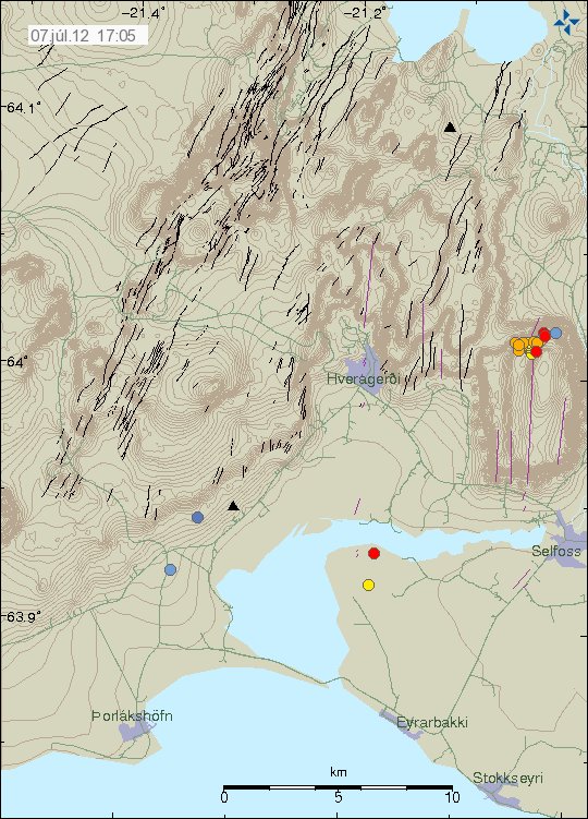
The earthquake swarm that I wrote about yesterday (7. July 2012) in South Icelandic Seismic Zone (SISZ) continues. The largest earthquake so far has reached magnitude 3.1. The earthquake swarm has been ongoing for almost three weeks now. But almost all of the earthquakes that have been taking place during this swarm have been small earthquakes, often with less then 2.0 in magnitude. Earthquake activity is ongoing in SISZ at the moment. It is impossible to know if there are going to be any more earthquakes with magnitude 3.0 in this area. The magnitude 3.1 earthquake was felt in Selfoss and Hveragerði towns.


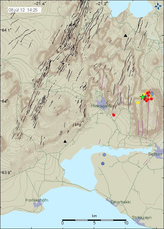
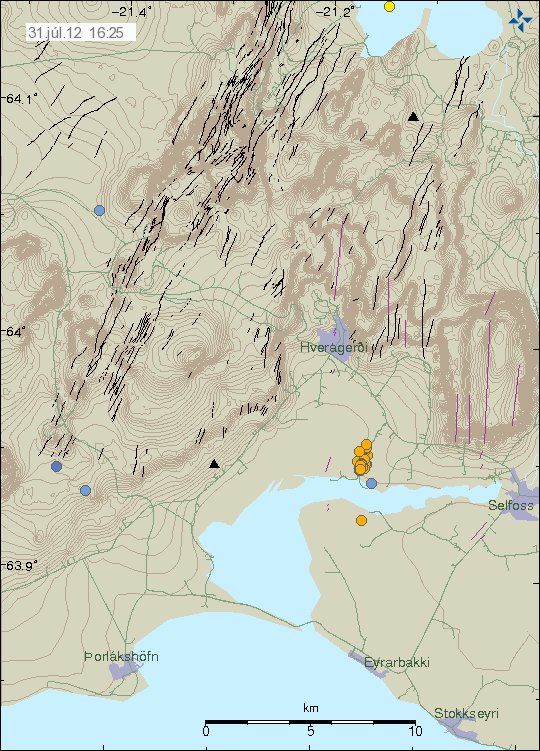
The area on SISZ where this earthquake swarm is taking place. Copyright of this picture belongs to Iceland Meteorological Office.


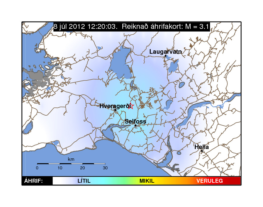
Map that shows how the earthquake was felt in this area of Iceland. Copyright of this picture belongs to Iceland Meteorological Office.


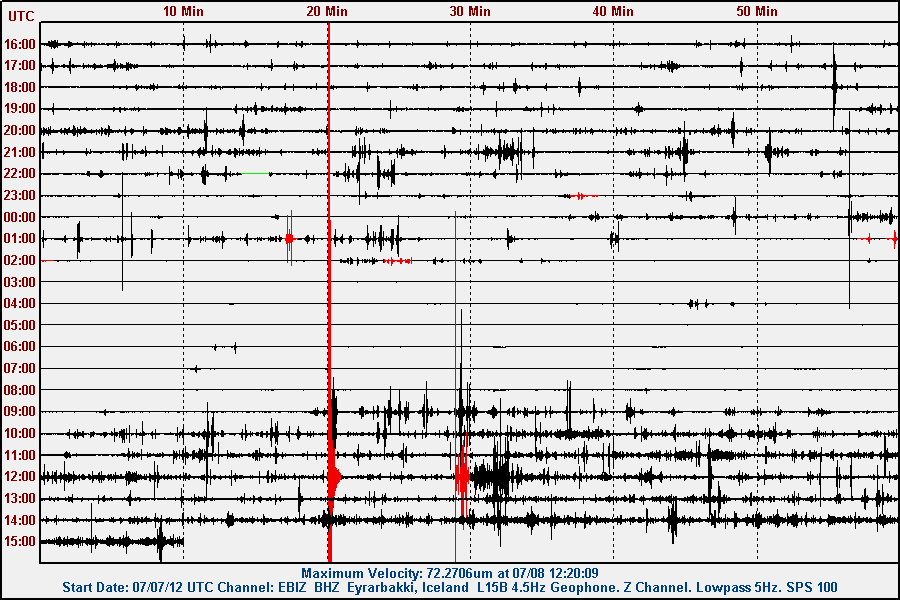
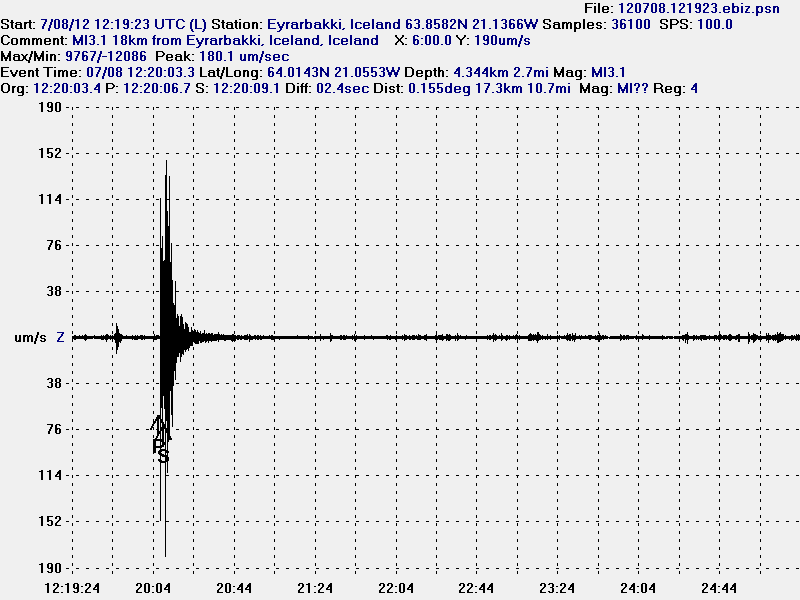
The earthquake did appear clearly on all of my geophones. This is from Eyrarbakki, the geophone that is closest to the earthquake swarm. Copyright of this picture belongs to Iceland Meteorological Office.


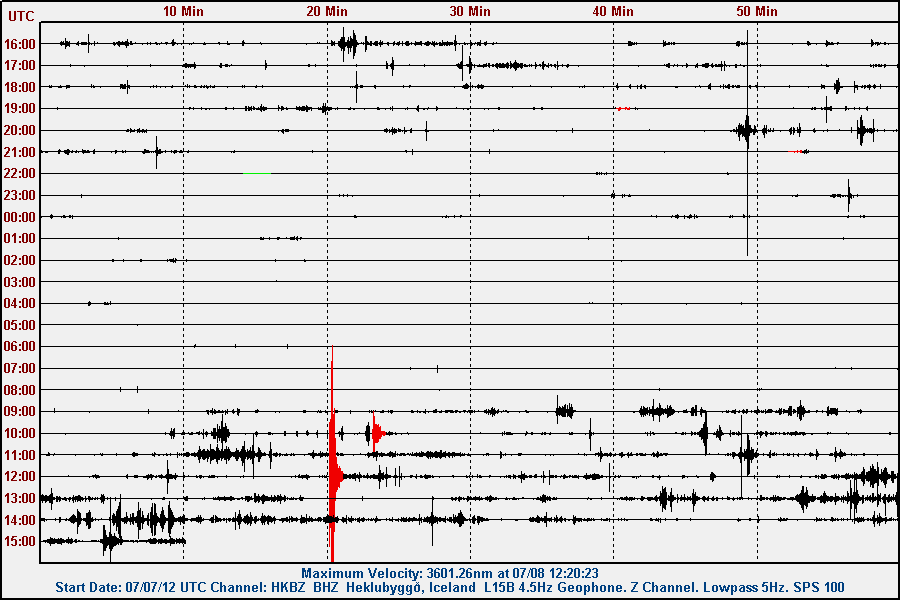
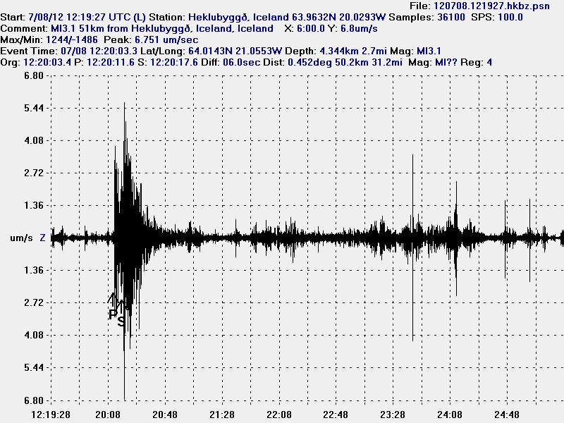
This is the earthquake seen on Heklubyggð geophone station.


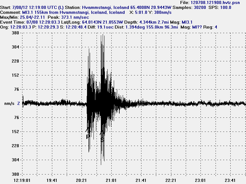
The earthquake seen on my Hvammstangi geophone. This is filtered at 4Hz due to local noise. This picture is released under CC Licence. Please see CC Licence for more information.


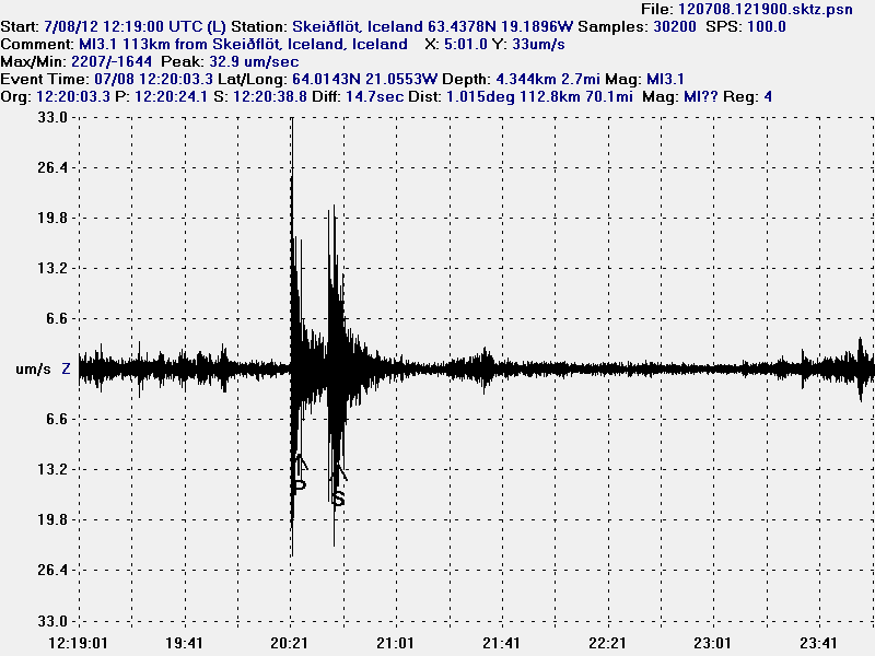
The earthquake as it was recorded on my Skeiðflöt geophone station. This picture is released under CC Licence. Please see CC Licence for more information.


The earthquake as it was recorded on Eyrarbakki geophone station. This geophone is closest to the earthquake swarm. But is noisy. This picture is released under CC Licence. Please see CC Licence for more information.


The earthquake seen on Heklubyggð geophone station. This picture is released under CC Licence. Please see CC Licence for more information.

Earthquake activity in this area of SISZ is ongoing, and shows no signs of slowing down at the moment. This earthquake swarm started about 3 weeks ago. But has mostly been making minor earthquakes. But that are earthquakes with the magnitude of 0.0 to 2.0. It is impossible to know for how long this earthquake swarm is going to continue in this area of SISZ.

Earthquake activity in Katla volcano and on SISZ

It has been quiet for the past weeks in Iceland. I do not know if that is changing. But this is the short update of what has been taking place in Iceland earthquake wise during this quiet period.

Katla volcano

Since Katla volcano earthquake spike in late April to middle of June. Sine then it has been rather quiet in June and what has passed of July. Today and yesterday there has been some earthquake activity in Katla volcano. But nothing like was seen in April to June.


Earthquake activity in Katla volcano during past few days. Copyright of this picture belongs to Iceland Meteorological Office.

South Icelandic Seismic Zone (SISZ)

Intresting earthquake activity has been taking place in South Icelandic Seismic Zone for few days now. Currently the activity is on the northern end of the fault that broke in the year 2008. This is most likely just an earthquake swarm in the fault area that is continuing to adjust after the Mw6.3 earthquake in the year 2008.


Earthquake activity on SISZ during the past few days and hours. Copyright of this picture belongs to Iceland Meteorological Office.

As for SISZ. This is just an earthquake activity. There is no volcano activity in this area of Iceland. But SISZ is a fault zone that moves N-S (W-E compared to Reykjavík). So with every major earthquake on SISZ, it is slowly moving south as the new rift zone (Iceland East rift zone) moves south at the same time. This is a slow progress. Takes millions of years and has been ongoing for million of years already.

Minor magma dike intrusion into Upptyppingar tuff mountain

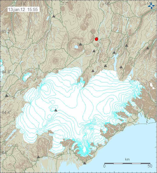
Yesterday (12.01.2012) there was an minor earthquake swarm in Upptyppingar tuff mountain. But they are inside Kverkfjöll volcano fissure swarm that extends several km away from the main volcano. The largest earthquake in this earthquake swarm was around ML2.0 in size, with the depth of 14.4 km. But this was also the deepest earthquake in this earthquake swarm. But most of the earthquakes had the depth of 14.4 km and up to 7.8 km. So I am sure that this was magma, rather then tectonic movements that did create this small earthquake swarm.


The earthquake activity in Upptyppingar tuff mountains. Copyright of this picture belongs to Icelandic Meteorological Office.

This might mean that there is more activity on the way in Upptyppingar tuff mountain. As this suggests that new magma has started to flow into the magma sill that has formed under the Upptyppingar tuff mountains. It is hard to know or if there is going to be an eruption there. But I find it most likely going to be the case. But it might well be good 10 to 20 years into the future until an eruption happens in that spot. But activity started in this area in the year 2007, so there already have been good 5 years since activity started in Upptyppingar tuff mountain. For the moment however, it is all wait and see and earthquakes.

Special donation help wanted!

I want to do something for my mom and dad. How are not the most technical people in the world. The fact is that where they live there is no mobile signal inside the house, but it is good out side the house. This can be fixed with an GSM repeater. But that costs money. Around 47.000 ISK, 2.189 DKK, 244 GBP, 294€, $372. I am going to get permission from the mobile companies and the authorities in Iceland to setup this minor repeater in the licensed spectrum (900Mhz). I want to do this. But I currently do not have the money to do this at present time. That is why I am asking for donation so I can do this. But I want to buy them the smallest GSM repeater that is possible to buy in Iceland, just so that they can get GSM signal inside the house.

Thanks for the support. 🙂

Hekla volcano is quiet

I have been seeing some rumors about Hekla volcano might be about to erupt. This is wrong. For the moment Hekla volcano is quiet as it has been since the last eruption in the year 2000. For few years Hekla volcano did erupt for about every 10 years. That might have change already. Nobody is sure on that now. But one thing is clear Hekla volcano is going to erupt one day. But when is always the question.

People have been speculating on the earthquakes west of Hekla volcano. This earthquakes do not belong to Hekla volcano. They are part of activity in the SISZ (South Icelandic Seismic Zone). Earthquakes in this area tectonic in nature, not volcanic. So in worst case, this earthquakes might be sign of new major earthquake preparing to take place some day in the future.

For the moment however. Everything is quiet in Hekla volcano.

Earthquake close to Hekla volcano. A earthquake swarm in Katla volcano

This has been a busy weekend in earthquakes, more then I was expecting. Here is a minor write up on the activity so far.

Hekla volcano:

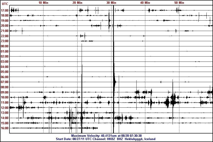
A ML2.4 earthquake did happen close to Hekla volcano at 07:30 UTC. Depth of this earthquake was 3.7 km. The earthquake did happen on earthquake fault line that was created in a large earthquake in the year 1912. This fault line has been known since then and is well documented.


The SISZ earthquake this morning. This picture is released under Creative Common Licence. See Licence web page for more details.

Katla volcano:

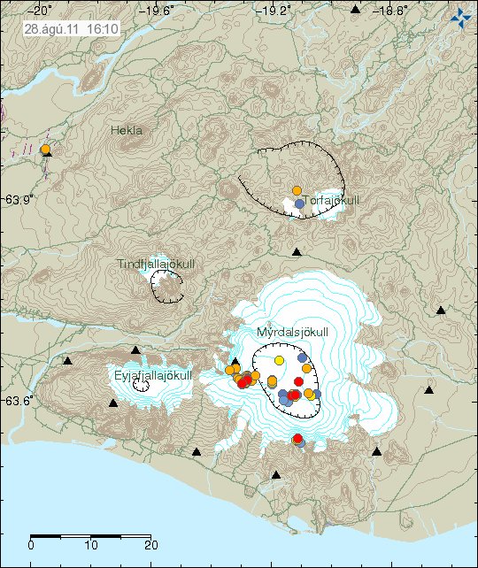
Two new earthquake swarms took place in Katla volcano today. This earthquake started around 09:30 UTC this morning. Most of the earthquakes where smaller then ML1.0 in size. The depth was around 5.5 km on average. The largest earthquake was ML2.3 in size, with the depth of 5.5 km. That earthquake swarm was in Goðabunga area of Mýrdalsjökull glacier (Katla volcano). But here was also a minor earthquake swarm inside Katla volcano caldera. But in that earthquake swarm the earthquakes there where even smaller, most of those earthquake didn’t reach the size ML1.0. The earthquake swarm in Goðabunga area in Katla volcano might be due to dike intrusion in that area. I do not know if this might be something else. But given the data, this is the most likely the reason for this earthquake swarm in this area. The earthquake swarm did stop at 12:47 UTC. After that everything has been quiet so far.

Few earthquakes also did happen SE part of the Katla volcano caldera. But there have been earthquakes in this area since July. But this activity did start soon after the glacier flood from Mýrdalsjökull glacier.


Earthquake activity in Katla volcano. Copyright of this picture belongs to Icelandic Met Office.

All the earthquake swarms of today in Katla volcano, also the single earthquake close to Hekla volcano.

Icelandic news about this activity.

Mikið um smáskjálfta nærri Mýrdalsjökli (Vísir.is)
Jörð skelfur nálægt Hellu (Rúv.is)

Other: Short announcement. I have finally figured out how I am going to have my writing schedule. But my working period is going to be from 1. September to 1. June every year. This also means more activity on this blog and my other (Icelandic) blogs. During the summer time there is going to be reduced activity on all my blogs. But if something happens during the summer in earthquakes and volcanoes. I am going to write about it anyway or soon as I can do so.

Also note that I have started school to finish basic in electronic (house electronics and other basics in electronics). So I am busy during the day (most days). So my response might be slower then normal if anything happens in Iceland with earthquakes or volcano activity.

Other #2: I am having minor issues with uploading the gif images from my earthquake computer at the moment. So that is currently being done by the remote geophone computers at the moment. Because of this, there is no red colour if a large earthquakes happens in Iceland or close to a geophone station that I have up and running.

Few right and wrong things about geology in Iceland, part 1

I have seen many speculations on how geology works in Iceland. Some of it is good and based on observation and factual basic. Other however is nothing but speculation and far from anything based on factual evidence on how geology works in Iceland.

Few right and wrong things about volcanism in Iceland

Volcano interaction Status: Limited truth to this

Volcano interaction is something of a debated among scientists. But what is not debated is the interaction between volcanoes that lies far apart. That interaction is none by it’s nature. So while I have been seeing discussion in the comments here that there is some connection between activity between Hengill volcano and Hekla volcano. This is untrue. There is no connection between those volcanoes and never has been. The reason is simple. The volcanoes are far apart. They don’t even share the same magma source. But that is evident by the lava that comes from this two volcanoes. But Hekla volcano has mixed types of eruption sometimes. But Hengill volcano only has Hawaii styles eruptions (if not hit by water) when it erupts, in style with other volcanoes on the Reykjanes ridge rift zone.

The only real life examples of volcano interaction are from Bárðarbunga volcano and Torfajökull volcano. The reason for this interaction is quite simple and logical one. Bárðarbunga fissure swarm cuts right trough Torfajökull volcano. When magma travels south-east in the fissure swarm (it last happened in the 15th century) it can hit the magma inside Torfajökull volcano. When this happens there is a big bang in Torfajökull volcano. As the magma in Torfajökull volcano seems to be colder and more Intermediate (andesitic) [link, Wikipedia] in nature. But in Bárðarbunga volcano the magma is Mafic (basaltic) in nature. When the two magmas mix, it ends with a bang and eruption in both volcanoes. But normally the process that starts this is because there is a ongoing eruption in Bárðarbunga volcano. So when Bárðarbunga volcano. I would worry about that rather then anything else.


See, no connection at all between Hekla and Hengill volcano. Copyright belongs too this picture owner. Owner unknown to me.

Iceland is going to have VEI-8 eruption. Status: Not likely.

All volcanoes can do a VEI-8. But the thing is that they are just not likely to do so. As the size of the eruption is directly connected to the inflow of magma it is getting. In the case of Icelandic volcanoes the inflow just seems to be few magnitude too small to make a VEI-8 eruption. The largest VEI eruption known in Iceland was a VEI-6 eruption that took place in Bárðarbunga volcano in the year 1477 (?).

As for VEI-8 eruption. I am not expecting that type of eruption any time soon in Iceland.

Iceland is one volcano. Status: False.

The simple answer is no. The long answer is. Iceland has many volcanoes, not just one. So the answer is no to this.

Geology in Iceland is well understood. Status: False

Geology in Iceland is understood. But far from being fully understood. As it happens geology science is just starting to now understand what complex progress are taking place in Iceland. A lot have been learned. But a lot more needs to be learned about how geology works in Iceland.

Volcano eruptions comes in active cycles. Status: True

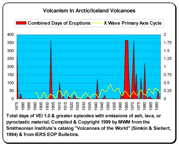
This has been observed by actual data. But volcano activity happens in periods of 80 to 160 years. With a quiet period of 50 to 90 years. But numbers are approximation. During the quiet time there are fewer eruptions and they are smaller (hint: Large eruption can still happen however during the quiet period). Last quiet period started in around the year 1870 and did not end until the year 1983. But that year there was a eruption in Grímsfjall volcano. But then Grímsfjall volcano had not erupted since the year 1954, but that break was 29 years long for Grímsfjall volcano.

This graph here also shows this clearly. But this is volcanism in Iceland during the years 1875 and to the year 1993.


Copyright holder unknown. Copyright of this picture belongs to this owner.

It is impossible to know for sure when the high peak in the current cycle is going to be be. But most geologist are estimating that to be sometimes from the year 2020 and to 2080 or about that. So the years ahead is going to be quite busy in Iceland in the terms of volcano activity.

I am going to write more right and wrongs about Icelandic volcanoes soon. But for now this is good enough.

Sources and other things.

Volcano-tectonic Interaction in the Hengill Region, Iceland during 1993-1998 (pdf)
Volcano geodesy and magma dynamics in Iceland (ScienceDirect)
Interaction between Continental Lithosphere and the Iceland Plume—Sr-Nd-Pb Isotope Geochemistry of Tertiary Basalts, NE Greenland
Tomographic evidence for a narrow whole mantle plume below Iceland (ScienceDirect)
Pdf document on Hengill volcano crustal deformation.
Magma (Wikipedia)
Volcano geodesy and magma dynamics in Iceland (pdf)

Earthquake swarm north of Langjökull glacier and volcano, new hole found in Selfoss town

This is a short update.

Langjökull glacier: Yesterday there was a minor earthquake swarm north of Langjökull glacier and volcano. This area did last time was last year when a good sized earthquake swarm did happen in this area, but last year it did start around this time of year and lasted until November. It remains to be seen if that happens now. So far all the data suggests that this earthquake swarm is just tectonic in nature. It also appears that earthquake swarms in this area start slowly with long breaks between them. So I am expecting more earthquakes there. Unless this has just been a single event with no repeats.

SISZ: On Selfoss town they have just found a new strange hole in the road. The opening of the hole is about 1.5 meter in size. But the depth is about 6 meters (guess?) and area that is hollow under the hole is few hundred meters (guess?) according to the news. It is believed that this did happen because of the SISZ Mb6.3 earthquake that did happen in this area in the year 2008.

Here are news about, with pictures of the hole.

Jarðskjálftahola á Selfossi (Rúv.is, Icelandic, Picture)
Hola myndaðist í jörðinni á Selfossi (Vísir.is, Icelandic, Pictures)

Katla volcano: I think that something might be about to start in Katla volcano. But that is just a speculation that I am doing now. I am far from sure about it. But it should be clear in few hours if something is happening in Katla volcano or not. I base my assessment on rather odd changes in the tremor plot. They are hard to spot, but still there and appears to be growing it seems. But I am going to check and see what happens in few hours time. This might be nothing. But only time is going to tell us that for sure.

A short history of earthquake activity on South Icelandic Seismic Zone (SISZ)

Here is a short overview of the activity on the South Icelandic Seismic Zone (SISZ) since Icelanders started to document it’s activity history. The oldest record of a large earthquake on SISZ is from the year 1103. In most cases it is not clear how large earthquakes are. But it was not until early 20th century when recording of earthquakes started it became clear how big the earthquakes in SISZ can really be. The average break between earthquake swarms in SISZ is from 1 year and up to 90 years.

Earthquake year.

Year 1103. A earthquake hits SISZ. It is not documented where. But 11 people died in that earthquake.

Year 1169. A earthquake hits Grímsnes. Total death was 19 people.

Year 1182. A earthquake kills 11 people. It is unclear where this earthquake did happen and how big it was.

Year 1211. A earthquake collapses many houses and kills 18 people. This earthquake took place 7th July.

Year 1294. A eruption in Hekla volcano and it is followed by many large earthquakes in SISZ. The hydrothermal activity increased in this earthquakes due to the earthquakes. It is believed that Geysir did form in this earthquake swarm in SISZ.

Year 1308. A large earthquake hits. Many houses collapse. Six people did die.

Year 1311. A large earthquakes hit on 10th and 11th of January. A total of 18 houses collapsed and 16 people died in this earthquakes.

Year 1339. A large earthquakes hit on 22nd of May. Witness account says that people where not able to stand up during the earthquake. Most collapse of houses did happen in Flóa, Holtamannahrepp and in places between Þjórsá and Eystri Rangár. Rockfall was witnessed following this earthquakes. A hydrothermal activity appeared in a mountain named Henglafjöllum (at that time) where none had been before.

Year 1370. A large earthquake south of Ölfus. A total of 12 houses collapse and six people did die in this earthquake.

Year 1389. Large earthquakes take place. Increased hydrothermal activity in Geysir area. New hot spring forms in that area.

Year 1391. A large earthquake takes place south of Grímsnes, Flóa and Ölfus. A total of 14 houses collapse and some so badly that they where totally destroyed. Water did flow from the ground following this earthquake. Only few people did die. They where sad as poor and the number it is not sad how many they where.

The gap between 1391 and too the year 1546 is most likely due to loss of historical documents. Not because there was a lack of earthquakes in SISZ during that time.

Year 1546. A large earthquake happens in SISZ. He is mostly noted in Ölfusi. A unknown number of houses collapsed. Nobody did die in this earthquake.

Year 1581. Earthquake did hit SISZ on the 30th of May around 03:00 local time (04:00 GMT modern time ?). Many houses collapsed during this earthquakes. Many people did die in this earthquake. In one instance is a death of a woman and here two year old kid is documented to have happened during this earthquake. Unconfirmed news from that time period say that that nine people died for east part of south Iceland and a large cracks did form in the ground because of the earthquake.

Year 1613. A earthquake hits. Date is not documented. A “mountain” is sad to have collapsed on Skeiðum and something called “reiðningstorfa” was outside a house. It did vanish during the earthquake and was never seen again. For the record. I have no idea what “reiðningstorfa” is. So don’t even try to ask me on it. I have no clue what so ever about this.

Year 1618. A large earthquake swarm hit SISZ. Earthquake hit SISZ all hours of the day. In one earthquake four houses collapsed and there was a formation of cracks so big that people where not able to cross over them.

Year 1624. A swarm of earthquake took place. Two houses collapsed. Human fatalities are not documented.

Year 1630. The winter that year a total of three earthquakes did happen. It did kill six people and collapsed unknown number of houses. The strongest earthquake took place on the 21st of February. A new fissures and cracks did form in the ground. The Geysir hydrothermal area did see large changes. New hot springs formed while others did dry up. Close to Skálhot fissures did open that both people and animals did fall into and die. They where also sad impossible to cross over.

Year 1633. Earthquake swarm hits SISZ,. Houses collapse in Ölfusi. Nothing more is documented.

Year 1657. A earthquake swarm both on SISZ and western part of Iceland (?). Two houses collapsed in this earthquake. But no human died in this earthquake swarm. On the 16th of March a earthquake did happen in Fljótshlíð and it did collapse many houses.

Year 1658. Earthquake swarm took place there between second and third day of Easter that year.

Year 1663. Many earthquakes in Reykjanes Peninsula did destroy many houses. Water levels in Kleifarvatn did drop. The water did flow into fissures that formed during the earthquakes. The water level dropped 300 feets. So that was once under water was now on dry land.

Year 1671. A earthquakes took place during the summer in Grímsnes and Ölfusi. But it is not documented if any damage took place during this earthquake swarm.

Year 1706. Large earthquakes take place this year. The first earthquakes takes place on the 28th of January. But the most earthquake takes place on the 20th of April when 24 houses collapsed. At least one person did die during this earthquake swarm. A loss was in live stock that did die during this earthquake swarm. This earthquake swarm lasted until spring. But was least noticed in western part of SISZ.

Year 1732. On the 7th of September a large earthquake took place in the area of Rangárvellir. This earthquake did damage 40 houses and 11 did collapse in the earthquake. Four people got hurt. But nobody did die during this earthquake.

Year 1734. On the 21th of March a large earthquake did take place. In Árnessýslu a total of 30 houses collapsed and 60 to 70 houses got damaged. The number of people how did die was 7 to 8.

Year 1749. A large earthquakes did happen in Ölfusi. There was a damage to houses. But none of them collapsed. But the base of one house did get lowered about 120 cm.

Year 1752. Earthquake swarm takes place in Ölfusi. It did collapse 11 houses and maybe one church.

Year 1754. A large earthquakes takes place in Krísuvík. It created a large hot spring. It was 6 faðmar wide and 3 faðmar deep (I have no idea what that is in the modern measurements).

Year 1784. This year one of the largest earthquake swarm in Iceland history took place on the 14th and 16th of August. It is believed that about 1900 houses where damaged or destroyed. The most damage was in the areas of Árnessýslu and Rangárvallarsýslu. Due this earthquake a lot of people lost there homes and had to spend the winter in a make shift houses made out of dirt or other poor building material, some people did try to repair there houses and live in them over the winter.

Year 1789. A lot of earthquakes where in Árnessýslu on 10th of June. This was followed by more earthquake activity a week later with earthquake being felt every 10 minute or less. A lot of new fissures and cracks did open up in Thingvellir following this earthquake swarm. Also in this earthquake swarm a lot of rock did fall out in Thingvellir and Almannagjá. Area in Almannagjá did become flooded (not sad what did flood it). In this area land did drop about 60 cm in some areas.

Year 1808. Strong earthquake in the SISZ. Did change hot springs and hydrothermal areas. Nothing more was reported on this earthquake that I know of.

Year 1828. Strong earthquake took place in Fljótshlíð. Most damage was in Fljótshlíð where 8 houses collapsed. One child did die because of lack of attention during this earthquakes.

Year 1829. On 21st of February a strong earthquake swarm did happen close to Hekla volcano. But the earthquake swarm was strongest closest to Hekla volcano. That area also did suffer the most damage. Where six to seven houses did suffer some damage.

Year 1896. One of the stronger earthquakes took place took place on the 26nd August that year. The first earthquake was the strongest and created a massive damage in the area of Árnes and Rangarvallarsýslum. It left many people homeless and there winter food for them selfs and winter saving of grass (what is that called in english?) for livestock. On the 27nd of August a second earthquake did happen. It epicentre was located close to the first one. The third earthquake did happen on 5th September in the area of Skeiðum. The fourth earthquake did take place on 6th September in the area of Ölfusi. The fifth and final did happen on the 10th of September, it’s location was in the area of Gaulverjarbæjarhreppi east of Selfoss. In this earthquakes about 3700 house and farms did collapse or suffer damage in this earthquake and three people did die.

Year 1912. A strong earthquake took place in the area of Hekla volcano. The size of that earthquake is estimated around M7.0. Around 30 houses got damage in a area from Þjórsá to Eyjafjallajökull volcano. One person did die, it was a child that got hit by a falling support beam (wood) in a house. It was in it’s mother arm when it did happen. The child is sad to have died instantly.

Year 2000. Two earthquakes did happen on SISZ that year. The first one was on 17th of June. It size was recorded Ms6.6. It did create a lot of damage all over SISZ. With many houses suffering heavy damage. The second major earthquake did happen on 21st of June. It size was Ms6.5 and it was a little bit more west then the first earthquake did happen. Over thousand smaller aftershocks took place following the first earthquake. Following this earthquake a earthquake swarm did start in Krísuvík, it got started with a earthquakes that where in the size of Mb5.5 to Mw6.0. But it is clear from the data that was collected that the bedrock in this area was already on the breaking point. The first earthquake that did happen on SISZ did trigger those earthquakes. The fault lines responsible for the earthquake where about 10 km long at the depth of about 5 to 9 km.

Science paper on the SISZ earthquake of the year 2000.
The June 2000 earthquake sequence in South Iceland (Icelandic Met Office, English)
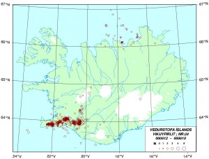

Week 24 of the year 2000. Shows the aftershock pattern after the strong earthquake that year. Copyright of this picture belongs to Icelandic Met Office. It is from there web site.
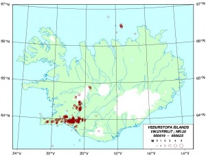

Week 25 of the year 2000. Shows the evolving aftershock pattern after the second strong earthquake on the SISZ that year. Copyright of this picture belongs to Icelandic Met Office. It is from there web site.
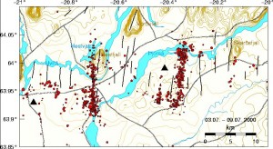

High detail picture of the earthquake activity area in SISZ of the year 2000. Copyright of this picture belongs to Icelandic Met Office. It is from there web site.

Year 2008. On the 29th of May 2008 there was a earthquake with the size of Mw6.3 on the SISZ. It’s location was between Selfoss and Hveragerði towns. Both towns did suffer rather extensive damage following the earthquake, nobody did die and just minor injuries where reported. Before the large earthquake did hit a smaller earthquake with the size of ML3.2 did happen, along with a swarm of smaller earthquakes. Sadly I did miss that earthquake due to a loss of power at my apartment during that time. Lucky for me I did just discover that just before the large Mw6.3 did happen.

This earthquake was felt in Reykjavík and all around south and west Iceland. There are even report it was felt in Ísafjörður town. I did notice it at home as it moved stuff around in my apartment, but it did not knock everything down in my apartment at Hvammstangi town.

Waveform data that I did record of this earthquake.
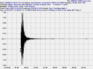

Mosfellsbær geophone that I had connection too in the year 2008 (that station has now stopped operations). The waveform data shows that the station got saturated when the earthquake did happen. This picture is released under Creative Commons Licence (see top link for more details).
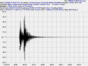

Hvammstangi geophone did record this earthquake clearly. But it did not saturate the geophone like in Mosfellsbær geophone. This picture is released under Creative Commons Licence (see top link for more details).
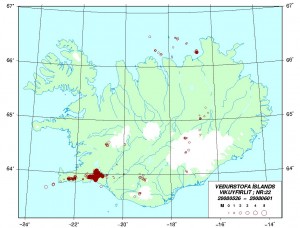

Map of Iceland showing the area of the main activity where the Mw6.3 earthquake did happen and the large view of the aftershocks that did follow it. This is from Week 22 in 2008. Copyright of this picture belongs to Icelandic Met Office. It is from there web site.
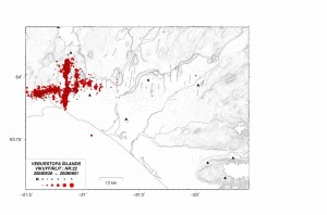

Close up map of the activity following this earthquake. The fault line is clear on this map, as the aftershocks arrange them self clearly alongside it. This is from Week 22 in 2008. Copyright of this picture belongs to Icelandic Met Office. It is from there web site.
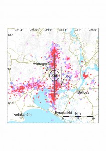

A detailed map of estimated epicentre of the earthquake, the pre-earthquake and how the crust did break up in this area. The fault line was about 12 km long this time around. This is from Week 22 in 2008. Copyright of this picture belongs to Icelandic Met Office. It is from there web site.

Here is a scientific paper on the SISZ 2008 earthquake. With all the details that are important when this type of earthquake happens in Iceland.

This is the short overview of activity in SISZ over the past 1000 years or so. It is clear that SISZ is going to have large earthquakes in the future. But when is always a good question. Like volcanoes it is impossible to know when a large earthquake happens in SISZ. But it is going to happen one day. You can be sure of that.

Reference

Nánar um Suðurlandsskjálftann. (This article is mostly based on this one. It is in Icelandic.)
Suðurlandsskjálfti (Wiki, Icelandic)
2000 Iceland earthquake (Wiki, english)
2008 Iceland earthquake (Wiki, english)

Sigurður Steinþórsson. „Hvenær kemur Suðurlandsskjálftinn?“. Vísindavefurinn 10.4.2003. http://visindavefur.is/?id=3326. (Skoðað 2.4.2011). (Icelandic)

Text updated at 1539 CEST on 3 April 2011. Minor text fixes.
Wave form picture of the ML2.5 earthquake in the South Icelandic Seismic Zone (SISZ)

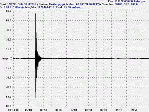
Here is a wave form picture of the ML2.5 earthquake that took place west of Hekla volcano. This earthquake is part of the the SISZ. Not Hekla volcano. But it remains to be seen if this is related to Hekla volcano, but Hekla volcano location appears to have some effect on SISZ. Normally during or after a eruption in Hekla volcano it is followed by a small swarms of earthquakes in SISZ. In the year 1878 there was a eruption in Hekla volcano that was pre-seeded by large earthquakes in SISZ. The eruption that followed was a fissure eruption near a peak named Krakatindur. This area also erupted in the year 1913, but that time on two new fissures.

The wave form data. This picture is released under CC licence, see the legal section for more information.

I was going to setup the location and distance data. But IMO has not released that data at present time.

Historical accounts of Hekla eruptions (Icelandic). GVP information on Hekla volcano.