Hengill volcano man made earthquake swarm

The man made earthquake swarm in Hengill volcano that happened today seems to have subsided, as it is most likely that Orkuveita Reykjavíkur has stopped pumping down water into the new drill hole that they where using today.

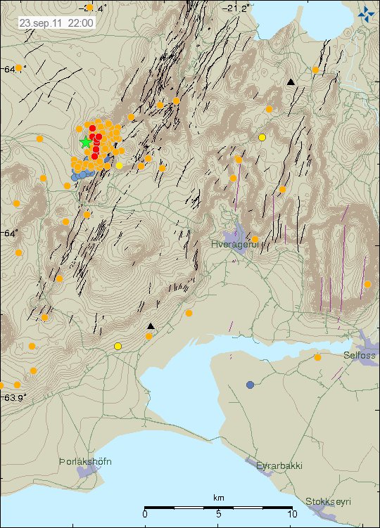
Over 400 earthquakes have been recorded in this man made swarm. I am not sure on the depth on most of the earthquakes. But it is in the range of 1 to 10 km from what I can tell. The largest earthquake in this earthquake swarm was ML3.4 in size, it had the depth of 3.9 km.


The man made earthquake swarm in Hengill volcano. Copyright of this image belongs to Icelandic Met Office.

I am going to post earthquake traces on Sunday or Monday. I am currently not at “home” (where my main computers are located), as I am taking this weekend off (if nothing large happens this weekend).


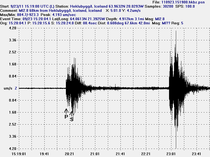
Two of the earthquakes from the man made earthquake swarm in Hengill volcano. This picture is released under Creative Common Licence. See licence web page for more details.

It is hard to know what happens as Orkuveita Reykjavíkur continues to pump down water into Hengill volcano. All that can be done is too wait and see what happens.

Blog post updated at 21:48 UTC on 26. September 2011.

Earthquakes in Katla volcano, strong sulphur smell in Múlakvísl river before the earthquake happened

This morning there has been some earthquake activity in Katla volcano. But it has also been reported in the news this morning that a really strong sulphur smell was found around 06:00 UTC on nearby farm to Múlakvísl river this morning. But this was before the earthquake did happen. I am not sure if this sulphur smell continues to be felt in the area close to Katla volcano. No changes in water hight has been detected in Múlakvísl glacier river.

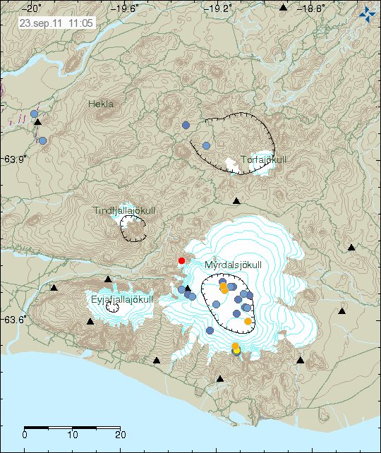
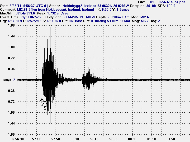
The ML2.6 earthquake in Katla volcano was on 2.3 km depth. This was mostly a dike intrusion into the bedrock of the Katla volcano caldera.


The earthquake swarm this morning in Katla volcano. Copyright of this picture belongs to Iceland Met Office.


High resolution of the Katla volcano earthquake this morning. Along with correct depth and size. This picture is released under Creative Commons licence. See Licence page for more details.

As before. This is just a wait and see what is going to happen in Katla volcano as before.

Icelandic News of the sulphur smell in Múlakvísl glacier river.

Brennisteinslykt fannst við Múlakvísl í morgun (Vísir.is, Icelandic)
Brennisteinslykt við Múlakvísl (mbl.is, Icelandic)

Update 1: According the news on Rúv this activity suggests that hydrothermal activity is continuing to increase in Katla volcano caldera. But the news also says that this activity is something like that did happen from the year 2002 to the year 2004, when hydrothermal activity did increase before it started to get lower again. It is also pointed out my Matthew Roberts that Múlakvísl glacier river is sensitive to changes in Mýrdalsjökull glacier and small floods can happen without any warning in it due to increased hydrothermal activity.

Rúv news in Icelandic about this.

Bendir til aukinnar jarðhitavirkni (Rúv.is, Icelandic)

Blog post updated at 13:07 UTC, 23 September 2011.

New earthquake swarm in Katla volcano

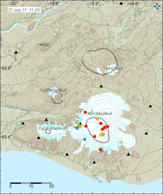
After few quiet days in Katla volcano. It seems that new earthquake swarm is about to start in it. But this earthquake swarm did start with a ML2.8 earthquake (automatic size) at 10:55 UTC. This earthquake have been followed by smaller earthquakes. So far there have not been many earthquakes in this earthquake swarm. But the largest earthquake took place on what I think is the fissure where the eruption in the year 1918 took place.


The earthquake swarm can be seen here. Copyright of this picture belongs to Iceland Met Office.

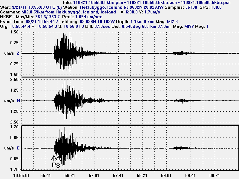
The largest earthquake clearly has magma signature in my opinion. As it can be seen on my geophone recording of this earthquake.


The ML2.8 earthquake. This picture is released under Creative Commons Licence. Please see licence web page for more details.


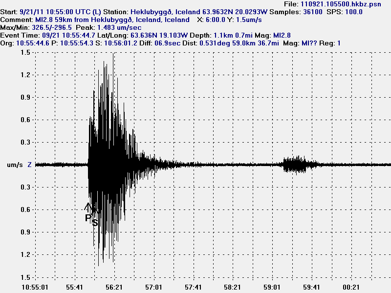
High resolution of the Katla volcano ML2.8 earthquake. The bump later on this earthquake trace is the second earthquake that only had the size ML0.9 according to the automatic size estimate. This picture is released under Creative Commons Licence. Please see licence web page for more details.

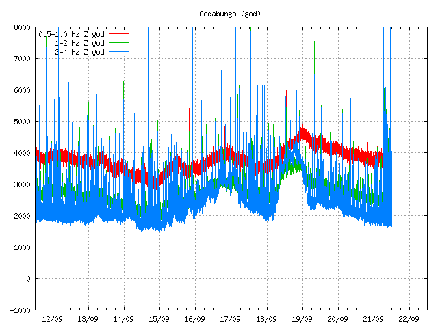
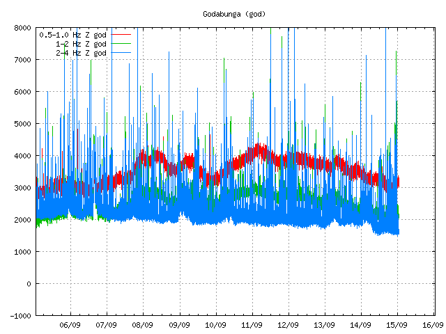
There seems to have been some type of tremor event on Goðabunga SIL station just before the earthquake. I am not sure what event this was. But it does not appear on other SIL stations around Katla volcano.


Goðabunga SIL station. Copyright of this picture belongs to Iceland Met Office.

For the moment the only thing that can be done is to wait and see what happens in Katla volcano.

More new tremor spikes in Katla volcano

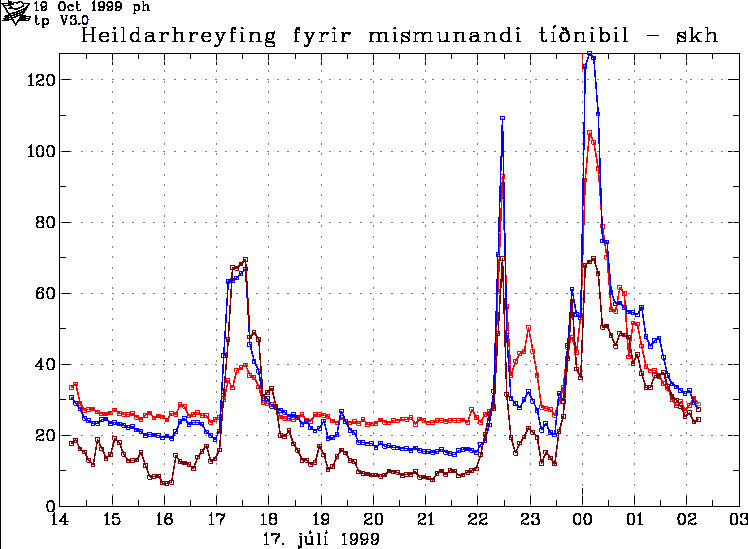
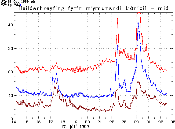
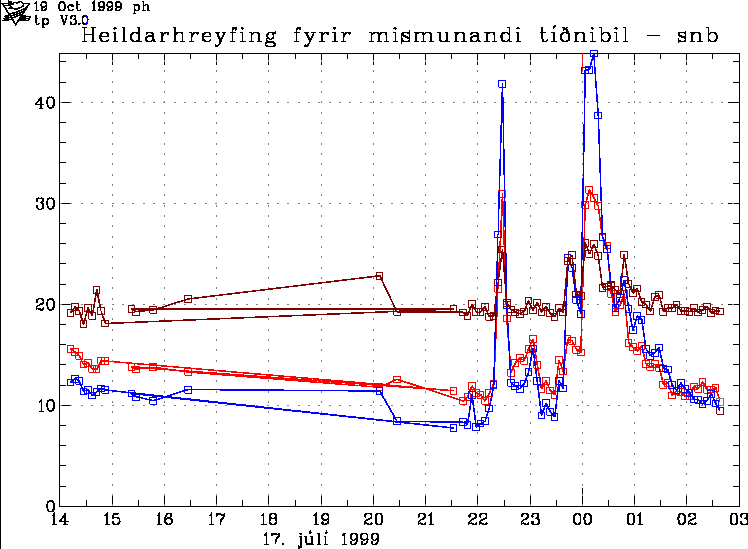
Yesterday and today there where two tremor spikes in Katla volcano. This follows a higher then normal background noise that I cannot directly trace only to wind as I did first think. What is going on is not clear, but it remains a bit of events just before the July 1999 minor eruption (suspected). But it has been speculated by scientist that event was related to inflation event deep inside Katla volcano systems. But the actual fact remains unclear. More information on the event in July 1999 can be read here (in Icelandic).

Pictures from the year 1999 of the harmonic tremor event in July that year.


The harmonic tremor spikes in July 1999 in Katla volcano. Copyright of this picture belongs to Iceland Met Office.

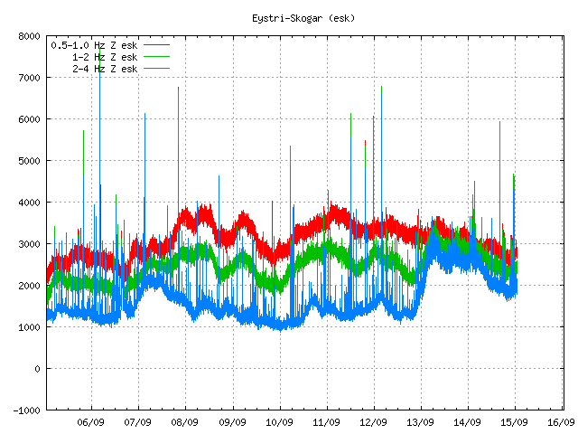
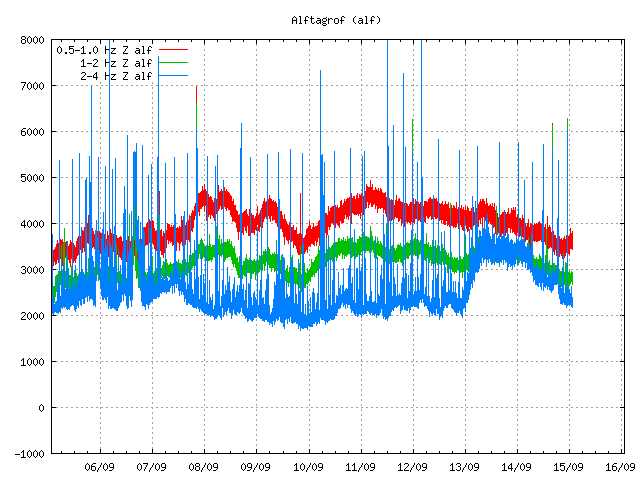
There was also special note on this tremor chart here from skh SIL station (now gone). But in the year 1999 this signal was most clear on Snæbýli SIL (snb). But today this signal appears to be most clear on Goðabunga SIL station and Eystri-Skógar SIL (esk) SIL station. I do not know what the difference is. But it clearly is something.


The harmonic tremor spikes in July 1999 in Katla volcano. Copyright of this picture belongs to Iceland Met Office.


The harmonic tremor spikes in July 1999 in Katla volcano. Copyright of this picture belongs to Iceland Met Office.

Please note that all earthquakes have been cleared from this old SIL tremor plots.

Current day activity in Katla volcano looks like this on the SIL stations where it is most clearly seen.


Odd spikes can be seen here on this tremor plot. I do not know what they are. Copyright of this picture belongs to Iceland Met Office.


Hard to see spikes can be seen on Goðabunga SIL station. They are the same as from Eystri-Skógar SIL station. Copyright of this picture belongs to Iceland Met Office.


Same as above. But stronger then on Goðabunga SIL station. Copyright of this picture belongs to Iceland Met Office.

It is hard to know for sure what this signals means. But I am sure that this signals are going to mean something someday. But when is hard to know.

More harmonic tremors in Katla volcano

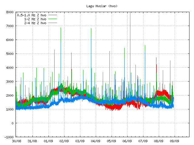
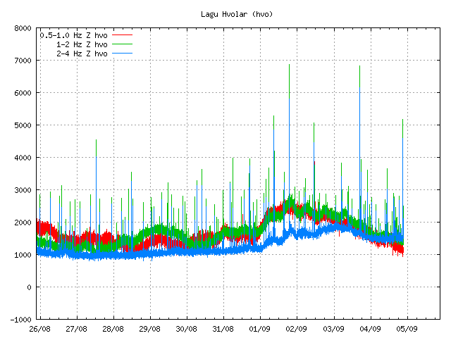
It seems that Katla volcano is not as quiet it seems to be. For the moment the harmonic tremor seems to be small and only properly observable on one SIL station due to how weak it is at current time. So far two harmonic spikes have happened. This is most likely a hydrothermal system going crazy under the glacier close to Lágu Hvolar SIL station, rather then magma on the move (or at least that is what I think).


Harmonic tremor at Lágu Hvolar SIL station. The harmonic tremor can be seen at the end of this tremor plot. Copyright of this picture belongs to Iceland Met Office.

There has not been a lot of earthquake activity in Katla volcano during the last 24 hours or so. But that might not mean anything, as eruption can and have started without any warning at all (example: Grímsvötn volcano May 2011). So for now, it is more wait and see and more waiting it seems.

Magma on the move in Katla volcano

While the source of the harmonic tremor yesterday in Katla volcano is not immanently clear. It is has been concluded that magma is on the move inside Katla volcano. It has been suggested that the harmonic tremor yesterday in Katla volcano is a mixture of both hydrothermal activity and water flows under the glacier. But hydrothermal activity has increased in Katla volcano since July and seems to be continuing on that path for now.

The earthquake activity in Katla volcano has been growing since July, when a sharp harmonic tremor spike did take place and was followed by a glacier flood that did destroy the Múlakvísl river bridge. But that flood did peak at ~5 meter high.

Currently the activity is quiet in Katla volcano. But that might be because the earthquakes are not being detected by the bad weather that is currently in this area (and all over Iceland for the fact).

Here is a overview of the change in activity since Week 34.


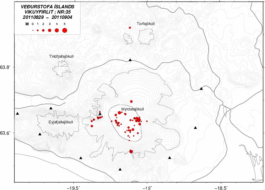
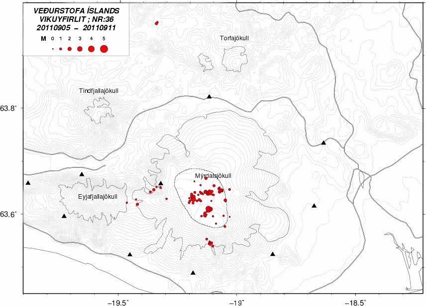
The earthquake activity in Katla volcano during Week 34. The number is the cauldron in Katla volcano. Notice the interesting earthquake activity in SE part of Katla volcano, well outside of the caldera area. Copyright of this picture belongs to Iceland Met Office.


The earthquake activity in Katla volcano during week 35. The earthquake activity in SE part of Katla volcano continues at the same place. Copyright of this picture belongs to Iceland Met Office.


The earthquake activity in KAtla volcano during week 36 (current week, last updated today 7. September 2011). Earthquake activity in SE part of Katla volcano continues as before.Copyright of this picture belongs to Iceland Met Office.

Current activity in Katla volcano is quiet (less detection due the storm is also a factor in this). But that can change without any warning at all and at any time. But there is no reason to scaremonger what is going on in Katla volcano. It is a fact of life and cannot be changed. So the best way is to prepare if people live close to Katla volcano, or if you live far from Katla volcano the best thing is to monitor and learn from what is now happening in Katla volcano. Scare tactics do not any good and serve no purposive at all and never done so.

Icelandic news about the activity in Katla volcano. Use Google translate to understand. But be aware it is not approved by Santa.


Ekki ótvíræð merki um yfirvofandi gos
(mbl.is, Icelandic)
Engin augljós skýring á óróa (mbl.is, Icelandic, 6. Sept, 2011)
Flogið yfir Kötlu (mbl.is, Icelandic, 6. Sept, 2011)
Kvika safnast saman undir Kötlu (Rúv.is, Icelandic)
Fylgjast með aukinni virkni í Kötlu (Vísir.is, Icelandic, Video in Icelandic, 6. Sept, 2011)
Jarðhiti aukist mjög mikið undir Kötlu (Vísir.is, Icelandic, 6. Sept, 2011)

Update 1: According to news the local emergency units and police have started to review the evacuation plans and emergency plans in the case of a eruption in Katla volcano.

News about that can be read here, if you risk Google Translate.

Fara yfir áætlanir um viðbrögð (mbl.is, Icelandic, 7. Sept, 2011)

Blog post updated at 00:43 UTC on 8. Sept, 2011.

Most likely water creating harmonic tremors in Katla volcano (for the moment)

In the news from Rúv at 22:00 UTC it was sad that water is the most likely source of the harmonic tremors in Katla volcano. But it seems that hydrothermal activity in Katla volcano is increasing and melting the glacier. But for the past few hours there have been signs of hydrothermal melt water getting into Múlakvísl glacier river, making the river have more water then normal and increasing conductivity in it. This is not glacier flood as such. The cauldrons that formed in July have not changed according to this news, but it was not reported if they had actually gotten deeper or larger.

Due to cloud cover it was not possible to explore the north part of Mýrdalsjökull glacier. Just the south part. According to the news on Rúv at 22:00 new small cauldron have formed in the south part of Mýrdalsjökull glacier. They are shallow at present time and may have taken few weeks for form to present size (not sure how big they are), but among this cauldrons is a cauldron that has not been seen for past seven to eight years, cracks have formed around the cauldron and he has gotten deeper and water has collected in the cauldron. But with more earthquake activity and increased hydrothermal activity under the glacier. So more monitoring is needed on Katla volcano according to Magnús Tumi Guðmundsson volcanologist at University of Iceland.

Note: When I wrote this blog post. It seems that new earthquake swarm is about to start in Katla volcano. At least I think so.

News about this events in Icelandic. Use Google translate if you want to insult the Easter-bunny.

Telja að vatn valdi óróa (Rúv.is)
Engin augljós skýring á óróa (mbl.is)
Jarðhiti aukist mjög mikið undir Kötlu – dæmigerð einkenni að menn eigi að búa sig undir gos (Vísir.is)

New harmonic tremors spikes in Katla volcano

This has become almost a daily occurrence. But today there was one harmonic tremor spike (at least) in Katla volcano. It is unclear why this harmonic tremor spikes happen in Katla volcano. But they often do happen just before a earthquake swarm starts, but often several hours before (sometimes). I am not sure why that is. But one idea is that this activity is connected to hydrothermal areas that are under the Mýrdalsjökull glacier.

Earthquake activity has been quiet in Katla volcano today. But it is hard to know for sure if that is going to last. As earthquake activity appears to be on the rise in Katla volcano during the whole of the year 2011 according to news in Iceland (see earlier blog post for details).


Harmonic tremor spike as seen on Lágu Hvolar SIL station. The spike is between 04/09 and 05/09. The spike is a small top in the tremor chart (hard to spot). Copyright of this picture belongs to Iceland Met Office.


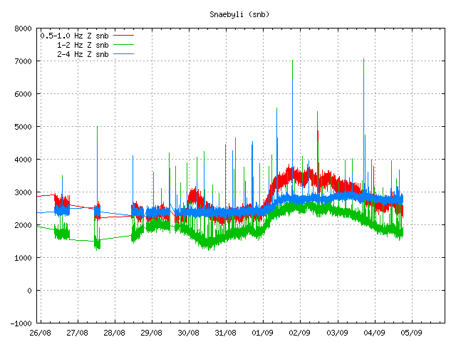
Harmonic tremor spike as seen on Snæbýli SIL station. The spike is between 04/09 and 05/09. The spike is the broad band that suddenly appears in the tremor data. It is easier to see then on Lágu Hvolar. Please note that it seems that Snæbýli SIL station has gone offline again, as it has stopped updating. Copyright of this picture belongs to Iceland Met Office.

It is clear that Katla volcano is going for a eruption. But the question remains is just when that is going to be, but it is impossible to predict when a eruption is going to take place in Katla volcano. But the signs have come clear in my opinion in this matter. For the moment it is just waiting and watching. But this might be a long wait until something happens in Katla volcano.

New pictures of Eyjafjallajökull Gígujökull glacier lava field

Rúv News has just published new pictures of Eyjafjallajökull volcano. The pictures are from Fimmvörðuháls lava field and the lava field that is in Gígujökull glacier. But in that area a lava flow did take place during the eruption. That lava field has not been explored before. According to the news, a moss has already started to grow on the new lava on Fimmvörðuháls. The Gígjökull glacier has already started to cover the lava field that did melt it during the eruption of 2010 in Eyjafjallajökull volcano.


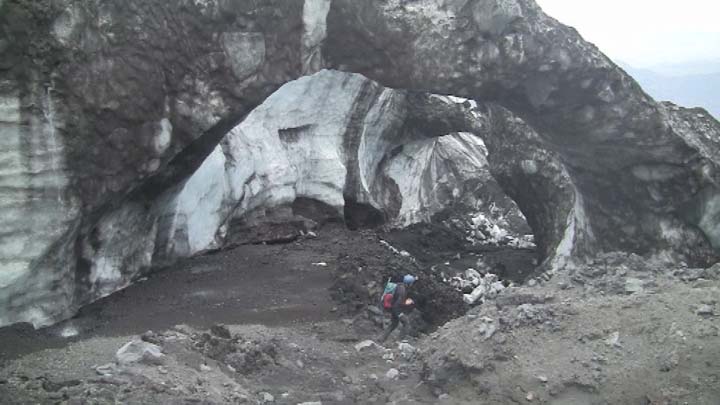
From Gígjökull glacier. Picture from Rúv News. Copyright holder of this picture is Rúv.

The news of this can be found here. This is in Icelandic.

News from Rúv.

Undraveröld í Gígjökli (Rúv.is, Icelandic, Picture, Video)

Overview of Hamarinn volcano current activity

Here is a short overview of the Hamarinn volcano activity this summer. From what I can gather in the current data this is most likely not over. During the past few days there have been at least suspected two minor eruption in Hamarinn volcano. But it hard to confirm it due to glacier that is covering this area.

This all starts on 12. July 2011 at 07:30 UTC with this event here.


The tremor spike on 12. July 2011 at 07:49 UTC. Copyright of this picture belongs to Icelandic Met Office.

When the clock is around 19:10 UTC the same day the tremor chart looks like this.
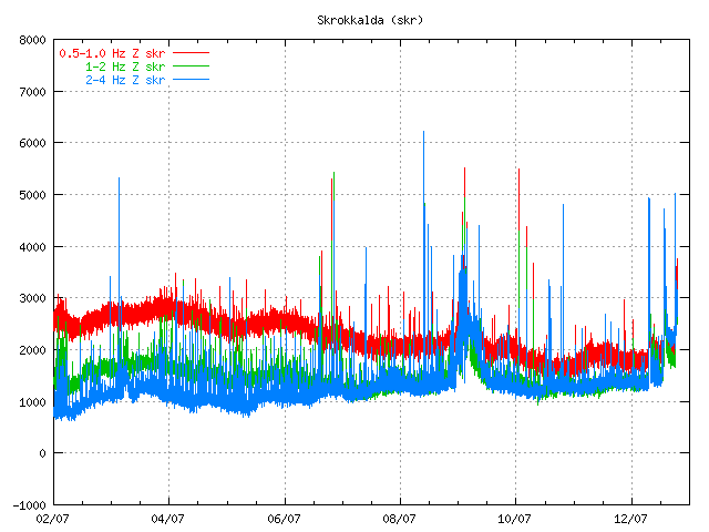

The tremor spikes are now three on 12. July 2011 at 19:09 UTC. Copyright of this picture belongs to Icelandic Met Office.

On the 13. July 2011 the tremor plot looks like this. But at that time the glacier flood had started and broken from the Vatnajökull glacier.
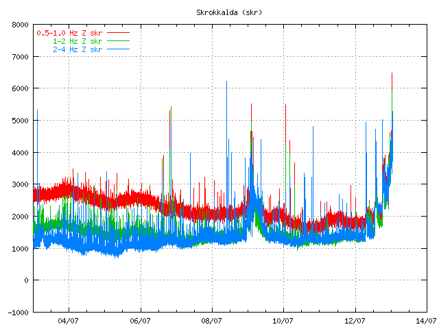

The tremor chart at 13. July 2011 at 01:10 UTC. Copyright of this picture belongs to Icelandic Met Office.
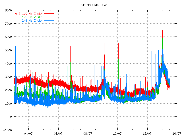

The tremor chart at 13. July 2011 at 12:59 UTC. Copyright of this picture belongs to Icelandic Met Office.

Then there was a short period of break when nothing interesting happened in Hamarinn volcano. That break did last until 16. July 2011 when a new, but smaller spike did appear on Skrokkalda SIL station.
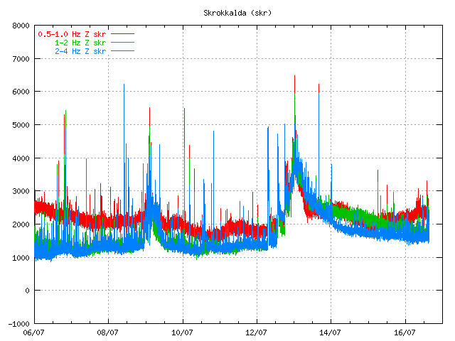

The tremor at 16. July 2011 at 15:22 UTC. It is not fully clear what did happen at this time. But this was most likely a earthquake in Hamarinn volcano. But that is yet unconfirmed at this time. Copyright of this picture belongs to Icelandic Met Office.

Then there is a new break that lasts until 1. August when a earthquakes happens deep under Bárðarbunga volcano. But the deepest earthquake had the depth of 25.2 km. But it is also important to notice this earthquake that took place on 13. July 2011 and it is from Hamarinn volcano.
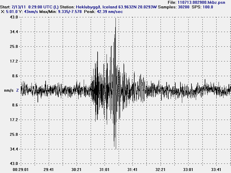

The earthquake from Hamarinn volcano. This picture is released under Creative Commons licence. Please see licence web page for more details.

On the 3. August 2011 around 02:00 UTC a new harmonic tremor spike starts to be visible on Skrokkalda SIL station.
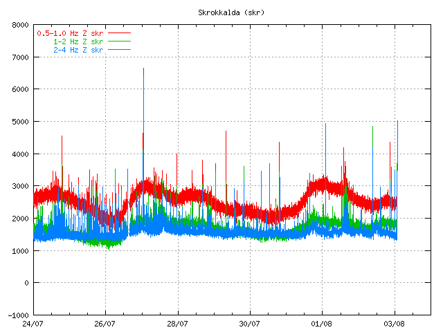

The tremor plot at 01:55 UTC on 3. August 2011. Copyright of this picture belongs to Icelandic Met Office.

This day two minor harmonic tremor happens. A change in Skaftá glacier river is noticed. That is higher conductivity and slightly more water. It was announced in the news that a Skaftá glacier river flood was about to start from the eastern glacier cauldron that is formed above the Hamarinn volcano. Today however that does not seem to be the case. As no glacier flood has taken place so far.

Today (5. August 2011) there was a new harmonic tremor spike on Skrokkalda SIL station. It did follow the same pattern as before. It started and lasted for about 20 to 60 minutes or about that long.
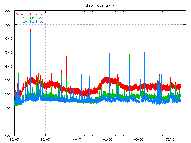

The tremor chart 5. August 2011 at 17:38 UTC. Copyright of this image belongs to Icelandic Met Office.

So far today only one harmonic tremor has been detected. But given the past experience that is unlikely to hold for a long time now. But it is impossible to know when a new event starts or how big it is going to be.

The original event on 12. July 2011 did create new cauldron in the glacier. This map from Icelandic Met Office shows the location of those new cauldrons. But it has been marked with a star on the map. The coloured dots are earthquakes in this area over the past few years.


Map of the area that is currently active in Hamarinn volcano. Copyright of this image belongs to Icelandic Met Office.

Given the current data I am expect a full scale eruption in this area soon. When is hard to know for sure. But until that happens there are going to be more smaller eruptions in this area. I do not know why there is a lack of earthquakes following this events. I cannot explain it. But because of that this can only be seen after it has started on the tremor charts.