Glacier quakes seen in Mýrdalsjökull glacier and Vatnajökull glacier

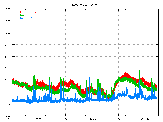
It seems that there have been few glacier quakes in Mýrdalsjökull glacier over the past few days. This glacier quakes are created by rain or some other movement in the glacier it self. This glacier quakes normally take place when there is heavy rain, or when the glacier is just moving because of water that is flooding below it. Sometimes glacier quakes also appear to happen around hydrothermal areas, but those might be harder to detect due to distance.

While not on the automatic earthquake list due how poor quality the glacier quakes are. It is still possible to see them on the tremor charts that Icelandic Met Office has on-line.

Glacier quakes seen on tremor chart of Icelandic Met Office. The quakes create an pattern of spikes on the tremor chart, it mixes into the other earthquake activity currently taking place in Katla volcano. Copyright of this picture belongs to Icelandic Met Office.

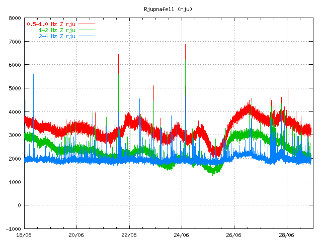
Same as above. Bust just stronger then on Lágu Hvolar SIL station. Copyright of this picture belongs to Icelandic Met Office.

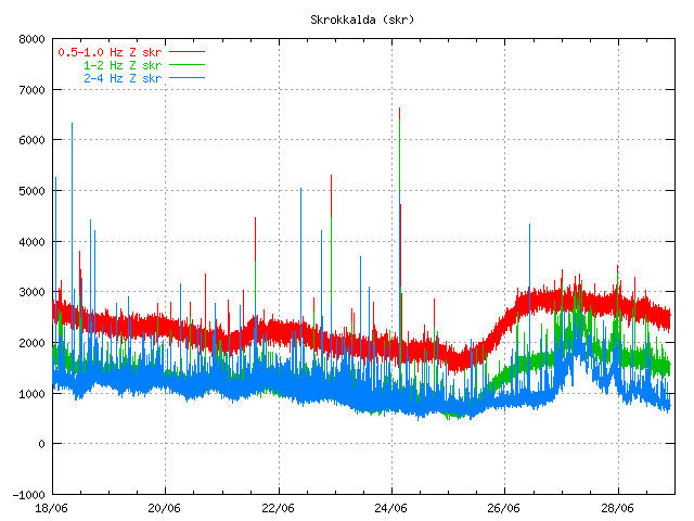
This glacier quake activity has also been taking place in Vatnajökull glacier. But the force for the glacier earthquakes in Vatnajökull glacier seems to be weather (rain and sun), rather then hydrothermal activity.

Glacier quakes can be seen close the 28th June line on the tremor chart. But most of the activity does not get recorded due to strong wind at the same time. Copyright of this picture belongs to Icelandic Met Office.

Other then this, it is quiet in Iceland. Both in earthquakes and volcanoes.

Update: I did update the history list for eruptions in Iceland to include the last eruption in Grímsfjall volcano.

Blog post updated at 22:36 UTC.

New harmonic tremor spike in Katla volcano

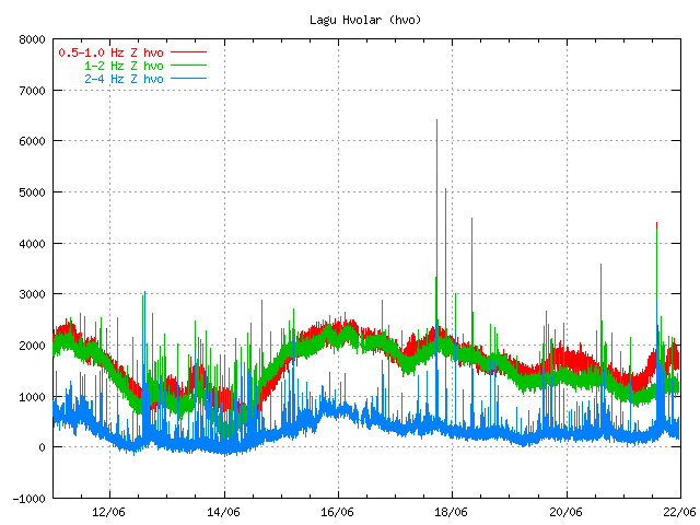
Today around 16:00 UTC there was an new harmonic tremor in Katla volcano. This harmonic tremor has two sources. Hyrdothermal activity under the glacier, or magma moving deep inside Katla volcano (without creating many earthquakes in Katla volcano). It is unclear what is the case at the moment.

This spikes are so far not related to glacier floods from Katla volcano. But that sometimes also happen without an eruption being involved.


The harmonic spike can be seen here. Close the end of the chart. It is different then the background noise as it is more powerful then the background noise. Copyright of this picture belongs to Icelandic Met Office.

It is impossible to know what happens next. But it is also important to be aware of the fact that earthquake season is starting in Katla volcano. But that is normally from end of June to beginning of October (or when it starts to snow again in Iceland). So more earthquakes are going to be seen this summer also because of more SIL seismometers around Katla volcano.

So there is no reason to panic about Katla volcano at current time. But it is worth to keep watch on it anyway.

Notice: Updates might be an little few due the fact that I am now working all day during the week and I am tired in the end of the day with no energy to write new blog posts. But I am going to do my best anyway.

Hydrothermal areas grow larger in Krýsuvík volcano due to earthquake swarm

According to news from Rúv. It appears that hydrothermal areas in Krýsuvík volcano are growing larger following the earthquake swarm in the past few days. This same news also tells that the number of cracks in the ground have grown in numbers following the earthquake swarm, this allows more water to get into contact with the hot rock and that warms the water up fast.

Currently the earthquake swarm in Krýsuvík volcano is quieting down. But that might chance without any warning at all. But won’t be surprised if the earthquake swarm stops completely.

In my personal opinion this is a clue that magma might be pushing it’s way up the Krýsuvík volcano system. I get the clue from the increased hydrothermal activity in the this area. But at the moment it is too early to know for sure if this is going to result in a eruption or not. But if this activity continues as it has then a eruption is going to happen one day. That can also chance without any warning at all. But this type activity means that status of the volcano it self is constantly changing and makes it unpredictable. How eruptions in Krýsuvík volcano behave is also a big unknown.

Update: According to Rúv evening news (Icelandic, video) there appears to be magma related aspect to this weekend earthquake swarm in Krýsuvík volcano. According to Dr. Páll Einarsson geologist at Iceland University it appears that magma is the source (as stated above) of this weekend earthquake swarm. This news also says that there has been a lot of earthquake activity in Krýsuvík volcano over the past two years and this earthquake activity is not only tectonic as is common in this area. The news at Rúv also says that geologist in Iceland are wondering and unsure what exactly is going on at Krýsuvík volcano at the moment. But the reported inflation in the news at Rúv is sad to be 10 cm (I do not know if that number is accurate or not). But it clearly a reason now to watch the activity at Krýsuvík volcano. If there is a eruption in Krýsuvík volcano it is going to be a harmless (as it can be) lava eruption. Unless it is under water, but then there is a Surtsey type of eruption for as long there is water getting into the crater. So don’t expect aircraft problem if there is a eruption in Krýsuvík volcano.

Thanks to The other lurker for the news tip.

News about this. Use Google Translate at own risk.

Jarðhitasvæðið hefur stækkað (Rúv.is)

Blog post updated at 21:15 CET on 28.02.2011. News item about Krýsuvík volcano from Rúv added.

Increased geothermal activity in Grímsfjall volcano

According to a news by Morgunblaðið (mbl.is) there is a increased geothermal activity in Grímsfjall volcano. The news reports that in fields close to the houses (hud or something like that) that research and mountain group have in the area there is increased geothermal activity. There is hard to know from the news report how much increase in activity there is. But but this increase appears to be significant as it got noticed by a group that was travelling in the area few days ago.

The group that did go there few days ago where from the Icelandic glacier research society. They did agree that they never had seen so much geothermal activity in the area. The inflation in Grímsfjall volcano is now more then it was before the eruption in 2004 according to the news. There is a good chance that the ML3.5 and ML4.2 earthquakes few days ago did change pathways in the ground and allowed the hot water to rise to surface in this location.

Thanks to Fireman to find this news.

Icelandic news about this. Use Google translate at own risk.

Mikill hiti í Grímsfjalli (mbl.is) – There is a picture in this news of the new geothermal activity.

Pictures of Kleifarvatn lake hot springs

I got this pictures in a email from a person how wants to remain nameless. Don’t ask me why, it is just a request that I got with the email and I see no reason not to grand it.

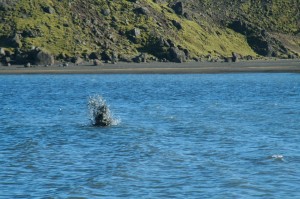
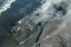
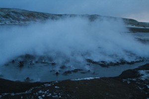
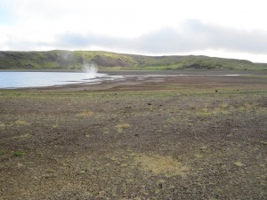
The hot springs at the south end of Kleifarvatn lake hot springs. The hot springs there are not new. But they do get lost when the water level rises in Kleifarvatn lake. When the water level dropped after the year 2000 years in the area this hot springs where for the first time visible to humans.

Click on all the pictures to get a full resolution.

The earthquakes swarm at Krísuvík (close to this area) continues with few breaks it seems.

Two earthquakes yesterday and ground water heat map of Iceland

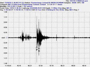
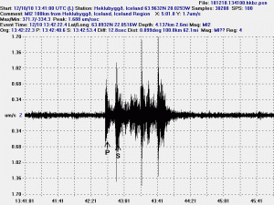
Here are two earthquakes that I did record yesterday. The earthquakes took place at Arnarvatns highland and in Krísuvík yesterday. The difference between the earthquakes is that one of them took place where the crust is old and carries the earthquake wave well. The second earthquake(s) took place where the crust is young, fractured and does not carry the earthquake wave that well most of the time. If a fracture area is not in-between the epicentre and the sensor in question.

The earthquake at Arnarvatns highland. The earthquake wave clearly shows what type of crust it has been going trough. In this case a old crust that carries the wave well in my direction. I cannot tell what way the crust fractured in this case, as I need a minimal of three geophones to do so.

The Krísuvík earthquakes. This is actually a string of many earthquakes. When this happens the SIL system that IMO has major issues with locating the earthquakes. As the S wave often get absorbed by the next P wave that follows the next earthquakes. Sometimes however the waves get separated at some distance. That often helps to figure out how many earthquakes happened at the same minute. What is also interesting about this earthquake is the fact that it is “noisy”. But a normal earthquakes has a clear P wave and clear S wave. But on Reykjanes and Reykjanes Ridge there are often noisy earthquakes. I do not know why that happens and I don’t think the reasons for noisy earthquakes are not at all understood (far as I know anyway).

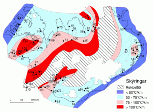
This map here shows how warm the hot water is in Iceland. Where I live the hot water is about 66C warm. It is a deep magma that warms the ground water up to this levels. There is a good article on this process at Wikipedia here.

Text updated at 17:15 UTC on the 11th of December 2010. Spelling error fixed and minor text changes.