Krísuvík volcano inflates and deflates regularly

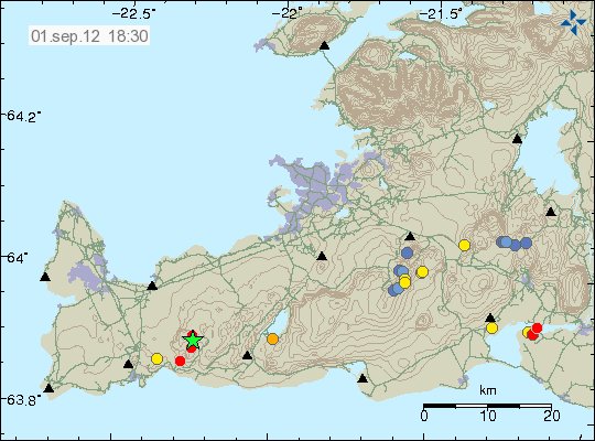
It seems that Krísuvík volcano is inflating and deflating on regular basic. I do not know how regular this change is. But it has been noticed by Icelandic scientists how are bit puzzled by this behavior. Last inflation episode did last until end of the year 2011. Since then deflation did start again and is currently ongoing. It is uncertain if what this means. At the moment it is too early to know for sure if this means if that Krísuvík volcano is getting ready for an eruption. But if there was an eruption in Krísuvík volcano, it would be Hawaiian eruption so no volcano ash. Volcano ash eruption would only take place if an eruption started in Kleifarvatn lake. But the effects of that would be limited to local area (Reykjavík and other nearby towns). It would not create any global problems, as many would want to believe.

Inflation and deflation period have been the years 2009, from January to September. In May 2010 inflation did start again, that inflation period lasted until end of the year 2011. Since then deflation has been taking place. Today there is continues GPS monitoring in Krísuvík volcano. But it is unknown if this type of behavior has taken place before in Krísuvík volcano. But for now Krísuvík volcano is being monitored both with GPS and the SIL network. What happens next anyone guess.

Icelandic news about this.

Land rís og sígur í Krýsuvík (Rúv.is)

Katla volcano warming up for an eruption. Small glacier flood continues

This is going to be a short blog post. As I am going to be short of table and a cheer for few more days.

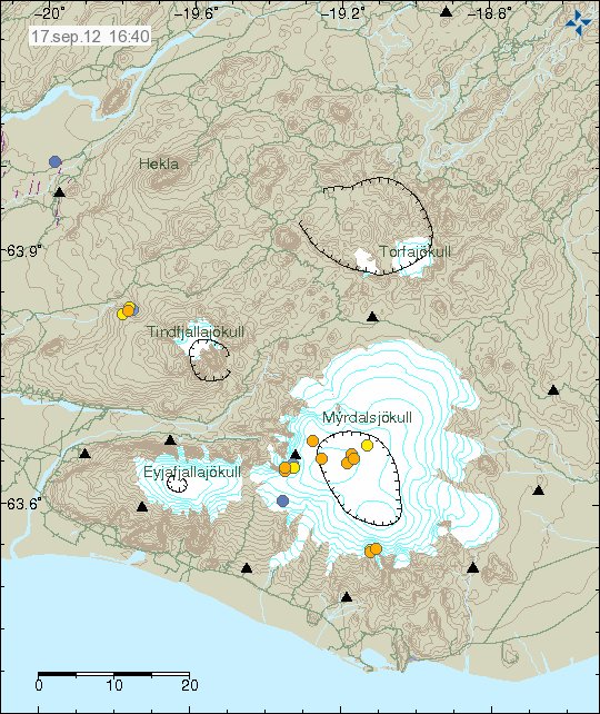
It seems that Katla volcano is warming up for a eruption. As I did mention in last blog post. But there is more to this. As the glacier flood that started on the 28. April 2012 continues according to a email that I got from an geologist working at Iceland Meteorological Office. But that suggests two things. That there is currently an ongoing melting of glacier taking place in Katla volcano, or there is a slow drainage taking place from some area in Mýrdalsjökull glacier. But given increased conductivity following this it is clear that this water has been in contact with magma. But that can be seen with the increased conductivity in the water.

There have not been many earthquakes following this events. But from the earthquakes that have happened. It seems that most likely source for current events is close to or the same area that erupted in July 2011. But at the moment this is just speculation based on limited data. It has not been confirmed so far.


The harmonic tremor that started on 28. April 2012. This is Lágu Hvolar SIL station. Copyright of this picture belongs to Iceland Meteorological Office. Used with written permission.

This plot shows clearly how the harmonic tremor starts and continues at same level for several days. I do not know if the harmonic tremor is ongoing. But I find it likely, if the small glacier flood is currently going on (that was my last information, but things might have changed during the day). But it is hard for me to know that for sure. But based on latest data from the water monitoring system around Katla volcano, the spike in this glacier flood is most likely over for now. But it impossible to know what happens next in Katla volcano. All that can be done is to wait and see what happens next.

Small glacier flood from Mýrdalsjökull glacier on 28. April 2012 [Updated]

This has to be short. I do not have any table to cheer right now. I have already bought one (used and cheap). But I get it next week. I also do not yet have a ADSL connection so far. But this is what happens when one moves between countries.

On the 28. April 2012 there was a small glacier flood from Mýrdalsjökull glacier that on top of Katla volcano. This activity did start few days earlier according to Iceland Meteorological Office. But it did peak on the 28. April 2012. This was then followed by a small glacier flood in Múlakvísl river. The same river that had the glacer flood last summer, that did destroy a bridge in that same area.


The red line marks the harmonic tremor of Katla volcano. The blue line marks the conductivity in Múlakvísl glacier river. This is from Week 18 of the year 2012. Copyright of this picture belongs to Iceland Meteorological Office.

There was also a second event that took place in Katla volcano on 6 and 7. May 2012. But I do not know if there was any glacier flood in Múlakvísk glacier river following that event. Buit it is clear that Katla volcano is warming up again. This events are clearly something that I consider a warning on what is going on in Katla volcano. But it is a question if it continues or just stops, as so often does happen with volcanoes.

Update 1: According to a email answer that I got with a question of mine. This glacier flood is currently ongoing. It has not stopped so far. But this is a small glacier flood. But this is a interesting what is going on in Katla volcano at the moment.

Icelandic news about this.

Smáhlaup í Múlakvísl (mbl.is, Icelandic)

Blog post updated at 14:38 CEST on 11.05.2012.

Overview of earthquake activity in Iceland past few weeks

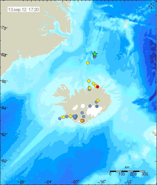
During the past few weeks it has been quiet in Iceland. With few earthquakes. March for instance was rather quiet month. In Week 17 there was more activity in Katla volcano, then the weeks before.

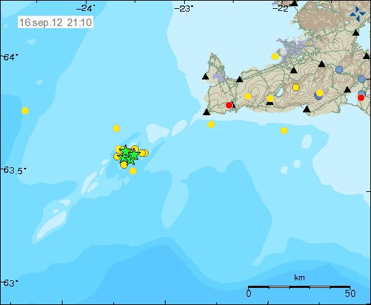
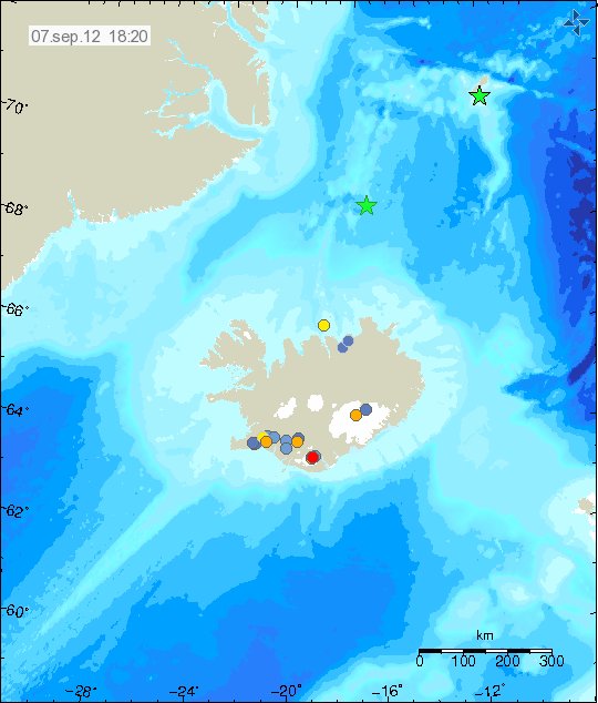
There have been several small earthquake swarms taking place in Iceland during past few weeks. Most noticeable was off the coast of Flatey. That is on TFZ earthquake zone. Also there was a noticeable earthquake swarm in Hengill volcano due to water pumping activity. There has also been earthquake activity on the Reykjanes ridge. Where the largest earthquake had the size of ML3.3.

Other then this minor earthquake activity. It is has been rather quiet in Iceland for several weeks now. This does happen in Iceland. But even so, there is always something interesting going on when it comes to earthquake activity in Iceland.

Earthquake activity close to Hekla volcano

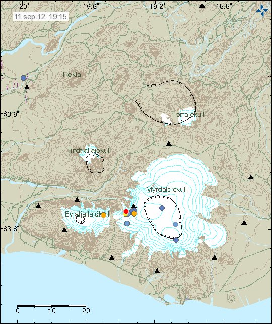
Yesterday there was an interesting swarm of small earthquakes in Hekla volcano system, or to be accurate. The earthquake swarm took place on the edge of Hekla volcano system. How far into the SISZ it was I do not know. For some unknown reasons, the earthquakes have not yet been reviewed. So errors are in there location and depth.


The earthquake activity on the edge of Hekla volcano system. Copyright of this picture belongs to Iceland Meteorological Office.

I have no idea what this means in terms of possible eruption in Hekla volcano. But this activity is interesting. But this is however not something that is new to this area. But it is uncommon anyway.

Activity in Hekla volcano system can be monitored on my web page with webicorders. Some of them have high human and wind noise however. As this is not expert setup that I am using.

Earthquakes recorded in Snæfellsjökull volcano

Snæfellsjökull volcano is not often in the news in Iceland. But today there was a short news about it due a study that was done last summer on earthquake activity in Snæfellsjökull volcano. The study was to see if there where any earthquake activity in Snæfellsjökull volcano. The results are really interesting, the main result was there is a lot of earthquake activity in Snæfellsjökull volcano. But also that most of the earthquakes take place on the depth from 9 to 13 km depth. This study was done by Matteo Lupi and Florian Fuchs at Bonn University in Iceland.

The reasons for earthquake activity in Snæfellsjökull volcano is magma. There are not a lot of tectonic movement in Snæfellsjökull volcano area. As it is a volcano zone, but not a rift zone as is the case in most areas of Iceland. But so far it seems that there is no risk of volcano eruption for now. At least that is the opinion for the moment.

Image removed at the request of its author.

Currently there is no permanent SIL network (IMO wants to install SIL stations, but they lack funding to do so) or other type of Seismometer network on Snæfellsnes peninsula. This is bad, because this area has three active volcanoes that erupted around 1000 years ago. Along with populated areas close to this volcanoes. I plan on trying to setup few geophones in that area if I can. But currently I do not have any money or way to install and run geophones on Snæfellsnes peninsula. My closest geophone to Snæfellsnes peninsula is at Hvammstangi village. Closest the distance is around 84 km or so to the Ljósufjöll volcano. But that means I can record earthquakes down to ML1.0 in the best weather. But since I just have one geophone in this area at the moment. I cannot locate any earthquakes. I just know that they take place.

This is based on blog post from Haraldur Sigurðsson, geologist.

Blog post and news about this in Icelandic

Jarðskjálftar undir Snæfellsjökli kalla á skjálftamælanet (blog.is, Icleandic)
Þörf á skjálftamælum við Snæfellsjökul (mbl.is, Icelandic)

Blog post updated at 20:10 UTC on 17.04.2012
Blog post updated at 20:13 UTC on 17.04.2012
Blog post updated at 15:23 UTC on 20.04.2012

Askja lake ice-free mystery deepens

A short update on Askja volcano ice-free lake.

There have been news about the tour of geologist to Askja lake this week in the news. So far the result are puzzling. It turns out that Askja lake is just 1C, but that is normal for this time of year. So why it is ice-free remains a mystery at current time. Data from GPS and seismometers. Samples of the water has been taken also for a analyze and review of weather condition’s is under way. But so far the Askja lake mystery deepens.

News about Askja volcano and new video of Askja volcano. Use Google translate in the hope to understand what is sad.

Ísleysið á Öskjuvatni er ráðgáta (Rúv.is, Pictures, Icelandic)
Loftmyndir af Öskjuvatni (Video of Askja lake, Icelandic)

Ice free Askja lake due to increased hydro-thermal activity

According to news on Rúv scientists are now on there way up to Askja volcano to see what is going on and why Askja volcano has become ice-free. But it now believed that increased hydro-thermal activity in Askja volcano is the reason why Askja lake got ice-free during middle of winter.

The tour is expected to last for around 3 to 4 days if the weather is good. GPS data is also going to be collected in this trip to Askja volcano.

Iceland news about this. Use Google translate in order to try and understand this.

Aukinn jarðhiti bræddi ís á Öskju (Rúv.is, Icelandic)

This blog is shorter then normal because the hard disk in my laptop is giving up. I am going to try and setup linux based USB stick to boot the computer up. That should resolve any major issue that I am currently having like speed, sometimes just opening up a new browser window takes up to two minutes due to how slow the hard drive is now.

Harmonic tremor event in Hamarinn volcano

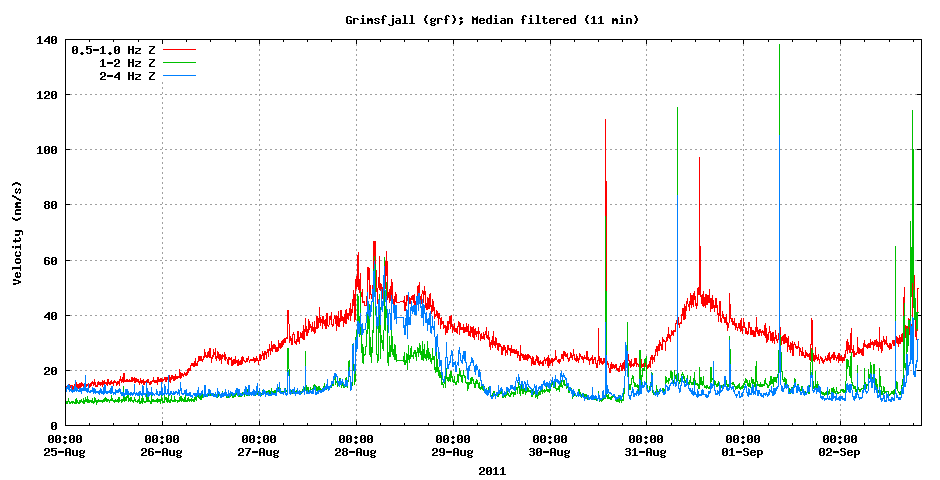
Tonight there was an small harmonic tremor event in Hamarinn volcano (Loki-Fögrufjöll, Bárðarbunga). This event was not big. But did appear on the Skrokkalda SIL station and on Grímsfjall SIL station. The pattern that is now appearing is the same one that did appear in July 2011 in the minor eruption in Hamarinn volcano. But that event took place week after Katla volcano minor eruption.


The harmonic tremor pulse on Skrokkalda SIL station. This is most likey from Hamarinn volcano. Copyright of this picture belongs to Iceland Meteorological Office.


The harmonic tremor pulse on Grímsfjall SIL station. This is most likey from Hamarinn volcano. Copyright of this picture belongs to Iceland Meteorological Office.

What gives clues that this Hamarinn volcano is that few days ago it had minor earthquake activity. But this area does not seem to need a lot of earthquake activity before a minor eruption takes place. Why that is I have no idea at present time.

I am going to update this blog post as event progress.

Few earthquakes in Hamarinn volcano and Kverkfjöll volcano

After several weeks of quiet period, activity in the volcanoes that are close to or in Vatnajökull glacier. During the past few days there have been earthquakes in several volcanoes in Vatnajökull volcano. Today it is the Hamarinn volcano and Kverkfjöll volcano.

Hamarinn volcano (Loki-Fögrufjöll)

Hamarinn volcano had its first eruption in July 2011. This eruption was small and started without even a hit of earthquake activity. It created a glacier flood that topped at 2100 M3. It did not create any damge. But it filled a human made lake that is used for power production in this area. That eruption was short, it only lasted for about 24 hours, maybe even less. Today this area of Hamarinn volcano has been having minor earthquake swarm. But this does not mean it is going to erupt again. But it also shows that current activity in Hamarinn volcano is not over.


Earthquake activity in Hamarinn volcano today (08.04.2012). Copyright of this picture belongs to Iceland Meteorological Office.


The earthquakes seen on Skrokkalda SIL station. The earthquakes from Tungnafellsjökull volcano are also clear on this tremor plot from Iceland Meteorological Office. Copyright of this picture belongs to Iceland Meteorological Office.

Kverkfjöll volcano

Kverkfjöll volcano have been warning up to a eruption for some time now. When they might erupt is impossible to know at current time. But it is save to say that at present time, no eruption is going to take place any time soon. This however means that earthquakes are increasing in Kverkfjöll volcano. Most of the time there are just small earthquake swarms in Kverkfjöll volcano. No other changes have so far been noticed in Kverkfjöll volcano. But that is unlike what has been taking place in Askja volcano in the past few weeks.


Earthquake activity in Kverkfjöll volcano. This are just small earthquakes so far. Copyright of this picture belongs to Iceland Meteorological Office.


The tremor plot from the SIL station that is closest to Kverkfjöll volcano. It just barely shows the earthquakes that have been taking place in Kverkfjöll volcano. Copyright of this picture belongs to Iceland Meteorological Office.

After several weeks of quiet in Iceland it seems to be that the quiet period is over. But if it is going to going to result in any major activity is impossible to know at this point.


Volcanoes of Iceland. Copyright unknown, Google Inc. But the picture is from here (warning! Conspiracy web site.)