Look at Tungnafellsjökull volcano earthquake swarm

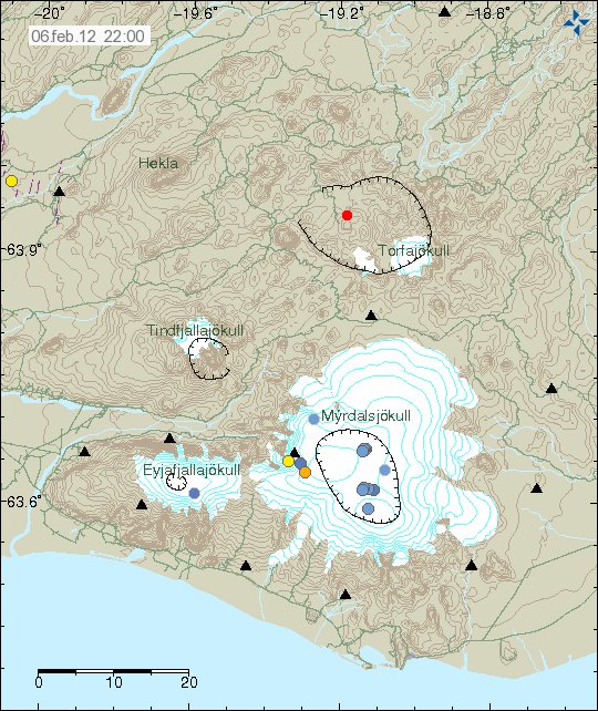
Here is a quick look at the earthquake swarm in Tungnafellsjökull volcano this morning. This earthquake swarm is interesting, as it started with few earthquakes at the depth of around 10 km. This suggests that magma might be pushing up to the volcano at depth now. So far this is not any high volume in my option, at least not enough to start an eruption now. But if this progress continues, it is going to end with an eruption one day. But when and how big is impossible to know at current time. for the moment the earthquakes have stopped. But it is my opinion that this a dike intrusion, not tectonic earthquakes. This can be seen how the earthquakes line them self up from 12.6 km depth and up to 3.6 km depth in almost straight line based on there location.


The earthquake swarm in Tungnafellsjökull volcano. Copyright of this picture belongs to Iceland Meteorological Office.

The earthquake swarm is dense, but that suggests an magma dike intrusion from deep within the volcano. Similar earthquakes have been seen in other volcanoes, like Esjufjöll, Askja, Katla so few are mentioned. So I know this pattern when I see it.
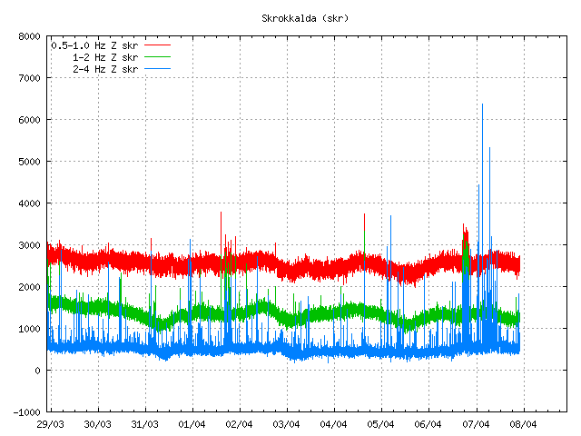

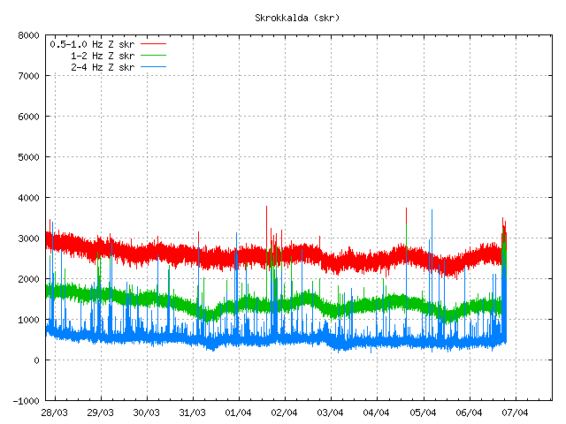
The earthquake pattern as it did appear on Skrokkalda SIL station. The tremor chart shows that the earthquakes where high-frequency earthquakes for most part. Something like that was seen in Eyjafjallajökull volcano before it erupted (it had earthquakes like that many years before it erupted, not just few weeks before). Copyright of this picture belongs to Iceland Meteorological Office.

I did record the largest earthquake on my geophone at Hvammstangi and at Heklubyggð. Based on that trace, the earthquake was noisy. Given me even more clues that support my suggestion that the earthquake swarm was due to dike intrusion.

Similar dike intrusion events are now taking place in Kverkfjöll volcano. But I am going to write about that tomorrow. But earthquakes in Kverkfjöll volcano have been taking place for several years now, with short and long breaks between earthquake swarms.

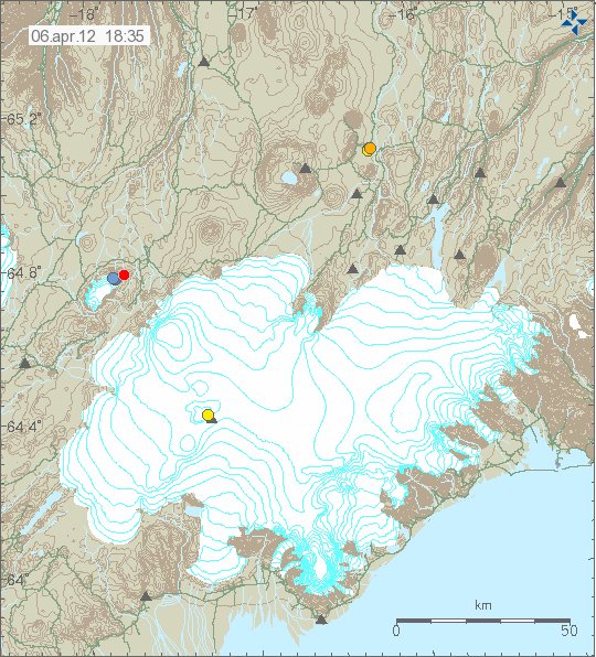
Interesting earthquake activity in Tungnafellsjökull volcano

This is not the most known volcano in Iceland, it also has not erupted in the last 10.000 years at least. Normally this volcano does not have any earthquakes and it remains really quiet. Last major earthquake activity was in the year 1996 in relation to the activity in Bárðarbunga volcano and in Grímsfjall volcano that year. This volcano is named Tungnafellsjökull. It is a small volcano compared to other volcanoes in the area. During the past few days there have been several interesting earthquakes in Tungnafellsjökull volcano. They are small, around ML1.6 the largest ones. But they do have the depth of 10 to 12 km. That is what makes this earthquake activity interesting. Since this suggest that magma might be pushing into the volcano. However at this point in time, there is nothing to suggest an eruption is even close to start there. But with all long dormant volcanoes, nobody never knows what can happen next in them.


The earthquake activity in Tungnafellsjökull volcano. The volcano is located NW of Vatnajökull glacier. Copyright of this picture belongs to Iceland Meteorological Office.

Following the later earthquake today. This activity started on Skrokkalda SIL station. But this might be due to activity in Hamarinn volcano (Loki-Fögrufjöll at GVP). Not Tungnafellsjökull volcano.


The odd tremor activity on Skrokkalda SIL station. I do not yet have any explanation for this activity. Note that Skrokkalda SIL station is on top of a volcano (not on GVP list, but geological maps made in Iceland), named Skrokkalda, it also has not erupted in historical times to my knowledge. Copyright of this picture belongs to Iceland Meteorological Office.

What happens next in Tungnafellsjökull volcano is impossible to know. But it is most likely going to do what it has been doing for the past 10.000 years. A lot of nothing.

Overview of current events in Askja volcano

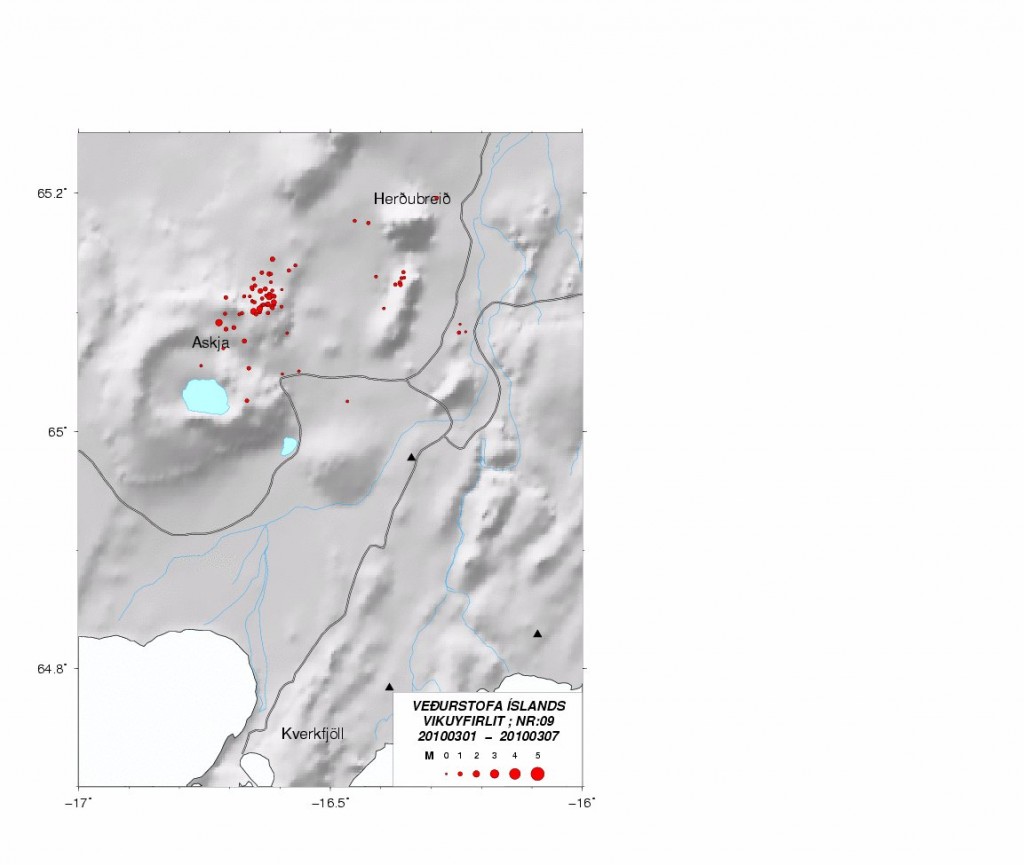
The current events in Askja volcano started in Week 9 of the year 2010. Before that, Askja volcano has been showing signs of change since the year 2007 at least. In the year 2010, Week 9 a earthquake swarm was recorded by Iceland Meteorological Office. Most of the earthquakes where at around 20 km depth, and it was followed by considerable amount of harmonic tremor activity. I did know about it at the time, but I did think it would be at least 10 to 20 years until Askja volcano would not erupt. But this might have been a event in an series of event that started long time ago, without me knowing about it before (I am still checking data, it takes some time).


The earthquake activity in Askja volcano in Week 9 of the year 2010. Copyright of this picture belongs to Iceland Meteorological Office.

The image above clearly shows where magma was flowing into Askja volcano around 20 km depth. But they are to the north-east of Askja lake. The depth of this earthquakes was from 20 to 23 km.


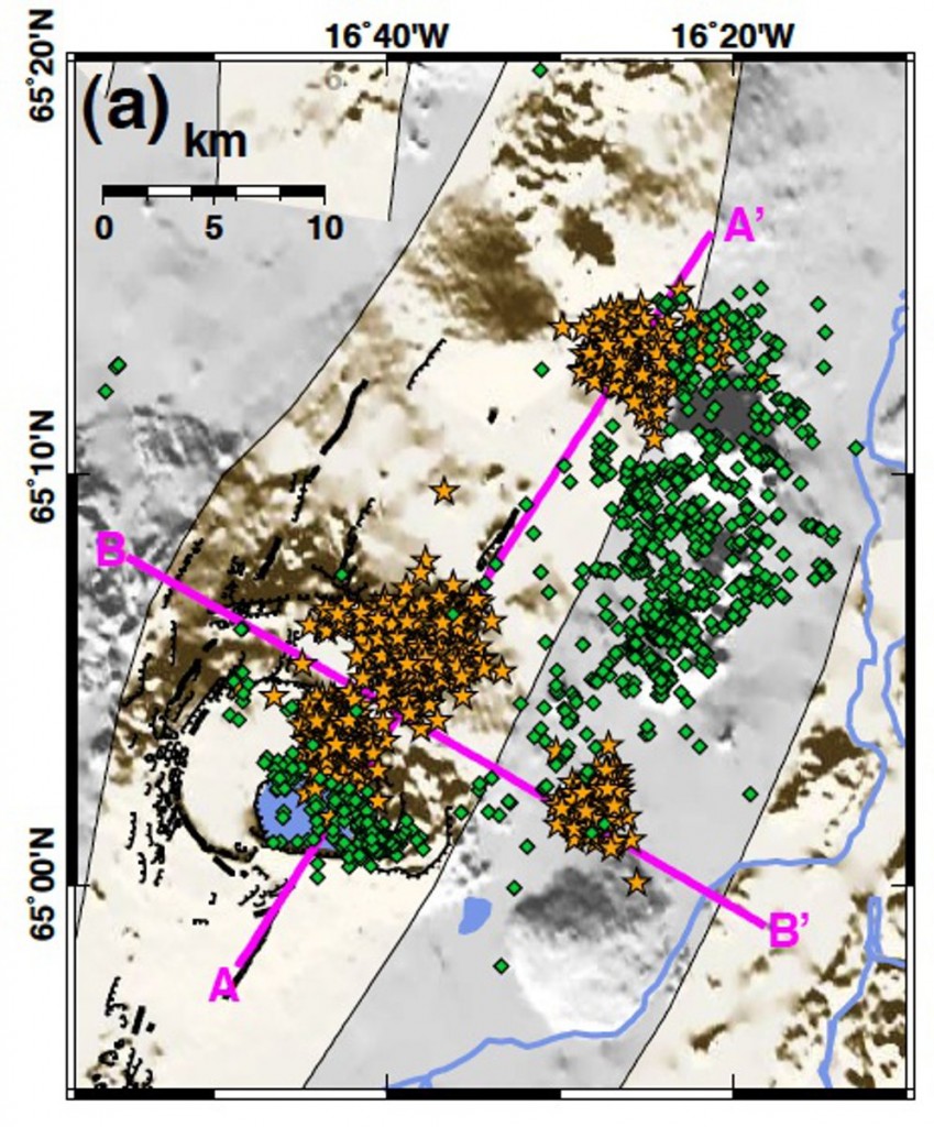
Map of earthquake activity in Askja volcano. The green dots are earthquakes with a shallow depth, that is depth from 2 to 8 km. Yellow earthquakes have the depth of 12 to 30 km. This data is from the year 2007 at least. Copyright of this picture belongs to its owner (Janet Key).


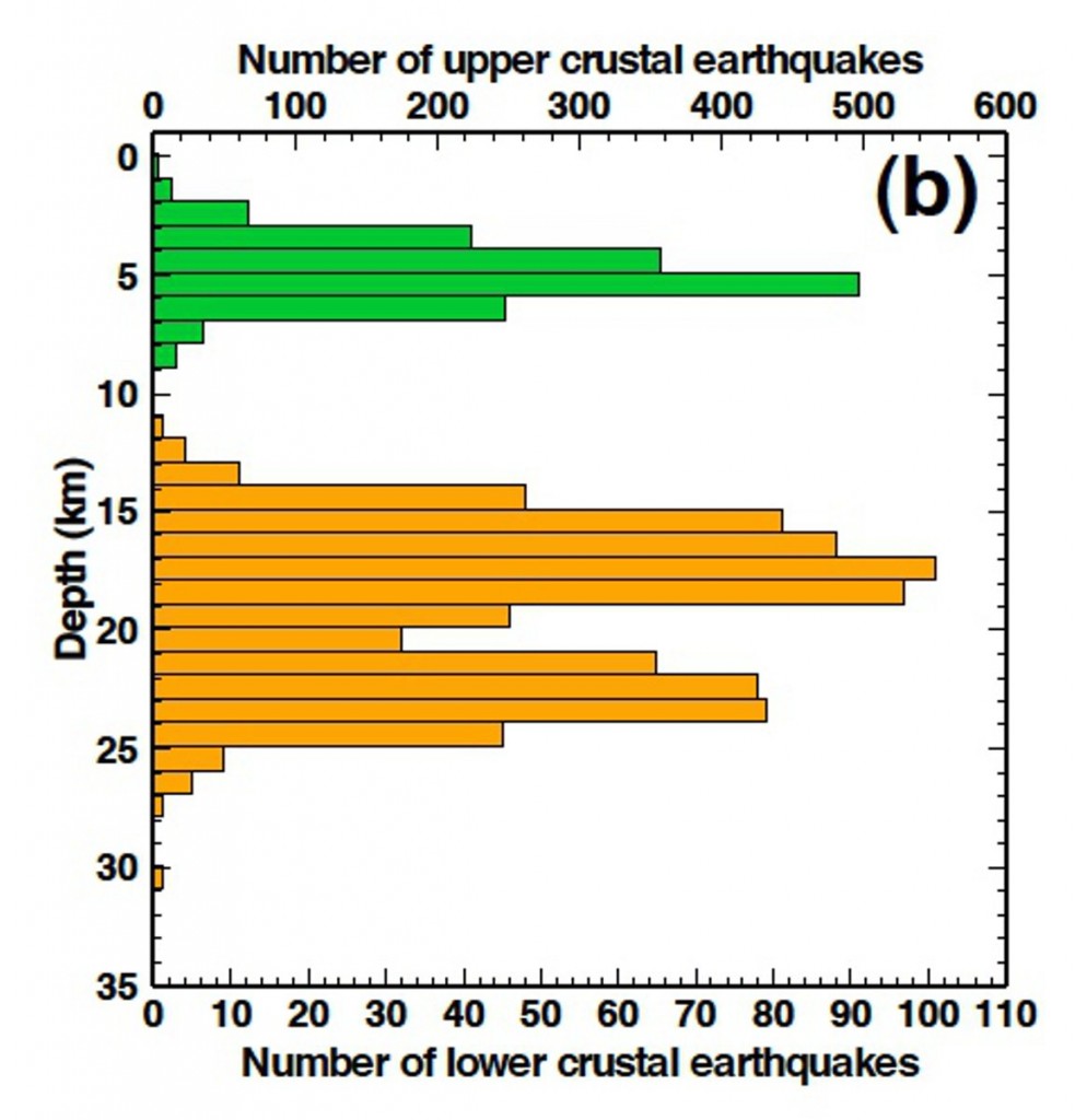
The depth of the earthquakes in Askja volcano. Copyright of this picture belongs to its owner (Janet Key).


Depth of the earthquakes. This view shows also where the earthquakes are taking place in Askja volcano and close to it. Copyright of this picture belongs to its owner (Janet Key).

All of this map and charts are from this blog post here.


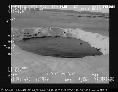
This is a heat camera image of Askja lake. Copyright of this picture belongs to Iceland Coast Guard, the image is from here.

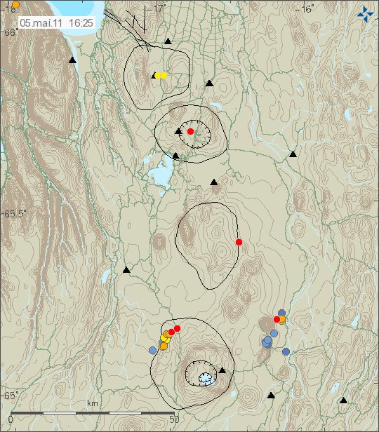
Last year (2011) there was an dike intrusion in north part of Askja volcano. This dike intrusion was clear by a earthquakes that took place. But it stopped and has not shown any activity again in this area. As sometimes happens with dike intrusions. But this activity is an good sign that magma is now flowing into Askja volcano again. But over period of at least 10 to 20 years, it seems that magma has been flowing out of Askja volcano system. Where it has been going I have no idea. But some hypothesis suggests that it might be flowing into Krafla volcano. But there is no good data to support this hypothesis in partial.


Activity in Askja volcano in the year 2011. This activity took place on 05.05.2011 at 16:25 UTC. Copyright of this picture belongs to Iceland Meteorological Office.

At the moment there is nothing that suggest eruption is imminent. But current progress in Askja volcano is something to keep an watch on. But it is also clear that current status in Askja volcano is changing fast. So while there is nothing to suggest a eruption at the moment, it might change without warning in Askja volcano.

Pictures of Askja lake.

Askja lake 12 June 2011.
Picture of Askja lake (32 months ago according to flickr.)

Minor earthquake cluster in Katla volcano caldera

There seems to be forming of minor earthquake clusters in Katla volcano caldera. But this has been following growing number earthquakes in Katla volcano caldera during past few weeks. This is most likely an signal of increased activity in next few weeks to months. But the increase does not have to been slowly up. It can be sudden as did happen in July 2011 in Katla volcano caldera when earthquake activity did increase suddenly and there was an small eruption without an warning.


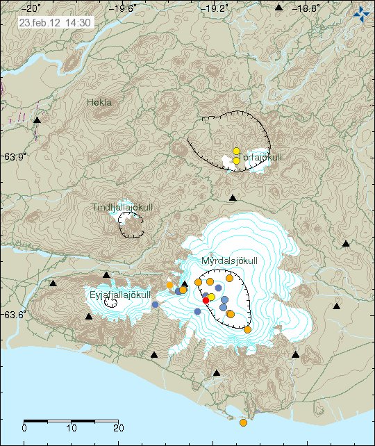
Current earthquake activity in Katla volcano. Note the small cluster of earthquakes close the area where an small eruption took place in the year 1999. Copyright of this image belongs to IMO.

There has been some small cluster of earthquakes taking place in Katla volcano caldera. I am not yet sure what that means at the moment. However this might be clues to minor dike intrusions into Katla volcano caldera. But without more data, it is impossible to be sure on this detail at current time.

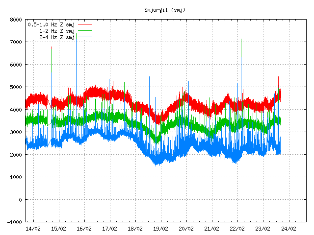
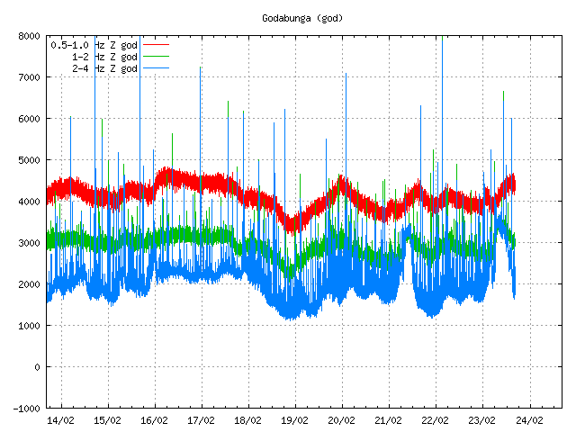
Last night there was an change in harmonic tremor on two SIL stations around Katla volcano. But due to high wind noise I am unsure what was going on. But it is possible that this was an small dike intrusion taking place close to Goðabunga part of Katla volcano, or this was an minor glacier flood that was taking place under the glacier. At current time I have no good idea what was going on.


The harmonic tremor on Smjörgil SIL station. The signal is unclear due to high wind noise. Copyright of this picture belongs to IMO.


The harmonic tremor signal on the Goðabunga SIL station. Due to high wind the signal is unclear and hard to see. Copyright of this picture belongs to IMO.

It is hard to know for sure what happens next in Katla volcano. But important signs can be found in earthquake patterns. But it is also important not to overlay broad interpret the data in the favor of an eruption taking place. As it is impossible to know for sure when Katla volcano erupts, and then how big. All we might get is an new small eruption like in July 2011. As Katla volcano can also have small eruptions like big ones.

Harmonic tremor pulse in Katla volcano

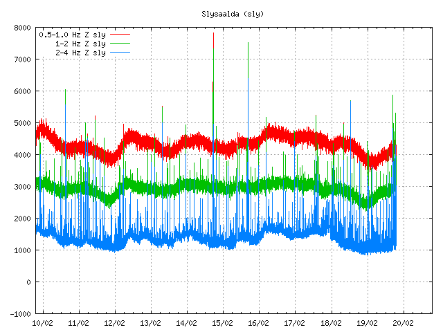
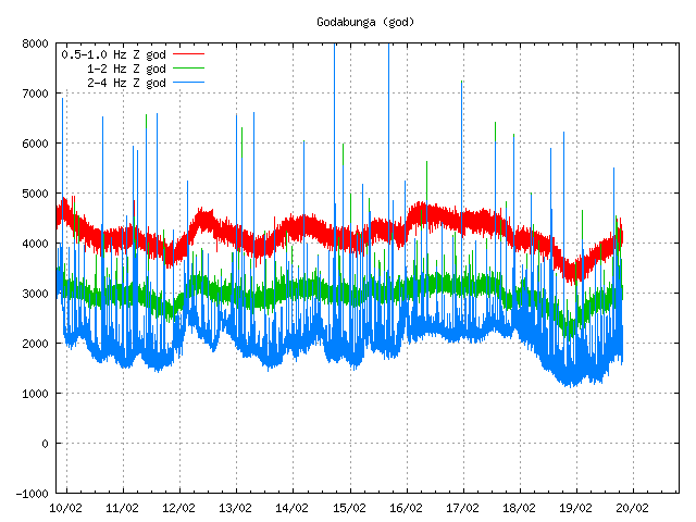
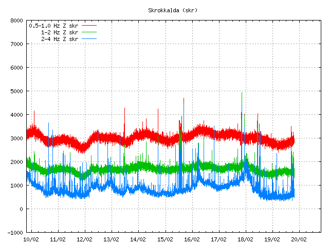
Today there was an harmonic tremor pulse in Katla volcano. I am not sure when this harmonic tremor pulse did start. But I am guessing around 15:22 UTC or maybe around 16:00 UTC. It seems that this harmonic tremor pulse was small, considering the activity in July 2011 in Katla volcano (an minor eruption). This harmonic tremor pulse seems to have happened in the north part of Katla volcano, outside the caldera from my best estimates but might well be inside it in the north part of it. But it hard to be sure on that detail. From what I can tell, this harmonic tremor pulse does not appear on my geophones clearly. But it might have appeared on Hekla geophone poorly. But it is hard to be sure on that due to wind noise. When this is written the harmonic tremor pulse appears to be dying down. But there is still an possibly that it might pick up again or an new one might start without warning. It is impossible to know for sure how long this is going to stop after this harmonic tremor pulse. This harmonic tremor pulse is due to dike intrusion in Katla volcano at depth, so earthquakes might not happen until it reaches shallower surface in the crust. If the dike intrusion gets that far to start with.


The possible location of the harmonic tremor marked by the poorly located earthquake in Katla volcano. Copyright of this image belongs to IMO (Iceland Met Office).


The harmonic tremor on the Slysaalda SIL station where it is the strongest. But that means it is closest to this SIL station. Copyright of this image belongs to IMO (Iceland Met Office).


The harmonic tremor pulse on Goðabunga SIL station. The harmonic tremor pulse is weaker here then on Slysaalda SIL station. Copyright of this image belongs to IMO (Iceland Met Office).


The harmonic tremor pulse on Skrokkalda SIL station. One of the SIL station that have the most distance from Katla volcano area where the tremor pulse is taking place. Copyright of this image belongs to IMO (Iceland Met Office).


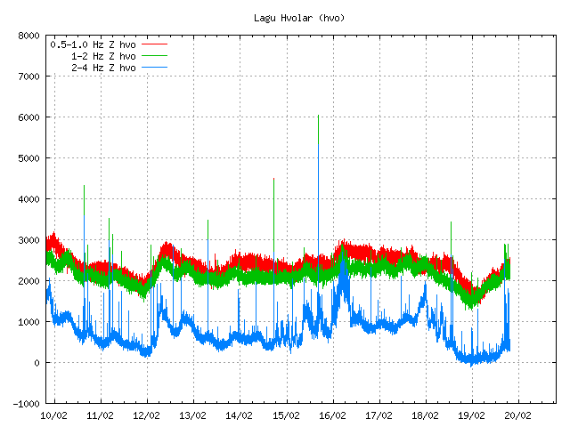
The harmonic tremor pulse can clearly be seen on Lágu Hvolar SIL station. Copyright of this image belongs to IMO (Iceland Met Office).


The harmonic tremor on Smjörgil SIL station, it is located in the flanks of Eyjafjallajökull volcano. This SIL station is close to Goðabunga SIL station. Copyright of this image belongs to IMO (Iceland Met Office).

What happens next in Katla volcano is hard to know. It all comes down to wait and see what happens next in Katla volcano. Eruptions in Katla volcano in January – February time period are not common, but due happen at times. So this harmonic tremor pulse might be an advance warning of what is to come. But that is just speculation on my part. It is impossible to know for sure what happens in Katla volcano until it happens.

Earthquake swarm in Katla volcano, earthquake in Hekla volcano

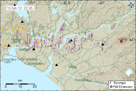
Tonight at 21:13 UTC there was an earthquake with the size of ML1.2, it had the depth of 0.1 km. But that is about 100 meters. This is the second earthquake in Hekla volcano during that past three weeks (almost an month since last earthquake did happen in Hekla volcano). So far nothing more has happened. But that might change without warning.


The earthquake in Hekla volcano. It is the red dot in Hekla volcano. Copyright of this picture belongs to IMO.

Katla volcano

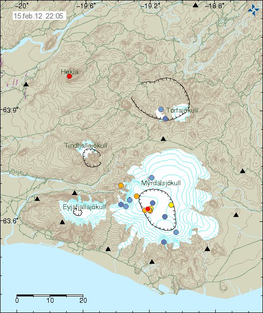
Today at 16:04 to 16:27 UTC there was an minor earthquake swarm in Katla volcano. The largest earthquake had the size of ML2.6, with the depth of 1.4 km. Like before this earthquake swarm was because of an dike intrusion into Katla volcano caldera. But this suggests that the unrest that started in Katla volcano in July 2011 is not over. But for the moment it continues at lower rate then before. But that might also change without warning at any time.


The earthquake swarm in Katla volcano. The earthquake in Hekla volcano can also be clearly seen on it. Copyright of this picture belongs to IMO.

It is impossible to know for sure what is going to happen next in both of this volcano. But it is clearly worth watching what is going on. The earthquake in Hekla volcano can clearly be seen on my Heklubyggð geophone, as it forms an clear spike on it, the web site can be found here. Same does the largest earthquake from Katla volcano earlier today.

Interesting earthquake activity in El Hierro volcano

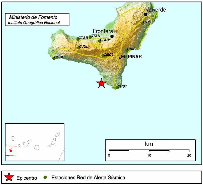
Over the past two weeks there has been interesting earthquake activity in El Hierro volcano in Canary Islands. What is so interesting about this earthquakes is the fact they are getting more shallow every day or so. Currently the most shallow activity that has been taking place is around 6km depth. But this is an rise from about 12 km depth.

What this means in my opinion is that magma is most likely rising to the surface at the location where the earthquakes are currently taking place (dike intrusions). This did happen before the first eruption in Eyjafjallajökull volcano. So it is an important to keep an eye on this earthquakes and where they happen, as eruption might take place in nearby area of this earthquakes. As magma might, and most likely is going find an clear path to the surface soon. The last part of that before an eruption might happen with no noticeable earthquakes at all. They might well be just over ML2.0 in magnitude or smaller.


Earthquake activity in El Hierro volcano over the past 10 days. Copyright of this image belongs to ING.

It is impossible to know for sure when or if an eruption happens in this area. But I find that is most likely going to be the case given the current activity. When and where is impossible to know for sure at current time.

Earthquake swarm on Reykjanes Ridge this morning

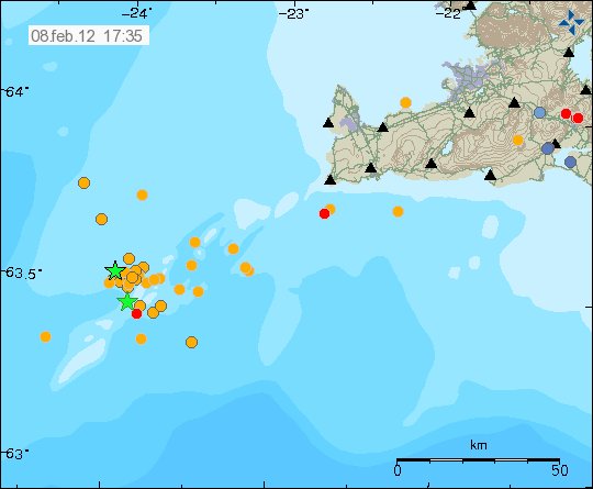
This morning at 05:48 UTC an earthquake swarm started on the Reykjanes Ridge. The earthquake swarm is believed to have been created by an dike intrusion in the area. Around 40 earthquakes have been recorded so far, the largest ones have had the size over ML3.0 in magnitude. But at the moment the earthquake swarm has stopped or is doing some idle time. As this earthquake swarm was created by an dike intrusion. It is not impossible that is going to resume in few hours to days time. But it is hard to know for sure what happens next in this area.


The area of activity. Please note that some earthquakes have wrong location due the distance from the SIL network. Copyright of this picture belongs to IMO.

This activity of dike intrusions suggests that this area of Reykjanes Ridge is getting more active then it has been since the year 1926, when the last confirmed eruption took place. But there might have been unconfirmed eruptions on the Reykjanes Ridge in the years 1966 and in 1970. It is also most likely that dike intrusion activity is going to continue for some time now. But as I sad above, it is impossible to know how long the breaks are going to be between activity episodes. Last large earthquake swarm in this area took place in early 2010 (Erik blog post about it can be found here). That activity was about one month before the eruption in Eyjafjallajökull volcano.

Largest earthquakes of this earthquake swarm appeared clearly on my geophones where the noise level was not too high. They can be viewed here on the 24 hour plot.

Icelandic news about this activity. Use Google translate and hope make sense of it.

Skjálftahrinan í rénun (Rúv.is)
Skjálftar við Eldey (Rúv.is)
Jarðskjálfti upp á 3,8 stig (mbl.is)
Á fjórða tug skjálfta við Eldeyjarboða (DV.is)

More earthquake activity in Katla volcano

Yesterday (05.02.2012) there was an new earthquake swarm in Katla volcano. This activity suggests that it was due to dike intrusion as before in the Katla volcano caldera. The largest earthquake was ML2.1 with the depth of 0.1 (~100 meters) km. So this where really shallow earthquakes this time around.


The location of the earthquake swarm in Katla volcano yesterday. Copyright of this picture belongs to IMO.

This pattern of activity has been ongoing since July 2011, when a minor eruption took place in Katla volcano caldera. I am expecting this pattern of activity to continue for some time now. For how long I do not have any idea. It depends if this going to end in a larger eruption then took place in Katla volcano in July 2011 or if this is going to quiet down one day for several more years.

Activity in Katla volcano can be observed on Iceland Met Office pages. It also can be observed on a geophone that I run in Skeiðflöt (website here), a farm located few km south of Katla volcano.

New earthquake swarm in El Hierro volcano

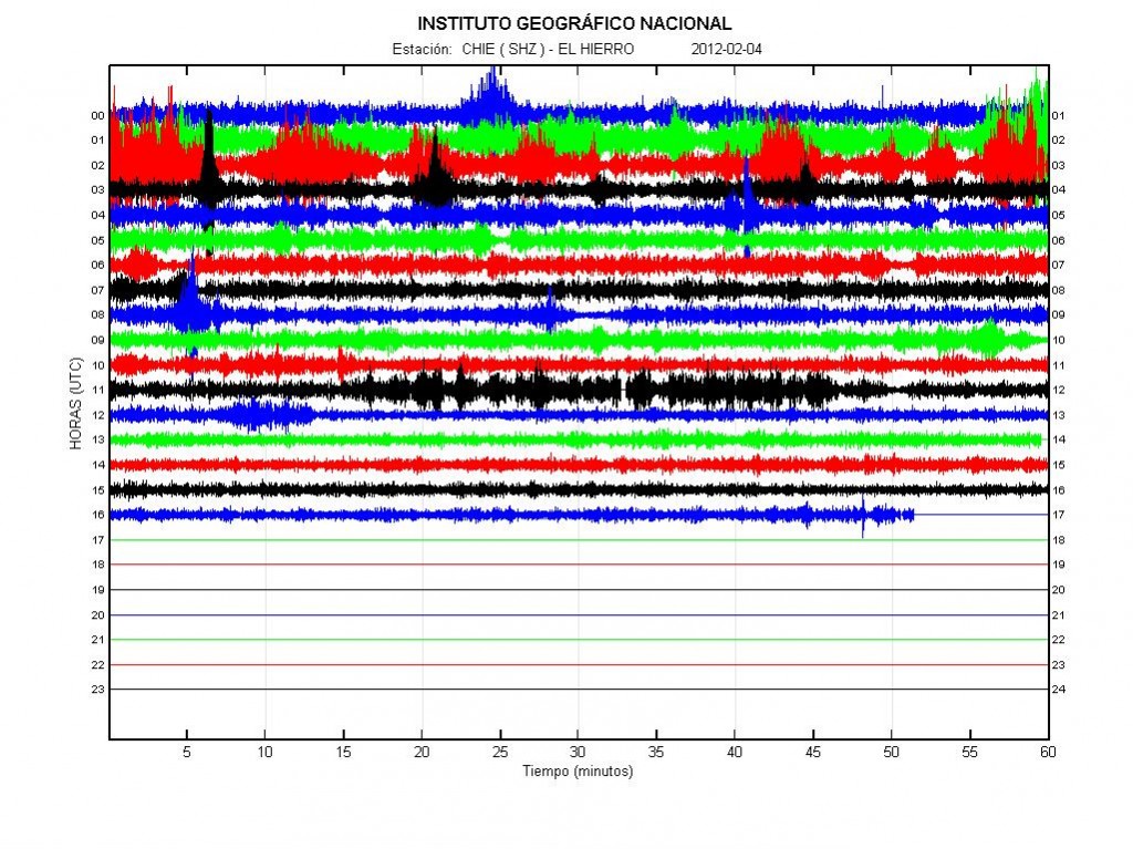
During the past few days there has been an earthquake swarm in El Hierro volcano in Canary Islands. Following this earthquake swarm there has been some increase in eruption activity. Resulting in some material reaching the surface of the ocean. The reason for this activity is that new magma is being injected into El Hierro volcano from depth. This magma is pushing the magma that is already there closer to the surface, creating dikes and sills in the rock along the way. This also increases the eruption in already open vents.


The harmonic tremor activity in El Hierro today. Copyright of this picture belongs to IGN.

The largest earthquakes in this swarm have had the size ML2.7 and ML3.4. They have been taking place at the depth of 12 to 15 km, based on early data from IGN.


The ML3.4 earthquake in El Hierro volcano that did happen during the night. Copyright of this picture belongs to IGN.

I am expecting this activity to continue for some time now. As it seems that more magma is coming up from depth. How long that progress is going to last is impossible to know. When it stops, it does so and only then the activity in El Hierro volcano is going to stop.