Fresh earthquake activity in Bárðarbunga volcano

At 12:39 UTC (16-November-2015) a magnitude 3,2 earthquake took place in Bárðarbunga volcano. The depth of this earthquake was only 0,5 km so it was not created by magma movement, rather stress changes in the crust. This earthquake took place in south-east part of the caldera.

151116_1920
The magnitude 3,2 earthquake in Bárðarbunga volcano on 16-November-2015. Copyright of this image belongs to Iceland Met Office.

There seems to be an minor increase in earthquake activity in Bárðarbunga volcano, this was mentioned in news today in Iceland about this earthquake. Iceland Met Office is keeping a watch for any changes that might be taking place in Bárðarbunga volcano and nearby area. Earthquake activity doesn’t appear to be quieting down even if the eruption in Holuhraun is over.

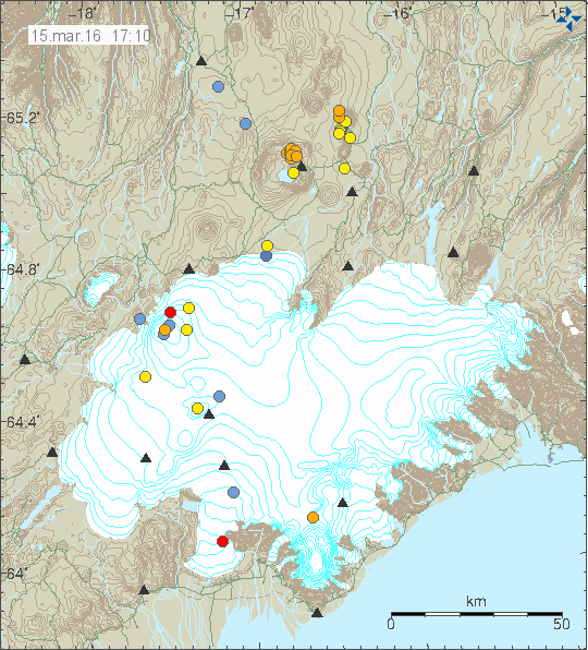
Deep earthquakes close to Trölladyngja (Bárðarbunga volcano)

During the night of 15-November-2015 a swarm of deep earthquakes took place not far from Trölladyngja. The thing about Trölladyngja is directly connected to Bárðarbunga volcano and its eruption cycles. Trölladyngja it self was formed in a eruption in the year 5000 BCE, according to historical overview from Global Volcanism Program. According to some sources, Trölladyngja is a shield volcano, I don’t know if that is exactly correct. Regardless of what type of volcano Trölladyngja is, there is clearly something going on in it. Since this is not the first time I see earthquake swarm at this depth at this location. I doubt that this are stress related changes in the crust due the collapse of Bárðarbunga volcano caldera.

151115_0550
The earthquake activity in Trölladyngja (red dot). Image is from 05:50 UTC. Copyright of this image belongs to Iceland Met Office.

All of the earthquakes taking place were small, the largest had the magnitude of 1,1 and the depth was from 18 – 15 km.

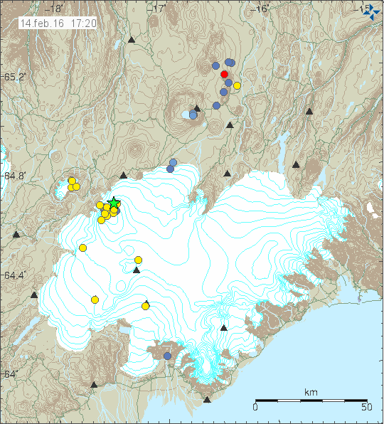
In the early days of the earthquake swarm that started in Bárðarbunga in August-2014 a dyke intrusion pushed into this direction and than it just stopped as it lost the energy, or hit a obstacle that it was unable to break trough.

140817_1645
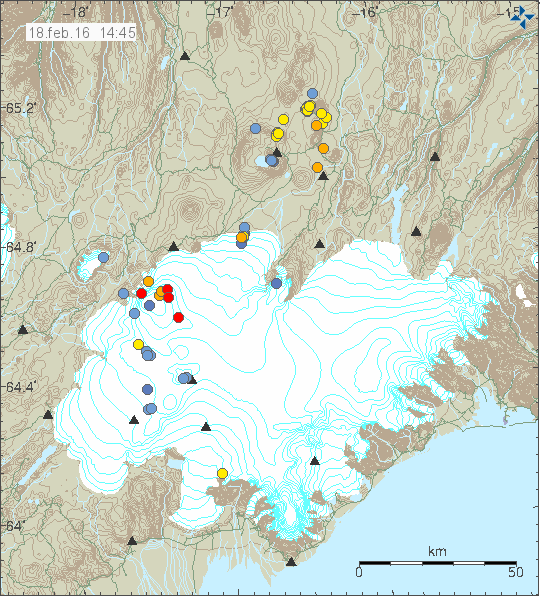
Image from August-2014. The earthquake activity close to Trölladyngja is clear on this image. Copyright of this image belongs to Iceland Met Office.

140818_1440
Image from August-2014. The earthquake activity close to Trölladyngja is clear on this image. Copyright of this image belongs to Iceland Met Office.

I don’t know yet what the chances are for an eruption at this location. More earthquake swarm activity is needed until the magma that is clearly down there breaks up. However the rifting that is taking place in this location might speed things up by unknown factor. This rifting might and possibly is allowing more magma entering this area deep underground without any earthquake activity. It is difficult to know what is going on at this location, so a lot of this is a speculation on what might happen. What actually happens in the end is a whole different thing and only time is going to tell us what happens next.

Earthquake activity in Bárðarbunga volcano

I’m sorry for lack of articles. It has been quiet in Iceland for the past few weeks and I needed some time off after the work I’ve been in. I’ve also been dealing with a tax problem in Denmark, that issue is on-going for me (sadly) and might delay my move back to Denmark, how much I do not know yet.

Earthquake activity continues in Bárðarbunga volcano continues, this are mostly minor earthquakes that are taking place. Most of the earthquake activity is taking place on the north-east part of Bárðarbunga volcano caldera. According to Iceland Met Office this is due to continued subsidence of the volcano at that location. It is my view that Iceland Met Office estimate is correct, with just one exception. It is my view that magma pressure inside Bárðarbunga volcano is increasing, based on latest data, the pressure increase might be happen at more depth than I first estimated.

151114_1810
Earthquake activity in Bárðarbunga volcano. Copyright of this image belongs to Iceland Met Office.

I’m also seeing cases of increased hydrothermal activity south of Bárðarbunga volcano, in Hamarinn volcano. This was best seen in the larger size of Skaftárkatlar cauldron. This change in size suggests higher output of hydrothermal activity and it might be connected to higher magma activity at depth in this volcano. It is difficult to be sure since the area is covered with a glacier, but it is a well known sign impending eruption in many cases. There are few cases when there is a increase in hydrothermal activity without an eruption taking place. It is impossible to know when anything might happen in Hamarinn volcano, if anything happens at all to start with. Last minor eruption that took place in Hamarinn volcano (in my view) was in July-2011, it lasted around 8 hours with breaks.

Donations

Please remember to support my work with donations or by using the Amazon banners for Christmas shopping (or just shopping). Thanks for the support.

Twich and Youtube

I’m currently testing my game stream on Twich here. My Youtube stream tests can be found here. This Youtube channel is a work in progress. I have a other YouTube channel (can be viewed here), it however mostly just contains nature video. Since I’m on slow 3G internet connect at the moment I won’t do a lot of streaming, just basic tests in order to learn how to properly due this. I won’t run many more tests with Youtube than I already have, it seems to work rather well as is.

Article update at 23:29 UTC. I changed the YouTube channel for streams. I’m going to use a other channel on YouTube with the same name as my Twitch channel. The name is Channel 99 on Twitch and YouTube.

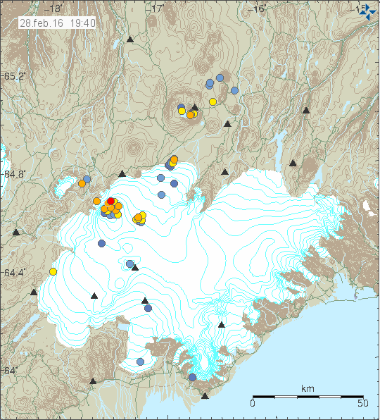
Earthquake swarm in Bárðarbunga volcano

Today (4-November-2015) a earthquake swarm took place in Bárðarbunga volcano. This is now almost a weekly feature in the Bárðarbunga volcano system. This is suggesting that magma pressure inside Bárðarbunga volcano is currently increasing at rather fast phase. If and when this might start a new eruption is impossible to know. Largest earthquake in this swarm had the magnitude of 3,1.

151104_2150
Earthquake activity in Bárðarbunga volcano. Copyright of this image belongs to Iceland Met Office.

I’m expecting this earthquake activity to continue for some time now. At least until a new eruption occurs in Bárðarbunga volcano, since the rifting process that started all this has not ended and this is going to last few more years.

Donations

Please remember to support my work with donations or by using Amazon banners that I have up here. Thanks for the support.

Article updated at 23:14 UTC.

Overview of week 44 activity in Iceland

This is a short overview of activity in week 44 in Iceland.

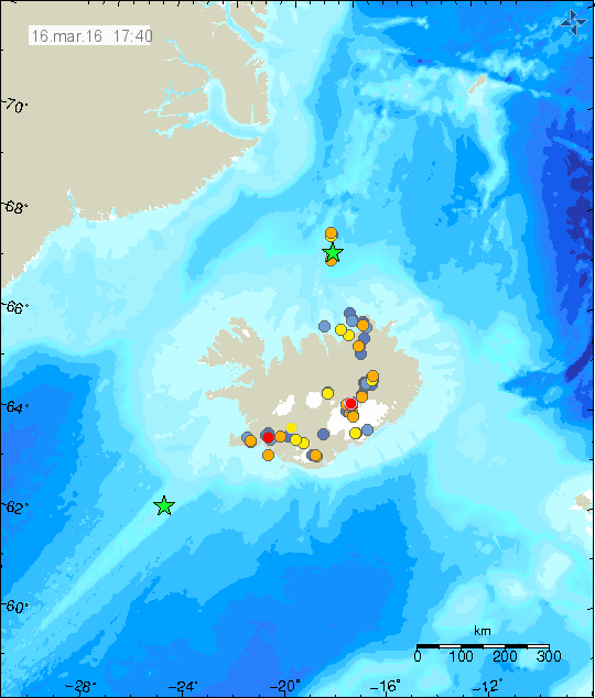
Tjörnes Fracture Zone (TFZ)

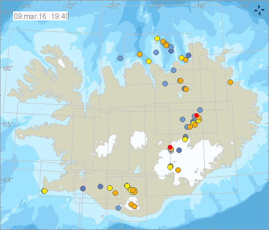
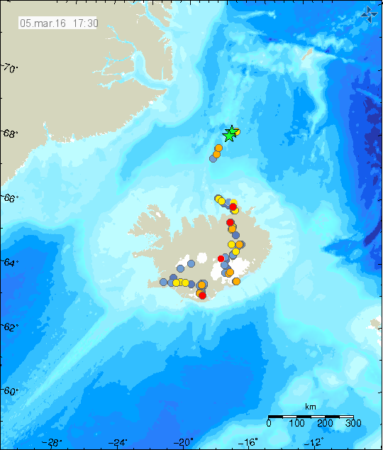
Earthquake swarm took place in TFZ in week 44. Largest earthquake had the magnitude of 3,5 and other earthquakes had the magnitude of 3,1. Other earthquakes where smaller in magnitude.

151030_2020
Earthquake swarm on the TFZ. Largest earthquake swarm took place where the green stars are. Copyright of this image belongs to Iceland Met Office.

A second smaller earthquake swarm took place south of Grímsey. It is not connected to the stronger earthquake swarm east of Grímsey island.

Bárðarbunga volcano

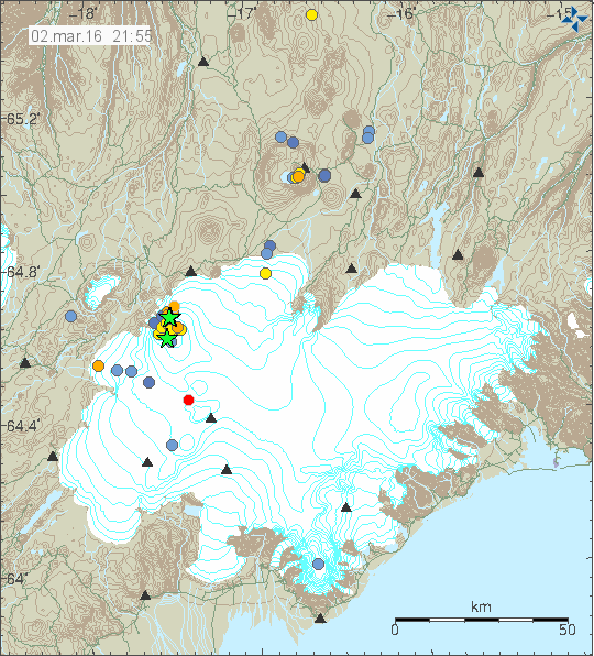
A magnitude 3,0 earthquake took place in Bárðarbunga volcano. This suggests increased pressure inside Bárðarbunga volcano. I forgot to save image of last week activity in Bárðarbunga volcano.

Tungnafellsjökull volcano

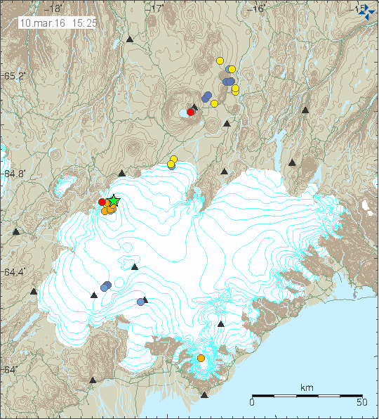
Earthquake activity continues in Tungnafellsjökull volcano. As before all of the earthquakes taking place are small in magnitude. At the moment the earthquake swarm activity appears to be centered around the top of the volcano, one of the main craters. Earthquake activity is steady in Tungafellsjökull volcano at the moment. It sometimes drop down, as is to be expected when magma moves inside volcano.

151102_1635
Earthquake activity in Tungnafellsjökull volcano. Copyright of this image belongs to Iceland Met Office.

Skaftárkatlar cauldrons in Vatnajökull glacier

Recent survey of Skaftárkatlar cauldrons in Vatnajökull glacier has shown that the eastern cauldron has grown considerable in size. This is now thought to be the main reason why the glacier flood from eastern skaftárkatlar cauldron was the largest in recorded history. The cauldron is now 2,5 sq/km in size and 150 meters deep. Video of the overflight can be found here (Facebook). Measurements and other details can be found here at University of Iceland Earth science website (Icelandic). This are early results from recent survey.

Other things

Please remember to support my work with donations or by using Amazon. Due to problems with the Danish tax authorities I did not get my social welfare paid out this month in Iceland. Reason being that I have not got my copy of the tax statement for the year 2014, that I have . I hope this is resolved in November as has been promised to me. This however means that I have to use the salary for last months work to survive this month, money that I was saving in order to pay for moving cost when I move back to Denmark. If this is not resolved by December, I have to go on emergency income from my municipality. I won’t move to Denmark until this issue with the Danish tax is resolved. The temporary work that I was in is over so I’m going to be updating now when things happen in Iceland or close to it.

Once I’m back in Denmark I can start uploading detailed images of earthquakes and keep a real time watch about what is going on in Iceland. Its difficult for me to do that at the moment.

Rare earthquakes in Hreppar micro-plate and other activity in Iceland

Due to family obligations I won’t be able to write a long post until Sunday (I hope). So here is a short overview of activity.

Hreppar micro-plate

A rare swarm of earthquakes took place on the Hreppar micro-plate today. All of the earthquakes had less magnitude than 1,0.

151023_2150
Hreppar micro-plate earthquake activity on its edge with the American plate. Copyright of this image belongs to Iceland Met Office.

South Icelandic Seismic Zone

A swarm of earthquakes took place in SISZ this week. Largest earthquake had the magnitude of 2,5 and was felt in nearby populated areas.

151021_2020
Earthquake swarm on SISZ. Copyright of this image belongs to Iceland Met Office.

Bárðarbunga volcano

Last week a magnitude 3,2 earthquake took place in Bárðarbunga volcano. This don’t appear to be deflation earthquakes, they rather look like inflation earthquakes. I don’t have time to write about it now, so details have to wait for now.

151017_0120
The magnitude 3,2 earthquake in Bárðarbunga volcano. Copyright of this image belongs to Iceland Met Office.

I hope to write more on Sunday if I have time.

Overview of week 41 activity in Iceland

Week 41 in Iceland was rather quiet, compared to last two weeks in Iceland. Here is a overview over the highlight in the earthquake activity in Iceland.

South Iceland Seismic Zone (SISZ)

Constant earthquake activity has been in SISZ over the week and it has been ongoing for the past weeks, none of the earthquakes have been large, with almost all of them being less then magnitude 1,0. Largest earthquake in this swarm had the magnitude of 2,5.

151011_1755
The earthquake activity on SISZ. Copyright of this image belongs to Iceland Met Office.

Bárðarbunga volcano

For most part earthquake activity in Bárðarbunga volcano was normal this week, with regular earthquake swarms taking place in the usual places. The most interesting earthquake this week took place under Trölladyngju, it was only magnitude 0,7, but it was on depth of 26,2 km.

151008_2140
Earthquake activity in Bárðarbunga volcano. Copyright of this image belongs to Iceland Met Office.

Herðubreið

Earthquake swarm has been taking place all week in Herðubreið. Earthquake swarms are common in this area and often have magnitude 3,0 earthquakes or larger. The earthquake swarm is ongoing when this is written.

151011_1815
Earthquake activity in Herðubreið/Herðubreiðarfjöll area (north of Askja volcano). Copyright of this image belongs to Iceland Met Office.

Reykjanes ridge

A magnitude 3,4 earthquake took place deep on the Reykjanes ridge this week. The earthquake was not felt and there might have been more than one earthquake. My geophone in Heklubyggð shows more than one earthquake one hour after the magnitude 3,4 earthquake happens.

151008_2040
Earthquake activity on the Reykjanes ridge. Copyright of this image belongs to Iceland Met Office.

A magnitude 3,0 earthquake also took place around 200 km off the coast of Reykjanes peninsula (around 153 km south of Eldeyjarboða). That earthquake location was poor due to the distance from the SIL network.

Donations: Please remember to support my work here with donations or by using Amazon banners when you buy from Amazon. Thanks for the support.

Glacier flood from Skaftárkatlar cauldrons and other updates

This is going to be a short article since I don’t have a time to write a long one.

The glacier flood from Skaftárkatlar cauldrons is mostly over. There continues to be a lot of water in rivers that were flooded, with the flood peak being at 2200 m³/s (uncorrected). Some damage has taken place on roads and few bridges, with one major bridge almost collapsing from the river eating into the river banks. A graph showing this glacier flood in realation to older glacier flood from the eastern skaftárkatlar cauldron can be found here (Icelandic news). The glacier water that did flood into a lava field (that erupted from Laki) is still on its way and is going to reappear in few days as clean water, a lot of clean water that might create problem in nearby rivers and nearby roads if any exist. I don’t know the layout of roads and such in this part of Iceland so I don’t release what type of damage might happen. Image of the largest damaged bridge can be found here (Icelandic news), there is a video in this news.

Bárðarbunga volcano

There has been a slight increase in earthquake activity in Bárðarbunga volcano this week. A magnitude 3,1 earthquake took place along with little increase in smaller earthquakes. There have also been clusters of small earthquakes been appearing in east and in south (both east and west) part of the volcano. This activity suggest that new magma is flowing into the magma chamber at depth and the pressure has increased. Maybe not to eruption levels at the moment, but that moment is getting closer as the time passes.

151004_1635
Earthquake activity in Bárðarbunga volcano. Copyright of this image belongs to Iceland Met Office.

North Langjökull volcano (Hveravellir)

Earlier this week an earthquake swarm took place close to Hveravellir (volcano). This earthquake swarm was not large and the largest earthquake only had the magnitude of 2,5 (or around that number. I was working when this happened and I did not have chance to check or save the data). Earthquake activity in this area has been increasing slowly for the past 10 years. It is unclear why that is happening.

151003_1200
The earthquake activity in Hveravellir volcano. Copyright of this image belongs to Iceland Met Office.

Western Fracture Zone

There has been for the past few days earthquake activity in WFZ. This earthquake activity appears to be taking place in a extinct volcano in this area. I don’t think that this volcano is named and I don’t know the name of the mountains at the location were the earthquake activity is taking place.

151004_1520
The earthquake activity in WFZ today (04-October-2015). Copyright of this image belongs to Iceland Met Office.

I do expect the earthquake activity to continue in this area for next few days. Due to how rare earthquakes are in this area there is a risk of sharp and strong activity. It might also last for a long period of time, up to weeks or months at the longest.

Donations

Please remember to support my work with donations. At the moment I’m trying to collect as much money as I can before I move back to Denmark. I am also trying to save up for a cheap new laptop so that I can write when I am traveling, in the case anything happens in Iceland. It is going to cost me 40.000,00 ISK (~280€/315USD). Currently I’m doing full workday until the end of October (when not in school). To clarify, the work is hard and they only pay legal minimal wages and overtime pay (1 – 3 hours each day).

Thanks for the support.

Increased activity in Tungnafellsjökull volcano

This is going to be short update on the activity in Tungnafellsjökull volcano. I just don’t have the time to write long article about it, doing so takes up to two hours to write. A time that I just don’t have at the moment due to work (and school) tomorrow.

Today (23-September-2015) there has been a sharp increase in earthquake activity in Tungnafellsjökull volcano. Largest earthquake so far had the magnitude of 3,0. Other earthquakes have been smaller in magnitude. Most of the earthquakes that have been taking place are shallow, but all of them (at least that appear on my geophones) are appearing to be long-period earthquakes. Suggesting that magma created them, rather than tectonic forces in the crust.

150923_2255
The earthquakes in Tungnafellsjökull volcano. Copyright of this image belongs to Iceland Met Office.

It is the official view of the Iceland Met Office that this activity is due to tectonic stresses in the volcano, due to adjustment of Bárðarbunga volcano. This is true, that is not the whole story in my view. Some of the earthquakes taking place in Tungnafellsjökull volcano are due to tectonic adjustment of the crust (stress changes). What adds complexity to this image is the fact that magma is involved in Tungnafellsjökull volcano, the problem that since there are no documented eruptions from Tungnafellsjökull volcano, it’s impossible to know for sure what happens before an eruption in it. If the current influx of magma results in an eruption is difficult to say for sure, at the moment I don’t rule it out. It is my view that there is now more chance, rather than less of an eruption in Tungnafellsjökull volcano.

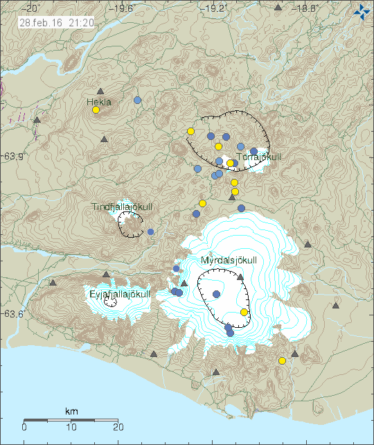
Earthquake activity in Katla volcano

Today (22-September-2015) there was an swarm of earthquakes in Katla volcano at shallow depth. Largest earthquake had the magnitude of 3,3 with the depth of 0,1 km. The earthquake looks long period from the looks of my geophone at low resolution (I will get the higher resolution back when my main earthquake computer is back on-line). Other earthquakes in this swarm were smaller in magnitude.

150922_2015
The earthquake activity in Katla volcano. Copyright of this image belongs to Iceland Met Office.

Last week there was a swarm of earthquakes at 15 – 24 km depth (about) in Katla volcano. I did notice it and monitored it, I didn’t evolve into anything serious so I didn’t write about it. I don’t think the two activities are directly connected. This might be changes to the hydrothermal systems in the volcano or just normal activity for Katla volcano. At the moment I don’t see any changes in the volcano it self, even if there is deep earthquake activity taking place. For the moment, there is nothing to worry about.