This information is going to get outdated quickly. This is current events in Báðarbunga volcano.
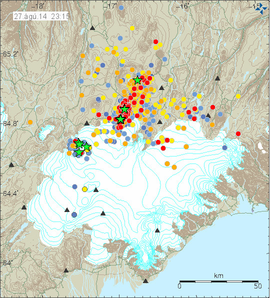
- Rift valley has formed south of the eruption. Part of this rift valley is not under the glacier. Most of this rift valley is under the glacier, were the glacier is thin the glacier has formed a cauldron that is around 1 km wide and several meters deep. There is a risk of eruption in the newly formed rift valley.
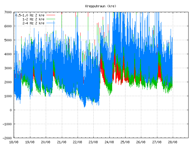
- Harmonic tremor suggest that an glacier flood is under way from Bárðarbunga volcano. What is happening is unclear at the moment. Scientists and press people have been told to evacuate the area due to this risk.
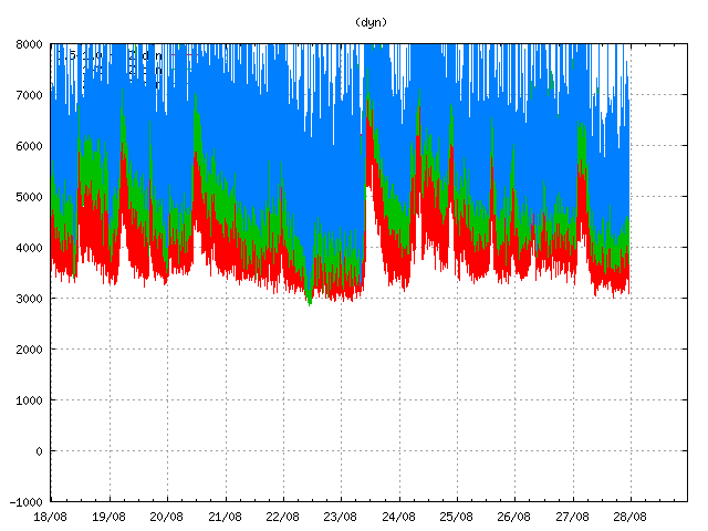
- More magma is going into the dyke then is erupting from it. This has increased the pressure inside the dyke.
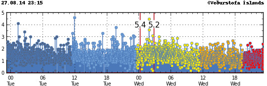
- Largest earthquake since midnight had the magnitude 5,5.
Updates
- There has not been any sign of an eruption under the glacier yet. One idea for this increase in harmonic tremor is that ground water got into contact with the magma at 1 to 2 km depth.
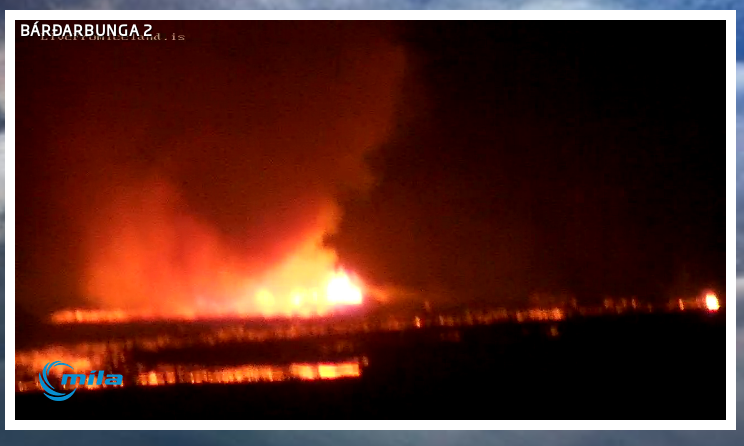
- There is a high risk of eruption taking place under the glacier in the area of Dyngjujökull glacier, that glacier is south of current eruption and can be seen on the Míla web cameras.
- There is a lot of cracks in the ground south of the eruption, in some places the ground has dropped some meters down.
Updates on 4-September-2014
- Largest earthquakes since midnight (04-September-2014) had the magnitude of 4,8 and 4,4.
- The eruption is now creating 120 to 130 meters tall lava fountains at the moment. No other change has been reported.
News in both Icelandic and English
Mikið af sprungum í jörðinni (Rúv.is, Icelandic, Video, Image)
Hraunbreiðan 9,1 ferkílómetri (mbl.is, Icelandic, Pictures)
Notice on commens
I have to approve all comments first time around. This is in order to prevent spam from taking place in my comment section. Spam prevention is the common Captcha puzzle and a maths test. Registered users don’t have to type in captcha word puzzle or the maths test.
Article updated at 00:27 UTC on 04-September-2014.
Article updated at 11:58 UTC on 04-September-2014.
Article updated at 14:01 UTC on 04-September-2014.