This article is short and is written at 16:10 UTC on 19. December 2023. Information here can go outdated quickly and without warning.
There has been a reduction in the eruption since it started at 22:17 UTC on 18. December 2023. This was to be expected. Since the eruption seems to be coming from a small sill in Svartsengi volcano, rather than a large magma chamber.
- The eruption is now limited to three to four eruption vents. The largest one is where the eruption started. Crater building is ongoing.
- The lava is flowing towards Fagradalsfjall volcano (mountain) at the writing of this article. This area is empty, outside of the the parking lots south of Fagradalsfjall. They are not at risk for now.
- The problem with eruptions of this type is that they can grow again in size if different sill breaks and starts flowing into the established flow channels that magma is now flowing and creating the eruption. If that happens is impossible to know. This can also result in a eruption that goes on for a long time. If that happens, an lava might end up reaching far away areas.
- It is going to take few days for GPS data to show what sill is deflating in Svartsengi volcano and what is going on in the crust in Svartsengi volcano.
- Weather might be a problem for next few days on Reykjanes peninsula.
- This area is not to hike around on. Its dangerous and the weather makes difficult walk extremely difficult. Just watch the online web cameras.
- The lava field is large and it creates its own strong wind as the lava warms up the air around it. That can be difficult to deal with in the snow for anyone close the the eruption.
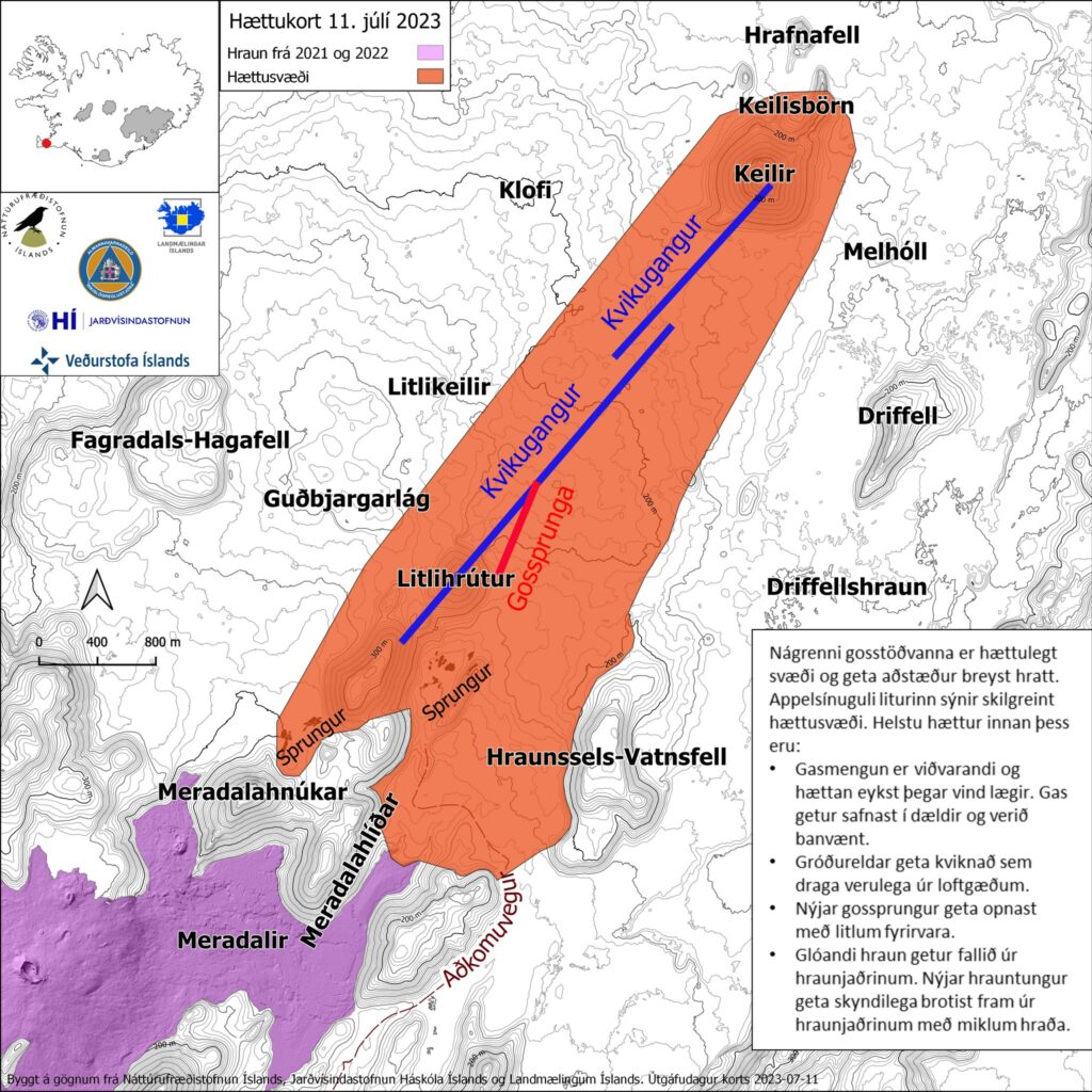
The dyke is longer than the part that erupted according to the news and measurements. The dyke is more south and it ends just 1,5 km north of Grindavík town. That area can erupt without warning if pressure starts to build up in that part of the dyke. That same goes for the north part of the dyke, how far more north the dyke is I don’t know.
I’ll post next update when I have more information what is going on or sooner if anything happens.