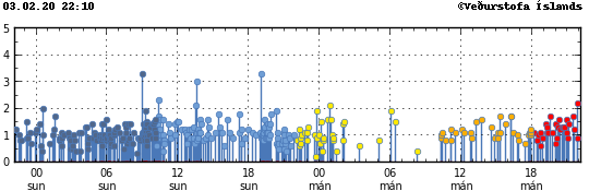
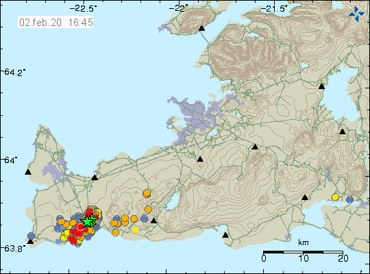
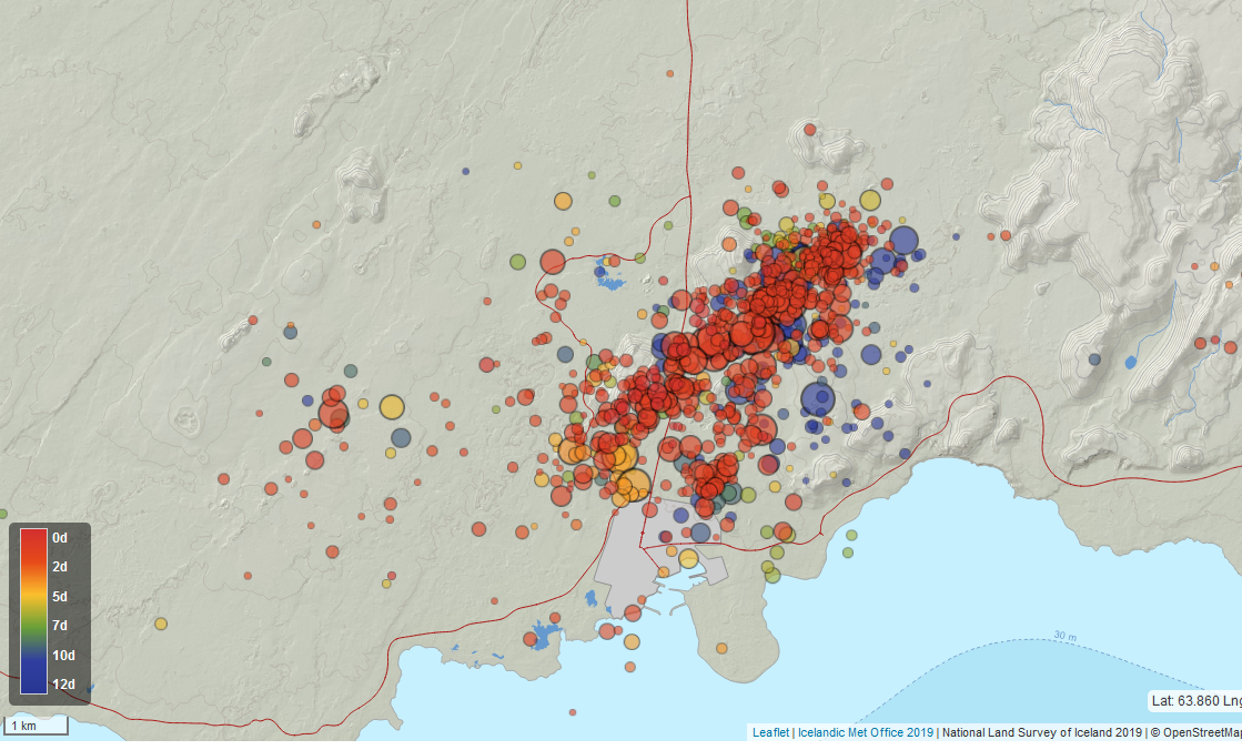
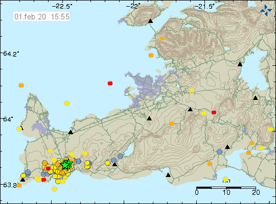
Today (4th February 2020) there has not been a huge change in activity in Reykjanes volcano. Today’s earthquake activity has only been minor earthquakes and around 100 have happened today. There is no change in harmonic tremor on nearby SIL stations so magma is not moving towards the crust. Current inflation is around 55mm to 60mm. The only noticeable change in last few hours is that area of earthquake activity seems to be pushing it self a little more north-east. There has not been any change in the south-west part of the active area.
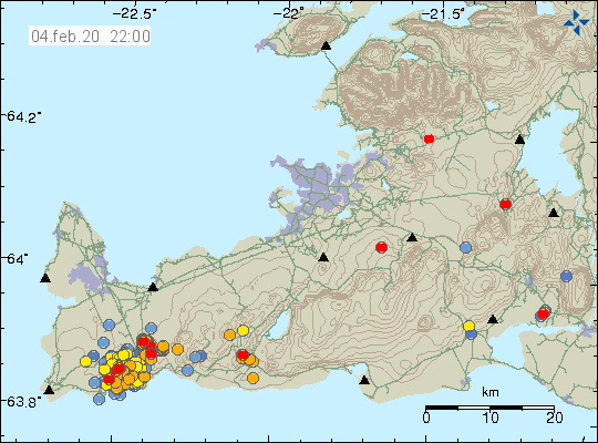
Earthquake activity in the Reykjanes volcano today (4th of February 2020). Copyright of this image belongs to Icelandic Met Office.
There is a possibility that this is going to be a long process before an eruption happens. It is a long time since an eruption last took place (but no time at all in geological time scale) in this area. It also takes the magma a while to get to the pressure levels needed for an eruption and at current amount of magma it might not be enough to start an eruption in this area.
While there is no major change between days or earthquake activity I am going to have fewer updates since too many articles about the same thing is not good and I know this from experience when Bárðarbunga volcano erupted in 2014 to 2015.
Donations
Please remember to support my work with donations if you can. I am also seeing that February is going to be a annoying broke month for me. Donations help me to keep this website updated and to keep an watch for what is happening in Icelandic geology. Thanks for the support. 🙂
Moving back to Iceland
I move back to Iceland next week. That might result in limited updates the days that I am moving (14th to 18th of February) if something happens on the Reykjanes peninsula in that time. I’ll try to update best I can during this time. Normal updates start soon as I get all my belongings back from transport by the start of March. At the same time I’ll fix errors with my geophone so I can start recording earthquakes again and provide updates of earthquake activity in Iceland in more details.