
Around 11:00 UTC a earthquake swarm started just north of Kolbeinsey island. This earthquake swarm looks rather powerful. But due to distance from land only the largest earthquakes are appearing on the SIL network and on my geophone at Böðvarshólar. I am estimating the largest earthquakes having the magnitude of 4.0+. But that has not been confirmed yet. Last known eruption in Kolbeinsey island volcano took place in the year 1755. A dike intrusion or a volcano eruption took place north (100 km) of current location back in the year 1999. Last eruption before the eruption in the year 1755 took place around the year 1372.
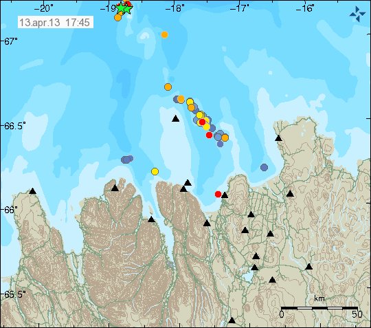
The earthquake activity in Kolbeinsey island. It is marked by the green stars on this map. Copyright of this image belongs to Icelandic Meteorological Office.
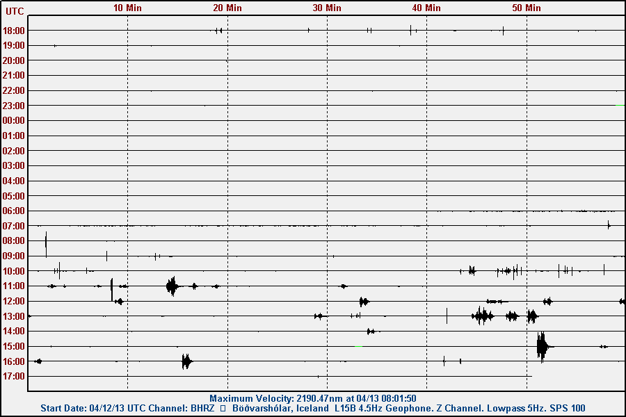
The earthquake activity as it has been appearing on my geophone at Böðvarshólar. This image is under Creative Commons Licence. See CC licence page for more details.
No signs of eruption have appeared so far. If they do. They are going to appear on the SIL network. I am not sure if my geophone is going to pick them up due to the distance (around 300 km). There is a chance of more earthquake activity to take place in this area in the next few hours to days. I do not know if this activity is connected to what has been taking place in other parts of Tjörnes Fracture Zone. The smaller earthquakes that are taking place in Kolbeinsey island are not being detected by the SIL network or by my geophone.
It is possible to view the earthquake activity here, on my webicorder web page.
Blog post updated at 19:35 UTC on 13.04.2013.