This is a short update on the earthquake swarm in TFZ. This is going to be a long earthquake swarm from the looks of it (currently).
The earthquake swarm in TFZ continues as it has been doing for the past six days now. The strongest earthquakes for the past 24 hours have had the magnitude 3.5, 3.6 and now 3.3 (automatic magnitude). This is a extremely complex earthquake swarm. Over a period of 48 hours there have been around 368 earthquakes. That is a drop in activity, but in the first few hours after the magnitude 5.5 earthquake in TFZ there where recorded over 500 earthquakes.
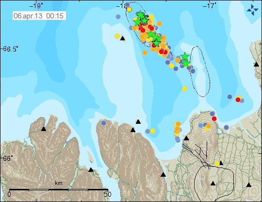
Earthquake activity in TFZ for the past 48 hours. Copyright of this image belongs to Icelandic Meteorological Office.

The trace plot that shows the earthquake activity for the past 48 hours in TFZ. Copyright of this image belongs to Icelandic Meteorological Office.
This earthquake swarm is complex due to three factors. There is a both slip fault and normal fault taking place there. There also appears to be a volcano in the area. But it not properly understood and is extremely poorly studied. It is unclear at present time if this volcano is connected to this earthquakes swarms at present time. Since so little is known about it. It is also not known if the current earthquake swarm is going to start something in the volcano. The second volcano that is in this area last erupted in the year 1868 following an earthquake swarm in this area. Why that did happen is also not known. But it has a Global Volcanism profile here. The volcano that is closer to Grímsey Island is currently unnamed. There is also almost no studies or documentation on it. But from the little I did find
Please note that the earthquake swarm information is always changing so this information here do get outdated fast. This mostly applies the maps and number of earthquakes.
Scientific data on Tjörnes Fracture Zone
As I did say here above. The Tjörnes Fracture Zone is complex and that is making this earthquake swarm extremely complex as it is taking place.
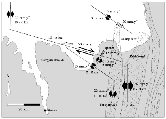
The rift fault lines in TFZ. This is the simple version. It is from a science study that can be found here. Copyright of this image belongs to Icelandic Meteorological Office/Hjorleifur Sveinbjornsson.
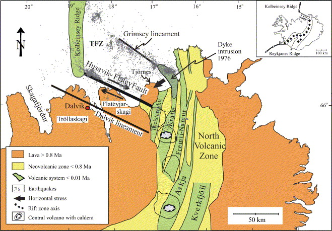
More complex nature of the fault systems in TFZ. Copyright of this image belongs to Agust Gudmundsson. From study Infrastructure and evolution of ocean-ridge discontinuities in Iceland.
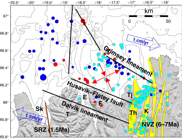
More complex image showing the fault lines in TFZ. Copyright Ragnar Stefansson, Gunnar B. Gudmundsson, Pall Halldorsson. From the study Tjörnes fracture zone. New and old seismic evidences for the link between the North Iceland rift zone and the Mid-Atlantic ridge.
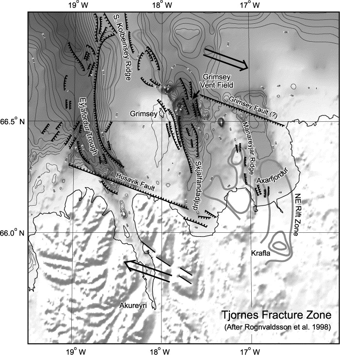
The most detailed picture that I was able to find of Tjörnes Fracture Zone and the ocean floor. Copyright of this image belongs to many people. Please see the list of copyright holders in the following link. From the study First observations of high-temperature submarine hydrothermal vents and massive anhydrite deposits off the north coast of Iceland.
It is clearly worth watching this earthquake activity. Since it might have interesting effects on the volcano where this earthquake activity is taking place. Even on the second volcano just north of Þeystareykjabunga volcano.

Thank you Jon. A very good post and I particularly appreciate you getting the collection of maps together. The last map of the ocean floor is fascinating and illustrates clearly where everything has been happening. Has the second volcano North of Þeystareykjabunga got a name?
The volcano east of Grímsey does not have any name that I know of. It anything happens there it is going to appear soon the surface. Since the ocean depth in this area is only about 400 meters or so.