While this blog now covers mostly Icelandic volcanoes. I am going to cover other volcanoes from time to time.
New earthquake activity started around 21:26 UTC in El Hierro volcano with an earthquake that had magnitude ML3.1 with the depth of 20 km. Largest earthquake so far had the magnitude of ML3.8 and the depth of 19 km. Depth of this earthquake swarms is mostly around 20 km. At current time nothing suggests that new eruption is about to start in El Hierro volcano. But that might change without any warning if the magma finds an clear path to the surface. But that would be detected by seismometers on El Hierro Island. So the risk of such events taking people by surprise is minimal. My automatic earthquake counter for El Hierro volcano shows that at least 143 earthquakes have taken place today so far. For the moment the earthquake swarm seems to have stopped. But I expect it to resume at any time and without any warning at all.

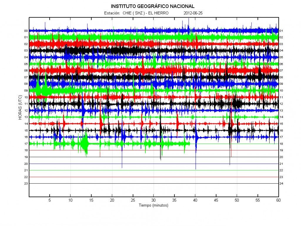
Earthquake activity today at El Hierro volcano. This picture is from 18:08 UTC. Copyright of this picture belongs to IGN.

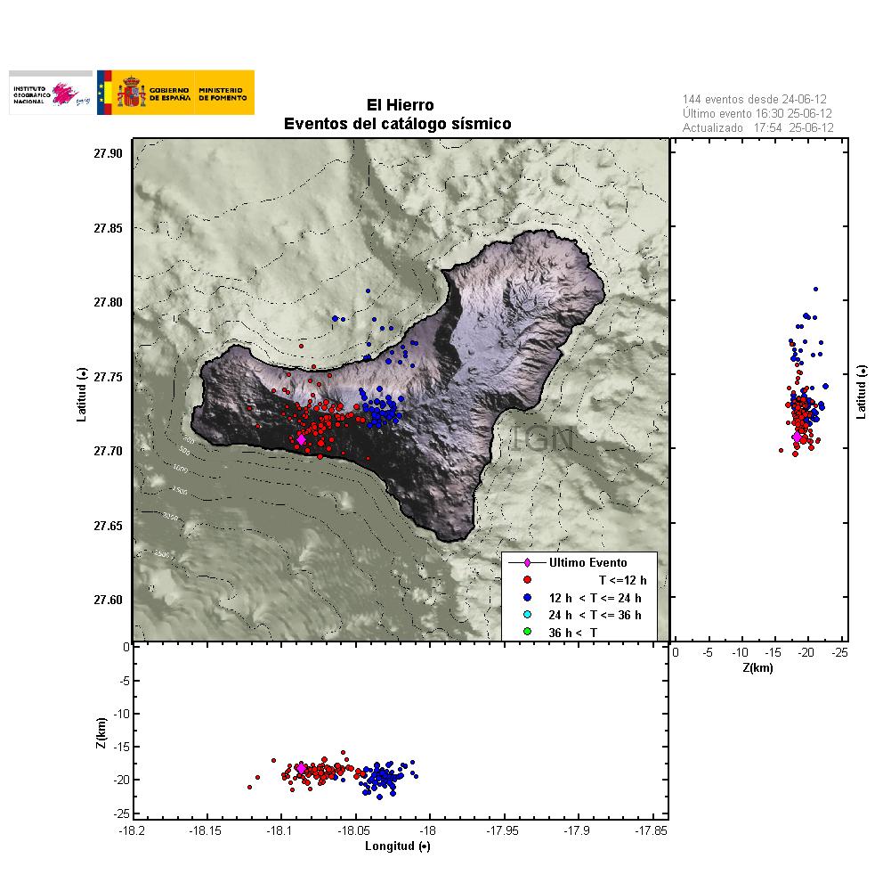
Location of the earthquakes, with depth in El Hierro volcano. This image is from 25. June at 18:09 UTC. Copyright of this picture belongs to IGN.
I do not know what is going to happen next in El Hierro volcano. But current status of the volcano is clearly something that needs to be and is monitored today. It is impossible to know for sure what is going to happen next in El Hierro volcano. But I am not going to rule out an eruption at this point.

If you take the image of the locations and place it on a Google Earth sat pic, you can see that some of these earthquakes line up with cracks in the ground. Such deformations look to be caused by errosion or shifting earth.
If a land-based eruption takes place, what would you say the chances of a landslide on the southern side of the island would be?
Cracks in the ground do not neccesarily mean that there will be a landslide when an eruption occurs.
That the quakes line up is just coincidence I think, because those cracks are there for a longer time already,
(google earth is not updated every day).
Sander
Nice El Hierro Map here; http://imm.io/u0bq
Nice Utube Channel; http://www.youtube.com/user/jcasvivero?feature=watch
Its annoying how IGN are so secretive when it comes to releasing information. Id like to know if there has been any inflation of the island since the recent activity. Too soon to know?
There must have been some inflation. But the question is how much and where it is centered.
It seems like the gps-datas are now online again. Could you explain if there is something special? I’m very bad in reading this 🙂
The link:
http://www.ign.es/ign/resources/volcanologia/html/deformacion.html
try this also :
http://www.seis.nagoyau.ac.jp/sagiya/Sagiyas_Page/Canary.html
Honestly… Go to Google Earth, create an ‘Image Overlay’, make it fairly transparent, then zoom in to see where all the quakes are centered.
It takes a little streching of the image, but it can be placed exact.
The cone, centered on the north west 1/3rd of the island.
Looking strictly at the difference in the depth of the quakes now compared to the quakes last year, could this be a second magma chamber?
This is an formation of an new dike sill in the volcano. The image in this news explains what sill is.
http://www.news.wisc.edu/18684
Here is an explanation on what sill is.
http://en.wikipedia.org/wiki/Sill_(geology)
Has a new eruption started at El Hierro?
http://www.ign.es/ign/head/volcaSenalesAnterioresDia.do?nombreFichero=CHIE_2012-06-26&ver=s&estacion=CHIE&Anio=2012&Mes=06&Dia=26&tipo=2
Yes. I now believe that to be the case (starting, but has not yet started). Blog post about it is going to be up soon.
I found a nice and interesting photos from 1980 Hekla eruption for the fun..
http://www.flickr.com/photos/35133216@N05/6823848957/in/photostream
Information on deformation has been released finally.
“GPS STATION FRON (FRONTERA) :
During the last 2 days there has been horizontal eastward displacement of 2 cm and northward of 3 cm. The vertical displacement was 2 cm.”
“The movements recorded during the last 2 days are real and much faster than those observed last year 2011.”
http://www.diarioelhierro.es/t26496/pag01.asp?Id=26496&Tp=6&Md=7
This remains a good and close up source, the local newspaper.
Headlines: “Involcan withdraws from El Hierro for lack of resources”… Austerity, you know. And: “The Association of Geologists (ICOG) has expressed concern over the increase in seismic activity on the island of El Hierro”.