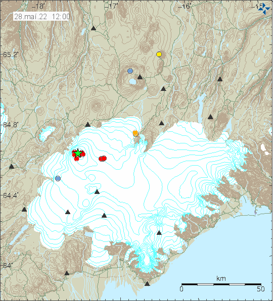
Today (28-May-2022) at 08:06 UTC an earthquake with magnitude of Mw4,4 or Mw4,7 (EMSC information can be found here) took place in Bárðarbunga volcano.
Earthquake activity in Bárðarbunga volcano. Copyright of this image belongs to Icelandic Met Office.
This earthquake activity is because of inflation in Bárðarbunga volcano magma chamber. That was emptied after the eruption in 2014 – 2015 and that resulted in collapse of Bárðarbunga volcano by drop of some 60 meters. This inflation now is reversing that process slowly. It is going to be decades until Bárðarbunga volcano erupts again because of this collapse.
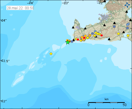
On Thursday 26-May-2022 at 20:11 UTC an earthquake with magnitude of Mw3,5. I think this earthquake was maybe felt in populated areas closest to the earthquake. This earthquake was out in the ocean, a good distance from land.
Earthquake activity on Reykjanes ridge and Reykjanes peninsula. Copyright of this image belongs to Icelandic Met Office.
This earthquake possibly is part of the earthquake activity that is happening in Reykjanes peninsula and Reykjanes ridge. It is more difficult to know what is going on in the ocean, than on land.
Posts are going to get delayed for the next few days because I am moving to Denmark.
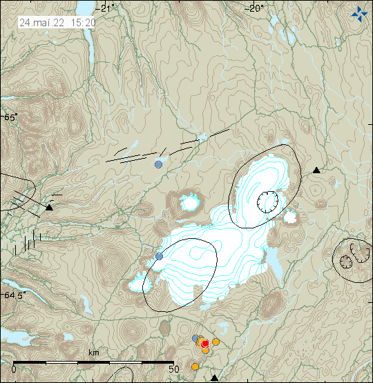
Today (24-May-2022) an earthquake swarm started north of Geysir. This earthquake swarm is mostly small and only around 40 earthquakes have been recorded so far. Largest earthquake had a magnitude of Mw2,8 and all other earthquakes have been smaller.
Earthquake activity north of Geysir. Copyright of this image belongs to Icelandic Met Office.
This earthquake activity is normal tectonic activity and I am not expecting anything more to happen. Larger earthquakes might happen, but at the writing of this article it seems unlikely. This area also has regular earthquake swarms.
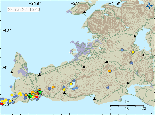
Today (23-May-2022) at 07:14 UTC an earthquake with magnitude of Mw3,5 took place north-east of Grindavík town. This earthquake was felt in Grindavík and in Reykjavík. The earthquake was located in a area that is either inflating or on the edge of area that is inflating.
Earthquake activity on the Reykjanes peninsula close to Grindavík. Copyright of this image belongs to Icelandic Met Office.
According to Icelandic Met Office news, the inflation around Þorbjörn mountain since the start of this earthquake activity is currently at 45mm. I don’t know how much inflation the crust can take in this area before an eruption starts in this area. Any eruption in this area is probably going to start with few craters that shut down with time and then there is just one crater that erupts until the eruption ends.
Donations
Please remember to support my work with donation. Everything helps me from being broke. Thanks for the support. 🙂
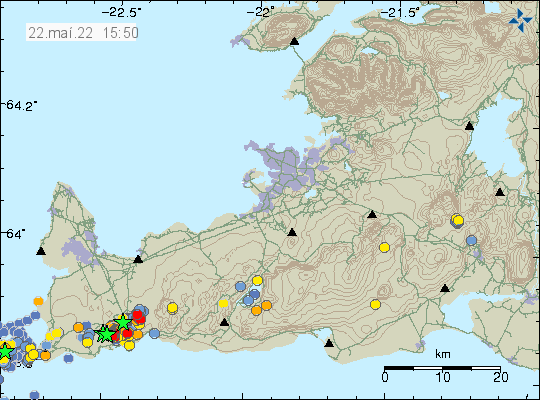
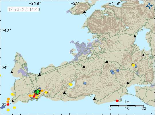
Today (22-May-2022) at 09:53 and 09:57 UTC earthquakes with magnitude of Mw3,5 and Mw3,6 took place north-west of Grindavík town. This earthquake was felt and did wake up people according to the news.
Earthquake activity close to Grindavík town. Copyright of this image belongs to Icelandic Met Office.
There is no signs that this earthquake activity is slowing down. It does come in waves according to Icelandic Met Office. This means that there are period of high activity with low activity between. Currently, at the writing of this article, there is a low activity period ongoing.
Donation
Please remember to support my work with donation if you can. Donations help me with this work and prevent me from going completely broke each month. Thanks for the support. 🙂
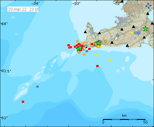
Today (20-May-2022) around 18:00 UTC the earthquake activity off the coast of Reykjanestá, that is part of Reykjanes volcano, increased again after few days of little earthquake activity. The earthquake swarm is ongoing and always changing so this article is going to be short because of that.
Earthquake swarm on the Reykjanes ridge, close to Reykjanestá. Copyright of this image belongs to Icelandic Met Office.
Largest earthquake so far had a magnitude of Mw3,8 and the second largest earthquake had a magnitude of Mw3,5. The Mw3,8 earthquake was felt in Grindavík and on nearby towns on Reykjanes peninsula. A Mw3,0 earthquake took place just north of Grindavík and was felt in the town.
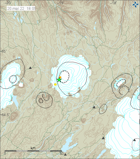
Today (20-May-2022) at 15:24 UTC an earthquake with magnitude of Mw3,2 took place in Hofsjökull volcano. Two smaller earthquakes had happened before the larger earthquake.
Earthquake activity in Hofsjökull volcano. Copyright of this image belongs to Icelandic Met Office.
There is no other earthquake activity following this. Earthquakes are rare in Hofsjökull volcano but they do happen every few years. There are no signs of any other activity in Hofsjökull volcano.
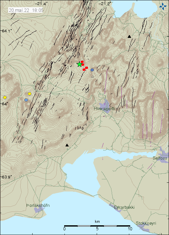
Yesterday (18-May-2022) I forgot to write about the earthquake activity that is ongoing north of Grindavík town. This earthquake activity is either in the new dyke that has formed or ongoing path of the dyke in Svartsengi that has now reached north of Grindavík town. I don’t know what applies here. Skjálftalísa map that Icelandic Met Office has strongly suggests a second dyke, but the results are bit unclear. In the area east of Þorbjörn is a older eruption fissure, I don’t know when it erupted, but it might have been as early as 12th to 13th century.
Six green stars north of Grindavík town. Copyright of this image belongs to Icelandic Met Office.
Yesterday (18-May-2022) total of five earthquakes happened with magnitude larger than Mw3,0. Largest earthquake had a magnitude of Mw3,5. Today (19-May-2022) at the writing of this article, only one earthquake with magnitude of Mw3,0 has happened. Earthquake activity seems to be slowing down. I am not sure why that is.
Donations
Please remember to support my work with donations. Everything helps me to get trough the month. Thanks for the support. 🙂
According to news today (18-May-2022) and based on recent measurements, a magma dyke has formed between Þorbjörn mountain and Eldvörp on Reykjanes peninsula. Eldvörp on Reykjanes peninsula where formed during last eruption cycle in the volcano of Reykjanes during 12th and early 13th century, exact times are poorly known. This is in a volcano named Reykjanes and is not connected to Krýsuvík-Trölladyngja volcano that erupted in 2021 (Fagradalsfjall mountain).
The dyke is shallow and narrow according the news that quote scientists from University of Iceland, Earth science department and Icelandic Met Office. The length of dyke is 7 to 9 km and depth is down to 4 to 8 km (?). This also shows up in the GPS data and other data that Icelandic Met Office has access to (I don’t have this level of access).
Earthquake activity north of Grindavík town. Copyright of this image belongs to Icelandic Met Office.
It is not possible to know when a eruption start or in what area. The main risk areas now are Blue Lagoon, HS hydrothermal energy thermal plant. The town of Grindavík is slightly south of this and is possibly in danger. How this goes depends on where the eruption starts and how large it is going to be. Smaller eruption is less of a problem than a big eruption in this area. All that can be done now is to continue to monitor the situation.
Donation
Please remember to support my work if you can. Thanks for the support. 🙂