
According to news today (18-May-2022) and based on recent measurements, a magma dyke has formed between Þorbjörn mountain and Eldvörp on Reykjanes peninsula. Eldvörp on Reykjanes peninsula where formed during last eruption cycle in the volcano of Reykjanes during 12th and early 13th century, exact times are poorly known. This is in a volcano named Reykjanes and is not connected to Krýsuvík-Trölladyngja volcano that erupted in 2021 (Fagradalsfjall mountain).
The dyke is shallow and narrow according the news that quote scientists from University of Iceland, Earth science department and Icelandic Met Office. The length of dyke is 7 to 9 km and depth is down to 4 to 8 km (?). This also shows up in the GPS data and other data that Icelandic Met Office has access to (I don’t have this level of access).
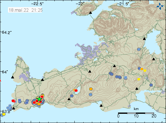
It is not possible to know when a eruption start or in what area. The main risk areas now are Blue Lagoon, HS hydrothermal energy thermal plant. The town of Grindavík is slightly south of this and is possibly in danger. How this goes depends on where the eruption starts and how large it is going to be. Smaller eruption is less of a problem than a big eruption in this area. All that can be done now is to continue to monitor the situation.
Donation
Please remember to support my work if you can. Thanks for the support. 🙂