This information is going to get outdated quickly.
Current status on Bárðarbunga volcano at 20:36 UTC
- Largest earthquakes in Bárðarbunga yesterday (17-September-2014) was a magnitude 5,2. Largest earthquake today (18-September-2014) was a magnitude 5,3. Other earthquakes have been smaller.
- Bárðarbunga volcano caldera continues to drop. When the magnitude 5,3 earthquake happened today at 14:21 UTC the caldera dropped 20 – 30 cm.
- GPS data (more GPS data can be found here) suggest to me that the dyke at Vonarskarð might be getting ready to erupt or getting re-activated. It formed in the first two weeks when current activity started in Bárðarbunga volcano on 16-August-2014. It is already there, it however failed to start an eruption, but as I say, it might be getting ready to get active again. This has been followed by some minor earthquake activity. There is however a more complicated picture into this. The details can be found later in this article. [Please note that due to licensing issues I only link to the GPS data. This means that data on the link is going to get updated in next few hours and are going to look different from what I have written about them now.]
- The eruption in Holuhraun continues as before. There has not been any view of the eruption for the past two days due to fog. So I don’t know for sure what is happening there.
Harmonic tremor data
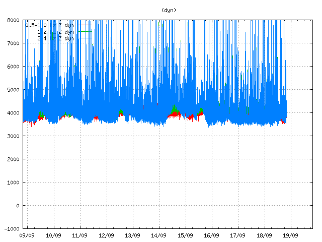
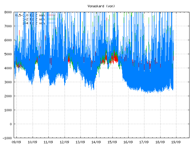
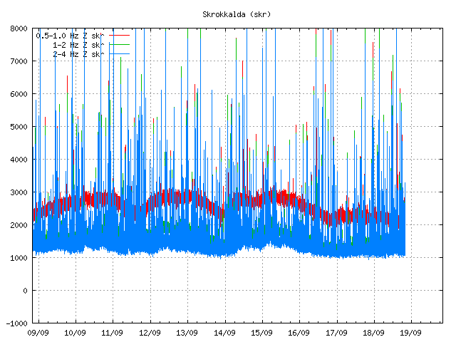
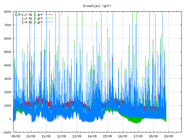
I can see two things in the harmonic tremor data. The pressure is increasing in Bárðarbunga volcano system. I am also seeing pulses of harmonic tremor and that is not good. It means that magma has somewhere found a path to the surface, it just isn’t there yet, but it is working way up. It is impossible to know if this magma gets all the way up or not. Small eruptions are also not impossible, since there signature might simply be lost in the noise on the tremor plots that I am using from Icelandic Met Office.

Tremor in Dyngjuháls SIL station. Copyright of this image belongs to Icelandic Met Office.

Tremor on Vonaskarð SIL station. Copyright of this image belongs to Icelandic Met Office.

Harmonic tremor as it appears on Skrokkalda SIL station. Copyright of this image belongs to Icelandic Met Office.

Harmonic tremor on Grímsfjall SIL station. Copyright of this image belongs to Icelandic Met Office.
Current status on the cauldrons
According to the news that I have heard some of the cauldrons that are in Dyngjujökull (south of Holuhraun) are still getting deeper. This suggest that there is still a lot of warm under the glacier that is melting the glacier. No glacier flood has happened due this. I don’t know if any new cauldrons have formed in recent days. Most of the cauldrons are located above the dyke, few are located above Bárðarbunga volcan in its slopes.
Tungafellsjökull volcano
I am seeing in the GPS data that Tungafellsjökull volcano might be getting more magma inflow. Since it appears to be inflating. This has not been confirmed so far. Currently there is nothing to suggest that Tungafellsjökull volcano is going to erupt at this point in time. It might simply be responding to the all the noise that Bárðarbunga is making at the moment, along with stress changes in the crust. If it erupts, it would be first documented eruption in the past 8000 years at least (maybe longer).
Next update is going to be tomorrow or sooner if anything major happens. It is possible to watch my webicorders here. They are updated every 5 min.
Article updated at 21:05 UTC.
Article updated at 21:14 UTC.
