It does not happen often. But I do detect earthquakes sometimes that Icelandic Meteorological Office does not detect on it’s network. The reason for that is simple. This earthquakes are too small to be detected by the SIL stations far away. My geophone network is able to detect earthquakes down to ML-2,0 when weather is good and if they are close enough. It doesn’t happen often, but it does happen. The earthquakes that I recorded on 20-February-2014 had the magnitude above ML0,0. What the magnitude is exactly I do not know. Since the software that I use does not allow for exact magnitude calculations (far as I know). The first earthquake took place at 12:36 UTC.
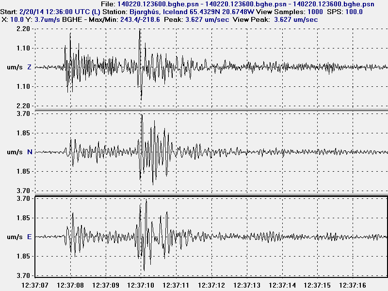
The earlier earthquake that I detected at Bjarghús geophone station. This earthquake had the magnitude of 0,1 to 0,5. This image is released under Creative Commons Licence. See CC Licence page for more details.
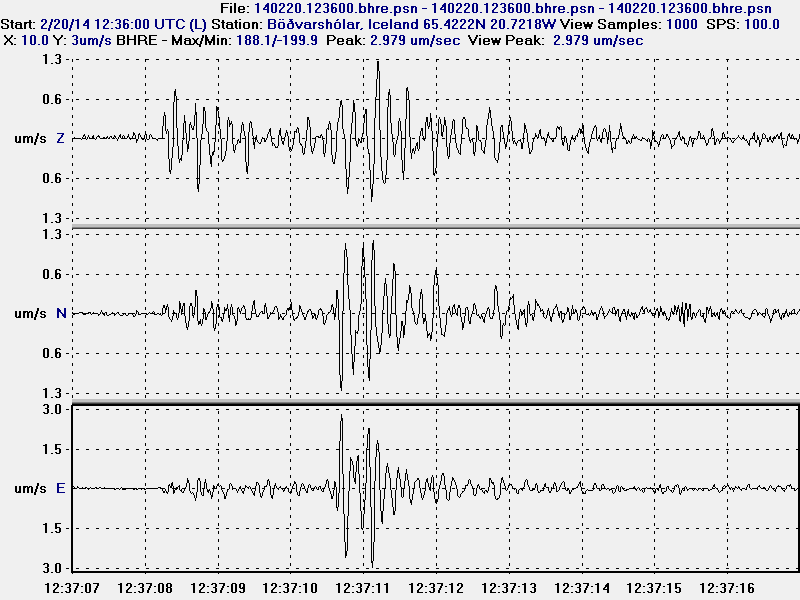
The earlier earthquakes at Böðvarshólar geophone station. This earthquake had the magnitude of 0,1 to 0,5. This image is released under Creative Commons Licence. See CC Licence page for more details.
A second earthquake took place at 18:41 UTC. It was slightly larger than the first earthquake.
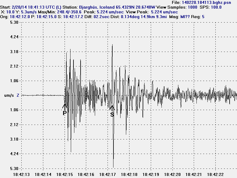
The second earthquake at Bjarghús geophone station. This earthquake had the magnitude of 0,8 to 1,2 and distance of around 14 km. This image is released under Creative Commons Licence. See CC Licence page for more details.
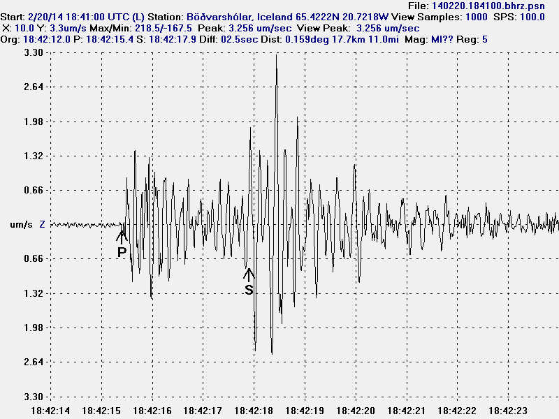
The earthquake at Böðvarshólar geophone station. This earthquake had the magnitude of 0,8 to 1,2 and an distance around 17 km.This image is released under Creative Commons Licence. See CC Licence page for more details.
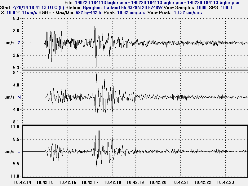
All three channels of the second earthquake. This is Bjarghús geophone station. This image is released under Creative Commons Licence. See CC Licence page for more details.
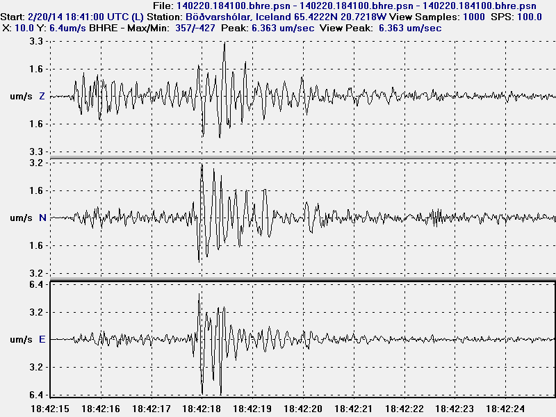
All three channels of the second earthquake. This is Böðvarshólar geophone station. This image is released under Creative Commons Licence. See CC Licence page for more details.
I have not recorded any more earthquakes since this activity. Last earthquake before that took place in the year 2006 best to my knowledge. That was just one earthquake and Icelandic Meteorological Office was unable to locate that earthquake too due to lack of SIL stations in the area of my geophone. Back in 2006 I had one geophone and it was located in the village of Hvammstangi where I used to live. I don’t know if any more earthquakes are going to take place. It is difficult to know if any more earthquakes are going to take place. If they do they are going to appear on my geophones (Böðvarshólar and Bjarghús) in Húnaþing Vestra.
