
It does not happen often. But I do detect earthquakes sometimes that Icelandic Meteorological Office does not detect on it’s network. The reason for that is simple. This earthquakes are too small to be detected by the SIL stations far away. My geophone network is able to detect earthquakes down to ML-2,0 when weather is good and if they are close enough. It doesn’t happen often, but it does happen. The earthquakes that I recorded on 20-February-2014 had the magnitude above ML0,0. What the magnitude is exactly I do not know. Since the software that I use does not allow for exact magnitude calculations (far as I know). The first earthquake took place at 12:36 UTC.

The earlier earthquake that I detected at Bjarghús geophone station. This earthquake had the magnitude of 0,1 to 0,5. This image is released under Creative Commons Licence. See CC Licence page for more details.
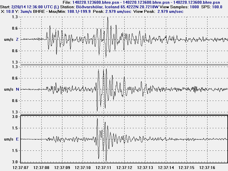
The earlier earthquakes at Böðvarshólar geophone station. This earthquake had the magnitude of 0,1 to 0,5. This image is released under Creative Commons Licence. See CC Licence page for more details.
A second earthquake took place at 18:41 UTC. It was slightly larger than the first earthquake.
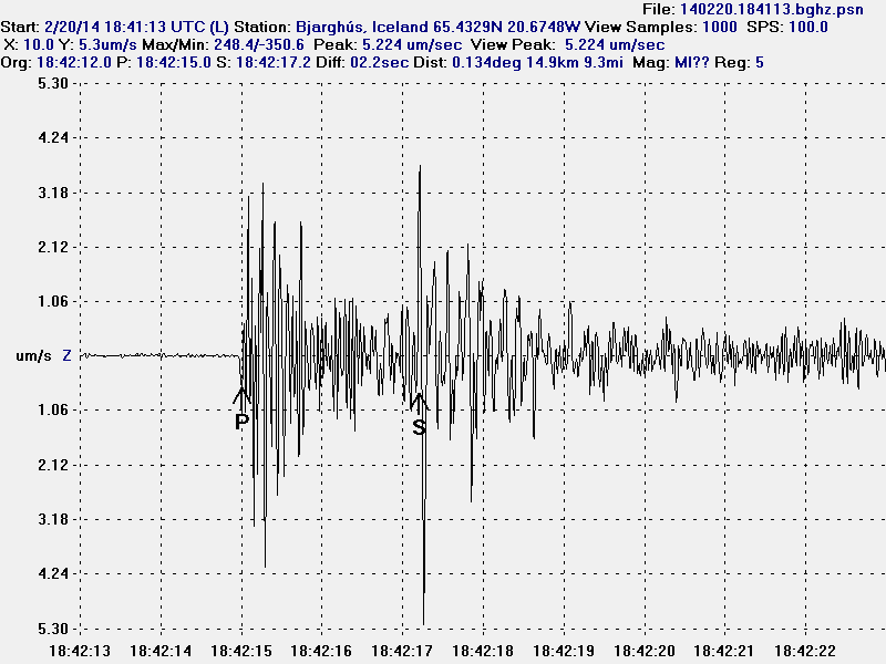
The second earthquake at Bjarghús geophone station. This earthquake had the magnitude of 0,8 to 1,2 and distance of around 14 km. This image is released under Creative Commons Licence. See CC Licence page for more details.
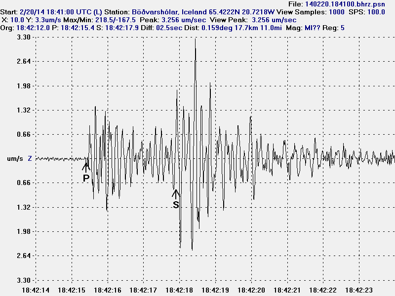
The earthquake at Böðvarshólar geophone station. This earthquake had the magnitude of 0,8 to 1,2 and an distance around 17 km.This image is released under Creative Commons Licence. See CC Licence page for more details.
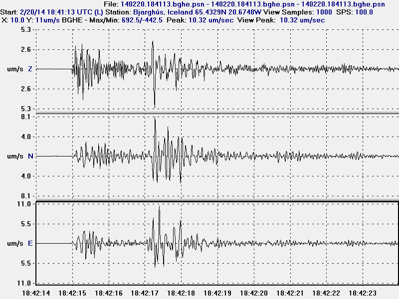
All three channels of the second earthquake. This is Bjarghús geophone station. This image is released under Creative Commons Licence. See CC Licence page for more details.
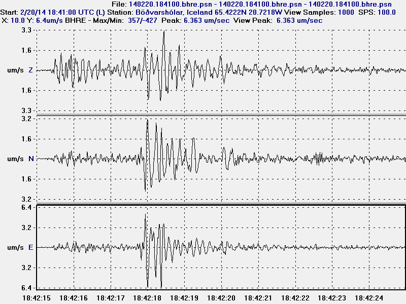
All three channels of the second earthquake. This is Böðvarshólar geophone station. This image is released under Creative Commons Licence. See CC Licence page for more details.
I have not recorded any more earthquakes since this activity. Last earthquake before that took place in the year 2006 best to my knowledge. That was just one earthquake and Icelandic Meteorological Office was unable to locate that earthquake too due to lack of SIL stations in the area of my geophone. Back in 2006 I had one geophone and it was located in the village of Hvammstangi where I used to live. I don’t know if any more earthquakes are going to take place. It is difficult to know if any more earthquakes are going to take place. If they do they are going to appear on my geophones (Böðvarshólar and Bjarghús) in Húnaþing Vestra.
Jon, you clearly are a genius reading helicorders for Iceland. Now in the USA, there is a problem with an area with a large and growing sinkhole..which kinds of replicates a mini mud volcano. Wonder if you reviews and posted your analysis if that increases your paid donation lists. Here is one helicorder for the Bayou Corne Sink Hole:
http://folkworm.ceri.memphis.edu/heli_temp/LA14_HHZ_YC_–.2014022612.gif
http://folkworm.ceri.memphis.edu/heli_temp/
Whole number of helicorders..
And two of several sites blogging on the same:
http://freedomrox.wordpress.com/
http://lasinkhole.wordpress.com/
Frankly the growth and engineering review of the sinkhole is very interesting. I wonder if in a way it relicates volcanic activity..
Sink-hole formation has nothing to do with volcanoes if not in already volcano active area. That area you mention has no active volcanoes that I know of. So the sink-hole formation is due to movement of soil or calcium based rock being removed by water.
As for mud volcanoes, they are an result of natural gas, water and soil. They can exist almost anywhere the ground allows for gas pockets to appear underground. The gas needs to pushed out of ground to make a mud volcano. That doesn’t always happen. An existence of mud volcano does not mean there is an active volcano in the area. Just a lot of natural gas in the ground escaping under high pressure.