Magnitude 3,4 earthquake 15 km north of Kolbeinsey island

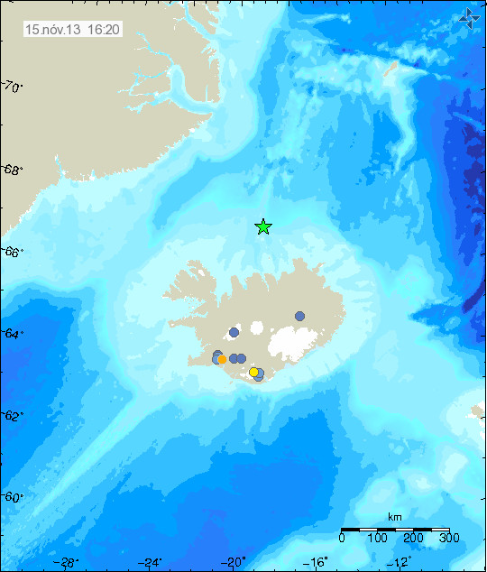
Today (15-November-2013) at 05:32 UTC an magnitude 3,4 earthquake took place 14,9 km north of Kolbeinsey island. The depth of this earthquake was 3,9 km according to Icelandic Meteorological Office. Due to distance from the SIL network the magnitude and depth might be underestimated.
131115_1620
The earthquake north of Kolbeinsey island is marked by the green star. Copyright of this image belongs to Icelandic Meteorological Office.

Due to distance from land it is difficult to know for sure what is happening at this location. So far no harmonic tremor has been detected so no eruption is taking place at this location. This earthquake did appear clearly on my geophone in Böðvarshólar. My geophone website can be found here.

50 years since Surtsey island erupted

On the 14-November-1963 an eruption started off the south coast of Iceland. This eruption lasted for several years, starting on 14-November-1963 and ending on 5-June-1967. This new island was later known as Surtsey. This eruption was an start of eruption period in the otherwise unnamed volcano in this area, inside this volcano also exist Vestmannaeyjar islands. Only ending in the year 1973 with an eruption in Vestmannaeyjar islands. Surtsey is an protected islands and tourist are not allowed to go there under any circumstances. Only scientific missions to check on the developing flora on the island are allowed to go there few times a year.

Rúv News did broadcast a news about the 50 years since the eruption in Surtsey and they included a lot of pictures of the eruption as it took place in Surtsey in the year 1963. That news coverage can be found here, but it is all in Icelandic. It includes an video from Rúv News.