Earthquake swarm in progress in Krýsuvík volcano

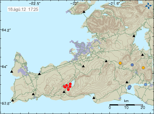
Today (18.08.2012) at 15:52 UTC an earthquake swarm did start in Krýsuvík volcano. So far this swarm is not big. With the largest earthquake having magnitude 1.8 according to automatic size. It is impossible to know at this point if this earthquake swarm is going to be strong, or has just ended. So far earthquake activity continues with minor earthquakes.


The earthquake swarm in Krýsuvík volcano. Copyright of this image belongs to Icelandic Meteorological Office.

If the earthquake activity picks up. I am going to do my best to update this blog. But I am on limited 3G internet connection. So it might be a while until update takes place.

Earthquake in Katla volcano today (17.08.2012)

Today at 15:48 UTC there was an magnitude 3.8, at the depth of 0.1 km in Katla volcano. This earthquake took place on the caldera rim in Katla volcano. No major harmonic tremor was detected following this earthquake. However some harmonic tremor was detected. But it was minor. This might have been hydro-thermal-activity or magma on the move. It is impossible to know for sure what is the case now. This earthquake did appear clearly on my geophone network. Mostly on the geophone station at Skeiðflöt and Heklubyggð.
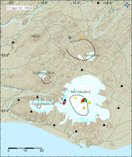

The location of the earthquake in Katla volcano. It was located on the edge of Katla volcano caldera. Copyright of this image belongs to Iceland Meteorological Office.
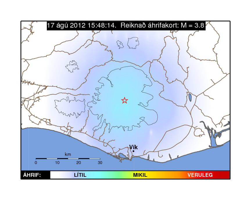

Influence map of todays ML3.8 earthquake. This suggests that it was not felt in nearby populated areas. Copyright of this image belongs to Iceland Meteorological Office.
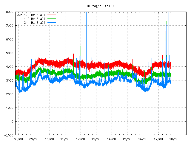

Tremor plot that clearly shows the earthquake of today. The spikes are the earthquakes that have been taking place in Katla volcano or close by areas. This is Alftagrof SIL station. Copyright of this image belongs to Iceland Meteorological Office.


This tremor plot shows some minor harmonic tremor following the earthquake in Katla volcano. The spikes show the earthquake from Katla volcano and areas close by. This is Austmannsbunga SIL station. Copyright of this image belongs to Iceland Meteorological Office.

It is impossible to know what this means exactly. But Katla volcano has been quiet since around middle of July. It remains to be seen if earthquake activity is picking up again or if this was just an single event.

Icelandic news about this earthquake

Jarðskjálfti í Mýrdalsjökli (Rúv.is, Icelandic)
Jarðskjálfti í Mýrdalsjökli (Vísir.is, Icelandic)
Jörð skalf við Austmannsbungu (mbl.is, Icelandic)

Blog post updated at 18.08.2012 at 11:51 UTC. Blog post title fixed for the future.
Magnitude 3.7 earthquake in Netherlands [Updated]

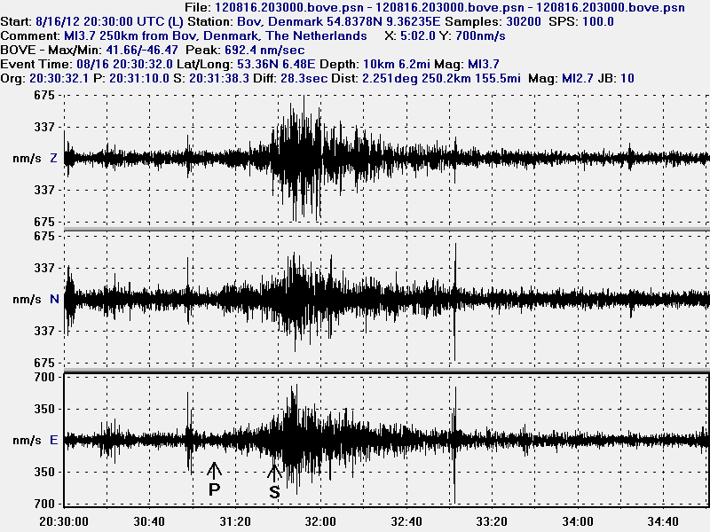
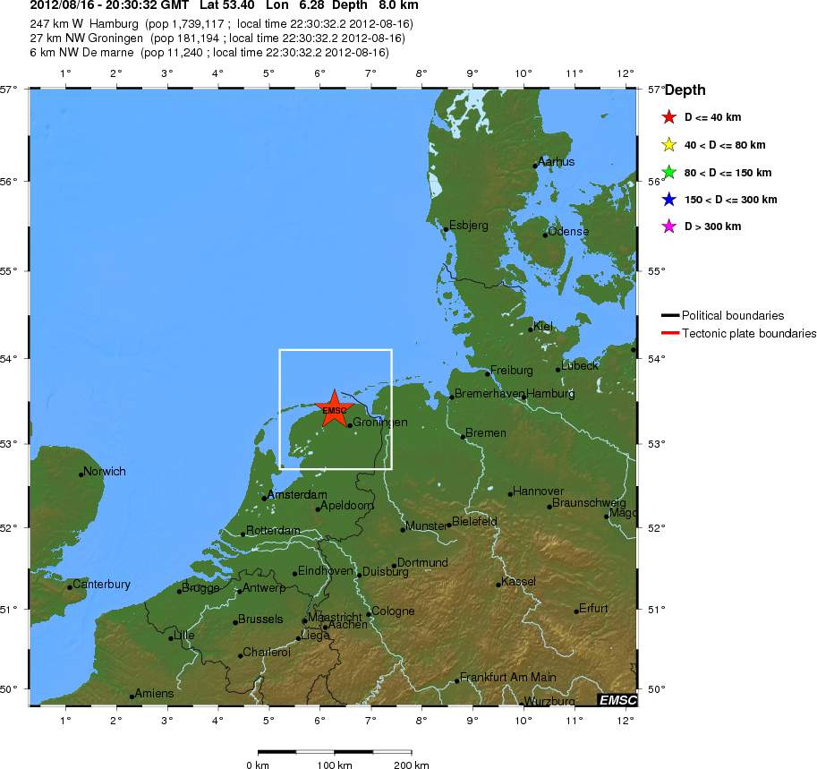
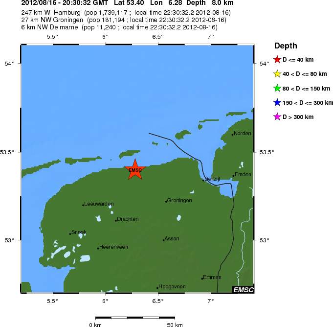
At 20:30 UTC on 16. August 2012 there was an magnitude 3.7 earthquake in Netherlands according to EMSC web site.


The earthquake in Netherlands at 20:30 UTC (22:30 local time). This earthquake was mostly felt in the area where it did happen. This picture is released under Creative Commons licence. Please see CC page for more details.


Regional view of the area where the earthquake did happen. Copyright of this image belongs to EMSC.


Local view of the area where the earthquake did happen. Copyright of this image belongs to EMSC.

Some have already been speculating this earthquake might be due to gas extraction in this area. That might be. But there is also an chance that might have just been intraplate earthquake that sometimes happens. There might be other factors at work here that I do not know about. But I am not well into local geology of this area at current time.

It is hard to know if any aftershocks are going to take place. But I find them unlikely at current moment. But that might change without warning.

Blog post has been updated. The earthquake size and location has been revised.

Earthquakes deep south on the Reykjanes Ridge [Updated]

During last night there has been some earthquake activity deep south on Reykjanes Ridge. This earthquake activity is far from the south coast of Iceland so it has not been noticed by any people. It has only appeared on seismometers. The web page of EMSC has shows the current earthquake activity started at 00:21 UTC with two earthquakes. The largest earthquake recorded in following hours had the magnitude of Mb5.3 according to EMSC web page. But that is automatic size estimate and is subject to a change.


The location of the earthquake deep south on Reykjanes Ridge. Copyright of this image belongs to EMSC.

There most likely have been more earthquakes in this area then are registered by seismometer networks. It seems that earthquake activity in this area has quieted down again. For now at least. But this area is subject to strong earthquake swarms on regular basic.

Blog post updated at 21:33 UTC on 15.08.2012.

Use of radar to monitor start of a volcano eruption under an glacier

During the start of the volcano eruption of Eyjafjallajökull volcano in the year 2010. Use of radar images during the start of the eruption from it’s top crater provided valuable information on what was going on in the volcano. But due to weather it was close to impossible to monitor the start of eruption when it started in it’s top crater on 14. April 2010. The radar did allow sciencetist to monitor the formations of the ice cauldrons in the glacier and see how they did empty of glacier flood water in the start of the eruption. This allowed warnings to be issued in time for the population living close to Eyjafjallajökull volcano.

Icelandic news about this

Radarmyndir notaðar á einstakan hátt (Rúv.is)

Marriage proposal on top of Eyjafjallajökull volcano yesterday

While for most people Eyjafjallajökull volcano eruption of the year 2010 was mostly doom and gloom because of air plain delays and closed air spaces. Something good did come out of it too. But something good did also come out of this eruption. But it is rare to hear of those stories. But this is one of those stories.

Rúv News tells about marriage proposal on top of Eyjafjallajökull volcano yesterday. But two and half years ago Catarinu Echeverri was on travel in Europe when the eruption in Eyjafjallajökull volcano hit Europe airspace. But due to mistake in flight booking just here friend did go to Venice on planned travel date. Because of this she was left stranded in Berlin. A man named Kay Kuehne offered here to stay with him for one night, but here flight to Venice the day after. Then the ash cloud from Eyjafjallajökull volcano eruption hit and she did end up staying longer with him then planned.

I wish the happy couple all the best in there future. 🙂

Rúv News about this.

Bónorð á Eyjafjallajökli (Rúv.is)

Minor earthquake swarm in Brennisteinsfjöll volcano system

When I was moving there was an small earthquake in Brennisteinsfjöll volcano. Because I was moving I was unable to track this earthquake swarm properly. But the largest earthquake was around ML1.5 from what I can remember. The earthquakes had the depth of at least 2 km. But I am not sure what the exact depth is. But I have not yet looked at the reviewed data on this earthquake swarm.


The earthquake swarm in south-west part of Brennisteinsfjöll volcano. Copyright of this picture belongs to Iceland Meteorological Office.

There has not been a lot of activity in Iceland during all summer. So I have not had lot to write about. But that might change without any warning. As is common in Iceland.

I did also move on 7th of August to a new town in Denmark. That means I am out of ADSL connection until 24th of August. So this blog is going to suffer from lack of updates until I am properly connected to the internet.

Magnitude 4.4 earthquake between Denmark and Sweden

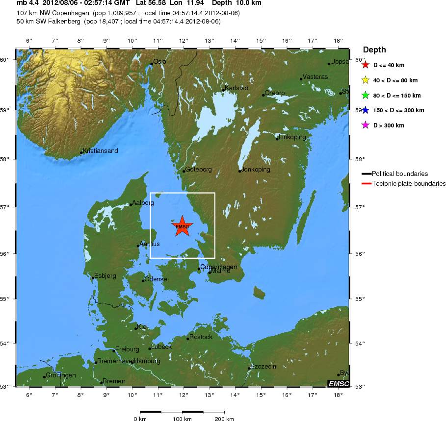
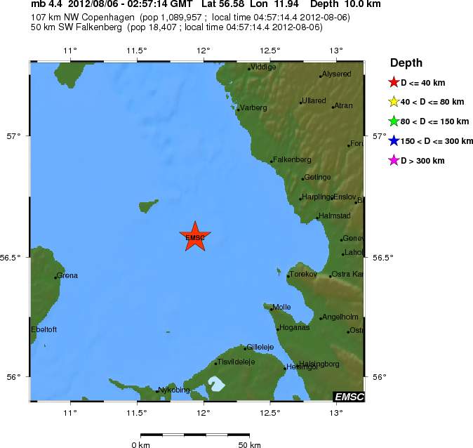
This morning there was a magnitude 4.4 earthquake between Denmark and Sweden. This earthquake was felt in Denmark and Sweden. No damage did take place during this earthquake, best to my knowledge. I did not record this earthquake, as I am currently moving to a new place in Denmark. But based on static I should record next earthquake that happens in or close to Denmark in about 2 to 3 years time. More information about this earthquake can be found on EMSC web page here.


Earthquake regional location according to EMSC. Copyright of this picture belongs to EMSC.


Earthquake location at local level according to EMSC. Copyright of this picture belongs to EMSC.

It is hard to know for sure if there are going to be any aftershocks following this event. This might just be one-off earthquake. But I would not rule out aftershocks in next few days with the magnitude of ML2.0 – ML4.0. But this are intra-plate earthquake. They are not connected with any fault zone as such. But continental plates have fault zones on there own. This fault zones sometimes move and make a earthquake in the process.

Danish news about this.

Jordskælv i havet mellem Danmark og Sverige (DR.dk)
Jordskælv i Danmark: Krig, tog eller et bump på vejen? (DR.dk)

Update 1: More news on this from Danish media

Vores fundament er presset (b.dk)

New mountain found deep west of coast of Iceland

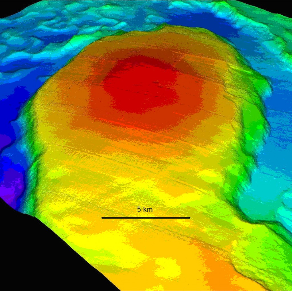
Marine Research Institute (of Iceland) has found new mountain off the coast of Iceland. The mountain is in a plateau in the same area. But it rises up from the ocean floor about 450 meters. The area that was mapped had the size of 300 square kilometer. Depth of the ocean at this location is around 1400 meters. This mountain is possibly an old tuff mountain (volcano). But that is not confirmed. According the news, this mountain has youthful look to it and around three craters where spotted on it. The age in this area is around 20 million years. So this might be a extinct volcano from the time period when volcano activity was ongoing in this area. But it most likely has never been above the coast line.


The unnamed mountain on the ocean floor off the west coast of Iceland. Copyright of this image belongs to Marine Research Institute.

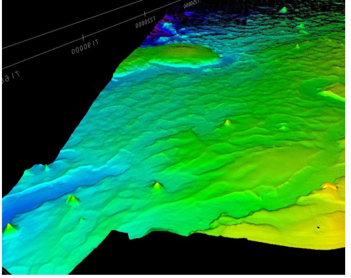
They found more then just this mountain in this survey. They also found more mud volcanoes off the coast of Iceland. Some of them are reaching 350 meters off the ocean floor.


Mud volcanoes appears as spikes in this image. This image has has things four times larger then they actually are. Copyright of this image belongs to Marine Research Institute.

There are many more unknowns off the coast of Iceland. As the ocean floor is largely unexplored today. As are many other parts of the ocean floor around the world.

Icelandic news about this

Stórt og mikið neðansjávarfjall birtist með fjölgeislamælingum djúpt vestur af Íslandi. (hafro.is, Icelandic, pictures)
Hafró: Fundu 450 m hátt neðansjávarfjall vestur af Snæfellsnesi – tífalt stærra en Ingólfsfjall (Pressan.is, Icelandic)

Blog post updated at 06:25 UTC on 02.08.2012. Correct English name for Hafrannsóknarstofnun added.