Glacier flood confirmed from western Skaftárkatli cauldron

Today (30.08.2012) an glacier flood was confirmed from the western Skaftárkatli cauldron. This glacier flood is small as expected. But it did take several days longer to appear from Vatnajökull glacier then expected. Some hydro-thermal activity in Hamarinn volcano (Bárðarbunga volcano) seems to be currently taking place at the moment. But some harmonic tremor spikes have been taking place in the past two hours.
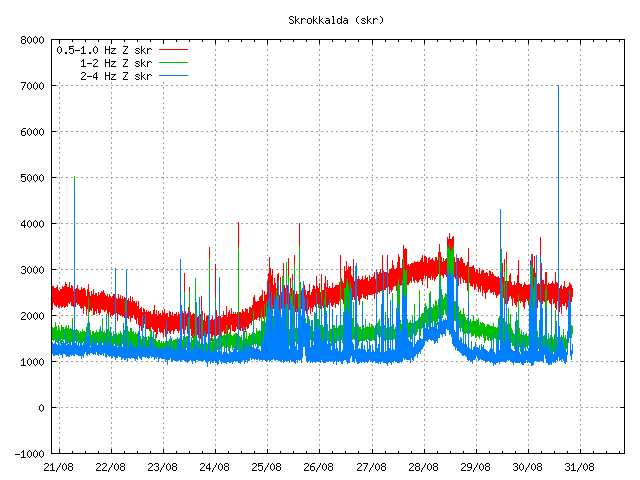

Harmonic tremor pulse can be seen at the end of this tremor plot from IMO. It only lasted for about 30 to 60 min. Copyright of this image belongs to Icelandic Meteorological Office.


Harmonic tremor pulse can be seen at the end of this tremor plot from IMO. It only lasted for about 30 to 60 min. Copyright of this image belongs to Icelandic Meteorological Office.
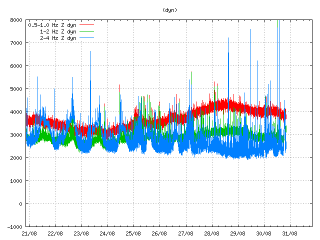

Harmonic tremor pulse can be seen at the end of this tremor plot from IMO. It only lasted for about 30 to 60 min. Copyright of this image belongs to Icelandic Meteorological Office.

It might be that this harmonic tremor signals are coming from other volcano system then Hamarinn volcano. This type of activity has been seen before in Hamarinn volcano and follows glacier floods from it. Given the activity last year. I cannot rule out volcano activity taking place now in Hamarinn volcano. New episode of harmonic tremor is now starting in Hamarinn volcano. Based on early observations . It seems that current activity is behaving in similar manner as did happen in July 2011 when an minor eruption took place in Hamarinn volcano. If that is the case now remains to be seen. But it should be clear in few hours what is exactly going on in Hamarinn volcano following this glacier flood.

Icelandic news about this glacier flood

Skaftárhlaup kom úr katlinum – myndband (Rúv.is, video)
Hlaupið kom úr vestari katlinum (mbl.is)

Two earthquakes in Jan Mayen today (30.08.2012)

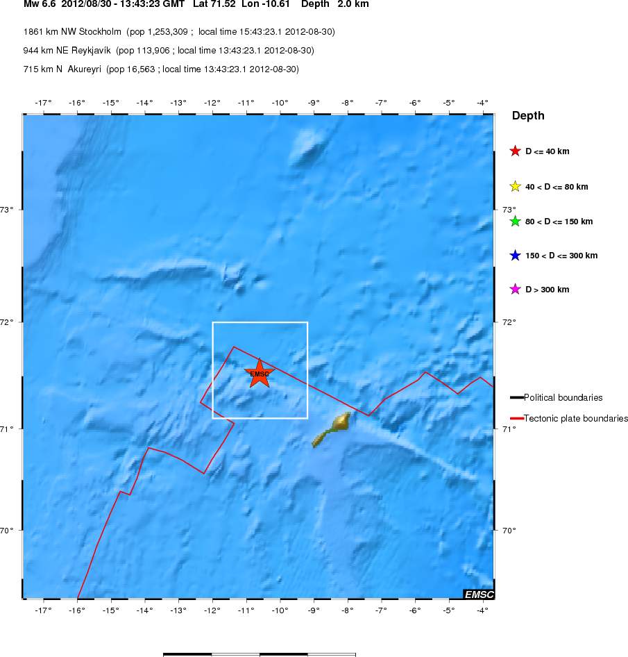
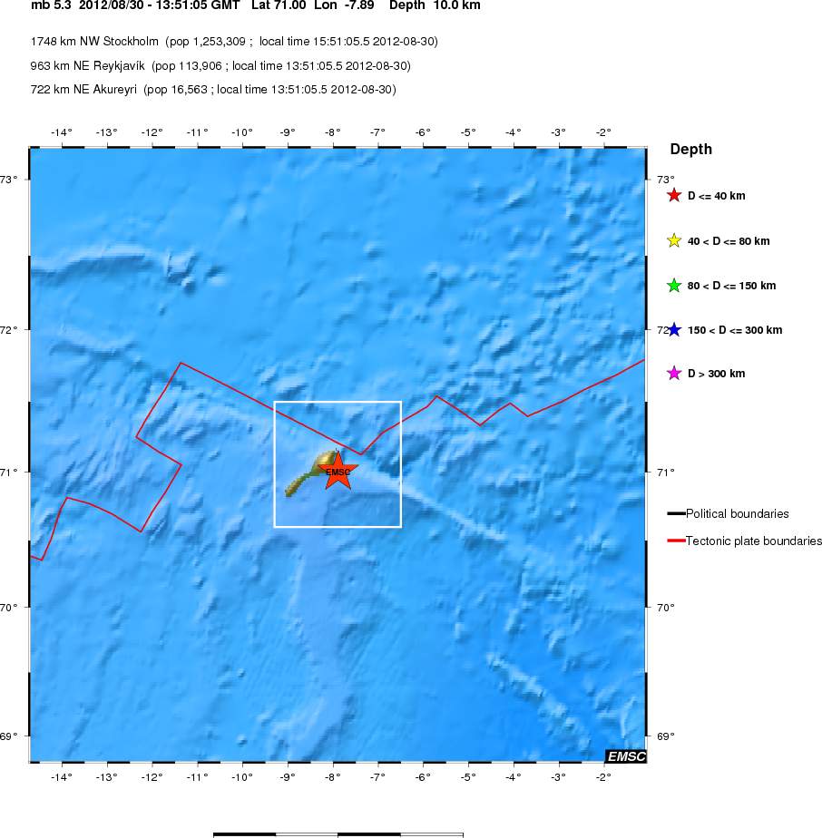
Today (30.08.2012) Jan Mayen was hit by two earthquakes. The second earthquake was not an aftershock of the first one. But it remains an question if it was triggered by the first earthquake. The first earthquake had the magnitude of Mw6.6 according to EMSC web site. The second earthquake had the magnitude of Mb5.3 according to EMSC. Both earthquakes where felt by Norwegian military and science staff that resides on Jan Mayen.


Location of the Mw6.6 earthquake off the coast of Jan Mayen. As can be seen. This earthquake took place far out in the ocean. Copyright of this image belongs to EMSC.

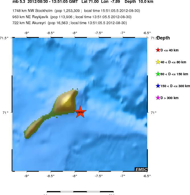
The second earthquake was less in magnitude. But was closer to the Jan Mayen Island. For that reason it was possibly felt better the first earthquake.


Large view of the second Jan Mayen earthquake. This earthquake had the magnitude of Mb5.3. Copyright of this image belongs to EMSC.


Close up view of the second Jan Mayen earthquake. Copyright of this image belongs to EMSC.


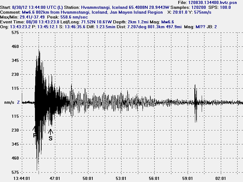
The Mw6.6 earthquake that took place in Jan Mayen. This geophone station is the closest to the earthquake in Jan Mayen. This image is released under CC licence. Please see CC licence page for more details.


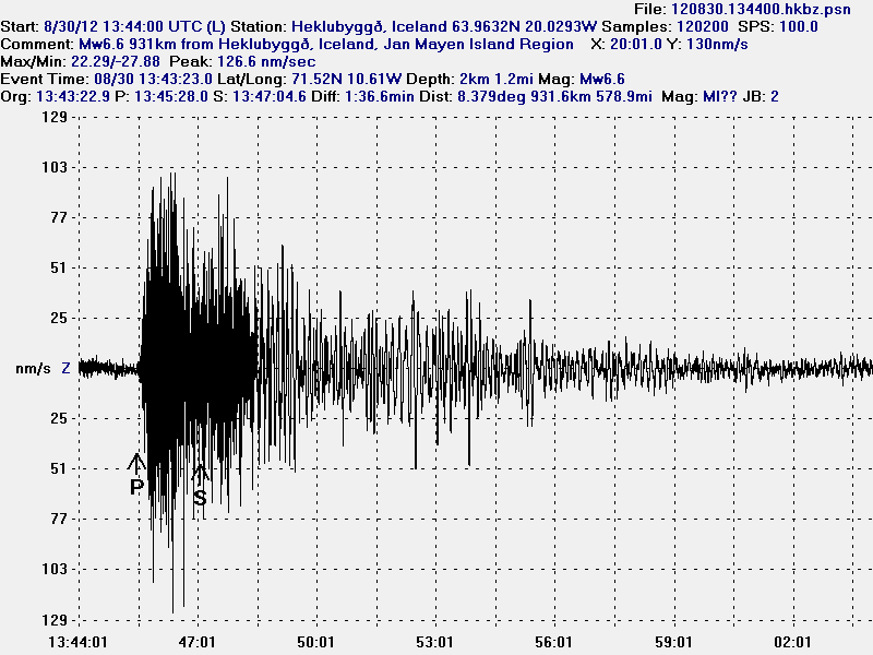
The Mw6.6 Jan Mayen earthquake as it was seen on Heklubyggð geophone station. This image is released under CC licence. Please see CC licence page for more details.


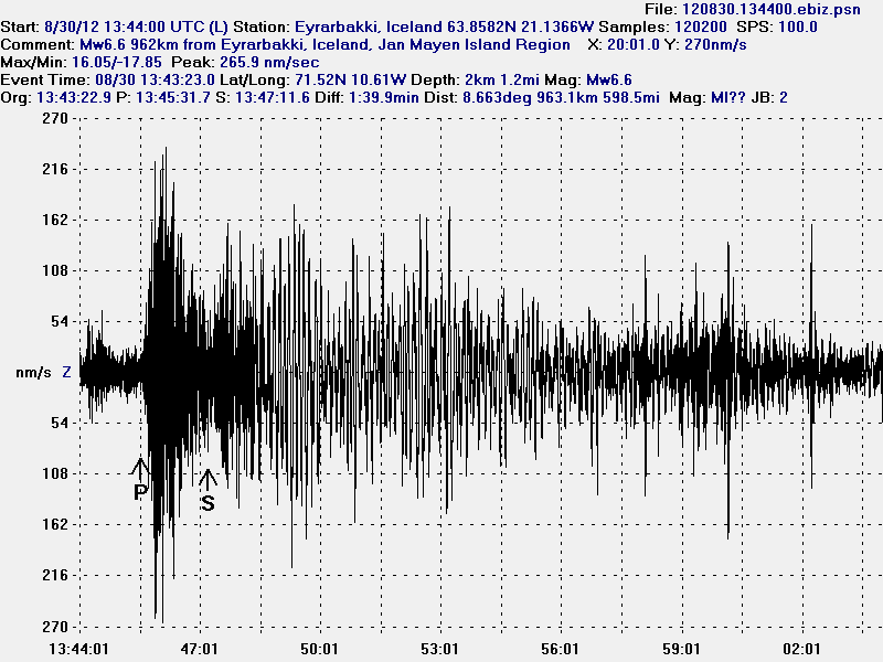
The Mw6.6 Jan Mayen earthquake as it was seen on Eyrarbakki geophone station. This image is released under CC licence. Please see CC licence page for more details.


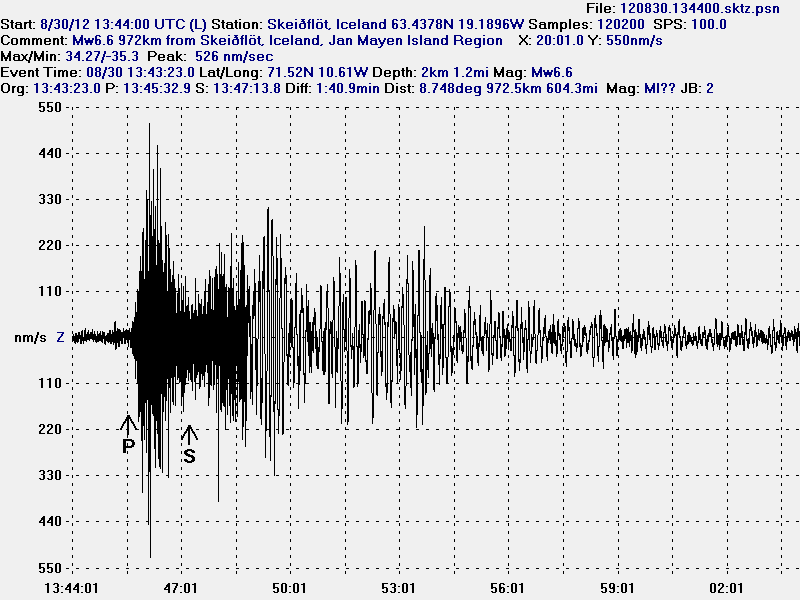
The Mw6.6 Jan Mayen earthquake as it was seen on Skeiðflöt geophone station. The P-wave goes trough something that speeds up it’s arrival. Something that the software that I use cannot account for. That is why the P-wave is in the wrong location. As model vs reality do not match in this case. This happen frequently with my location data. This image is released under CC licence. Please see CC licence page for more details.


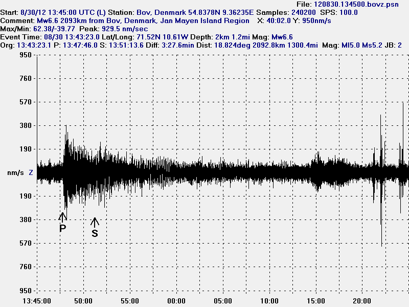
I did also record this earthquake in Denmark. Where I now live. This is the most distance that I did record this earthquake. But the distance was around 2000 km. The signal did appear. But I did not record any surface waves as I did in Iceland. Background noise is also higher here in Denmark then in most location in Iceland and it is more constant. This image is released under CC licence. Please see CC licence page for more details.

I did not record the Mb5.3 earthquakes on my geophones. It was just too small for my hardware to detect it. The waveform from the second earthquake was also lost in the surface waves from the first earthquake during this time period. At least when it comes to my hardware as it currently is.

Icelandic news about this earthquake

Jarðskjálfti við Jan Mayen – 6.6 stig (Vísir.is)
Almannavarnir: Ekki miklar líkur á flóðbylgju (Vísir.is)
Jarðskjálfti upp á 6,6 stig (mbl.is)

Norwegian and danish news about this earthquake

Kraftig jordskjelv utenfor Jan Mayen (NRK.no)
Skælv på 6,6 ryster Grønlands østkyst (DR.dk)

Earthquake in Brennisteinsfjöll volcano / SISZ earthquake zone

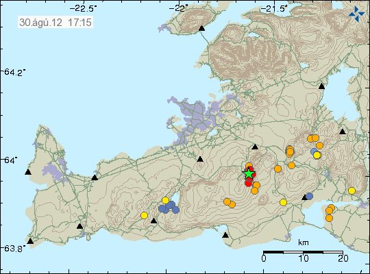
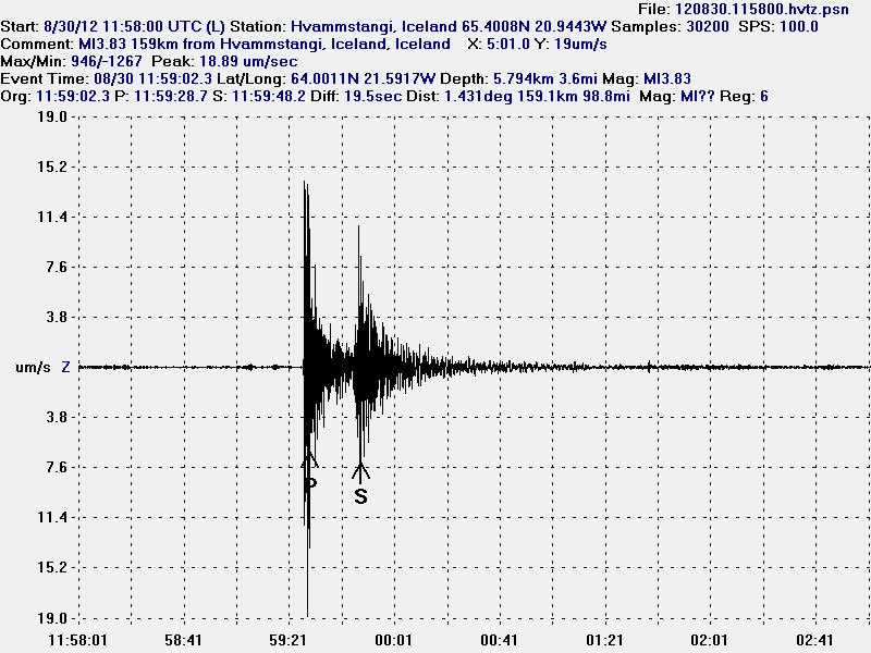
Today (30.08.2012) at 11:59 UTC there was an earthquake with the magnitude of ML3.8 (4.2Mw) in Brennisteinsfjöll volcano / SISZ. But SISZ overlaps this area to some extend. So large earthquakes do happen in this area of Iceland on regular basis. This earthquake was felt in Reykjavík area, south Iceland and some part of western Iceland.


The earthquake location and the following aftershocks. Copyright of this image belongs to Icelandic Meteorological Office.

In around 30 aftershocks have been detected in the area. More aftershock activity in this area cannot be ruled out. This earthquake did appear clearly on my geophones all over Iceland.


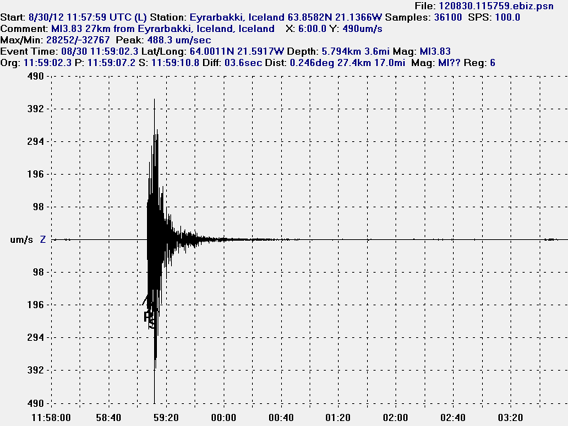
The earthquake at Eyrarbakki geophone station. This geophone is the closest to the earthquake. The most movement in this earthquake was on an N-S and E-W fault according to my geophones. This picture is released under CC Licence. See licence page for more details.


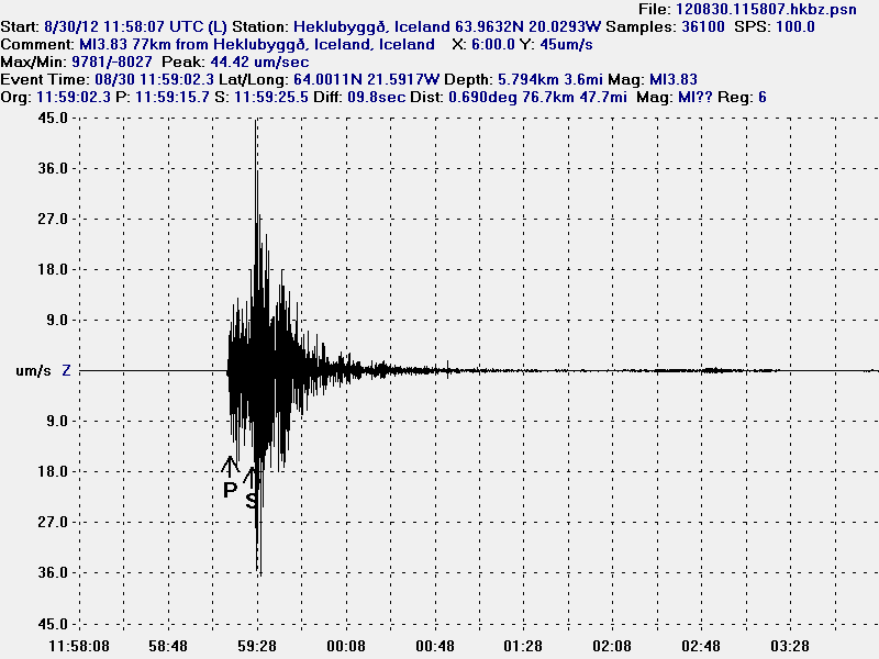
This is the earthquake as it was recorded on Heklubyggð geophone. It is the second closest geophone station to this earthquake. This picture is released under CC Licence. See licence page for more details.


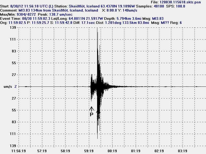
Here is the earthquake as it did appear on Skeiðflöt geophone. This picture is released under CC Licence. See licence page for more details.


Here is the earthquake as it did appear on Hvammstangi geophone. This picture is released under CC Licence. See licence page for more details.

It is impossible to know for sure what this earthquake activity means. But earthquake activity in this area of Brennisteinsfjöll volcano did stop around 15:49 UTC. No aftershocks did go above 2.0 in magnitude. More earthquakes in this area should not be ruled out in the next few days to weeks.

Icelandic News about this earthquake

Alltaf von á eftirskjálftum (Rúv.is)
Skjálftinn á enda stórs misgengis (Rúv.is)
Verra ef safnið hefði skemmst (Rúv.is)
Skjálftinn hápunktur – ekki fyrirboði (Rúv.is)
Jörð skalf í dag (Rúv.is. Afternoon radio show about this earthquake in Icelandic)
Jarðskjálftasvæðið undir smásjá sérfræðinga (Vísir.is)
Má búast við nokkrum eftirskjálftum (Vísir.is)
Fólk hljóp á dyr í Litlu Kaffistofunni (Vísir.is)
Jarðskjálftinn var 4,6 stig (Vísir.is)
Á þriðja tug eftirskjálfta hefur mælst (mbl.is)
Jarðskjálfti upp á 4,6 stig (mbl.is)
Snarpur jarðskjálfti á höfuðborgarsvæðinu – Stærsti skjálftinn í 3 ár (Pressan.is)
Jarðskjálftafræðingur: Ekki búið að losa um neina spennu að ráði (Pressan.is)

Low earthquake activity in Iceland

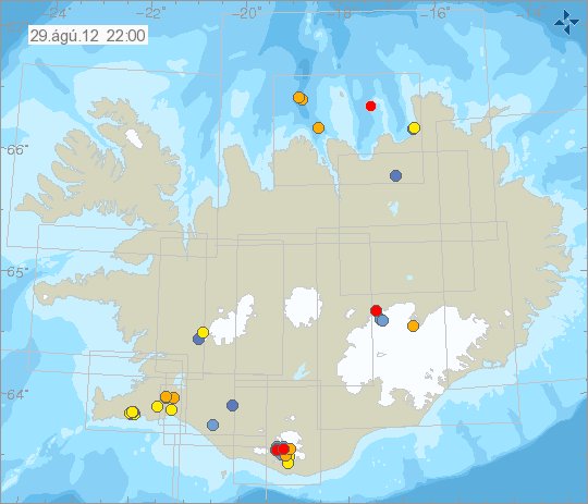
This is not going to surprise anyone how read this blog on regular basis. But earthquake activity and volcano activity in Iceland is minimal those past days. As it has now been for past several weeks. This has sadly lead to less blog post then I like. But I have also been busy. So it has helped in that sense for me. At current rate, the year 2012 is so far the most quiet year that I remember in an long time. I have been monitoring earthquake activity in Iceland more or less since the year 1996.


Current earthquake activity in Iceland on 29. August 2012. As can be seen. Activity is rather slow today. Copyright of this image belongs to Icelandic Meteorological Office.

While it is quiet in Iceland. I am going to work on other articles about other interesting features in Icelandic geology. They won’t be long. But short and as informal as I can make them. This quiet time might last a bit longer then it already has. I would not expect anything else.