Minor earthquake activity in Iceland

During the past few weeks it has been quiet in Iceland. Really quiet, with almost nothing going on. It is still like that to some extent. So this is just a short overview of the small activity that has been taking place in Iceland during the past 48 hours or so.


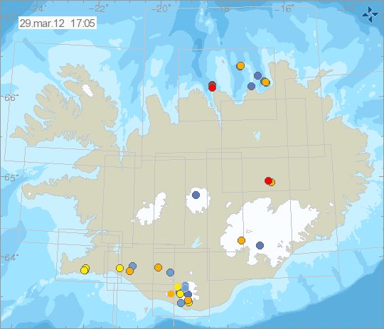
The earthquake activity in Iceland during the past 48 hours. Copyright of this image belongs to Iceland Met Office.

The most activity in the last 48 hours have been on the Reykjanes and on TFZ. But there was an small earthquake swarm in each area. With earthquakes that did not get over ML2.5 in size so far. Two earthquakes where in Askja volcano. One in Grímsfjall volcano fissure system (maybe in Þórðarhyrna volcano).


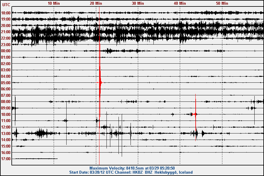
Earthquake west of Hekla volcano, in the SISZ. This picture is released under Creative Common Licencee. See the licence page for more detail.

Katla volcano

During this winter. Katla volcano has been quiet. This is somewhat normal, as more snow means more ice-mass on top of the volcano. But now that has started to melt a little and that means less ice-mass on top of the volcano. That could mean more activity in Katla volcnao during the next few weeks. So far however the activity remains small and there are no special earthquakes to report.


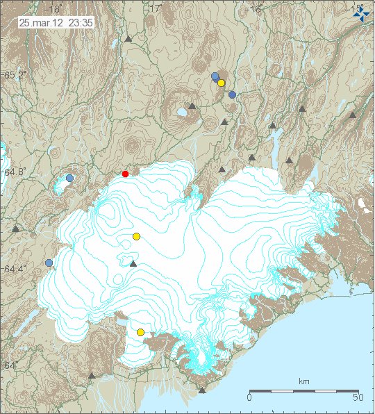
Earthquake activity in Katla volcano, on this picture earthquake activity west of Hekla volcano can also been seen here. Copyright of this image belongs to Iceland Met Office.

The earthquakes west of Hekla volcano belong to the SISZ fault area. Not Hekla volcano it self. What is also interesting is the earthquake activity in south part of Katla volcano. In area outside of the glacier. This are small earthquakes, that do not appear on my geophone. Even if they are close to it. I am unsure what this means for the future. But it is worth keeping an eye on it.

Grímsfjall volcano continues to prepare for a new eruption

As I did mention in a blog post from 16. January 2012. Grímsfjall volcano is preparing for a new eruption. That progress has not slowed down at all. I am rather sure that the eruption prepare progress in Grímsfjall volcano has sped up. But this is nothing confirmed at the moment. I am just noticing slow increase in earthquakes from Grímsfjall volcano.


Today’s activity in Grímsfjall volcano. Copyright of this picture belongs to Iceland Met Office.


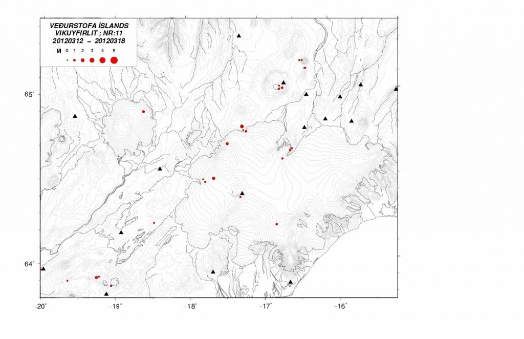
Grímsfjall volcano activity in Week 11 2012. Copyright of this picture belongs to Iceland Met Office.


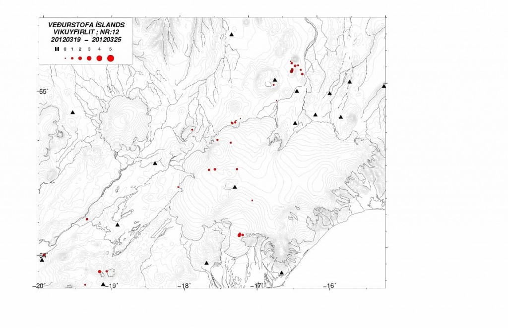
Grímsfjall volcano activity in Week 12 2012. Copyright of this picture belongs to Iceland Met Office.

It is impossible to know for sure when next eruption starts in Grímsfjall volcano. But at the current time, the clock is ticking down faster then it did before in my opinion. As is known from history. Grímsfjall volcano has erupted sometimes the year after. Even after a big eruption. As was the case last year (2011), when it had the largest eruption in 140 years.

Pictures of a old volcano rift zone

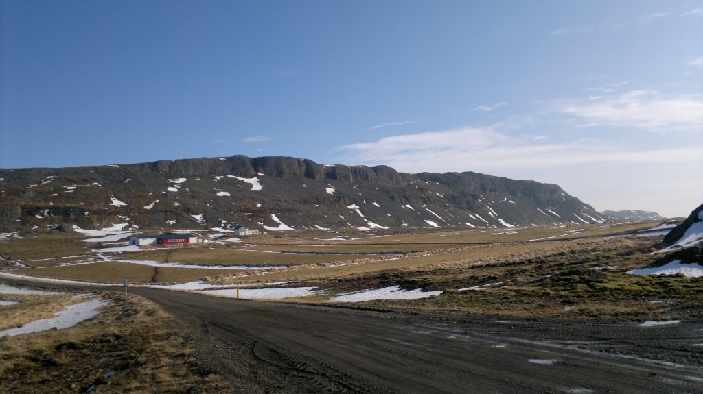
Here is a picture of what remains of Snæfellsnes – Húnaþing Rift zone. But this rift zone was activity about 4 million years ago. I do not know why this part of the rift zone is visible. But it seems to have escaped glacier erosion during past 4 million years since it became extinct.


The visible part of the Snæfellsnes – Húnaþing rift zone that was active about 4 million years ago. The farm in this picture is called Bjarghús. This picture is released under Creative Common Licence. Jón Frímann Jónsson took this picture on 24.03.2012.


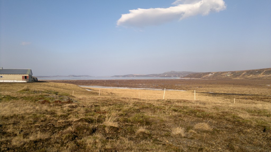
This is where the visible rift zone disappear back into the ground. Its visibility resumes at distance. This picture is released under Creative Common Licence. Jón Frímann Jónsson took this picture on 24.03.2012.


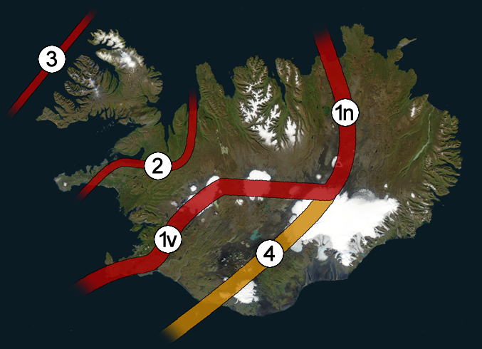
The Snæfellsnes – Húnaþing rift zone is number two on this picture. What can be seen above ground is just a small part of it. This picture has been released under public domain licence. See this web page here for more details. This picture is not 100% correct on the details on the rift zones in Iceland. But is a good start for it.

Older blog post about this area can be found here. I am not expecting any eruption in this area. But it is always a possibly of a volcanic cone popping up in area like this. As the closest volcanoes to this area are only at the distance of 80 to 90 km south of it. But that is the Langjökull volcano, in the north part of it.

List of known eruptions in Grímsfjall volcano and connected volcanoes

Here is an list of eruptions in Grímsfjall volcano and Þórðarhyrna volcano based on data from Global Volcanism Program and documented eruptions. In most cases, eruptions that took place in the early 10 to 16th century are poorly documented if they where smaller eruptions. This even goes on somewhat into the 20th century.

Year ~8230BC +-50 years. Area of activity, unknown. Size VEI=6. Known as Saksunarvatn tephra layer. Dating done with Radiocarbon (corrected).

Year ~4550BC +-500 years. Area of activity, Laki. Size VEI=0. Dating method, Tephrochronology.

Year ~3550BC +-500 years. Area of activity, S of Þórðarhyrna. Dating method, Tephrochronology.

Year ~1950BC +-100 years. Size VEI=2 Area of activity, Raudholar and Brunuholar. Dating method, Tephrochronology

Year ~50BC. Size VEI=2. Area of activity, Halsagigur. Dating method, Tephrochronology

Year ~910AD. Area of activity, ?. Dating method, Tephrochronology.

Year ~960AD. Area of activity, ?. Dating method, Ice core.

Year ~1010. Area of activity, ?. Dating method, Ice core.

Year ~1060. Area of activity, ?. Dating method, Tephrochronology.

Year ~1090. Area of activity, ?. Dating method, Ice core.

Year ~1150. Area of activity, ?. Dating method, Ice core.

Year ~1190. Area of activity, ?. Dating method, Ice core.

Year 1230 +- 10 years. Area of activity, ?. Dating method, Ice core.

Year 1270 +- 10 years. Area of activity, ?. Dating method, Ice core.

Year 1290 +-10 years. Area of activity, ?. Dating method, Ice core.

Year 1310 +-10 years. Area of activity, ?. Dating method, Ice core.

Year 1332, November. Area of activity, ?. Size VEI=2. Dating method, historical documents.

Year 1341, May. Area of activity, ?. Size VEI=2. Dating method, historical documents.

Year ~1350. Area of activity, ?. Dating method, Ice core.

Year ~1354. Area of activity, ?. Dating method, historical documents.

Year 1369. Area of activity, ?. Dating method, Ice core.

Year 1370 +-10 years. Area of activity, ?. Dating method, Ice core.

Year 1390 +-10 years Area of activity, ?. Dating method, Ice core.

Year 1430 +-10 years. Area of activity, ?. Dating method, Ice core.

Year 1450 +-10 years. Area of activity, ?. Dating method, Ice core.

Year ~1469. Area of activity, ?. Dating method, Ice core.

Year 1470 +- 10 years. Area of activity, ?. Dating method, Ice core.

Year ~1471. Area of activity, ?. Dating method, Ice core.

Year 1490 +- 10 years. Area of activity, ?. Dating method, Ice core.

Year ~1500. Area of activity, ?. Dating method, Ice core.

Year ~1509. Area of activity, ?. Dating method, Ice core.

Year 1510 +- 10 years. Area of activity, ?. Dating method, Ice core.

Year 1521 +- 10 years. Area of activity, ?. Dating method, Ice core.

Year 1530 +- 10 years. Area of activity, ?. Dating method, Ice core.

Year 1598. November 7. Area of activity, ?. Size VEI=3?. Dating method, historical documents.

Year 1603. October 31. Area of activity, possibly Grímsvötn. It is unclear. Dating method, historical documents.

Year 1610. Area of activity, ?. Dating method, Ice core.

Year 1619. July 29. Area of activity, ?. Size VEI=2. Dating method, historical documents.

Year ~1622. Area of activity, ?. Dating method, Ice core.

Year 1629. Area of activity, ?. Size VEI=2. Dating method, historical documents.

Year 1632. Area of activity, ?. Dating method, Ice core.

Year 1638 February 24 +- 4 days. Area of activity, ?. Size VEI=2. Dating method, historical documents.

Year 1659 November. Area of activity, ?. Size VEI=?. Dating method, historical documents.

Year 1681 April 10. This might not be an eruption in Grímsfjall volcano.

Year 1684 November 5 +- 4 days. Area of activity, ?. Size VEI=2. Dating method, historical documents.

Year 1697. Area of activity, ?. Size VEI=?. Dating method, historical documents.

Year 1706 October 15 +- 45 days. Area of activity, ?. Size VEI=2. Dating method, historical documents.

Year 1716 October 6. Area of activity, ?. Size VEI=2. Dating method, historical documents.

Year 1725 February. Area of activity, ?. Size VEI=2. Dating method, historical documents.

Year 1730. Area of activity, ?. Size VEI=?. Dating method, historical documents.

Year 1753 October 15 +-45 days. Area of activity, ?. Size VEI=2?. Dating method, historical documents.

Year 1768. This eruption might not have taken place in Grímsfjall volcano.

Year 1774. Area of activity, ?. Size VEI=?. Dating method, historical documents.

Year 1783 to 1785 May. Stop date May 25 1785. Area of activity, Laki, Lakagígar. Size VEI=4+. Dating method, historical documents.

Year 1794. Eruption might not have been in Grímsfjall volcano. Somewhere in West Vatnajökull.

Year 1816 May. Area of activity, ?. Size VEI=?. Dating method, historical documents.

Year 1823 February 4 +-4 days. Area of activity, Grímsvötn-Þórðarhyrna. Size VEI=2. Dating method, historical documents.

Year 1838 June. Area of activity, ?. Size VEI=2. Dating method, historical documents.

Year 1854. Area of activity, ?. Size VEI=2. Dating method, historical documents.

Year 1861. This eruption is uncertain.

Year 1867 August 29. Area of activity, ?. Size VEI=1. Dating method, historical documents.

Year 1873 January 8, it ended in August. Area of activity, ?. Size VEI=4. Dating method, historical documents.

Year 1883 January 15, it ended in April 15 +-5 days. Area of activity, ?. Size VEI=2. Dating method, historical documents.

Year 1887 August 15, it ended in the year 1889. Area of activity, Þórðarhyrna. Size VEI=2. Dating method, historical documents.

Year 1891 November, it ended in March 16 1892. Area of activity, ?. Size VEI=2. Dating method, historical documents.

Year 1897. Location of this eruption in uncertain. Area of activity, ?. Size VEI=2. Dating method, ?.

Year 1902 December, this eruption ended in the year 1904 on 12 January. Area of activity, Grímsfjall and Þórðarhyrna. Size VEI=4. Dating method, historical documents.

Year 1910. Area of activity, ?. Size VEI=?. Dating method, ?.

Year 1919. This eruption is uncertain.

Year 1922 September 29 +-1 day. This eruption ended on October 23. Area of activity, ?. Size VEI=2. Dating method, historical documents.

Year 1933 November 29 +-1 day. This eruption ended on December 9 +-1 day. Area of activity, North of Grímsvötn Caldera. Size VEI=1. Dating method, historical documents.

Year 1934 March 30, this eruption ended on April 7 in the year 1934. Area of activity, Close to south caldera wall. Size VEI=2. Dating method, historical documents.

Year 1934. This eruption is uncertain. But it took somewhere in Vatnajökull glacier.

Years 1938 May. Area of activity, 8 km south of Svartibunki. Size VEI=1. Dating method, historical documents.

Uncertain eruptions the years 1939 June, 1941 April, 1945 September 25, possible VEI=1 eruption, 1948 February.

Year 1954 January 15 +-45 days. Area of activity, ?. Size VEI=1. Dating method, historical documents.

Year 1954 July, this eruption is uncertain. Area of activity, north and south part of the caldera. Size VEI=1?. Dating method, historical documents.

Year 1972 March. This eruption is uncertain.

Year 1983 May 28. This eruption ended on June 2. Area of activity, close to the south part of the caldera wall. Size VEI=2. Dating method, historical documents.

Year 1984 August 20 (or around that date). This eruption is uncertain.

Year 1996, September 30. This eruption ended on November 6. Area of activity, Gjálp fissure. Size VEI=3?. Dating method, historical documents.

Year 1998, December 18. This eruption ended on 28 December. Area of activity, South Caldera wall. Size VEI=3. Dating method, historical documents.

Year 2004 November 1. This eruption ended on November 4. Area of activity, South West and east sides of the caldera. Size VEI=3. Dating method, historical documents.

Year 2011, May 21. This eruption ended on May 30. Area of activity, South West part of the caldrea. Size VEI=3. Dating method, historical documents.

This is just short overview of the eruptions that have taken place in Grímsfjall volcano and in Þórðarhyrna volcano. It does not contain a lot of details on them. Please not that this blog post might contains errors. If you see them. Please comment on them and I am going to fix them soon as I can.

This blog post is going to be updated with time.
Historical eruption of Grímsfjall volcano of the year 1783 to 1785

The year 1783 is something that is going to live in historical memory of the Icelandic people for long time to come. The historical memory of Icelanders still remember the eruption of Laki that took place 229 years ago. This eruption is among Iceland biggest eruption in historical times and since Iceland got populated around the year 600 (or around that time, according to new data). It is unclear when the exact eruption started in Grímsfjall volcano and in Þórðarhyrna volcano (a smaller volcano south-west of Grímsfjall volcano, it is inside Grímsfjall volcano fissure swarm). But what is known is that this eruption started sometimes in May.

The eruption started in Grímsfjall volcano it self, it is unclear where exactly it started. Creating a glacier flood that did go down Þjórsá that same month in some part. But was documented that Þjórsá was darker and had worse smell then normally and had more water in it. It was also documented that Skaftá did have more water in it and was darker and had bad smell early spring in Iceland (that means late April or early May). But the glacier flood that must have taken place after an eruption started are not well documented in history best to my knowledge. From what I can read it seems that the eruption of Grímsfjall volcano started in the main volcano (unknown where exactly). The years 1755 and to the year 1785 seems to have been extremely active in terms of volcano activity in Iceland. But that year there was also an eruption on the Reykjanes Ridge that created a short lived Island. It did however only last few months at the best. It is possible that the eruption on the Reykjanes Ridge was in the area of Eldey or close to it. But it is impossible to confirm it for sure.

It is not known when the actual eruption started in Grímsfjall volcano or in Þórðarhyrna volcano. But it has been assumed from what I can gather that Þrórðarhyrna volcano was also erupting during this eruption. But the reason for that might well be due to dike intrusions from Grímsfjall volcano might have started an eruption in Þórðarhyrna volcano. But best to my knowledge, there have not been many eruptions in Þórðarhyrna volcano since the eruption in the year 1783 (or around that time).

According to documented history, the fissure eruption started around 8. June 1783. This fissure eruption had growing earthquake swarms before it took place. This was due (but they did not know this at the time for obvious reasons). When the eruption started, it started with a large ash cloud that did go down Skaftárhrepp and nearby area. Following this ash cloud was a lot of gas pushing up with the erupted material. But blue haze was reported in historical documents about this eruption. The problem with the carbon-monoxide did not get any better . Given the year this did happen, there are holes in the event as they did happen. But by 12th of June 1783 the lava had already filled several canons at least and had already destroyed a lot of farmland and farms. But it is documented that lava bombs where known to have been found up to 112 km distance from the eruption. The total fissure length is around 25 km long. It is among Iceland longest eruption fissure in historical times. But Askja volcano had an fissure eruption that was around 20 km long in its eruption episode around the year 1875 to the year 1961, when it took a break that is continuing to this day.

Based on historical documents. It seems that this eruption had two phases. The the first one started with an eruption in the south part of what is now the eruption fissure of Laki. The second one was when eruption craters did open up north part of the fissure after several months of eruption on the south part of the eruption fissure. But by that time the eruption had already diminished in strength at the same time, or before that. It is hard to know from historical documentation what actually did happen at this time. But the eruption is believed to have stopped on 26 May 1785.

Many of the eruption craters did make ash, not lava. The ash layers from those craters where up to 2 meters thick at the distance of 500 meters in some areas. It is also believed that the eruption strokes from many of the craters where up to 800 to 1400 meters high when they where at the tallest. During this eruption there was a sour rain, along with other deadly effects that did follow this eruption. It did also happen during this eruption that many animals did die due to ash poisoning, and gas poisoning from the eruption. Just as humans did at this time. But at this time Iceland did not have any functional government that was able to handle this type of natural disaster. The amount of volcanic gases also had effects around northern hemisphere. But this effects did create huge problems in Europe, Canada, U.S and in Russia from best of my knowledge (it might however not be correct).

Many people might believe that after such a big eruption Grímsfjall volcano would stop for a long time. This was not the case. Only 22 years after the major eruption of the year 1783 to 1785 Grímsfjall volcano had an new eruption. This was smaller, only having the VEI scale of 2. But Laki eruption has the VEI scale of 4+. Before the Laki eruption, there had been an other eruption in the year 1774, but it was an minor VEI=2 eruption. Last eruption in Þórðarhyrna and Grímsfjall volcanoes was in the year 1902. That was an VEI=4 eruption that lasted from December 1902 and until January 1904.

For this reasons I classify Grímsfjall volcano (including also Þórðarhyrna volcano) one of the dangerous volcanoes in Iceland. I do think it might be even be more dangerous the Katla volcano all considered. But this is just my personal opinion and nothing else.

Based on following references

Skaftáreldar 1783 (Icelandic)
Grímsvötn (Icelandic)
The eruption that changed Iceland forever (BBC News)

Blog post updated at 01:49 UTC on 22.03.2012.

Going back to being Iceland volcano and earthquake blog from midnight (21.03.2012)

One of the lessons in life is that something you do does not always work, this is what I learn from when it comes down it. Sometimes it does not work first time around, sometimes it does work second time around. Sometimes it just does not work at all. My change in focus on this blog falls into the last group. It does not seems to work in my opinion of my readers. While only few have expressed this opinion to me. I take it seriously. Based on the opinions that I have heard so far. I have come to the following conclusions and made this decision following it.

From midnight UTC time. This blog is going to be renamed back into being Iceland volcano and earthquake blog. This means my focus is only going to be Iceland and nothing else (well, maybe I make an exception or two if it something really interesting) . As has been told here in comments there are other bloggers how cover other parts of the world and do an good job of it.

So from midnight. This blog and the forum is going back to the name “Iceland volcano and earthquake blog”. This also covers the forum. But the change is going to be more dramatic there. As I am going to arrange it in accordance with this change. No posts are going to be deleted, but are going to move around a bit. No blog posts are going to be deleted from this blog do to this name change. It is part of history in my view.

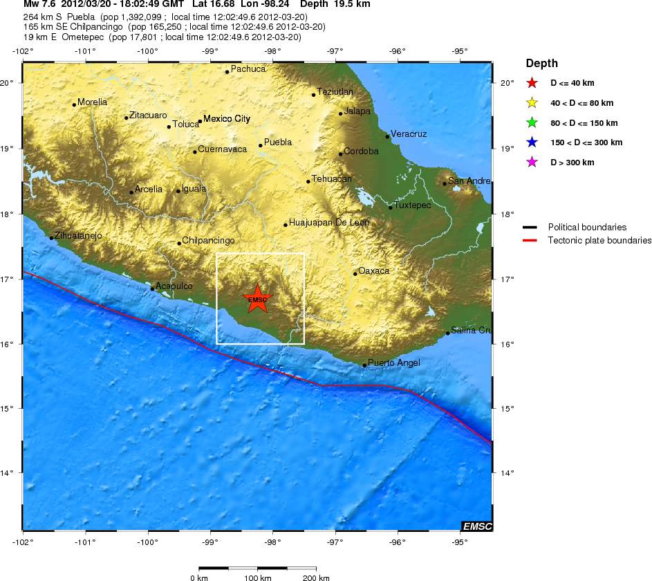
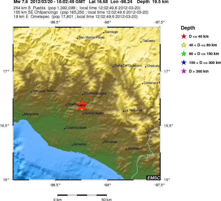
Strong earthquake in Mexico, early size is estimated at Mw7.6 (EMSC)

At 18:02 UTC there was an earthquake with the size of Mw7.6, it had the depth of 20 km according to EMSC. This size estimate is based on early data and is a subject to a change.


Regional view of the earthquake according to EMSC. This might change as the earthquake data is reviewed by EMSC and USGS. Copyright of this picture belongs to EMSC.


Local view of this earthquake according to EMSC. This might change as EMSC reviewed by EMSC and USGS. Copyright of this picture belongs to EMSC.

This earthquake was detected by my geophones. Currently I am unable to publish those traces as my earthquake computer is still offline as I have not yet moved to Denmark. This earthquake also appears clearly on IMO SIL network.

I am going to update this blog post as the information changes.

Quiet period ongoing in geology, except in current erupting volcanoes

Everything seems to be quiet in Iceland and around the world. Nothing major is taking place in regards to earthquakes or volcano activity. So I do not have a lot to report on at current time. If this quiet period continues I am going to write about something in Iceland geological history that I know of. Nothing long, just short and as detailed as I can make it.

Last week volcano activity

Smithsonian/USGS Weekly Volcanic Activity Report

New Activity/Unrest: | Bezymianny, Central Kamchatka (Russia) | Cleveland, Chuginadak Island | Ijen, Eastern Java (Indonesia) | Iliamna, Southwestern Alaska | Lamongan, Eastern Java (Indonesia) | Marapi, Sumatra (Indonesia) | Nevado del Ruiz, Colombia | Tungurahua, Ecuador

Ongoing Activity: | Karymsky, Eastern Kamchatka (Russia) | Kilauea, Hawaii (USA) | Kizimen, Eastern Kamchatka (Russia) | Puyehue-Cordón Caulle, Central Chile | Sakura-jima, Kyushu | Santa María, Guatemala | Shiveluch, Central Kamchatka (Russia) | Villarrica, Central Chile

Rest of this report can be found here, http://www.volcano.si.edu/reports/usgs/

I hope to have more to write on soon. But it is hard to know for how long this quiet time is going to continue.

Continued earthquake activity in El Hierro volcano

While the eruption in El Hierro volcano ended some time ago, there has been an constant earthquake activity ongoing in El Hierro volcano. While this earthquake activity has not been in high volume at the moment. It has been deep. Suggesting that this earthquake activity has its source in inflow of new magma at depth. But it is the depth of those earthquakes it is the clue that magma is flowing again into El Hierro volcano.

This however does not mean that an new eruption is going to happen soon. So far the magma seems to be at the depth of 20 to 10 km and at the moment it is not moving at all. It is impossible to know when or if this magma is going to move at all.

Hydro-thermal zone off the coast of El Hierro Island

In the area where the eruption took place from October 2011 to February 2012. This area now has highly active hydro-thermal area. It is hard to know for sure how long it is going to be active. That depends on many factors. But activity should be noticed for at least next one to two years, possible even longer. But this hydro-thermal area off the coast of El Hierro Island is going to continue to create discoloration of the ocean for some time now. So when discoloration happens, it is not because the eruption has started again. It is because the hydro-thermal area activity is changing or some chemicals are getting mixed into the ocean creating discoloration of it.

Strong earthquake in Japan, small earthquake swarm on Reykjanes Ridge in Iceland and more

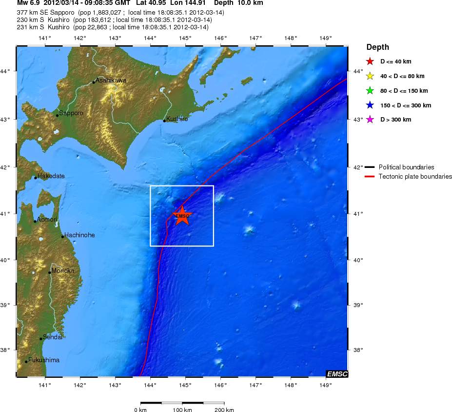
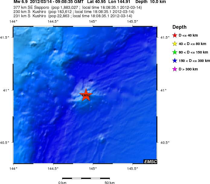
Yesterday (14.03.2012) at 09:08 UTC there was an strong earthquake in Japan. The size of this earthquake was Mw6.9 and it had the depth of 10 km. Local tsunami warning was given out for the area closest to the epicenter of the earthquake. Aftershock activity has been ongoing after the main earthquake. The largest aftershock so far had the size Mw6.0. More details on the earthquake in Japan can be found here at EMSC web page.


Regional view of the earthquake in Japan yesterday morning. Copyright of this image belongs to EMSC.


Local view of this earthquake. It appears to have been in an subduction mountain, or close to it. Copyright of this image belongs to EMSC.

Iceland

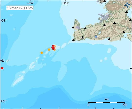
Currently there is an earthquake swarm ongoing on the Reykjanes Ridge off the coast of Iceland. So far the strongest earthquake has reached the size of ML2.7. The depth is about 7 – 16 km. There is an slight chance that his might be an dike intrusion taking place on the Reykjanes Ridge. But this also might just be normal fault movement in the area. For the moment. There is no way to know for sure exactly why this earthquake swarm is taking place.


Reykjanes Ridge earthquake swarm as it is at 00:35 UTC. Copyright of this image belongs to Iceland Met Office.

South Norway

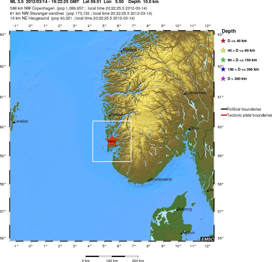
An minor earthquake took place in south Norway at 19:22 UTC. The size of this earthquake was ML3.5 according to EMSC. With the depth of 10 km. This earthquake was clearly felt in Norway according to EMSC and news reports of this earthquake. More details on this earthquake can be found here, on EMSC web page.

The regional view of the earthquake in south Norway. Copyright of this image belongs to EMSC.


Local view of the earthquake. It can clearly be seen here how close it was to several towns in south Norway. Copyright of this image belongs to EMSC.

This earthquake was clearly felt in Norway due the old crust that it took place it. But older crust conducts earthquakes better then new crust. Like the one that can be found in Iceland. That is due to lack of faults in it and the fact it is more dense with sediments then new crust. Earthquake in this area should be expected every 5 to 20 years or so. As there are old fault lines in this area, they sometimes break and create a earthquake.

Norwegian news about this earthquake.

Kanskje noen glass har falt ned fra bordet
Jordskjelv i Rogaland i kveld

New Britain region

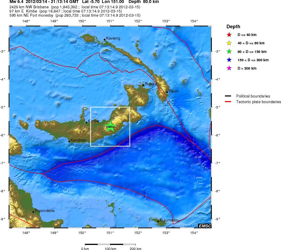
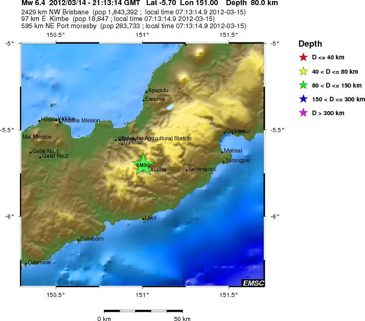
Today at 21:13 UTC there was an Mw6.4 earthquake in New Britain region. The depth of this earthquake was 80 km according to EMSC. I do not know if this earthquake was felt or not. It at least has not been reported yet.


Regional view of the earthquake from EMSC. Copyright of this image belongs to EMSC.


Local view of the earthquake from ESMC. Copyright of this image belongs to EMSC.

More information about this earthquake can be found here, on EMSC web page.

Other

I am sorry for late post. I was flying back to Iceland today. It took awhile. I also had to do other things this evening before I could write about the most recent activity yesterday. This is going also going to happen later when I move back to Denmark. But I am going to post more details on that later.

Blog post updated at 12:11 UTC on 15.03.2012. Location of the earthquake in Norway was fixed.