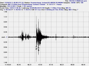
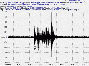
Here are two earthquakes that I did record yesterday. The earthquakes took place at Arnarvatns highland and in Krísuvík yesterday. The difference between the earthquakes is that one of them took place where the crust is old and carries the earthquake wave well. The second earthquake(s) took place where the crust is young, fractured and does not carry the earthquake wave that well most of the time. If a fracture area is not in-between the epicentre and the sensor in question.
The earthquake at Arnarvatns highland. The earthquake wave clearly shows what type of crust it has been going trough. In this case a old crust that carries the wave well in my direction. I cannot tell what way the crust fractured in this case, as I need a minimal of three geophones to do so.
The Krísuvík earthquakes. This is actually a string of many earthquakes. When this happens the SIL system that IMO has major issues with locating the earthquakes. As the S wave often get absorbed by the next P wave that follows the next earthquakes. Sometimes however the waves get separated at some distance. That often helps to figure out how many earthquakes happened at the same minute. What is also interesting about this earthquake is the fact that it is “noisy”. But a normal earthquakes has a clear P wave and clear S wave. But on Reykjanes and Reykjanes Ridge there are often noisy earthquakes. I do not know why that happens and I don’t think the reasons for noisy earthquakes are not at all understood (far as I know anyway).
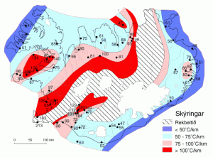
This map here shows how warm the hot water is in Iceland. Where I live the hot water is about 66C warm. It is a deep magma that warms the ground water up to this levels. There is a good article on this process at Wikipedia here.
Text updated at 17:15 UTC on the 11th of December 2010. Spelling error fixed and minor text changes.


