Dike intrusion starting in Torfajökull volcano ?

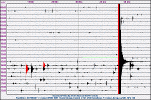
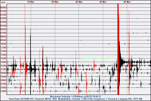
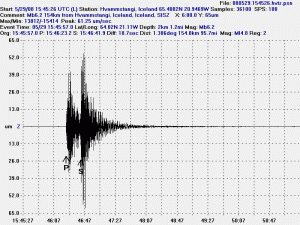
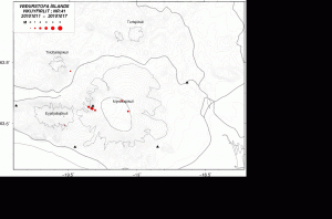
There was a small earthquake at 23:50 UTC in the Torfafjökull volcano. The earthquake it self was only ML1.7 in size, but the depth was 15 km. But that depth indicates that the earthquake was started by magma rather then tectonic process in the area. This would mean that a dike intrusion was starting in Torfajökull volcano at present time.

I did record this earthquake on my geophone, but this earthquake had a magma looking signature in it. But it was not clear and hard to see due to a minor weather effect in the area. Torfajökull volcano is not monitored with GPS instruments at the moment.

This is unlikely to be a pre-event to a eruption in the area. But dike intrusions appears to be a common events in Torfajökull volcano.

Earthquakes swarm in a slow start on Reykjanes Ridge

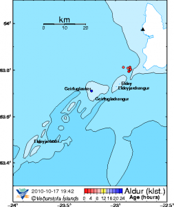
A earthquake swarm on Reykjanes Ridge is currently under way. At this time is it quite impossible to know how big and how long this earthquake swarm is going to be or if happens at all. But the biggest chance is that this earthquake swarm is going to be a small one, and is only going to last for a few more hours. But this earthquake swam started today with a small earthquake at 13:09 UTC close to Geirfuglasker. Over the past few hours the earthquakes have been getting more dense and growing slighty in size at the same time. A common feature for a earthquake swarm in Iceland.


The location of the earthquake swarm as it is now (19:49 UTC 17th of October 2010). Image is from Icelandic Met Office web page.

The best way to monitor this earthquake swarm is on IMO web page. They can also be seen on my helicorders. But they show clearly up on the Hekla helicorders.

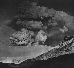
Two pictures of the 1918 eruption at Katla volcano

Here is a pictures of the 1918 eruption at Katla volcano.

This is not the most famous pictures of the 1918 eruption in Katla. But they do tell a lot of story what we can expect next time Katla erupts.

Here is what we can expect in terms of ice that is going to come down with the flood from next Katla eruption.

There are two people on top of the glacier ice-bergs. Gives a idea of the scales in question.

Pictures are from various sources on the internet.

More videos of Eyjafjallajökull eruption

While the quiet times are happening in Iceland with nothing special going on. It is good to view the videos of the Eyjafjallajökull eruption earlier this year.


The glacier flood at the start of the second phase of the eruption in Eyjafjallajökull.


Video of the early start of eruption in Eyjafjallajökull 2010.


The flooded area following the eruption in Eyjafjallajökull.

GPS changes in Grímsfjall due to ice on GPS antenna

I did just speak with geologist at Icelandic Met Office and the he told that the recent changes in GPS measurements in Grímsfjöll where not real. But they where created by ice. But now the ice has been cleared of the GPS antenna and the data is now correct.

But the real movement is to the south and Grímsfjall has continued to do that. So Grímsfjall is continues to inflate at relative fast rate and prepares for a eruption as magma flows into the Grímsfjall magma chamber.

Grímsfjall continues to inflate

I see that many people think that Grímsfjall has started to deflate due to a drop in GPS measurements. But the “Up” part of the GPS measurements have been dropping over the past few days from about 85mm and down to about 65mm today.

As that may be true that the mountain has started to deflate from the top. It is not to say that deflation process has started at Grímsfjall. As the GPS data clearly shows that a inflation process has just moved from the top and to the south. But current GPS measurement clearly show that Grímsfjall is now inflating to the south (15mm today) with minor inflation to the east (about 15mm today). So it is clear that the magma is moving inside the volcano from one location to a other over the past few days. What that means is unclear at the moment. But it appears that the inflation to the south is speeding up at current time. This might get interesting soon in my opinion. Regardless if there is a eruption or not.

Data: ISGPS GFUM
Vatnajökull continued GPS data project from 2004.

The harmonic tremors of a volcanic eruption

Many people want to know how to identify a volcanic tremor when they appear. Here are few examples of volcanic tremors that I have seen over the past few years.


The volcanic tremor following the eruption in Grímsfjall in 2004.


Harmonic tremor spike in 2005, following a glacier flood in Skaptárkötlum in Vatnajökull glacier (they are in Hamarinn volcano).

I hope that this two examples show people what to look for when something is going on in Icelandic volcanoes. All images are from Icelandic Met Office web page.

Sudden rise in harmonic tremors around Katla and Eyjafjallajökull

There is a sudden and sharp rise in harmonic tremors around Katla and Eyjafjallajökull volcano. I currently do not know what volcano is responsible for the spike in harmonic tremor. But this does not look like is a noise from the weather. But that can happen often this time of the year, as the wind forecast is good for all of Iceland at current time.

I will post more information if and when I get them.

SIL stations where the harmonic tremor rise can be seen.

Mið-Mörk
Eystri-Skógar
Lágur Hvolar (Currently most rise here for some reason)
Snæbýli
Saurbær
Ásmúli

Icelandic Met Office tremor web page.

Grímsfjall continues to inflate

According to GPS data from GPS station located on top of Grímsfjall the volcano continues to inflate. Now it is about 80mm and does not seems to go much higher then that for some reason. Since Grímsfjall has stopped to inflate up at the moment it is currently inflating in other directions. The automatic GPS data clearly shows that the inflation is now moving south but is interestingly is holding it east-west movement. I am not clear on why that is the case at the moment.

Data: GFUM ISGPS