The quiet time in Iceland continues with few to no earthquakes. Besides the strong Mw6.2 earthquake in Jan Mayen Island (Belongs to Norway, regional to Iceland geological area in my personal view) there is nothing happening.
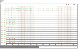
On the night of 25th of January there where ice-quakes in Vatnajökull glacier. This appears to have happened due to heavy rain in that area from the 21st of January. But that can make the glacier move suddenly and that makes the ice-quakes. Icelandic Met Office has some pictures of this activity.

Picture is from Icelandic Met Office web site. Copyright belongs to them.
Ice-quakes in this plot appear as spikes. As can be seen a lot of ice-quakes took place in Vatnajökull glacier during the heavy rain.

Picture is from Icelandic Met Office web site. Copyright belongs to them.
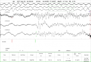
A high detail of the ice-quakes. As can be seen, the ice-quakes look different then normal earthquakes. This is because ice is not as dense then rock and is under less pressure, and therefor breaks in a different way.

A lack of experience, but I see strange behavior VAT tremor, the peaks begin with the strange behavior of strain Hekla
http://hraun.vedur.is/ja/oroi/vat.gif
translated by Google
No worries, the VAT tremor is caused by some poor ole bloke buying a big screen TV in the EU.
Someone go up to Hekla and flick it a little bit with your finger. Or just put your ear to the ground over the caldera and tell me if you hear any groaning like an alcoholic moaning for beer.
My Mom is getting ready to book her flight to Hamsburg.
In the next 24 hours there is going to be a storm in Iceland. With winds going up to 23m/s. So there is going to be a lot of wind noise on the SIL network and on my geophone network (the stations that are active).
Two transients again, following eachother
If you are referring to the earthquakes at Torfajökull (Álftavatn). Then I think it is a ghost in the system. But there is a chance that this is a double earthquake. But it hard to know from the raw data.
I’m referring to these anomalities in strain near Hekla.
http://hraun.vedur.is/ja/hekla2009/borholu_thensla.html
There is a storm coming, and it might affect the strain (low pressure).
http://en.vedur.is/weather/forecasts/text/
No, this phenomenon has been going for a few days, and I have closely checked it against the online windmeters for the area. It is entirely unrelated to wind.
This is something going on under Hekla.
When I am writing this there has just been another transient of the long type in 1m/s…
And no, I have checked against barometric pressure, happens without correlating changes in pressure.
And ontop of that, they are also autocorrected against barometric variation.
We can rule out weather.
Ahhh! low pressure…. i hadn’t thought of that.
Best!motsfo
Talking about patterns…
🙂
I was wondering if anyone else was still awake and watching Vatnajökull tonight
😮
Fimmtudagur
03.02.2011 01:11:29 64,741 -17,245 5,0 km 1,6 64,86 4,8 km SSV af Kistufelli
Fimmtudagur
03.02.2011 00:59:28 64,732 -17,283 5,5 km 2,6 68,2 6,5 km SSV af Kistufelli
Fimmtudagur
03.02.2011 00:56:53 64,764 -17,266 1,1 km 3,3 90,05 3,3 km SV af Kistufelli
Fimmtudagur
03.02.2011 00:13:50 64,746 -17,262 4,9 km 2,4 64,85 4,6 km SSV af Kistufelli
Fimmtudagur
03.02.2011 00:10:29 64,735 -17,244 4,4 km 2,2 90,01 5,4 km SSV af Kistufelli
Jökulsá á Fjöllum Grímsstaðir 1062.4 m³/s 4.3 °C
The water temperature has gone up several degrees. Is this significant? It is north of the Vatnajokull glacier. Just reading the comments and watching with great interest.
Oh this is faulty measurement by the meters due to ice, that’s why the spot on the graph is gray.
Whats happening at Kistufelli? Looks like more than storms, I would guess that’s what an earthqauke swarm looks like.
That is a short quake-swarm yes.
it’s definatly looking very noisy there tonight Doug
Yes, Doug, this is a swarm that appears to have started in Bardarbunga and now moved to Kistufell. I’ve seen them before, so, let us wait and see…
it’s been snowing for 3 days…. i’ll be happy to watch something else.
Best!motsfo
Time vs Depth vs Magnitude
http://i53.tinypic.com/2hrzx44.png
Interesting, both strongest quakes fairly shallow.
OT look at this…
http://volcanoes.usgs.gov/hvo/cams/POcam/
Po’ O’ vent is going great!
Best!motsfo
Thanks for the plot LurkMan 🙂 Now I have to learn to read one, HA ! I’ll wait with interest to see if this develops into anything and if anyone offers any interpretations as to whether this swarm is magmatic or tectonic or a combination with some ice thrown in for flavoring.
Meanwhile, things are heating up a little bit over in Southern California with a small swarm on the San Jacinto Fault (Clark section) which is 13 miles from my cabin in Idyllwild…great 🙁 The San Andreas has been pretty busy too both south and north sections. I keep telling my friends that are local there to try to imagine life with no outside support or supplies for weeks and months of limited access to supplies, food, water, electricity, etc, etc, etc. Not quite like Haiti but similiar. The SAF could be a monster.
Major transient again!
http://hraun.vedur.is/ja/hekla2009/borholu_thensla.html
And not even bad weather . . .
If you have a picture, please post it for the rest. I have one, but cannot post from this computer… 🙁
Hekla:
I have been saying that weather is not causing it a lot lately… But now I have hard figures for the last 120 hours.
I hav logged all the transients during this time (since I noticed it). I then ruled out those that happened when windspeed was above 8m/s, and also if there had been a barometric pressure-change during the event time.
56 double transient where Burfell moved in the opposite direction from the rest. Cut off value was at 20 units nano-strain. (There was a hell of a lot more that was smaller, but I like the big jouicy ones)
14 discarded due to wind or barometric pressure.
So, it is not weather, it is Hekla. Does it mean anything? Well, only time can tell.
Hekla is probably just waiting for the 26th 🙂
I will probably hit my head and feel stupid, but…
What happens then?
The last eruption started on February 26th, 2000.
Nah, then she was just cranky for being left out on Valentine’s day.
My vote is that she will go off on Valentine’s when her date with Kistufell goes badly.
Slow longtime rise of Godabunga Tremor Levels:
http://hraun.vedur.is/ja/Katla2009/god_trem.gif
I would like to know what you think about this…. over time the spikes have become quite large, if you correlate them with the ones during the eyjafjalla eruption.
and something other i would like to get your thoughts:
http://hraun.vedur.is/ja/vatnajokulsvoktun/gps_grimsfjall.html
GPS-Data indicate a slow and steady move to the northwest with a rise in altitude, as far as i interpret the data:
– the west-east component is changing direction: from steady east to west
– the north-south component is steady and “jumpfree” to the north since quite a few days with a little errorrate
– the up component is in a new cycle of upwards movement, till now without larger up- or down jumps in the last few days
For me that means that southeast of the GPS-Station there is Inflation, so the Station itself moves northwest and upwards. I think Ice shouldn’t be the cause here because every component is behaving differently than in other situations before.
Greetings
Stefan
@Stefan
The part about that plot that I find interesting… is that the low frequency component has been rising a bit independently than the others. Then the mid range freq started tagging along.
This is sort of what I would expect if something large is on the move. You hear the low freqs, then as it gets closer, the frequency goes up since low freqs travel further than higher ones.
Caveat: I am not a professional at this. Other, more learned people may have a better explanation.
As a reward for reading my post, a picture set of a very lucky guy. (Non Geologic, Non Volcanic, Totally OT… unless you count the gently rolling hills of what used to be marine terrane about 50 to 60 million years ago. Since I went there, there is also an ancient transform fault in the area, an artifact of when the Gulf of Mexico opened up… and responsible for the cracked limestone and subsequent karst topoligy of the area)
http://i55.tinypic.com/28r30go.jpg
One thing I would like to mention… ignore it if you like (directed at anybody) is that Station GOD is over at Mýrdalsjökull and GFUM is at Vatnajökull.
and GFUM is the continous tracking-station, and GRIM is the benchmark-station situated 207 metres away… 🙂
But what probably disturbs any flavour of baptist is that GOD is a crypto-dome.
(Sorry, just couldn’t shut up after your posted picture)
I wonder if he suffered from a spontaneous sill formation….
The dude on the photos? Yeah, probably! I would have. 🙂
Nah, he had a dyke intrusion! (One of those days)
I was thinking along the lines of a dike being a minor intrusion and a sill requiring a greater mass of intrusive material to effect a wide area uplift…
Oh my, have we just invented the new discipline of “Comparative accidental volcanologized scatology”?
I think it is time for me to go home now… 🙂
See Ya’ll!
i think you need to explain to me how that happened 😀 i mean if i spinn your idea a littel bit farther, then there should be a hole in his pants ; )
Well.. remember a sill doesn’t break the surface. If it does then it’s a volcano. So.. no rupture needed. I think in this case if the strenght of the sill formation had been intense enough to rupture the surface, it would surely have been phreatomagmatic.
This obviously didn’t happen since the local populace didn’t evacuate the area around the event. Likely, the odoriferous nature of the event kept them at bay, but didn’t drive them away.
Carl: What was the Dutch word again? “arspuits”, or something?
Jep, arsgespuiten, but that still not a real dutch word 😛
Quite some earthquakes now in Iceland (even with a storm going on!)
Sander
The storm isn’t here yet, isn’t predicted until midnight
No less then two former dutch cyclists have independently confirmed it to be a technical term of highly odiferous nature. So yes, aarsgespuiten seems to be confirmed…
I believe, dear sir, the word you are looking for is “Arsgespuiten” 🙂
Sorry for being nasty, Daniel, I was just referring to Lurking’s shots, and the discussion come out of it.
The analogy works great for volcanoes, though… 🙂
No need for apologies. I find the word quite amusing also. 🙂
My god! An earthquake beneath Tindfjallajokull, I predict a massive cataclysmic eruption 21 december 2012!
Okay I don’t, but I’m really interested in what the origin of this earthquake is.
maybee the result of deep seated tectonic stresses caused by the steady magma accumulation beneath katla.
By the way, did you know that Tindfjallajokull is the source of the largest known Pleistocene eruption in Iceland? (Thörsmork ignimbrite)
It has a very low quality, 34.54 %, so it is likely not under Tindfjallajokull.
A new blog post is up! 🙂