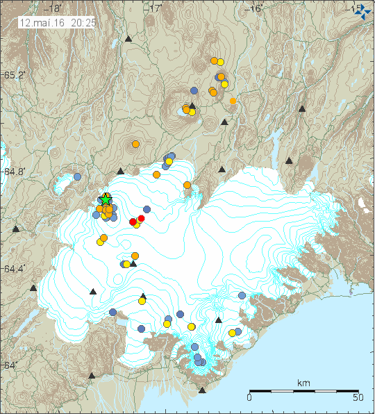
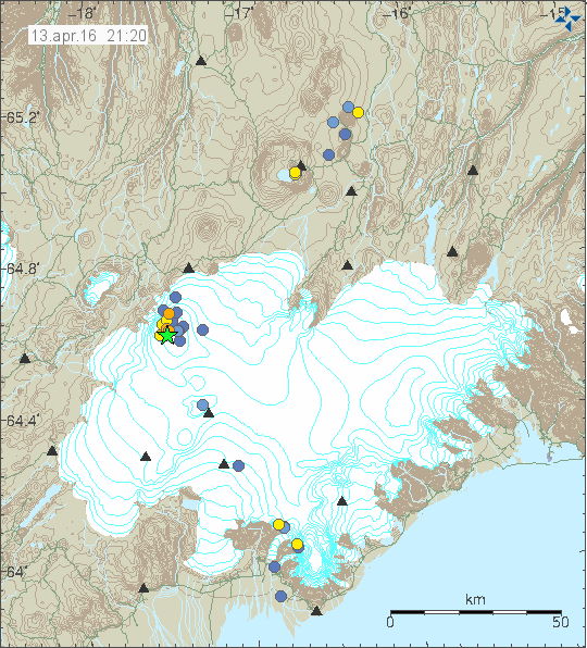
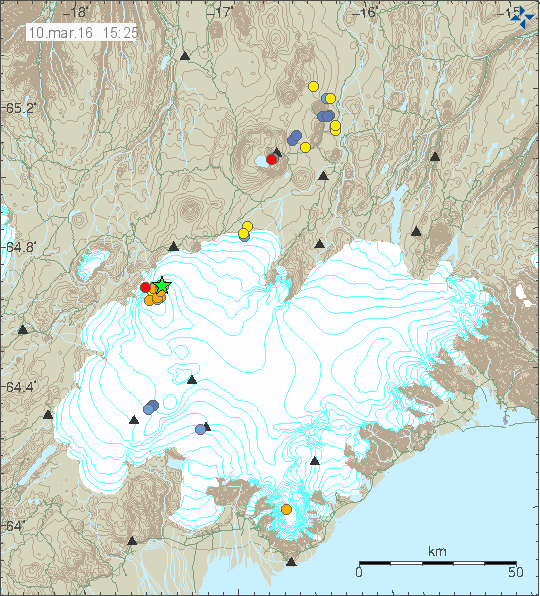
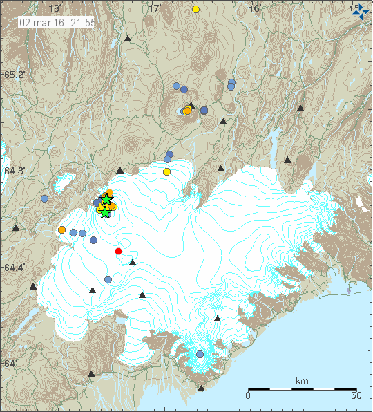
Today (20-May-2016) a magnitude 4,4 earthquake took place in Bárðarbunga volcano. This is the strongest earthquake so far since the end of the eruption in February-2015. This earthquake swarm also had two magnitude 3,3 earthquakes. Other earthquakes where smaller in magnitude.
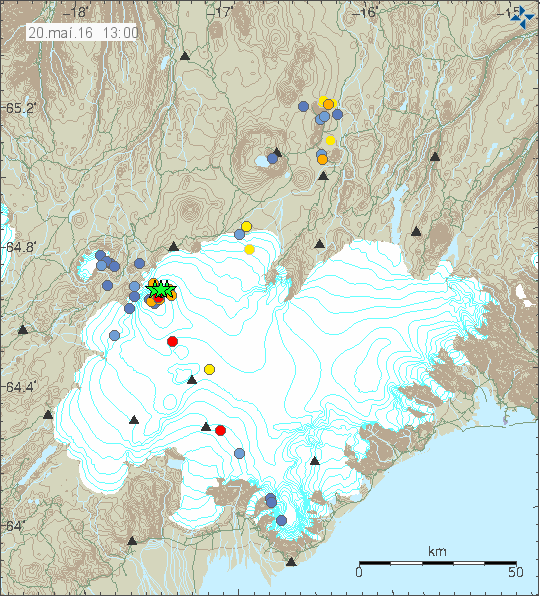
The earthquake activity in Bárðarbunga volcano. Copyright of this image belongs to Iceland Met Office.
Official statement from Iceland Met Office is that they are not sure what is going on. What is clear is that seismic energy being released from Bárðarbunga volcano has increased a lot since end of the eruption in February-2015 and current GPS data suggest rapid inflation. Both of are unusual after caldera collapse like Bárðarbunga volcano experienced in the 2014 – 2015 eruption. Due to lack of historical data it is hard to know for sure what is going on, whatever it is, it’s the first ever that is being monitored in great details.
Current events have not lead to an eruption so far. They however might do so in the future, when is difficult to know since the time frame of this development is unknown, it might be hours, it might be decades. Satellite images also show that cauldrons that have formed at the edge of the caldera are getting deeper and possibly larger, suggesting an increased hydrothermal energy at the locations where they have formed. This suggest that more magma is collecting at depth in the caldera, something as sad above is highly unusual due the recent caldera collapse in the last eruption. I’m expecting more earthquake swarms like this and growing magnitude of the earthquakes that take place. The weekly pattern is going to continue and I suspect it might increase soon, when is impossible to know for sure.
Donations
Please remember to support my work with donations (or by using Amazon). Currently my financial status is not so good (worse then what I was expecting). It will get better, just takes few months and I need to survive those months. Thanks for the help. 🙂