Earthquake activity continues in Katla volcano with activity dropping between swarms. It is unclear at the moment if this is going to result in a eruption but at the moment it is my view that chances of an eruption happening soon (maybe in matter of hours) is high. Official view (government) is more conscious about what is going on in Katla volcano and does not yet issues this type of statements.

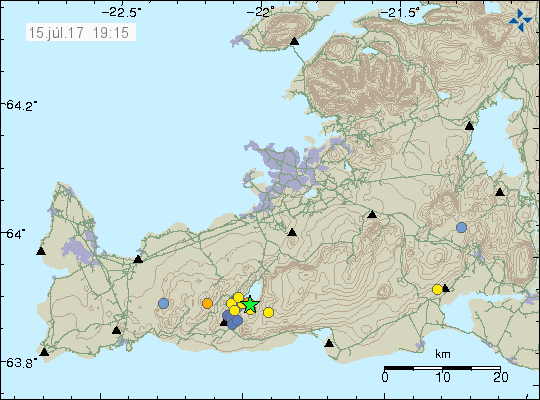
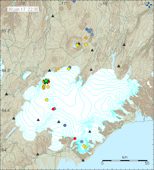
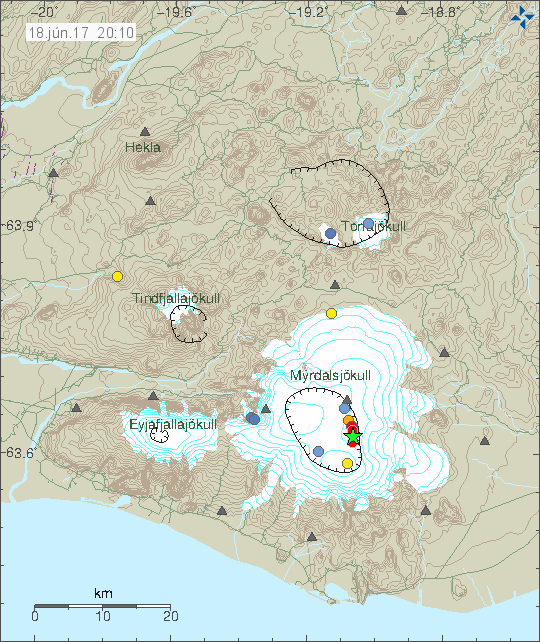
Current earthquake activity in Katla volcano. Copyright of this image belongs to Icelandic Met Office.
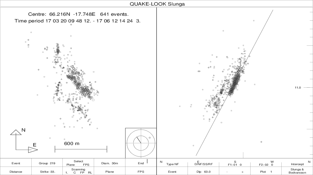
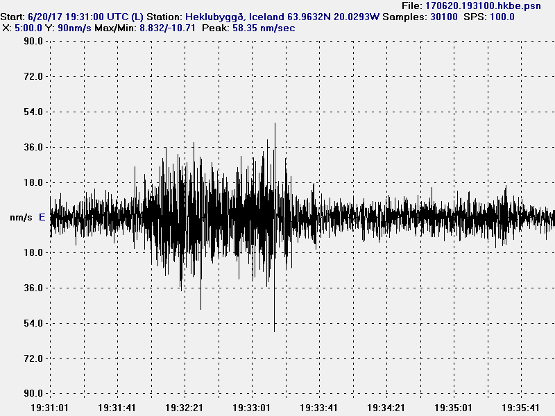
Largest earthquake today had the magnitude of 3,4 at the depth of 0,1 km. Yesterday magnitude 3,6 earthquake had a fore-shock of magnitude 1,9 at the depth of 14,4 km. This is unusual and suggests that the reason for the current earthquake activity is an injection of new magma, rather than moving of old magma in Katla volcano system. For that reason I’m expecting more earthquake activity in next few hours. This change in activity appears clearly in the earthquake activity that has been taking place, the earthquakes that have happened have variety of depth, with most depth at 15,5 km and up to 0,1 km.
There appears to be a cycle of earthquake activity with quiet period between them that last for few hours at the time. The cycles appear to be getting shorter. I don’t know why that is, but this suggest that Katla volcano is getting more unstable as this earthquake activity. I don’t know yet if it does the same thing as last year (2016) when a swarm of activity started and then dropped after few months of activity. Few SIL stations appears to be showing slightly higher tone on 2 – 4Hz band (just two at the moment). I don’t know why that is. Currently the situation is quiet, I am however expecting that to change without warning at any time. If anything more happens remains be seen, but the chances are high at the moment.
Update 1
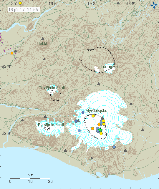
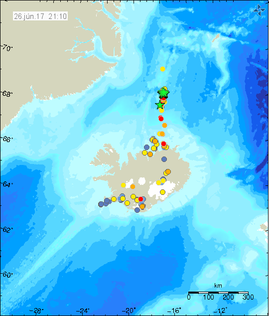
There has been a new depth record in this swarm. Earlier 15,5 km earthquake has been relocated down to 25,0 km depth. At this depth it is only magma that can make an earthquake, normal tectonic processes do not work at this depth in Iceland since Iceland is not a subduction zone with deep earthquakes. Just three new earthquakes have appeared in last few hours and current activity remains quiet.
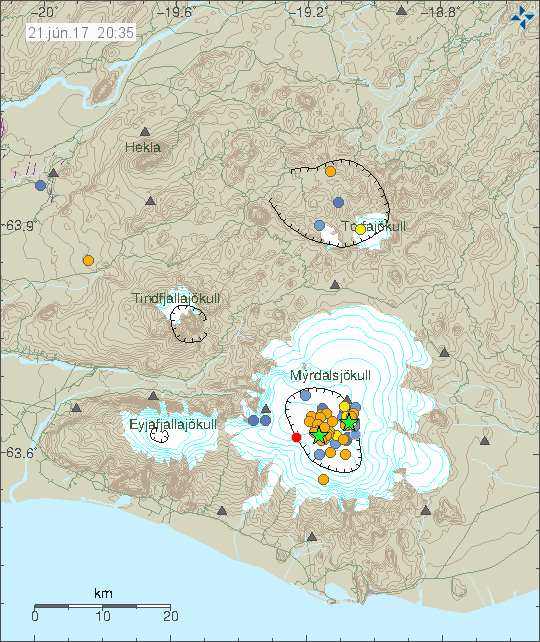
Current earthquake activity in Katla volcano. Copyright of this image belongs to Icelandic Met Office.
There is a lot to suggest that this increase in earthquake activity in Katla volcano is not over. This quiet periods where also observed during large earthquake activity in August-2016. I don’t know why this quiet period happens, they just do.
This article is going to be updated today (21-June-2017) if something more happens.
Article updated at 20:56 UTC. Added new information.