Before I start. I want to remind people that donations help me to keep this blog up and running. I only have social welfare from Iceland and that is barely enough to make end meets. Just 10€ go a long way for me. Thanks!
Hekla and Katla volcanoes
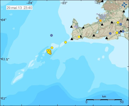
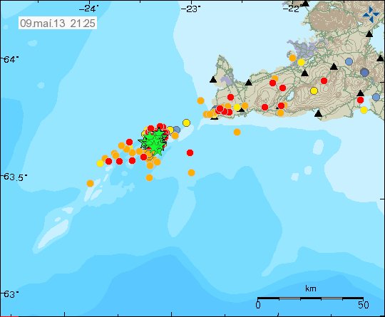
I am going to write about both this volcanoes here. Since I am going to be using the same image anyway for both volcanoes.
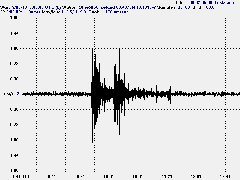
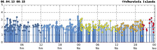
Yesterday (26.04.2013) there was a magnitude 1.1 earthquake in Hekla voclano. This earthquake was in the same area that triggered uncertainty level to be declared just before Easters in March. It was later cancelled when nothing more happened.
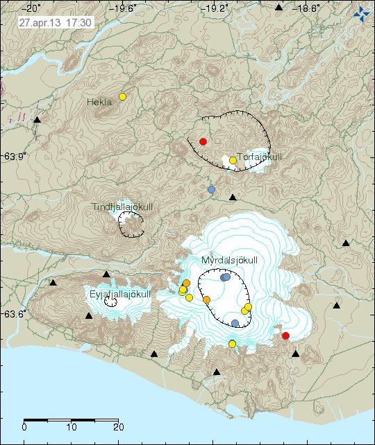
Earthquake in Hekla volcano. Also on this picture earthquake activity in Katla volcano (read more below). Copyright of this picture belongs to Icelandic Meteorological Office.
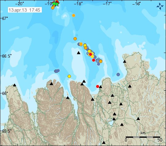
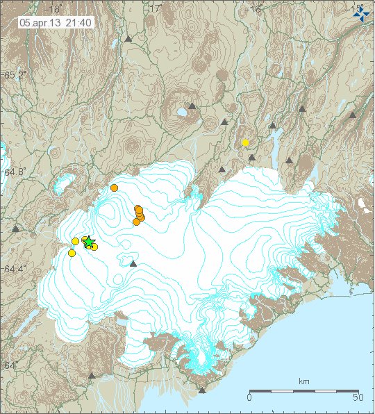
Katla volcano has been having some earthquake activity in past days. So far it has just been minor earthquakes and nothing more. But it has been taking place where a minor eruption took place in Katla volcano during the summer of 2011. That minor eruption created a minor glacier flood. But it did destroy a bridge and closed down the ring road (road 1) in this part of Iceland.
While this activity is currently nothing to worry about. It is worth keeping a eye on it. Just in case it increases, or if some other changes start to take place in Katla volcano.
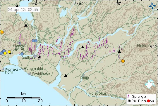
Krísuvík volcano
A minor earthquake swarm took place in Krísuvík volcano today (27.04.2013). The largest earthquake had the magnitude of 1.9. The depth of this earthquakes was around 8.6 km. Activity in this area is normal and there does not seem anything strange about it. But Krísuvík volcano has been having periods of inflation and deflation for the past three years. Earthquake activity increases when Krísuvík volcano is in period of inflation. If that is the case now I do not know.
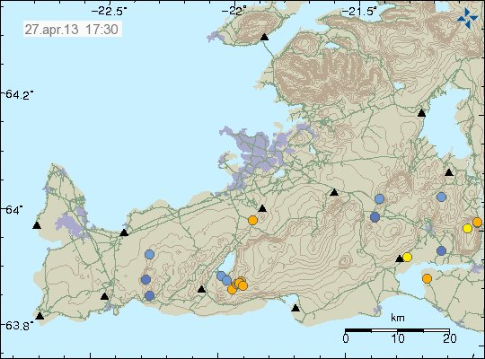
Earthquake activity in Krísuvík volcano. Copyright of this picture belongs to Icelandic Meteorological Office.
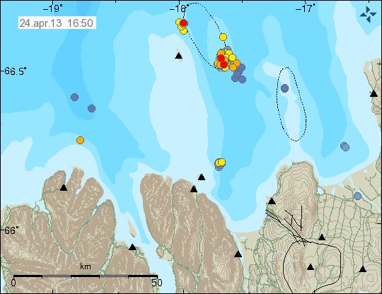
Bárðarbunga volcano
A minor earthquake swarm took place in Bárðarbunga volcano today. Largest earthquake in this swarm had the magnitude of 1.3. Depth range was from 18.8 km and up to 11.1 km. This earthquake swarm is important. Since it appears that this is a dike intrusion in Bárðarbunga volcano. But a minor dike intrusion also took place in this area few weeks ago. That also resulted in a minor earthquake swarm in this same area.
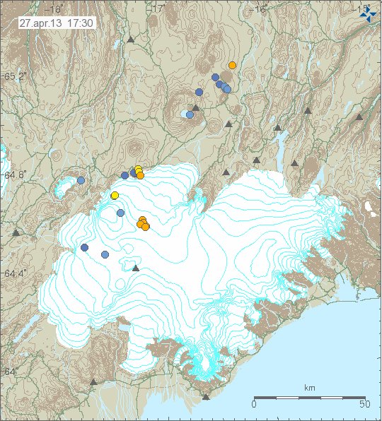
Earthquake activity in Bárðarbunga volcano. Most likely due to minor dike intrusion into the volcano. Copyright of this picture belongs to Icelandic Meteorological Office.
A minor dike intrusions into a volcano does not mean a eruption is going to take place. In many Icelandic volcanoes (and around the world also) dike intrusions into the volcanoes are common event and in most cases do not result in any eruptions. But it is worth keep a watch out for this type of eruptions. Since it might signal a more active period ahead in Bárðarbunga volcano. But it might also just equally don’t mean anything. There is no way to know for sure.
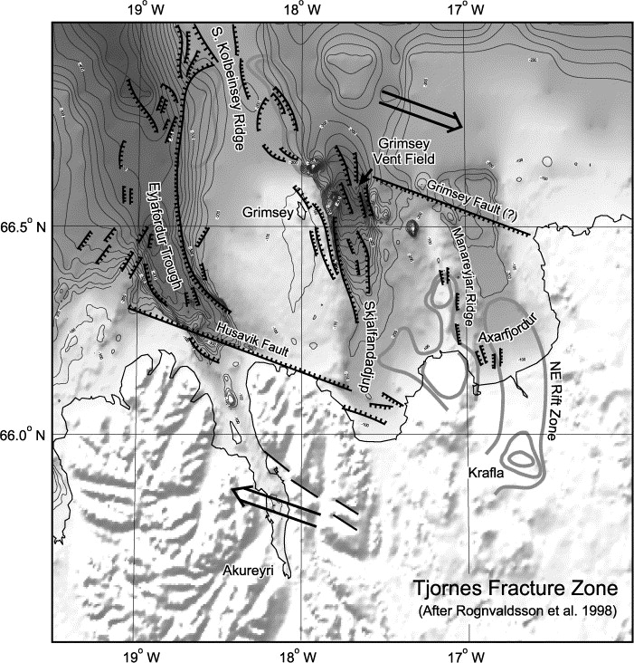
Other then this activity. It has been rather quiet in Iceland at the moment. No larger earthquakes have been taking place in the past two weeks since activity slowed down in Tjörnes Fracture Zone.
Blog post updated at 22:32 UTC on 27.04.2013.
Blog post updated at 22:53 UTC on 27.04.2013.