Minor earthquakes in Katla and Bárðarbunga volcanoes

There has been minor earthquake activity in Bárðarbunga volcano and Katla volcano for the past few days. This is just a short overview of this earthquake activity.

Bárðarbunga volcano

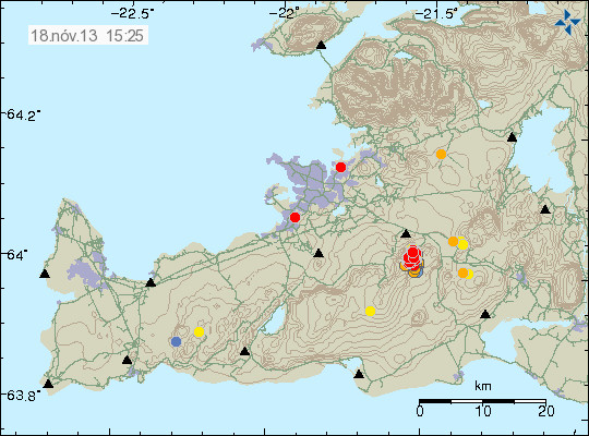
A minor dike intrusion took place in Bárðarbunga volcano on 18-June-2013. This was a small earthquake swarm, with largest magnitude at 1.2, the most depth in this earthquake swarm was at 24.3 km. So this was most likely a magma dike formation.

130618_1835
The magma dike earthquakes form a nice line on this IMO map. Copyright of this image belongs to Icelandic Meteorological Office.

Katla volcano

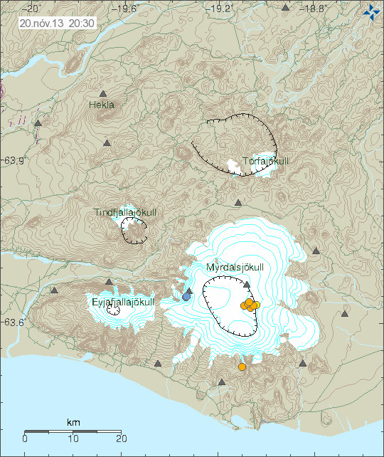
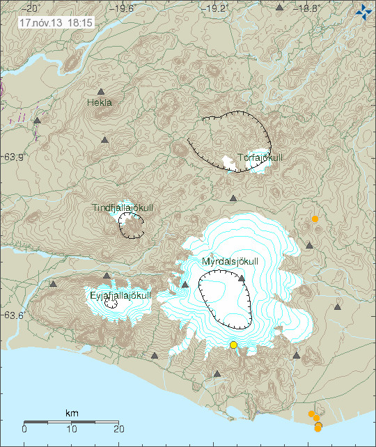
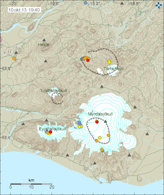
A minor earthquake activity has been taking place in Katla volcano for the past few days. So far it does not mean anything, this is most likely a summer related earthquake activity as glacier weight gets less on Katla volcano during the summer. Some deep earthquakes have been taking place in Katla volcano, it is unclear if they are sign of anything at this stage. This is most likely a some magma dike intrusion at depth, it happens commonly in Katla volcano without resulting in a eruption.

130618_1835
Activity in Katla volcano. Copyright of this image belongs to Icelandic Meteorological Office.

Other then minor activity, it is rather quiet in Iceland at the moment. With no special activity taking place currently.

Interesting earthquake swarm south of Grímsfjall volcano

Interesting earthquake activity took place in Vatnajökull glacier today (03.06.2013). This earthquake activity took place just south of Grímsfjall volcano, that last erupted in the year 2011.

130603_2055
The earthquake activity south of Grímsfjall volcano. Copyright of this image belongs to Icelandic Meteorological Office.

This earthquake activity is interesting, since it started after the eruption in Grímsfjall volcano at that area. It has been suggested that this activity is due to stress changes in this are, following the eruption in Grímsfjall volcano in the year 2011.

bab_week21
Earthquake activity in the same area in week 21 in the year 2011. Copyright of this image belongs to Icelandic Meteorological Office.

I am not sure what is going on in this area, no volcano is known, or volcano fissure is known in this area. But that might well just be because this area is covered with a thick glacier. What makes this also interesting is the fact this area has been having earthquake activity since the year 2011 and there doesn’t seems to be any end in sight. This is clearly something worth keeping a eye out for, even if nothing happens in this area for a long time.

Minor earthquake swarm on the Reykjanes Ridge on the 29th of May

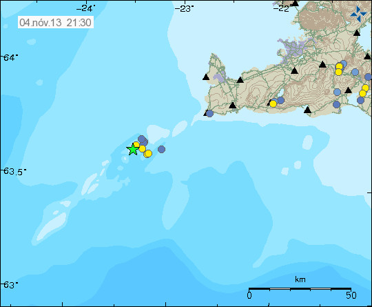
On the 29th of May (2013) a minor earthquake swarm took place on the Reykjanes Ridge. The largest earthquake in this swarm had the magnitude of 2.3, the depth range in this earthquake swarm was about 5.5 to 12 km. This was just a minor earthquake swarm, it also did not last long.

130529_2340
The earthquake swarm on the Reykjanes Ridge on 29th of May 2013. Copyright of this image belongs to Icelandic Meteorological Office.

This area of the Reykjanes ridge is highly active, only about three weeks ago there was a strong earthquake swarm in this area. This might just be a aftershock activity from that, it is however difficult to know for sure. I am expecting more earthquakes in this area in next few weeks to months.

Strong earthquake swarm on the Reykjanes Ridge

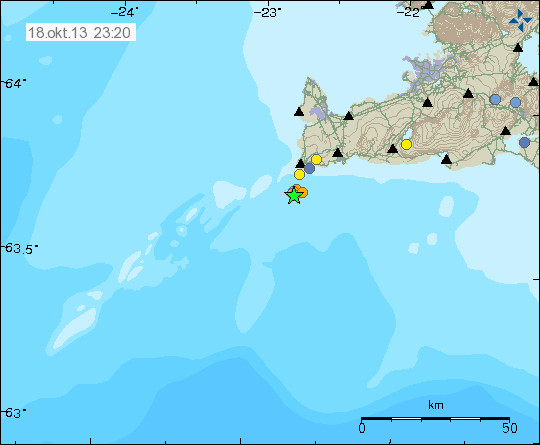
Last night a earthquake swarm started on the Reykjanes Ridge, this earthquake swarm started slowly with just few minor earthquakes. It however did pick up later today with stronger earthquakes and more activity. Strong earthquakes in this swarm so far have had the magnitude 4.5 and 4.7 according to USGS/EMSC. There have been over 10 magnitude 3+ earthquakes, there is also a chance of more earthquakes with the magnitude above 4.0+ in next few hours to days. According to Icelandic Meteorological Office, there have been over 310 earthquakes in this area today (my counter is still offline, more on that later in this blog post).

This earthquake swarm has been showing the pattern of stopping and then continue for few hours, and repeating this pattern. This sometimes happens in earthquake swarms on the Reykjanes Ridge, why that is I do not know. Last eruption in this area was sometimes on the 18th or 19th century I think. If this activity is connected to volcano activity it is too early to know at the moment, at the moment there is nothing that suggest that is the case. That might however change without a warning if that is the case. This volcano is located out in the ocean, so it is poorly monitored so current status of it is impossible to know for certain. Currently there are no harmonics being detected, just normal earthquake activity and nothing else.

130509_2125
Earthquake swarm on the Reykjanes Ridge. Copyright of this image belongs to Icelandic Meteorological Office.

130509_2125_trace
Trace showing how the evolution of the earthquake swarm has been for the past few hours.Copyright of this image belongs to Icelandic Meteorological Office.

It is difficult to know for sure what happens next in this earthquake swarm. It is clear for the moment that this earthquake swarm is in full force as is, so more earthquake activity is to be expected. This earthquake activity can be monitored here, on my webicorder web site. It is updated every 5 min.

Other

I am sorry for this late blog post, but I always use some time to see how earthquake swarm evolve and what happens in them before I write, unless there is a really big earthquake with magnitude 50 or larger.

I have also been busy today trying to get my server computer back up and running, it has been working somewhat but I had to start from scratch again due to technical issues with few things. I am running FreeBSD on my server computer now. Since I am moving away from Linux solutions and it has been more of a challenge then I expected. I hope to have everything worked out now, so I hope to have my server computer up and running properly tomorrow. Since I know what I did wrong first time around and I did avoid it this time around, so I am not expecting any problems in setting up FreeBSD properly this time around.

I also want to point out that donations help me running this blog, since my financial status is not as strong that I wanted it to be. Thanks for the help.

Blog post updated at 13:26 UTC on 11. May 2013.

Earthquake swarm deep off the south coast of Iceland

Yesterday (02.05.2013) at 06:08 UTC there was a earthquake swarm deep off the south coast of Iceland. This earthquake swarm was around 300 km south of Iceland. I do not know if there are any volcanoes in this area, at least nothing is documented. Depth of the ocean in this area is around 3 to 4 km, or more. Icelandic Meteorological Office did register two earthquakes from this area. The location is a good estimate at best. Since the SIL network has problems locating earthquakes this far out in the ocean.

130502_2245
The green star marks the location of this earthquake swarm. Copyright of this picture belongs to Icelandic Meteorological Office.

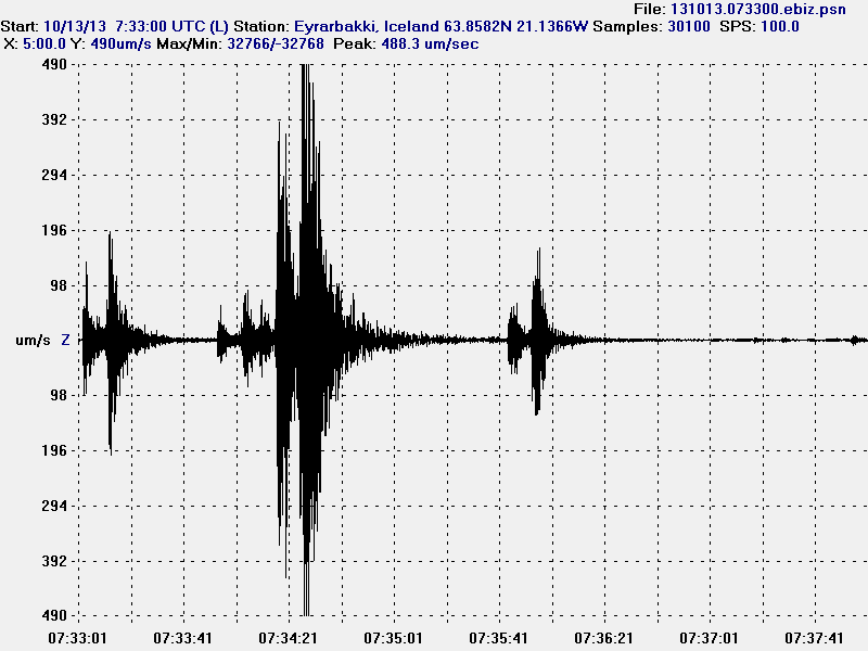
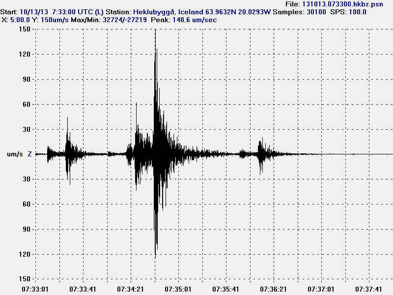
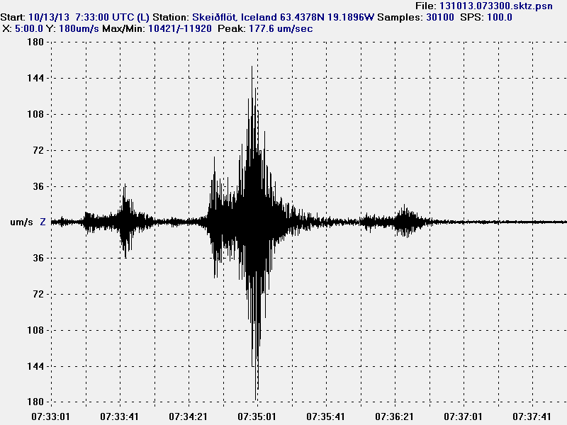
I did record this earthquakes on my geophone network. This earthquake activity was clearly seen on Skeiðflöt geophone stations, but also in Heklubyggð geophone stations. The data from my geophone network suggests that this earthquake had stronger magnitude then ML3.0 as it is registered with Icelandic Meteorological Office. Estimating magnitude of earthquake this far away from the SIL network is difficult at best, so its magnitude is at best too low. I do not know by how much it is.

130502.060800.sktz.psn
The earthquake as it did appear on Skeiðflöt geophone station. This image is released under Creative Commons licence. Please see licence page for more details.

It is possible that more earthquakes did take place in this location. The SIL network did record one (and my geophones too) at 03:56 UTC, that earthquake was smaller but at the same location. So this was most likely a earthquake swarm taking place in this location. I do not know if there are any volcanoes in this area, it might well be. If that is the case, it is unknown and undocumented as is and is going to be that for a while now.

Earthquake activity in Hekla, Katla, Krísuvík and Bárðarbunga volcanoes

Before I start. I want to remind people that donations help me to keep this blog up and running. I only have social welfare from Iceland and that is barely enough to make end meets. Just 10€ go a long way for me. Thanks!

Hekla and Katla volcanoes

I am going to write about both this volcanoes here. Since I am going to be using the same image anyway for both volcanoes.

Yesterday (26.04.2013) there was a magnitude 1.1 earthquake in Hekla voclano. This earthquake was in the same area that triggered uncertainty level to be declared just before Easters in March. It was later cancelled when nothing more happened.

130427_1730
Earthquake in Hekla volcano. Also on this picture earthquake activity in Katla volcano (read more below). Copyright of this picture belongs to Icelandic Meteorological Office.

Katla volcano has been having some earthquake activity in past days. So far it has just been minor earthquakes and nothing more. But it has been taking place where a minor eruption took place in Katla volcano during the summer of 2011. That minor eruption created a minor glacier flood. But it did destroy a bridge and closed down the ring road (road 1) in this part of Iceland.

While this activity is currently nothing to worry about. It is worth keeping a eye on it. Just in case it increases, or if some other changes start to take place in Katla volcano.

Krísuvík volcano

A minor earthquake swarm took place in Krísuvík volcano today (27.04.2013). The largest earthquake had the magnitude of 1.9. The depth of this earthquakes was around 8.6 km. Activity in this area is normal and there does not seem anything strange about it. But Krísuvík volcano has been having periods of inflation and deflation for the past three years. Earthquake activity increases when Krísuvík volcano is in period of inflation. If that is the case now I do not know.

130427_1730
Earthquake activity in Krísuvík volcano. Copyright of this picture belongs to Icelandic Meteorological Office.

Bárðarbunga volcano

A minor earthquake swarm took place in Bárðarbunga volcano today. Largest earthquake in this swarm had the magnitude of 1.3. Depth range was from 18.8 km and up to 11.1 km. This earthquake swarm is important. Since it appears that this is a dike intrusion in Bárðarbunga volcano. But a minor dike intrusion also took place in this area few weeks ago. That also resulted in a minor earthquake swarm in this same area.

130427_1730
Earthquake activity in Bárðarbunga volcano. Most likely due to minor dike intrusion into the volcano. Copyright of this picture belongs to Icelandic Meteorological Office.

A minor dike intrusions into a volcano does not mean a eruption is going to take place. In many Icelandic volcanoes (and around the world also) dike intrusions into the volcanoes are common event and in most cases do not result in any eruptions. But it is worth keep a watch out for this type of eruptions. Since it might signal a more active period ahead in Bárðarbunga volcano. But it might also just equally don’t mean anything. There is no way to know for sure.

Other then this activity. It has been rather quiet in Iceland at the moment. No larger earthquakes have been taking place in the past two weeks since activity slowed down in Tjörnes Fracture Zone.

Blog post updated at 22:32 UTC on 27.04.2013.
Blog post updated at 22:53 UTC on 27.04.2013.

Earthquake activity in Hekla, Askja volcanoes and TFZ

Before I start. I want to remind people that donations are import to me. Since they help me keeping this blog and my earthquake web page up and running.

Hekla volcano earthquake activity

A minor earthquake activity took place in Hekla volcano yesterday. None of the earthquake was larger then ML1.2. The depth of this earthquake activity was around 8.4 km. This earthquake activity took place outside the main volcano. But was in the connected fissure swarms that extends from Hekla volcano.

130424_0235
Earthquake activity in Hekla volcano system. The earthquakes are the orange dots just south-west of Hekla volcano. Copyright of this image belongs to Icelandic Meteorological Office.

Earthquakes have been taking place in this area for few years now. I do not know what they mean. This might just be a earthquake activity and nothing else. Uncertainty level has been canceled for few weeks now due to lack of any more activity in the main Hekla volcano.

Askja volcano

There has been minor earthquake activity in Askja volcano this past weeks. All of the earthquakes have been smaller then magnitude 1.5. Depth of this earthquakes is around 18 to 22 km. Suggesting that current earthquake activity has its source in magma movements rather then tectonic earthquakes.

130424_1440
Earthquakes in Askja volcano. Askja volcano is the volcano north-east of Vatnajökull glacier. Copyright of this image belongs to Icelandic Meteorological Office.

Tjörnes Fracture Zone

Activity in Tjörnes Fracture Zone has slowed down since 2. April when a large earthquake swarm started in it. But earthquake activity remains as is. Even if the earthquakes are smaller and fewer. This means the earthquake activity has been continuous for the past three weeks.

130424_1650
Earthquake activity in Tjörnes Fracture Zone. It remains in two areas as of now. New activity has also been taking place. Copyright of this image belongs to Icelandic Meteorological Office.

It is difficult to know for sure what happens next in TFZ. But tension in it remains as before and so does the risk for larger earthquake in this area. For the moment however, it remains rather quiet. When that might change is impossible to know for sure.

Blog post updated at 18:16 UTC on 24.04.2013.

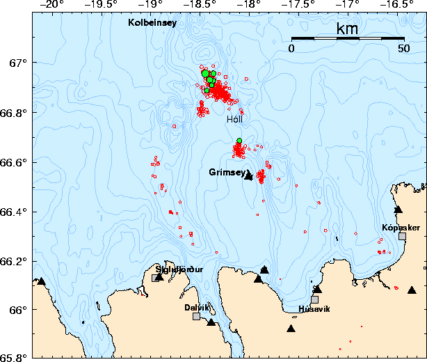
Earthquake swarm north of Kolbeinsey island

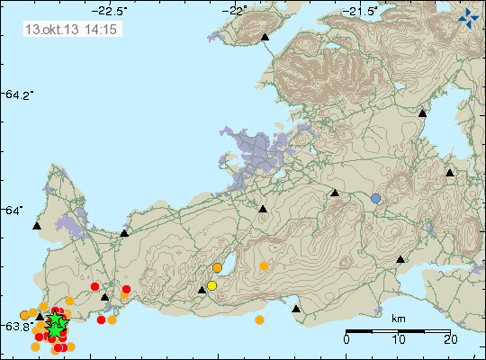
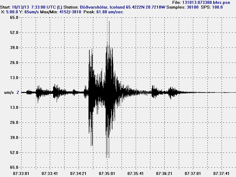
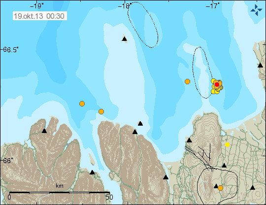
Around 11:00 UTC a earthquake swarm started just north of Kolbeinsey island. This earthquake swarm looks rather powerful. But due to distance from land only the largest earthquakes are appearing on the SIL network and on my geophone at Böðvarshólar. I am estimating the largest earthquakes having the magnitude of 4.0+. But that has not been confirmed yet. Last known eruption in Kolbeinsey island volcano took place in the year 1755. A dike intrusion or a volcano eruption took place north (100 km) of current location back in the year 1999. Last eruption before the eruption in the year 1755 took place around the year 1372.

130413_1745
The earthquake activity in Kolbeinsey island. It is marked by the green stars on this map. Copyright of this image belongs to Icelandic Meteorological Office.

bhrz.svd.13.04.2013.17.55.utc
The earthquake activity as it has been appearing on my geophone at Böðvarshólar. This image is under Creative Commons Licence. See CC licence page for more details.

No signs of eruption have appeared so far. If they do. They are going to appear on the SIL network. I am not sure if my geophone is going to pick them up due to the distance (around 300 km). There is a chance of more earthquake activity to take place in this area in the next few hours to days. I do not know if this activity is connected to what has been taking place in other parts of Tjörnes Fracture Zone. The smaller earthquakes that are taking place in Kolbeinsey island are not being detected by the SIL network or by my geophone.

It is possible to view the earthquake activity here, on my webicorder web page.

Blog post updated at 19:35 UTC on 13.04.2013.

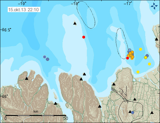
Less earthquake activity in Tjörnes Fracture Zone

Yesterday (09.April 2013) there has been less activity in Tjörnes Fracture Zone. The largest earthquakes yesterday did have the magnitude 4.0 and 3.3. A smaller earthquake with the magnitude 3.1 also took place. Many other smaller earthquakes also took place as is normal for this type of earthquake swarm. There are no signs of any volcano activity in the area during this earthquake activity.

130409_2345
Earthquake activity in Tjörnes Fracture Zone during the past 48 hours. Copyright of this image belongs to Icelandic Meteorological Office.

This earthquake swarm does not appear to be over. Even if it has slowed down from its peak one week ago following the magnitude 5.5 earthquake. This type of slowdown are common in this type of earthquake swarms. In many cases the activity stops altogether and starts again after some time. I now believe that current earthquake swarm is connected (not sure how yet) to the earthquake swarm that took place in TFZ in October 2012 and started view few smaller earthquakes and had one magnitude 5.6 earthquake. For now however the earthquake activity is dropping. But it is impossible to know for sure what happens next in TFZ area.

Update on the TFZ earthquake swarm at 01:01 UTC

This is a short update on the earthquake swarm in TFZ. This is going to be a long earthquake swarm from the looks of it (currently).

The earthquake swarm in TFZ continues as it has been doing for the past six days now. The strongest earthquakes for the past 24 hours have had the magnitude 3.5, 3.6 and now 3.3 (automatic magnitude). This is a extremely complex earthquake swarm. Over a period of 48 hours there have been around 368 earthquakes. That is a drop in activity, but in the first few hours after the magnitude 5.5 earthquake in TFZ there where recorded over 500 earthquakes.

130406_0015
Earthquake activity in TFZ for the past 48 hours. Copyright of this image belongs to Icelandic Meteorological Office.

130406_0015_trace
The trace plot that shows the earthquake activity for the past 48 hours in TFZ. Copyright of this image belongs to Icelandic Meteorological Office.

This earthquake swarm is complex due to three factors. There is a both slip fault and normal fault taking place there. There also appears to be a volcano in the area. But it not properly understood and is extremely poorly studied. It is unclear at present time if this volcano is connected to this earthquakes swarms at present time. Since so little is known about it. It is also not known if the current earthquake swarm is going to start something in the volcano. The second volcano that is in this area last erupted in the year 1868 following an earthquake swarm in this area. Why that did happen is also not known. But it has a Global Volcanism profile here. The volcano that is closer to Grímsey Island is currently unnamed. There is also almost no studies or documentation on it. But from the little I did find

Please note that the earthquake swarm information is always changing so this information here do get outdated fast. This mostly applies the maps and number of earthquakes.

Scientific data on Tjörnes Fracture Zone

As I did say here above. The Tjörnes Fracture Zone is complex and that is making this earthquake swarm extremely complex as it is taking place.

img94
The rift fault lines in TFZ. This is the simple version. It is from a science study that can be found here. Copyright of this image belongs to Icelandic Meteorological Office/Hjorleifur Sveinbjornsson.

1-s2.0-S0264370706000597-gr2
More complex nature of the fault systems in TFZ. Copyright of this image belongs to Agust Gudmundsson. From study Infrastructure and evolution of ocean-ridge discontinuities in Iceland.

1-s2.0-S0040195107003794-gr1
More complex image showing the fault lines in TFZ. Copyright Ragnar Stefansson, Gunnar B. Gudmundsson, Pall Halldorsson. From the study Tjörnes fracture zone. New and old seismic evidences for the link between the North Iceland rift zone and the Mid-Atlantic ridge.

1-s2.0-S0025322701001724-gr2
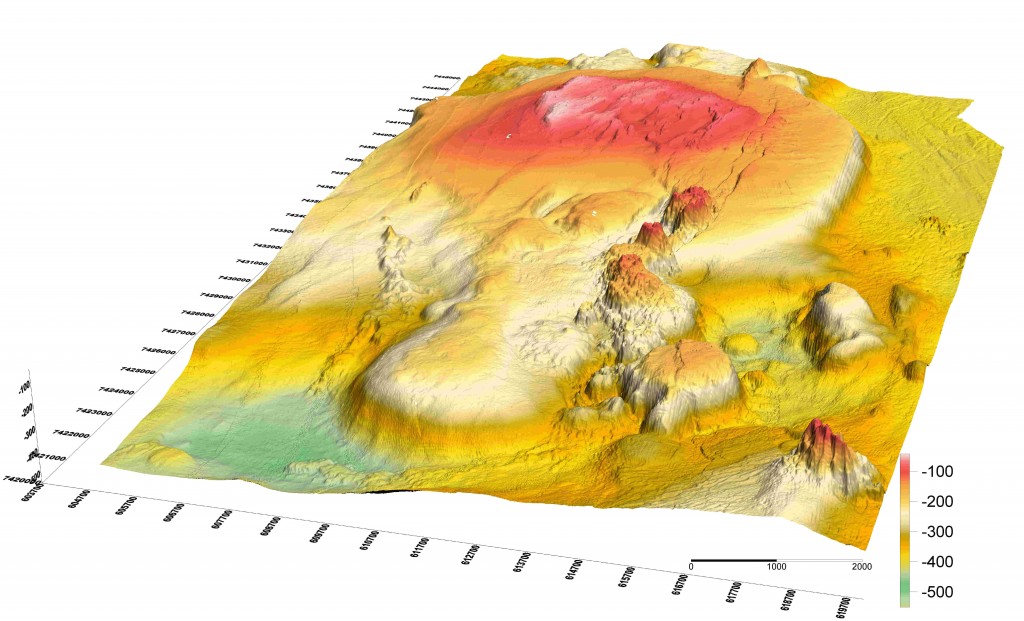
The most detailed picture that I was able to find of Tjörnes Fracture Zone and the ocean floor. Copyright of this image belongs to many people. Please see the list of copyright holders in the following link. From the study First observations of high-temperature submarine hydrothermal vents and massive anhydrite deposits off the north coast of Iceland.

It is clearly worth watching this earthquake activity. Since it might have interesting effects on the volcano where this earthquake activity is taking place. Even on the second volcano just north of Þeystareykjabunga volcano.