Earthquake swarm on the Reykjanes peninsula

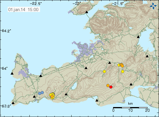
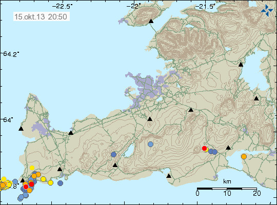
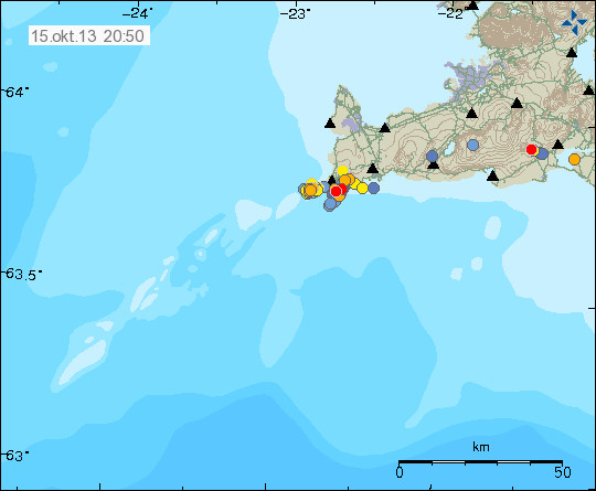
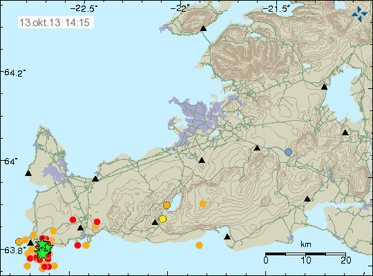
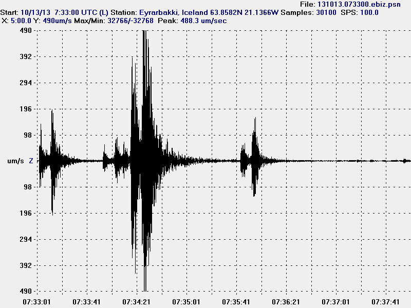
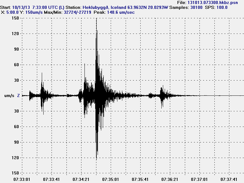
Today at 01:11 UTC (13-October-2013) an earthquake swarm started on the Reykjanes peninsula. Early in this earthquake it was just minor earthquakes until 07:34 UTC an earthquake with magnitude 4,8 took place on the Reykjanes peninsula. Before the strongest earthquake took place, an magnitude 3,4 and 3,5 took place. Several earthquakes with magnitude above 3,0 took place following the main earthquake. The strongest earthquake was felt over an wide area, from Vík í Mýrdal to Hólmavík in north-west Iceland. Far as I know no damage did take place following this earthquake.
131013_1415
The earthquake swarm on the Reykjanes peninsula. Green stars mark earthquakes with magnitude above 3,0. Copyright of this image belongs to Icelandic Meteorological Office.

This earthquake did appear clearly on all of my geophone stations in Iceland. They can be viewed here.
131013.073300.ebiz.psn
The magnitude 4,8 earthquake on the Eyrarbakki geophone station. The earthquake signal is strongest on this geophone station and clearly tops the sensor it self, it can be seen how the signal goes above the maximum line on the geophone image. This image is released under Creative Commons licence. Please see CC Licence page for more details on this licence.
131013.073300.hkbz.psn
The magnitude 4,8 earthquake at Heklubyggð geophone station. This image is released under Creative Commons licence. Please see CC Licence page for more details on this licence.
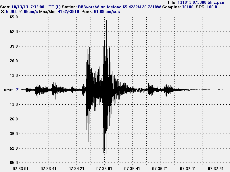
131013.073300.bhrz.psn
The magnitude 4,8 earthquake at Böðvarshólar geophone station. This image is released under Creative Commons licence. Please see CC Licence page for more details on this licence.
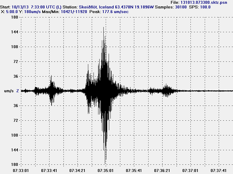
131013.073300.sktz.psn
The magnitude 4,8 earthquake at Skeiðflöt geophone station. The earthquake did appear clearly even if the noise level is high on that station. This image is released under Creative Commons licence. Please see CC Licence page for more details on this licence.

It is impossible to know for sure if this earthquake swarm is going to increase again. For the past few hours activity has been dropping, there is however nothing that says activity is not going to increase again. Such activity is common in this area, but it’s impossible to know for sure what happens next. At the moment there is nothing to suggest that volcano activity is the source of this activity. That might change but I think it is unlikely to be the case at the moment, regardless of what the future has in store.
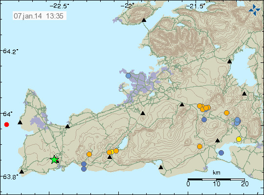
Magnitude 3.1 earthquake on the Reykjanes peninsula

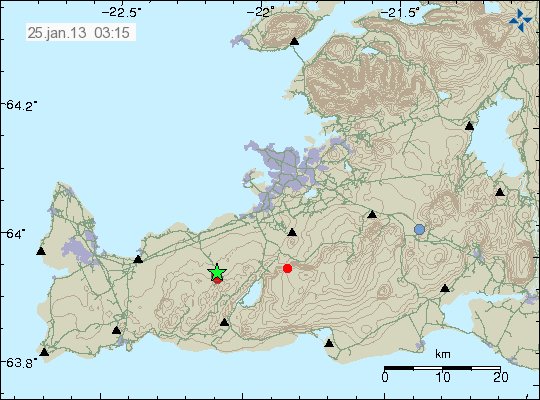
At 00:41 UTC on 25.01.2013 an magnitude 3.1 earthquake did take place on Reykjanes peninsula. This earthquake was felt in Reykjavík, Hafnarfjörður and few other nearby populated areas. Two aftershocks did follow this earthquake. Both had the magnitude 1.5. It is impossible to know if this earthquake activity is going to start an earthquake swarm in this area. Sometimes that happens, sometimes it doesn’t.


The green star marks the location of the magnitude 3.1 earthquake. Copyright of this image belongs to Icelandic Meteorological Office.

No further earthquake activity has so far taken place in this area during the past two to three hours. This earthquake activity does not appear to be volcano related. But this is normal tectonic movements of the rift zone that makes up Reykjanes peninsula.

Icelandic news about this earthquake. Please use Google translate and hope for the best.

All snarpur skjálfti á Reykjanesskaga (Rúv.is)
Jarðskjálfti fannst á höfuðborgarsvæði (mbl.is)
Jarðskjálfti við Keili (Vísir.is)

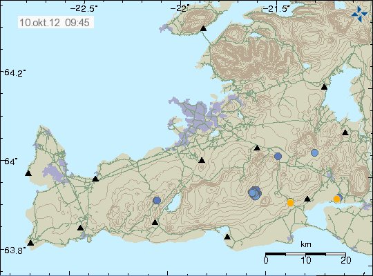
Earthquake swarms in Brennisteinsfjöll volcano and TFZ

Over the past few days there has been continued earthquake activity in Breinnisteinsfjöll volcano. The largest earthquake in this swarm had the magnitude of ML2.5. It is possible that this earthquake swarms have there orgin in SISZ. Rather then Breinnisteinsfjöll volcano. But at current time is hard to be sure on this detail.


Earthquake activity in Breinnisteinsfjöll volcano during the past few days. Copyright of this image belongs to Icelandic Meteorological Office.

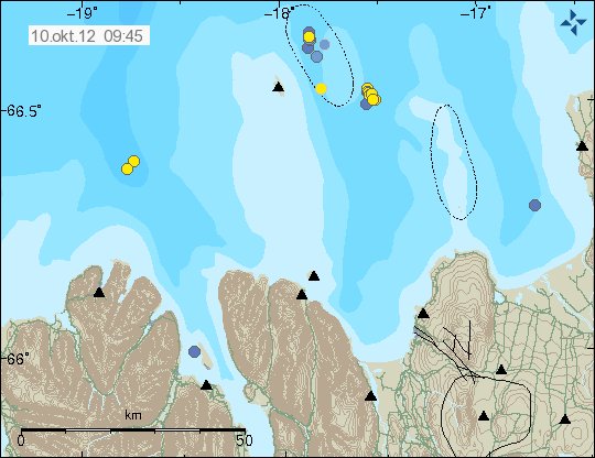
Tjörnes Fracture Zone

Earthquake activity has also been taking place east of Grímsey Island. This earthquake activity has mostly been small. But this are earthquake swarm did not have any earthquake that was above 3.0 in magnitude.


Earthquake swarm on TFZ. Copyright of this image belongs to Icelandic Meteorological Office.

The largest earthquake in this swarm had the magnitude of ML2.8. More earthquake activity should be expected in this area. As this is one of most active areas in Iceland when it comes to earthquake swarm.

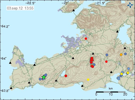
Ongoing earthquake swarm in Breinnisteinsfjöll volcano / SISZ

Since yesterday (02.09.2012) there has been ongoing earthquake swarm in Breinnisteinsfjöll volcano / SISZ (south iceland seismic zone). It is impossible to know how this earthquake swarm is going to proceed. But from what I can tell. It does not seem like it is going to be over any time soon. It is also an possibility that current earthquake swarm is part of an larger stress change in the area. But for now it is too early to know for sure what it means in the long term. Current earthquake activity is ongoing. With almost no breaks or stops. Most earthquakes have the magnitude of 0.1 and up to 2.0. But no larger earthquakes have been detected so far. The first earthquake in this earthquake swarm had the magnitude of ML4.4. Depth of this earthquakes is from 3 to 7 km (in that range).


The earthquake activity in Breinnisteinsfjöll volcano. The earthquakes align them self on an fault line that almost directly north-south direction. Copyright of this image belongs to Icelandic Meteorological Office.

It is impossible to know what is going to happen next in this earthquake swarm. But strong earthquake should not be ruled out for now. This might also activate nearby fault lines if the activity intensifies. As that sometimes happens in Iceland. Whatever happens next in this area. It is worth keeping an eye on the progress of this earthquake swarm.

Icelandic news about this earthquake swarm

Enn skelfur undir Bláfjöllum (mbl.is)
Enn skelfur í Bláfjöllum (Rúv.is)

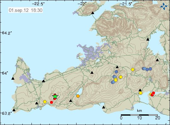
Magnitude 3.2 earthquake on the Reykjanes peninsula

Today (01.09.2012) at 16:33 UTC there was an earthquake with the magnitude of ML3.2. The depth was 7.6 km. Following this earthquake there was an swarm of smaller earthquakes following the first earthquake. None of those have been above magnitude 2.0. The earthquake took place in the Reykjanes volcano most likely. But it appears tectonic in nature. Rather then volcanic.


The magnitude ML3.2 earthquake on the Reykjanes peninsula. Copyright of this image belongs to Icelandic Meteorological Office.

It is hard to know for sure if this activity is going to continue. But since this earthquakes. Activity in this area has stopped. But it might resume at later time.

Icelandic news about this earthquake

Jarðskjálfti á Reykjanesskaga (Rúv.is)
3,2 stiga skjálfti við Grindavík (mbl.is)

Earthquake in Brennisteinsfjöll volcano / SISZ earthquake zone

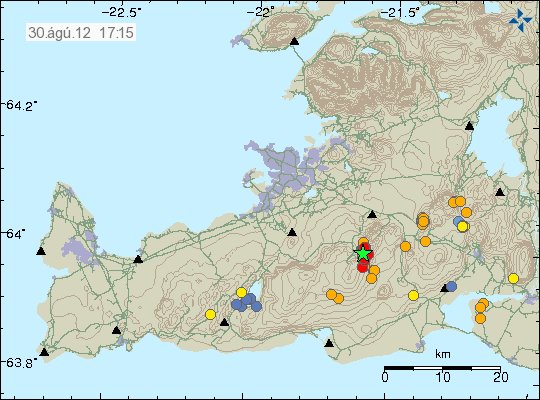
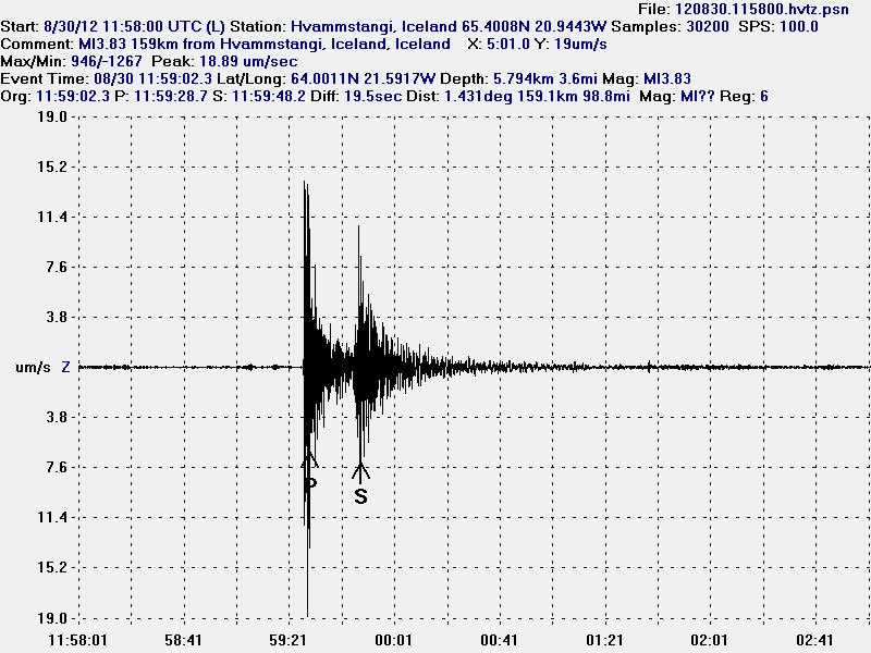
Today (30.08.2012) at 11:59 UTC there was an earthquake with the magnitude of ML3.8 (4.2Mw) in Brennisteinsfjöll volcano / SISZ. But SISZ overlaps this area to some extend. So large earthquakes do happen in this area of Iceland on regular basis. This earthquake was felt in Reykjavík area, south Iceland and some part of western Iceland.


The earthquake location and the following aftershocks. Copyright of this image belongs to Icelandic Meteorological Office.

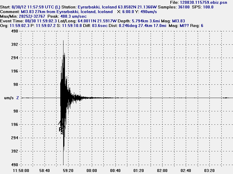
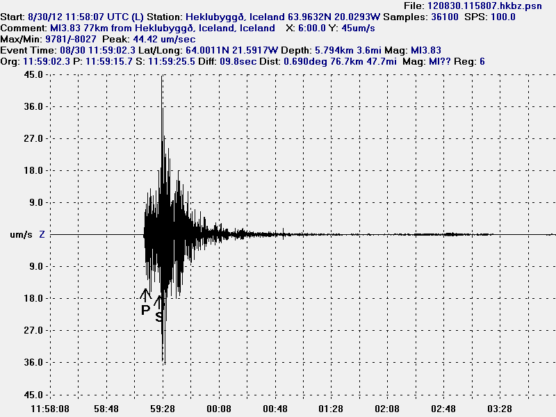
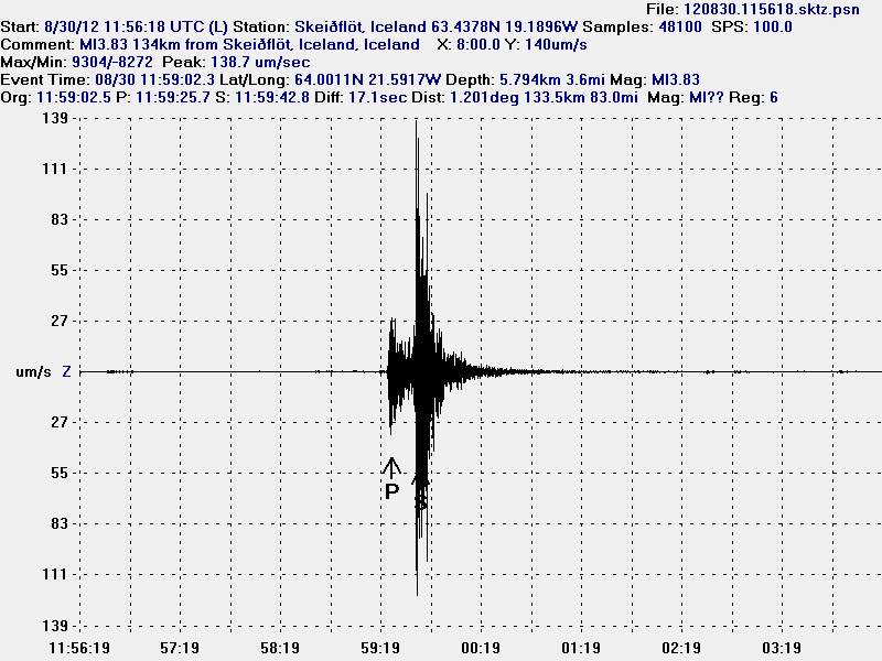
In around 30 aftershocks have been detected in the area. More aftershock activity in this area cannot be ruled out. This earthquake did appear clearly on my geophones all over Iceland.


The earthquake at Eyrarbakki geophone station. This geophone is the closest to the earthquake. The most movement in this earthquake was on an N-S and E-W fault according to my geophones. This picture is released under CC Licence. See licence page for more details.


This is the earthquake as it was recorded on Heklubyggð geophone. It is the second closest geophone station to this earthquake. This picture is released under CC Licence. See licence page for more details.


Here is the earthquake as it did appear on Skeiðflöt geophone. This picture is released under CC Licence. See licence page for more details.


Here is the earthquake as it did appear on Hvammstangi geophone. This picture is released under CC Licence. See licence page for more details.

It is impossible to know for sure what this earthquake activity means. But earthquake activity in this area of Brennisteinsfjöll volcano did stop around 15:49 UTC. No aftershocks did go above 2.0 in magnitude. More earthquakes in this area should not be ruled out in the next few days to weeks.

Icelandic News about this earthquake

Alltaf von á eftirskjálftum (Rúv.is)
Skjálftinn á enda stórs misgengis (Rúv.is)
Verra ef safnið hefði skemmst (Rúv.is)
Skjálftinn hápunktur – ekki fyrirboði (Rúv.is)
Jörð skalf í dag (Rúv.is. Afternoon radio show about this earthquake in Icelandic)
Jarðskjálftasvæðið undir smásjá sérfræðinga (Vísir.is)
Má búast við nokkrum eftirskjálftum (Vísir.is)
Fólk hljóp á dyr í Litlu Kaffistofunni (Vísir.is)
Jarðskjálftinn var 4,6 stig (Vísir.is)
Á þriðja tug eftirskjálfta hefur mælst (mbl.is)
Jarðskjálfti upp á 4,6 stig (mbl.is)
Snarpur jarðskjálfti á höfuðborgarsvæðinu – Stærsti skjálftinn í 3 ár (Pressan.is)
Jarðskjálftafræðingur: Ekki búið að losa um neina spennu að ráði (Pressan.is)

Deflation stops in Krýsuvík volcano

According to Rúv News today. Deflation has stopped in Krýsuvík volcano. But this is the latest chapter in inflation and deflation episodes that have been taking place in Krýsuvík volcano during the past three years. It is unclear what happens next in Krýsuvík volcano. But an new inflation episode should not be ruled out at this point.

Lat inflation episode started earlier this year (2012) and stopped in May. Then an deflation episode started. It stopped sometimes in August 2012. It is impossible to know for sure when an new inflation episode starts in Krýsuvík volcano. But it is my opinion that is going to be soon. But how soon exactly is impossible to know. Inflation episodes in Krýsuvík volcano have been followed by strong earthquakes swarms. So that are the signs of an inflation period having started in Krýsuvík volcano.

Icelandic news about this

Landsigið er hætt í Krýsuvík (Rúv.is)

Minor earthquake swarms in Iceland

It has been quiet in Iceland during the past few weeks. Besides activity in Katla volcano and Kolbeinsey ridge. Nothing of interest has been going on in Iceland. Here is however the overview of activity in Iceland during the past few hours.

Kolbeinsey Ridge

Some minor earthquake activity has been taking place in Kolbeinsey Ridge during the past few hours. This earthquake swarm is small in nature, with largest earthquakes reaching the magnitude 2.4. Otherwise it remains quiet in this area.


Earthquake activity in Kolbeinsey Ridge. Just north of Grímsey Island. Copyright of this image belongs to Iceland Meteorological Office.

Kolbeinsey ridge has seen some activity during past few weeks. But it might just be normal tectonic earthquakes taking place. So far nothing suggest any volcanism nature of this earthquake activity.

Krýsuvík volcano

During the past few hours. Krýsuvík volcano did see some earthquake activity. This activity is most likely to be tectonic in nature. As Reykjanes peninsula has frequent earthquake swarm that are tectonic in nature.


Earthquake swarm on Reykjanes. It is located within Krýsuvík volcano. This was small earthquake swarm. Copyright of this image belongs to Iceland Meteorological Office.

It remains rather quiet on Reykjanes besides this minor earthquake swarm today.

Katla volcano

After rather interesting activity during the past few weeks. It seems that Katla volcano is slowing down in earthquake activity. For now at least. But it is impossible to know for sure if current quiet sense is going to continue in Katla volcano.


Earthquake activity in Katla volcano during past few days. The activity is mostly concentrated into Katla volcano caldera. Copyright of this image belongs to Iceland Meteorological Office.

Besides this top of the activity. All is quiet in Iceland. Both in volcanoes and earthquakes. That might however change at any time without warning. It happens often in Iceland. I also want to remind people of my geophone web page. Where earthquakes can sometimes be seen soon after they have taken place.

Krísuvík volcano inflates and deflates regularly

It seems that Krísuvík volcano is inflating and deflating on regular basic. I do not know how regular this change is. But it has been noticed by Icelandic scientists how are bit puzzled by this behavior. Last inflation episode did last until end of the year 2011. Since then deflation did start again and is currently ongoing. It is uncertain if what this means. At the moment it is too early to know for sure if this means if that Krísuvík volcano is getting ready for an eruption. But if there was an eruption in Krísuvík volcano, it would be Hawaiian eruption so no volcano ash. Volcano ash eruption would only take place if an eruption started in Kleifarvatn lake. But the effects of that would be limited to local area (Reykjavík and other nearby towns). It would not create any global problems, as many would want to believe.

Inflation and deflation period have been the years 2009, from January to September. In May 2010 inflation did start again, that inflation period lasted until end of the year 2011. Since then deflation has been taking place. Today there is continues GPS monitoring in Krísuvík volcano. But it is unknown if this type of behavior has taken place before in Krísuvík volcano. But for now Krísuvík volcano is being monitored both with GPS and the SIL network. What happens next anyone guess.

Icelandic news about this.

Land rís og sígur í Krýsuvík (Rúv.is)

Minor earthquake activity in Iceland

During the past few weeks it has been quiet in Iceland. Really quiet, with almost nothing going on. It is still like that to some extent. So this is just a short overview of the small activity that has been taking place in Iceland during the past 48 hours or so.


The earthquake activity in Iceland during the past 48 hours. Copyright of this image belongs to Iceland Met Office.

The most activity in the last 48 hours have been on the Reykjanes and on TFZ. But there was an small earthquake swarm in each area. With earthquakes that did not get over ML2.5 in size so far. Two earthquakes where in Askja volcano. One in Grímsfjall volcano fissure system (maybe in Þórðarhyrna volcano).


Earthquake west of Hekla volcano, in the SISZ. This picture is released under Creative Common Licencee. See the licence page for more detail.

Katla volcano

During this winter. Katla volcano has been quiet. This is somewhat normal, as more snow means more ice-mass on top of the volcano. But now that has started to melt a little and that means less ice-mass on top of the volcano. That could mean more activity in Katla volcnao during the next few weeks. So far however the activity remains small and there are no special earthquakes to report.


Earthquake activity in Katla volcano, on this picture earthquake activity west of Hekla volcano can also been seen here. Copyright of this image belongs to Iceland Met Office.

The earthquakes west of Hekla volcano belong to the SISZ fault area. Not Hekla volcano it self. What is also interesting is the earthquake activity in south part of Katla volcano. In area outside of the glacier. This are small earthquakes, that do not appear on my geophone. Even if they are close to it. I am unsure what this means for the future. But it is worth keeping an eye on it.