This is a short overview of the micro-earthquake activity in Iceland on 28-September-2016. Please note that some of this earthquake activity may have started some days ago and only got really busy on 28th September 2016.
Kolbeinsey Island / Ridge
Late on the 28-September-2016 an earthquake swarm took place in Kolbeinsey Island / Ridge. This is the largest earthquake swarm in this article. With the largest earthquakes having the magnitude above 3,0. Due to distance from the SIL network exact calculation of the magnitude and depth doesn’t appear to be possible. Last eruption taking place in Kolbeinsey Island / Ridge took place in the year 1755. No other eruptions have been documented since, but they might regardless have happened. The area is far from land and difficult to observe.
East of Grímsey Island (Tjörnes Fracture Zone)
Minor earthquake swarm has been taking place earth of Grímsey Island in a area that many suspect is a volcano (it is marked as such in the GVP database). The earthquake swarm in question does not appear to be a volcanic in origin. This appear to be a tectonic activity taking place, as the movement of TFZ is 20mm lateral movement/year (they fault slide each other 20mm/year) the rift movement is only 5mm/year (eastern part only). Image showing the movements can be found here (vedur.is).
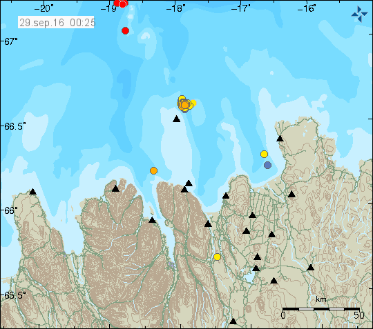
Earthquake activity in Kolbeinsey Island and Tjörnes Fracture Zone. Copyright of this image belongs to Icelandic Met Office.
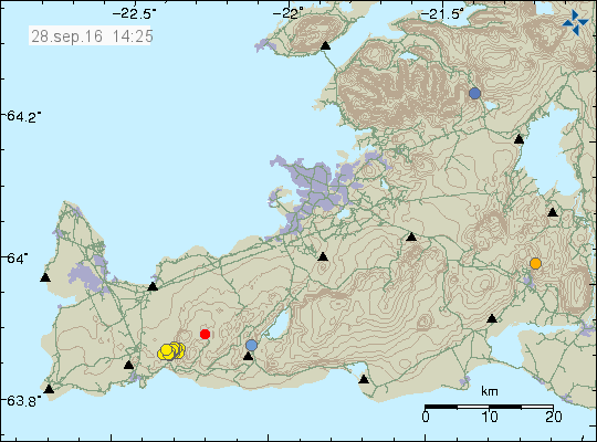
South Seismic Zone (SISZ)
A small swarm of earthquakes has been taking place in SISZ this week. The largest earthquake in this swarm has only had the magnitude of 2,1. The activity is only minor and does not suggest a large earthquake is about to happen. This might be aftershocks of the earthquakes in 2000 or 2008.
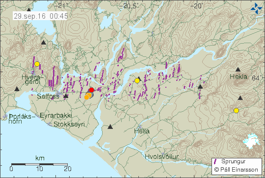
The earthquake activity in SISZ. It’s only minor and west of Selfoss (red dot). Copyright of this image belongs to Icelandic Met Office.
Reykjanes peninsula
Earthquake swarm started on 28-September-2016 on the Reykjanes peninsula. This earthquake swarm was not strong and the largest earthquake in this swarm only had the magnitude of 2,1 and all other earthquakes where smaller in magnitude. Total of 60 earthquake happened when the swarm was active.
The earthquake swarm on the Reykjanes peninsula. It was not big in magnitude, but had a total of 60 earthquakes. Copyright of this image belongs to Icelandic Met Office.
Few earthquake have also been taking place around Iceland without any other activity. This type of one-off earthquake activity is common in Iceland. Why it happens is unclear.
Article updated at 02:03 UTC on 29-September-2016. Word corrections.