During the night of 10-April-2017 at around 03:39 a magnitude 4,5 earthquake happened and started a earthquake swarm at same location, total number of recorded earthquakes is around 71 but that number is not confirmed as of yet. There is also a good chance a few magnitude 3,0 earthquakes happened, but this earthquake swarm has not been reviewed by Icelandic Met Office as of yet (I don’t know why it’s slow today).
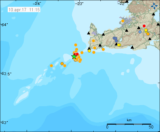
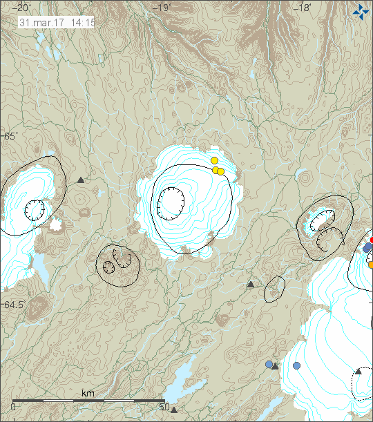
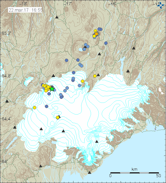
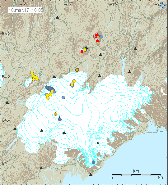
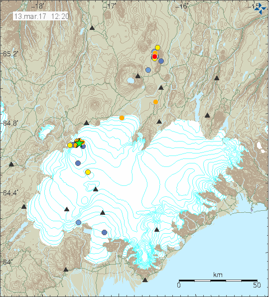
The earthquake swarm as it appears on Icelandic Met Office maps, green star is the location of the magnitude 4,5 earthquake. Copyright of this image belongs to Icelandic Met Office.
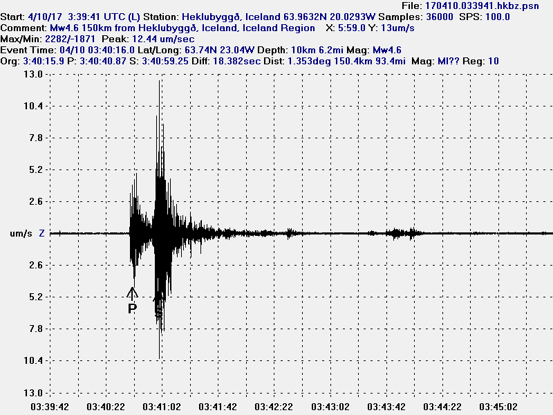
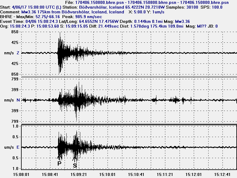
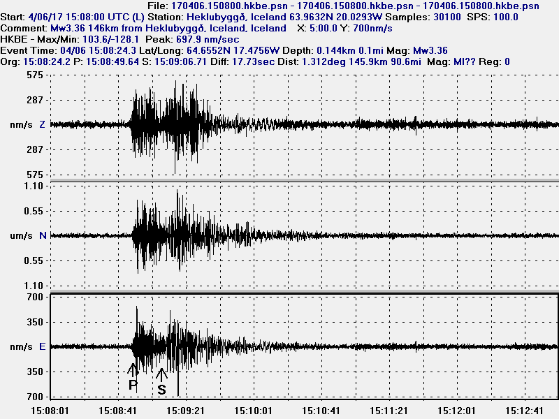
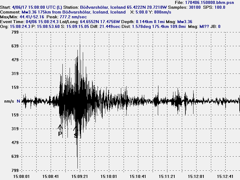
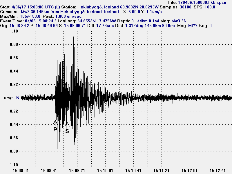
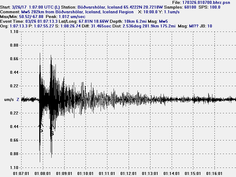
The earthquake as it appeared on my geophone in Heklubyggð. This image is under Creative Commons licence. Please see CC licence for more details.
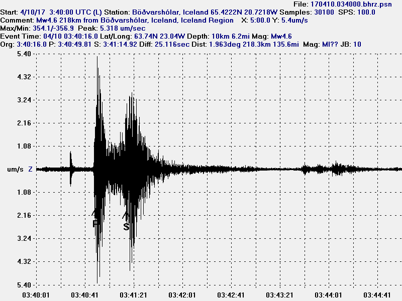
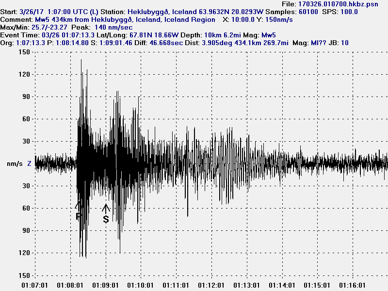
The earthquake as it appeared on my geophone in Heklubyggð. This image is under Creative Commons licence. Please see CC licence for more details.
This appears to be a normal tectonic earthquake in the rift valley that is at this location. No change was observed in the harmonic tremor, that means there was no magma movement during this activity. Based on earlier earthquake behaviour in this area, there is a good chance that new earthquake swarm is going to happen in this area after few days or at most weeks before this area going quiet again.
Donations
Please remember to support my work with donation. It helps me keeping this website and my self going and to do this job. Thanks for the support. 🙂