All quiet at Katla volcano

Currently everything is quiet in Katla volcano. At the moment the harmonic tremor level have gone back to normal levels. But there appears to be some earthquake activity taking place inside Katla volcano caldera. But most of this earthquakes do not appear on the automatic earthquake list that IMO has. But it might be impossible to actually locate this earthquakes as they might just appear on single or two SIL stations.

The glacier flood is over and the flood water have continued to lower during the day.

It is hard to know for sure what happens next. But the current events started around 17. June when earthquake swarms started to appear on the Katla volcano caldera. This has been developing rather fast since then. I do not expect that to change any time soon. But what I think was harmonic tremor pulses started around 12. June.

For now however all that can be done is to wait and see what happens in Katla volcano. As I do not think that this is over. But we might be in for an few hours or days of an break until something new happens in Katla volcano.

Icelandic News about this.

Einungis brúin eftir (Rúv.is, Icelandic, Picture)
Highway no. 1 disrupted for weeks. (Rúv.is, English, German)

Harmonic tremor drop down. New earthquake happen in Katla volcano caldera

It seems that on many SIL station around Katla volcano that the harmonic tremor has gone mostly down to background levels, on other stations it continues to drop. This are mostly SIL stations that are at the most distance to the source of the area that this minor eruption took place during the night. But at the moment this seems to be over. The main source of the activity appears to be where the eruption took place in the year 1918, or so scientists think at the moment.

According to the news there was an flood wave around 04:00 UTC during the night. When the water meters did show an rise of 5 meters suddenly. Soon after that the bridge over Múlakvísl river was lost in the glacier flood. This did close the main road 1 in this area, that area of the main road is going to remain closed for the next few weeks while they fix the damage done in the flood (build an new bridge).

Even if the harmonic tremor seems to be dropping. This does not seem to be over, as an earthquake activity did resume from around 13:00 UTC in the Katla. Since then the earthquake activity seems to have been building at slow rate.


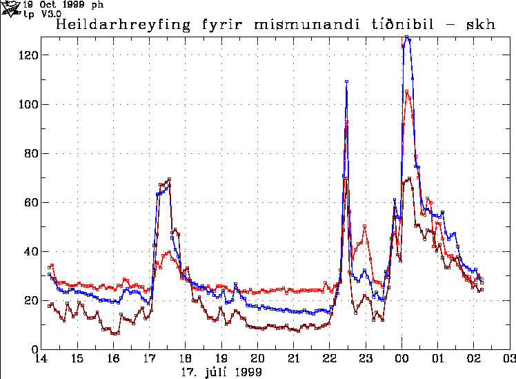
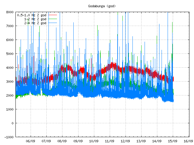
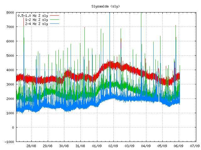
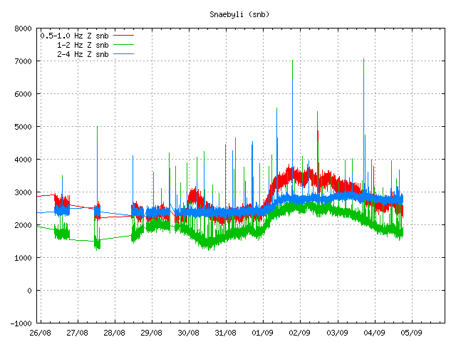
Tremor plot at 18:23 UTC. The tremor is dropping. It also shows that earthquakes are taking place (spikes the tremor chart). Copyright of this picture belongs to the Icelandic Met Office.


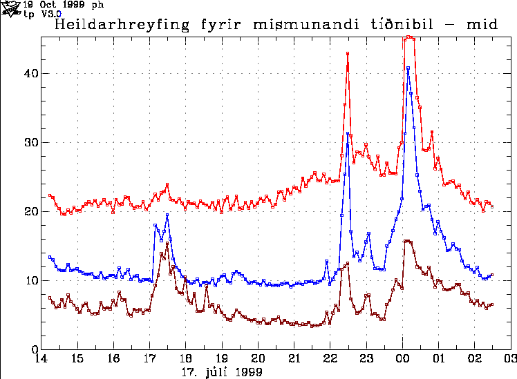
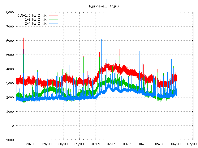
Tremor chart from Goðabunga at 18:24 UTC. Copyright of this picture belongs to the Icelandic Met Office.


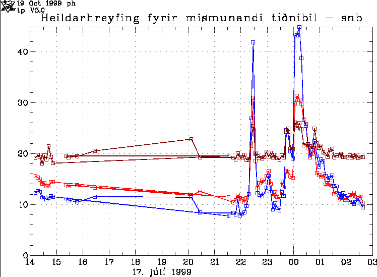
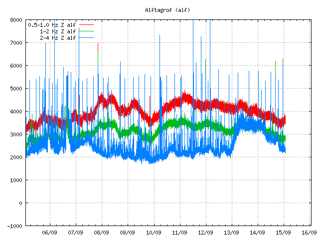
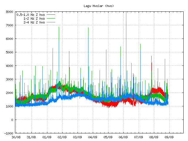
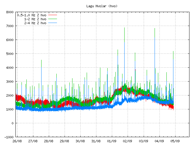
Dropping harmonic tremor on Lágu Hvolar. Earthquakes appear as spikes here. Copyright of this picture belongs to Icelandic Met Office.


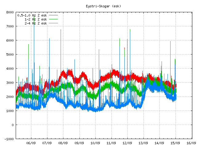
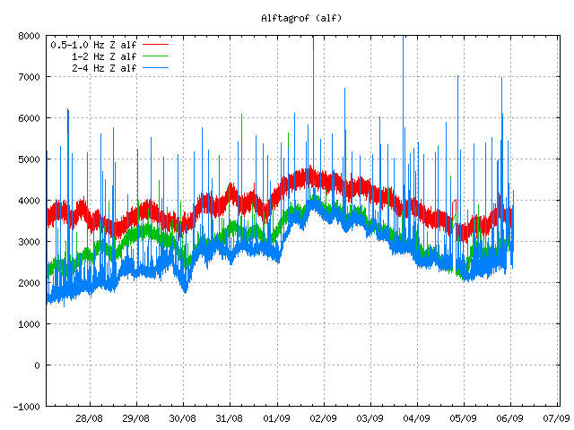
Dropping tremor and earthquakes as before. Copyright of this picture belongs to Icelandic Met Office.


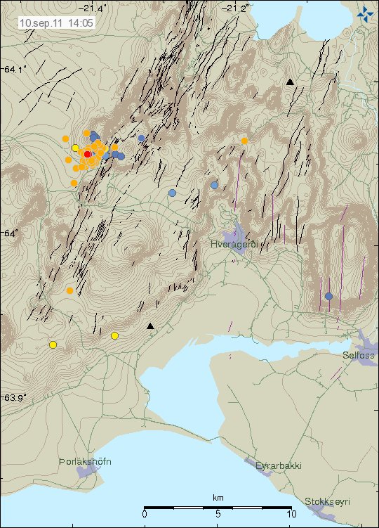
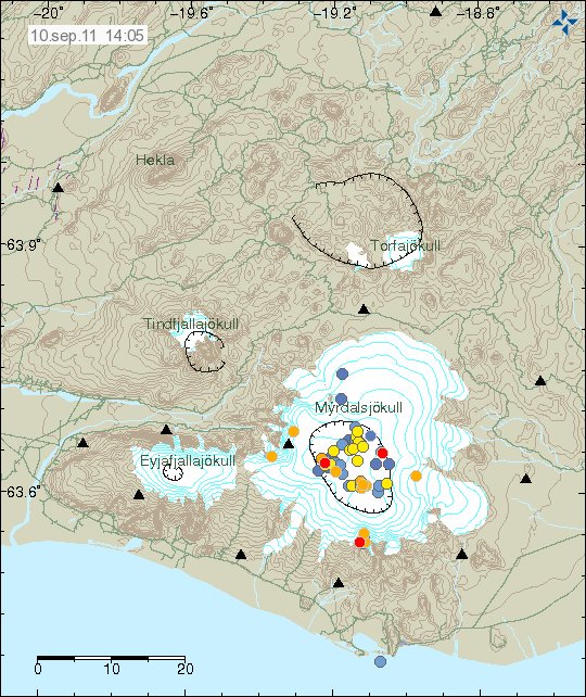
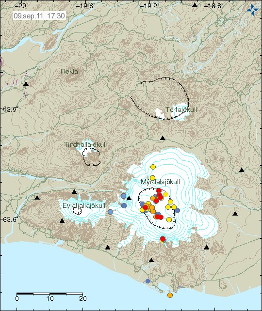
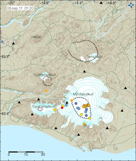
Earthquakes as they are tonight. The southern part of the caldera is having earthquake swarm, even if it is just an small one. Copyright of this picture belongs to Icelandic Met Office.

I am waiting too see how this develops. Something larger might happen. But nothing else might happen for an while in Katla volcano. The only thing that can be done is too wait and see what happens in Katla volcano.

Icelandic News about the road damage.

Meiri skemmdir en talið var (Rúv.is, Picture, Icelandic)

Harmonic tremor still high in Katla volcano

Currently harmonic tremor remains high in Katla volcano. But at the moment the harmonic tremor is dropping. Earthquakes have also stopped for the moment. But currently the harmonic tremor is well above the background level for this area. It is still not clear if this was an eruption or just hydrothermal areas clearing it self of extra water. But in the news at Rúv noon they did report that the ice cauldrons that are normally there had deepened over the past few weeks in Mýrdalsjökull glacier.

Update 1: Earthquake activity has stopped for the moment. But I am expecting it to resume soon. As I do not think that this event is over, even if it has just paused for the moment.

Three cauldron have formed in Mýrdalsjökull glacier and large cracks have formed around them. All traffic has been banned on Mýrdalsjökull glacier and the glacier that comes from it.

Here are the current tremor charts from Icelandic Met Office web page.


Harmonic tremor is dropping as can clearly be seen on this picture. Copyright of this picture belongs to Icelandic Met Office.


Harmonic tremor is dropping as can clearly be seen on this picture. Copyright of this picture belongs to Icelandic Met Office.


Harmonic tremor is dropping as can clearly be seen on this picture. Copyright of this picture belongs to Icelandic Met Office.

I am going to post update on Katla volcano later today and earlier if anything major happens.

News with picture of the Mýrdalsjökull glacier. It is covered with dark ash from Eyjafjallajökull volcano eruption last year and volcano ash from the eruption in Grímsfjall volcano 2011.

Miklar sprungur í sigkötlunum (mbl.is, Picture, Icelandic)
Svona lítur jökullinn út (Rúv.is, Icelandic, Picture)
Þrír greinilegir sigkatlar (Vísir.is, Icelandic, Picture)
Brúin rofnaði af í heilu lagi (Vísir.is, Icelandic, Picture)
Óvissa um hlaup eða lítið eldgos (Rúv.is, Icelandic, Pictures)

Blog post updated at 13:13 UTC 9. July 2011.

Glacier flood from Múlakvísl has been confirmed

According to the Icelandic news an glacier flood started around midnight in Múlakvísl (link should work, let me know if it doesn’t) glacier river that runs from Mýrdalsjökull glacier. Last time this type of event did happen was in the year 1955, when an minor eruption is believed to have taken place under the Mýrdalsjökull glacier. I do not know if that is the case now. As this might just be hydrothermal water being released due to increased activity in hydrothermal areas that are in Mýrdalsjökull glacier.

Following the flood there is an strong smell of sulphur and there might be dangerous gases in it. At current time the flood appears to be growing and according to the news (written at 01:54 UTC) the bridge was still safe. But there was just 1 meter from the river and up to the floor of the bridge.

Some minor earthquakes have been taking place in the past few hours, they do not appear on the automatic earthquake list on Icelandic Met Office web page. Some of them appear on my Hekla webicorder.

Currently the harmonic tremor is dropping. But that might not mean anything in the long run. So far everything suggests that an eruption has not yet started in Katla volcano. But given the current status that might not last long as it is. The best thing that can be done is to wait and see what happens. But no fear scaremongering please!

Added: When I just finished writing this blog post an new earthquake just started to appear on my geophone at Hekla volcano. IT is from Katla volcano for sure. It was in the ML1.5 to ML2.5 size range it seems. It was an long period earthquake as they have been so far. I think it is from the main caldera, not Goðabunga area.

Icelandic News about the glacier flood.

Hlaup hafið í Múlakvísl (mbl.is, Icelandic)

Harmonic tremor continue to increase in Katla volcano

When this is written around 00:36 UTC on 9. July 2011 the harmonic tremor levels on SIL stations around Katla volcano have continued to increase. The latest spike in harmonic tremor levels happened after an ML1.5 (automatic size) earthquake that took place at 22:13 UTC. There has been an small earthquake swarm in Katla volcano caldera yesterday. But the largest earthquake in that earthquake swarm had the size ML2.4.

The harmonic levels are getting so strong that they have started to appear on stations around Hekla and on my own geophone, even if it is located almost 60 km away from the source of the harmonic tremor. Currently there is little to suggests that this is slowing down at the moment. But that might yet happen. But it is impossible to know for sure at the moment.

The lack of earthquakes tells me that the magma has not yet reached the surface. When or if that might happen is an good question that I do not have the answer to. But this might take several more hours until something happens in terms of earthquakes or other activity in Katla volcano.


Harmonic tremor can clearly be seen on this SIL station at the end of the tremor chart. This is saved around 00:36 UTC 9. July 2011. Copyright of this picture belongs to Icelandic Met Office.


Harmonic tremor can clearly be seen on this SIL station at the end of the tremor chart. This is saved around 00:36 UTC 9. July 2011. Copyright of this picture belongs to Icelandic Met Office.

As sad before the harmonic tremor can now be seen on SIL stations far away from Katla volcano. But the maximum range so far is around 65 km or so at the moment.

This is the last update for tonight. I am going post an update tomorrow on what has happened during the night. Even just to say people that things have slowed down or gone back to normal. Whatever happens. I am going to post information about it tomorrow when I awake up.

Harmonic tremor in Katla volcano

At the moment there is an ongoing harmonic tremor going on in Katla volcano. It is just an small one, just above the background level noise floor. This is most likely an small dike intrusion. But nothing in the data from Icelandic Met Office suggests that an eruption has started in Katla volcano at this stage. But that might change without an warning, since this is an volcano after all. This change in harmonic tremor does not seems to be created by an glacier flood of some type. What is interesting is that this harmonic tremor pulse looks like an harmonic tremor pulse detected in the year 1999, just before an small eruption took place in Katla volcano southern caldera rim.

This harmonic tremor is in the high frequency range at the moment. But no change has been seen in the low frequency range at the moment. This is the same thing that did happen in the year 1999. At the moment however it is too early to know what is going to happen in Katla volcano for sure. All that can be done is to watch and wait. This might quiet down, or it might not. Only time is going to tell us what happens next. At the moment the harmonic is falling at fast rate, so this might be over.

Before the harmonic tremor pulse there was an earthquake swarm in Katla volcano caldera. The largest earthquake was ML2.1 and that was an long period event, but that tells me that magma was the source of this earthquakes in Katla volcano caldera. There where two earthquake swarms in the caldera today, but that makes total of three earthquake swarms in the Katla volcano caldera since the beginning of June.


The two earthquake swarms that took place in Katla volcano caldera today. Copyright of this picture belongs to Icelandic Met Office.


The only earthquake that I did record out of this earthquake swarm. This earthquake was ML2.40 with the depth of ~400 meters. This plot is filtered at 1Hz . This picture is released under Creative Common licence. See Licence web page for more detail.


Spectrogram of the ML2.4 earthquake in Katla volcano from this morning. This is filtered from 1Hz. This picture is released under Creative Common licence. See Licence web page for more detail.


Harmonic tremor can clearly be seen at the end of this tremor chart from the Icelandic Met Office. Copyright of this picture belongs to Icelandic Met Office.


Harmonic tremor can be seen at the end of this tremor chart from the Icelandic Met Office, but it is not clear at this SIL station. Copyright of this picture belongs to Icelandic Met Office.


Harmonic tremor can clearly be seen at the end of this tremor chart from the Icelandic Met Office. Copyright of this picture belongs to Icelandic Met Office.


Harmonic tremor can clearly be seen at the end of this tremor chart from the Icelandic Met Office. Copyright of this picture belongs to Icelandic Met Office.


Harmonic tremor can be seen (not clearly) at the end of this tremor chart from the Icelandic Met Office. Copyright of this picture belongs to Icelandic Met Office.


Harmonic tremor can clearly be seen at the end of this tremor chart from the Icelandic Met Office. Copyright of this picture belongs to Icelandic Met Office.

The harmonic tremor is strong enough on many SIL station to go above the background noise level on the SIL stations (wind, ocean waves etc..). But this is not an strong harmonic tremor. They can be stronger.

This does NOT mean an eruption is imminent in Katla volcano. What this does mean that is an magma is on the move inside the Katla volcano. What happens at later time is something that nobody can guess at current time. But it is now time to watch Katla volcano even closer.

It is also important to notice that nobody really knows how Katla volcano behaves before an eruption. We only get those answers after an eruption in Katla volcano. For the moment we can only wait and see what happens in Katla volcano.

I am going to post more updates if anything interesting happens. Also, there seems to have been an Long period earthquake at 22:14 UTC, most likely in Katla volcano. It appeared on my geophone close to Hekla volcano. I am guessing the size of this earthquake is ML2.0+.

Blog post updated at 22:39 UTC. Spectrogram picture added.

Update on Hekla volcano status

Here is an update on Hekla volcano. First of, for the moment the inflation in Hekla volcano is deflating at the moment. This is following the same pattern as before last time this did happen. But that does not mean this might not happen again soon. For the moment, nobody knows what exactly is going on inside Hekla volcano as there are no earthquakes following this inflation period. The magma that is on the move down there is most likely moving deep down in the crust also, as Hekla volcano does not have shallow magma system that I know of (or is known of anyway).

What did happen inside Hekla volcano was most likely an dike intrusion somewhere in the volcano system. This dike intrusion did not create any earthquakes, that suggests to me that it was travelling trough an old dike system already in place inside Hekla volcano system. This is most likely to happen again in Hekla volcano, if that starts an eruption is hard to know for sure.

In regards to possible ash cloud from eruption in Hekla volcano is impossible of know for sure now what happens in next eruption. There might be an ash cloud, but then again there might not be. All that can be done is to wait and see what happens in the next days, weeks or years.


The GPS movement of Hekla volcano. The inflation and the deflation can clearly be marked here. There is an inflation spike around 2011.45 on this plot. But this did also happen in April/May I think (but it might be wrong). Daily updated chart can be found here. Copyright of this picture belongs to Icelandic Met Office.

It is also important to notice that Civil Emergency Authority (Almannavarnir) in Iceland advice against it travelling up to Hekla volcano at current time. Since an eruption can start in Hekla volcano without any warning at all and the maximum time that people have evacuate the mountain is from 1 hour and up to 1 hour and 30 min. No more then that. Being on top of Hekla volcano when an eruption starts is deadly to everyone. If you want to go up to Hekla volcano. Please let somebody know about and have an fully charged mobile phone with you at all times. As the Civil Emergency Authority send out an SMS message to all mobile phones in the area around Hekla volcano if an eruption is starting (I think they do that).

Icelandic News.

Almannavarnir: Hekla tilbúin í gos (Rúv.is, Icelandic)
Almannavarnir vara fólk við Heklu (Vísir.is, Icelandic)

Harmonic tremor pulse in Katla volcano

There appears to be an harmonic tremor pulse going on in Katla volcano. While I currently do not think that this is going to start an eruption. It is worth watching this harmonic tremor pulse in Katla. But in the year 1999 this type of activity did result in minor eruption in Katla volcano on the 17. July that year (it is believed).


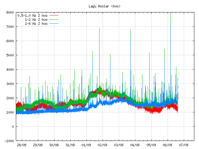
Harmonic tremor pulse can be seen on the SIL station Lágu Hvolar. Copyright of this picture belongs to Icelandic Met Office.


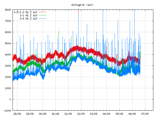
Harmonic tremor pulse can be seen on this SIL station Álftagröf. But it is hard too see it then on Lágu Hvolar. But that suggests that this tremor pulse is in fact quote weak one. Copyright of this picture belongs to Icelandic Met Office.


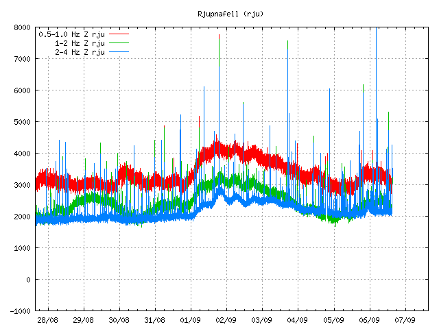
Harmonic tremor pulse can be seen on this SIL Rjúpnafell. It is more stronger signal then on Álftagröf, so it suggest that the source of this tremor pulse is closer to this station then on Álftagröf. Copyright of this picture belongs to Icelandic Met Office.

All pictures are from 16:28 UTC on 12. June 2011.

On other station around Katla volcano I do not see this harmonic tremor pulse on the Icelandic Met Office on-line tremor chart. But that does not mean that it this tremor pulse is not being detected on other SIL stations around Katla volcano.

The source of this tremor pulse is most likely an dike intrusion at great depth inside Katla volcano that is taking place without any earthquake activity. This has happened before without resulting in an eruption from Katla volcano (besides the event in the year 1999). I do not think that this means an eruption is going to happen soon. But this might signal that Katla volcano is about enter an more activity phase then in last few decades. But if that is going to turn out that way is something that only time can answer.

Eruption in Grímsvötn appears to be over (hopefully correct this time around)

It appears that the eruption in Grímsvötn / Grímsfjall volcano is over or is about to end, but authorities in Iceland might not declare the eruption over until after next weekend. No ash plume has been observed for over 24 hours now from Grímsfjall volcano. Harmonic tremor pulses are still taking place in Grímsfjall volcano and it is still dangerous to get close to the eruption site. As explosion still take place in the eruption area and that makes going there dangerous. It is not only the area where the water is that is having explosions. There are also gas and explosions taking place in the crater rims and nearby area. According to news today Icelandic Met Office did stop recoding the eruption in Grímsfjall volcano around 07:00 UTC this morning (28. May 2011). But harmonic tremor pluses might still be taking place in Grímsfjall volcano. But the SIL stations around Grímsfjall volcano have now started to record background noise again, including the SIL station at Grímsfjall volcano.

Earthquake activity has continued at similar levels as before the eruption took place. I am not sure why that is. But this might indicate that Grímsfjall volcano has already started to prepare it’s next eruption. But when that might happen is a question that only time is going to answer. The main earthquake activity is currently taking place NW of Grímsfjall volcano, and SW of Grímsfjall volcano.

According to automatic GPS data it appears that Grímsfjall volcano has started to inflate again. This inflation appears to be rather rapid at current moment. But it appears to be close to 1mm/day inflation to the south and east. This means that new magma has already started to flow into Grímsfjall volcano magma chamber and magma system from greater depth. So far Grímsfjall volcano has not started to inflate upwards and it might be an while until that happens, as there might be enough space for the magma to move into inside Grímsfjall volcano.

Measurements of the volcano tephra that did fall, along with measurement of the volcano ash that did fall have recorded the depth up to 170 cm in some areas of Vatnajökull glacier even at distance of 8 km from the eruption site. This is going to create problem in the summer when it is dry and the wind blows this volcano ash around Iceland. But mostly in the areas that where closest to the main ash fall areas.

Update 1: According to news on Vísir.is the Icelandic Coast Guard did see an plume with the hight of 1,5 km yesterday. This plume was however mostly made out of steam rather then volcano ash. The news about this can be found here, along with an picture of the plume. Here is an second news of this steam plume that was seen yesterday.

Update 2: According to news on Rúv there is small harmonic tremor being recorded. But most of the time, no harmonic tremors are being detected from Grímsfjall volcano. The Rúv news can be found here (Icelandic, Picture). It also has an new picture of the eruption crater. But this picture was taken around 10:00 UTC today (28. May 2011).

Icelandic News about this. Use Google translate on this for an risky translation.

Eldgosið mælist ekki lengur á jarðskjálftamælum (Vísir.is, Icelandic)
Enginn gosmökkur í dag (From 27. May 2011, Rúv.is, Icelandic)

Blog post updated at 19:11 UTC.
Blog post updated at 20:15 UTC.

Explosions are still taking place in Grímsvötn crater

While the activity has almost stopped in Grímsfjall volcano, but there are still explosions taking place in Grímsvötn lake where the eruption took place due to magma going up, explosions take place all over the fissure at random times. That makes travelling to this area really dangerous thing to do. Ash fall is still taking place in Grímsfjall volcano when explosions take place. But the ash fall is limited to the local area in Grímsfjall volcano. Because of this, the official word is that the eruption is not yet over. Even if it just an small eruption at the moment. So far there is no data that suggests that new magma is currently flowing into Grímsfjall volcano. This is according to news in Icelandic media.

An new caldera (correct word?) has formed in the glacier close to the eruption site. But that suggests that a lot of heat is below in the glacier and is creating strong melt where this taking place. This is according to news on Rúv. But they don’t say where this glacier melt is taking place. But it can be assumed that this formation is somewhere close to the current eruption site. But when I know more about this location. I am going to update this post when I can.

Harmonic tremors pulses are still being detected from Grímsfjall volcano up to 200 km away from the volcano. Why they are still taking place while there is no eruption taking place is unknown to me. It is important to notice that currently the harmonic tremor is slowly dropping for now. But it might increase again without any warning. For now there is no way to know what this tremor means for Grímsfjall volcano.

Automatic GPS data from Icelandic Met Office tells an interesting story. According to this data (it might not be 100% accurate due to nature of GPS) Grímsfjall volcano has moved close to 320mm to the west, close to 350mm to the north, it has also lowered down about 250mm. This is major movement in Grímfjall volcano. To compare it with something, Eyjafjallajökull volcano only inflated about 60mm before it did erupt. This is many times more deflation that took place in Grímsfjall volcano then in Eyjafjallajökull volcano for example.

Earthquakes are still taking place SE and SSE of Grímsfjall volcano. There is no volcano at this location. So I am assuming that this are tectonic earthquakes taking place due to stress changes in the crust around Grímsfjall volcano. All earthquakes so far have been small but with the depth from 15 and up to 5 km.

Extra: According to new news (while I was writing this blog post). The Civil Emergency Authority in Iceland has lowered the alert level from danger level to alert level. News about that can be read here (Icelandic, mbl.is)

Icelandic News about this. Google Translate in an maze. It might work or maybe not.

Enn sprengivirkni í Grímsvötnum (Rúv.is, Icelandic)
Jarðeðlisfræðingur: Orðum ofaukið að gosinu sé lokið (Vísir.is, Icelandic)