I am sorry for lack of blog posts for the past few days, the reasons for this lack of blog post is that it has been quiet in Iceland for past two weeks. Money issues have also been heavy on me for the past few months and it drains you slowly, but it does drain you in the long run. This has affected my writing in the short term, both here on this blog and what I am creating in my short stories and books, so this have become self feeding circle that is hard to break out of, I just hope to break out of it soon. I did get a large donation this month, it has helped me greatly in paying down some of my debt and in the progress lower my monthly payments down a little. I also got a help from people I know here locally (this was before I got the donation and was expecting to survive on €30 for the rest of this month).
Some of my loans are also going to be paid up soon, I for instance only have three payments left on my washing machine. With the last payment due to take place in August. This is going to make my life a bit more easy, since it lowers my payment threshold a bit. I still have some big debt to pay down and it is going to take some time to pay it down. Since my social welfare from Iceland is low and I do not expect it to improve any time soon. I am going to pay down my debt faster as my income increases, but it might take a while until that happens.
Getting into money issues have been a bit of a drag for me, not surprising since often I have had no money for food in the past several months (8 months as it now stands). Some months have been worse then others, this is not a budget issue as such. I am currently having stripped budget and not spending anything extra if I can avoid it. This is going to be a temporary measure for me, I am going to end it once my income has increased to such levels that I am no longer poor. When that is going to be I do not know, it depends on how my books and short stories are going to be doing in the book market, the book market is not a easy market to work with. Since there are many writers out there and a lot of publishing taking place every day of the year.
As for moving again, it is not going to happen for the next few years. Since I am going to stay here in Bov, Padborg for the next few years, I might in the end just stay here for the rest of my life. I am not sure what I am going to do in the long run. I often change my mind, since I sometimes have issues with figuring my self out. I am bit open about it, and that bother some people who do not like my sudden change of heart.
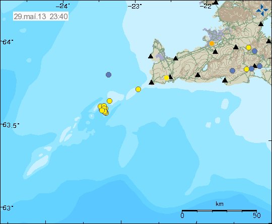
Earthquake swarm deep on Reykjanes Ridge on 19th of May
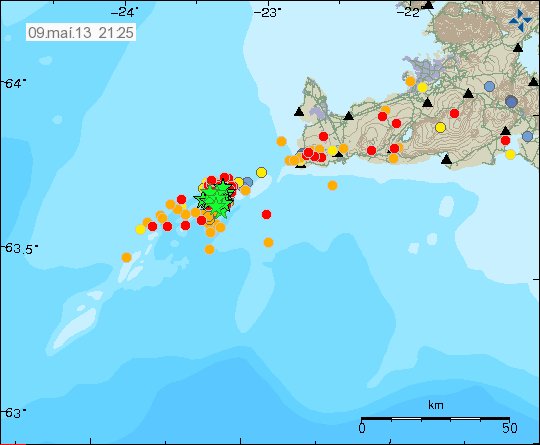
During late night on 19th of May a magnitude 4.2 earthquake too place deep on the Reykjanes Ridge, a total of three to four earthquakes where detected on my geophone network at the time. I do not have exact magnitude for those earthquakes, I am guessing there magnitude was around 2.9 to 3.5 at least, it is not confirmed as is and it might never be confirmed. EMSC has more information on the magnitude 4.2 earthquake here.
Increased volcano monitoring in Iceland
BBC News has interesting news article about increased volcano monitoring in Iceland, due to the eruption of Eyjafjallajökull volcano in the year 2010. There is a ongoing project in Iceland with BGS and IMO to increase the monitoring of Iceland volcanoes, I do not know what volcanoes they are going to increase the monitoring. It can be assumed it is going to be the most active ones, Katla, Hekla, Grímsfjall and so on. I do not know what they are going to do about less active volcanoes like Snæfellsjökull and other volcanoes in that area, currently Snæfellsjökull volcano is not being monitored at all, or other volcanoes on the Snæfells peninsula. This increased monitoring of volcanoes in Iceland is going help detect when volcanoes are ready to erupt, or just play a simple bluff on the monitoring system.
The BBC News can be found here below. I recommend watching the video that is with this news article.
Volcano project scours Iceland for early warning signals (BBC News)
