Before I start. I want to remind people that donations are import to me. Since they help me keeping this blog and my earthquake web page up and running.
Hekla volcano earthquake activity
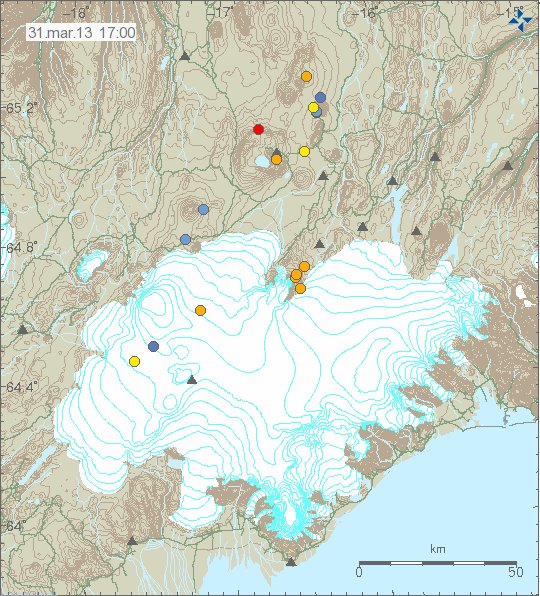
A minor earthquake activity took place in Hekla volcano yesterday. None of the earthquake was larger then ML1.2. The depth of this earthquake activity was around 8.4 km. This earthquake activity took place outside the main volcano. But was in the connected fissure swarms that extends from Hekla volcano.
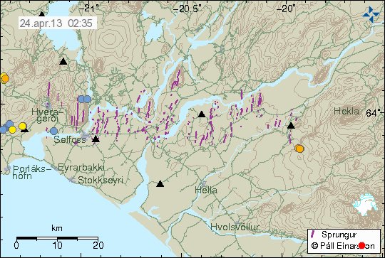
Earthquake activity in Hekla volcano system. The earthquakes are the orange dots just south-west of Hekla volcano. Copyright of this image belongs to Icelandic Meteorological Office.
Earthquakes have been taking place in this area for few years now. I do not know what they mean. This might just be a earthquake activity and nothing else. Uncertainty level has been canceled for few weeks now due to lack of any more activity in the main Hekla volcano.
Askja volcano
There has been minor earthquake activity in Askja volcano this past weeks. All of the earthquakes have been smaller then magnitude 1.5. Depth of this earthquakes is around 18 to 22 km. Suggesting that current earthquake activity has its source in magma movements rather then tectonic earthquakes.
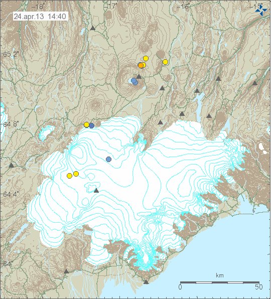
Earthquakes in Askja volcano. Askja volcano is the volcano north-east of Vatnajökull glacier. Copyright of this image belongs to Icelandic Meteorological Office.
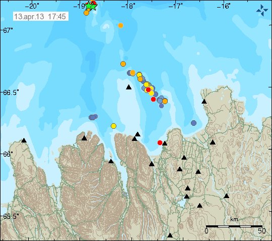
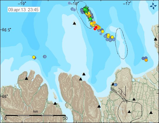
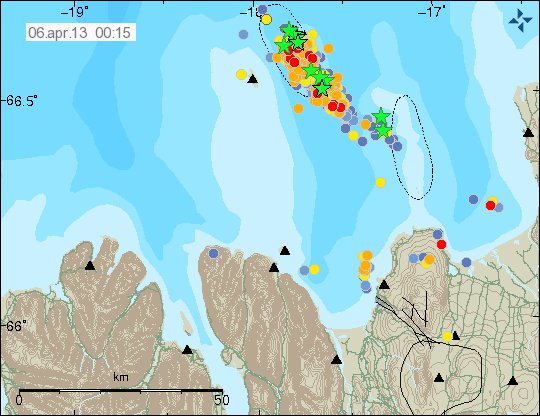
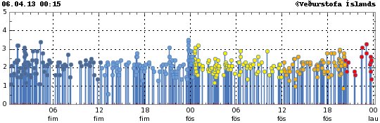
Tjörnes Fracture Zone
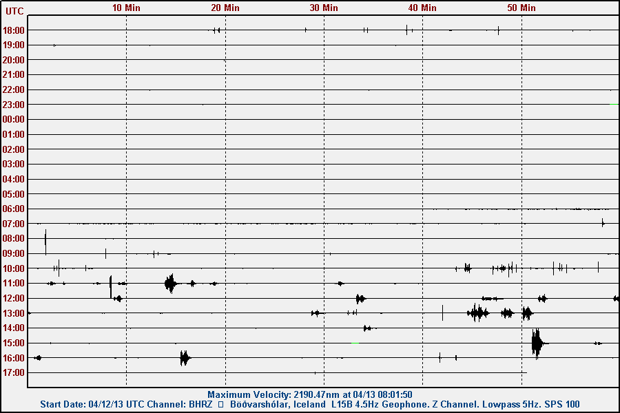
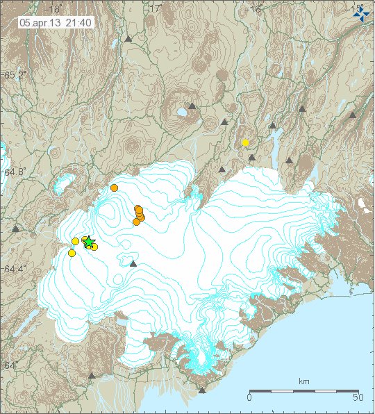
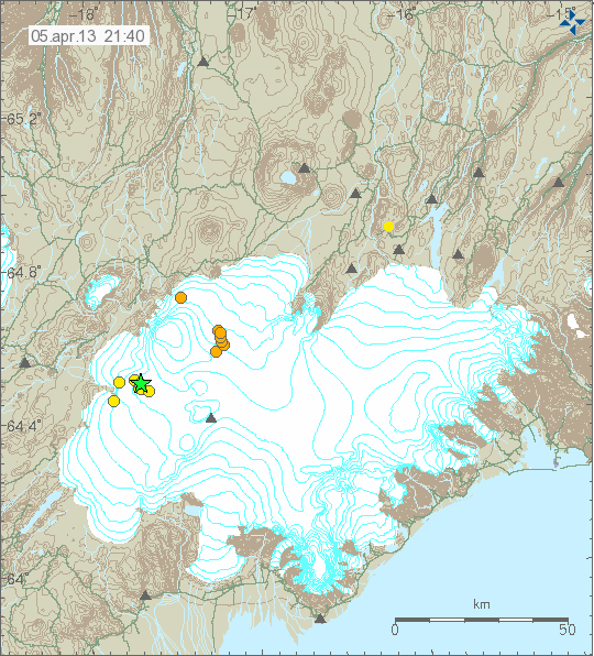
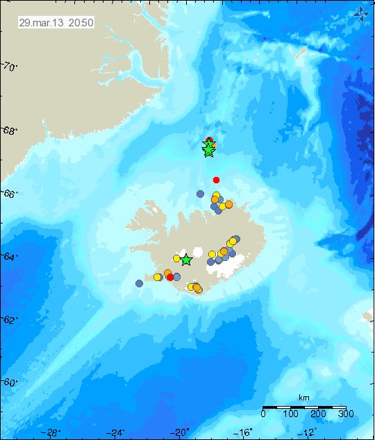
Activity in Tjörnes Fracture Zone has slowed down since 2. April when a large earthquake swarm started in it. But earthquake activity remains as is. Even if the earthquakes are smaller and fewer. This means the earthquake activity has been continuous for the past three weeks.
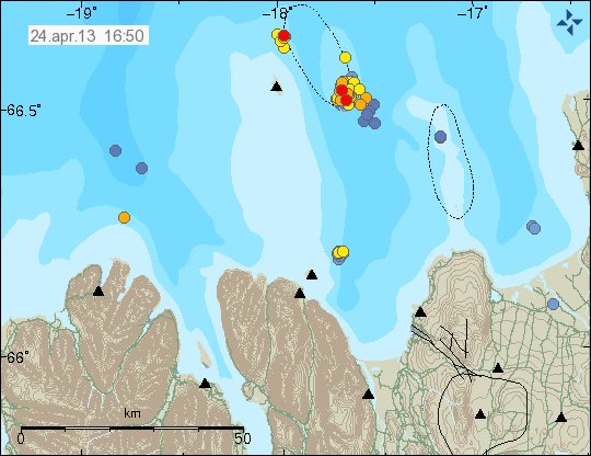
Earthquake activity in Tjörnes Fracture Zone. It remains in two areas as of now. New activity has also been taking place. Copyright of this image belongs to Icelandic Meteorological Office.
It is difficult to know for sure what happens next in TFZ. But tension in it remains as before and so does the risk for larger earthquake in this area. For the moment however, it remains rather quiet. When that might change is impossible to know for sure.
Blog post updated at 18:16 UTC on 24.04.2013.