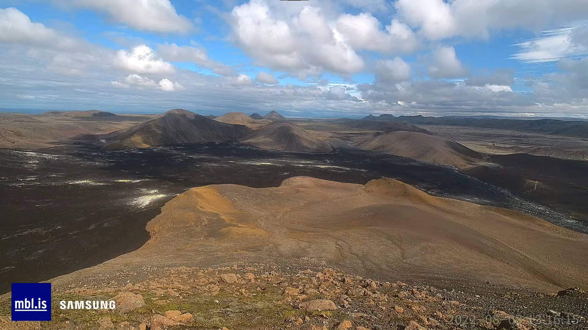
This is a short update on Meradalir valley/Fagradalsfjall mountain eruption at 21:25 UTC on 3-August-2022.
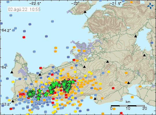
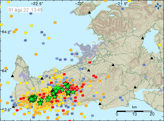
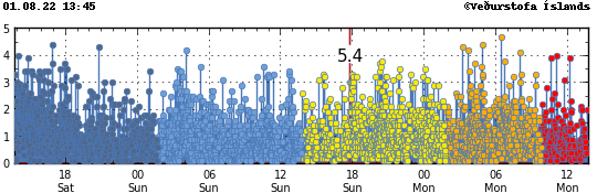
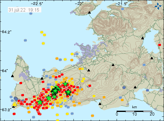
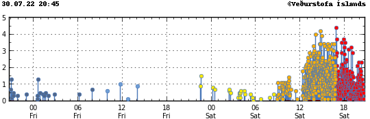
Most of the fissure that started erupting at 13:16 UTC in Meradalir valley, just north of the old crater in Geldingadalir in Fagradalsfjalli mountain (Icelandic location names are long) is active after few hours of activity. Earthquake activity is now slowing or stopping almost completely as is the same thing that happened in 2021 after the Fagradalsfjall mountain / Geldingadalir valley eruption started.
The most northern part of the eruption fissure already seems to be shutting down. How fast that happens I don’t know, but there seems to be a crater started to form at the south end of the eruption fissure. At least for now. The news report at Rúv today noted that people where walking over a patch of land that was releasing gas and thermal camera showed the ground to be warmer than normally. This strongly suggests that an eruption might start at those location without warning. I don’t know exactly where those locations are, but they must be in the walking path, placing them south of the 2021 eruption crater.
Donations
Please remember to support my work with donations. August is going to be a broke month for me, since I am always broke because of my low income. Thanks for the support. 🙂