Update on Grindavík for 28. November 2023

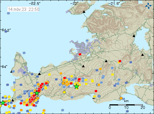
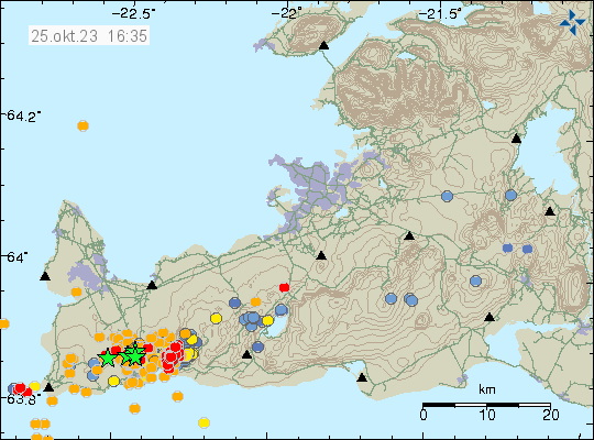
This is a short update for Grindavík and nearby area on 28. November 2023. This article is written at 23:22 UTC. This is a short update and information here can go outdated quickly and without warning.

Last few days have been quiet with little or few earthquakes. There have been earthquake swarm activity at times, suggesting that magma is trying to push at faster rate into the crust at Sundhnúkagígar and Sundhnúkar mountain. I don’t know what the current rate of magma inflow is.

Daily information

  • Magma continues to flow into the dyke. I don’t know how fast that rate is.
  • The dyke is wider than originally thought. This means it cools down more slowly. The dyke is widest around Sundhnúkar and Sundhnúkargígar area.
  • Eruption can start without warning in Sundhnúkar or Sundhnúkargígar and that area.
  • New cracks continue to form in Grindavík, along with sink holes and other issues that is creating.
  • Inflation at Svartsengi is around 10mm/day and up to 40mm/day. Currently, the inflation has slowed down to 10mm/day. This can change without warning.
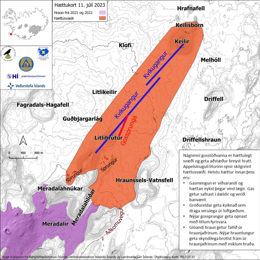
  • Top of Keilir mountain has moved according to the news. I don’t know how much. But this is a displacement.
  • Rocks with the size of mobile homes have moved and rolled down from mountains.
  • Cracks are forming in a wide area around the dyke according to the news. Making it dangerous to travel in the area around Grindavík because of this new cracks in the ground.

The event in Grindavík and nearby area is not over. It is ongoing, this is just a quiet time period that is currently happening. This quiet time period is going to happen frequently in the Reykjanes volcano system. I don’t know why that is the case, this is the reality of what is going on.

Article updated at 23:56. I forgot to add few things.

Update on Grindavík 17. November 2023

This is a short update on the situation in Grindavík on 17. November 2023. Information here can go outdated quickly and without warning.

Daily updates

  • Grindavík town continues to sink as the rift valley continues to move. The speed of sinking has slowed a little according to the news today.
  • Earthquake activity has slowed down in last few hours (this is written around 22:51 UTC). What that means is unclear.
  • Some houses in Grindavík town have been completely destroyed. Iceland has a natural disaster fund for this type of situation and that is going to cover the owners loss according to the news.

General update

It took me a week. But it seems that this dyke intrusion under Grindavík town is because of the magma sill (dyke) under Svartsengi. That area has inflated around 110mm in a week. That is a inflation of 15mm/day based on my best calculations. That is a lot of inflation, since before 10. November the inflow of magma into Svartsengi was at most 8m3/sec according to measurements of Icelandic Met Office.

The sill in Svartsengi created a lateral dyke in Sundhnúkar and nearby areas. When the pressure in the sill is high enough again it is going to push the magma into the dyke at Sundhnúkar again with the same force as it did before. How long that takes I don’t know. Last time this was from 25. October to 10. November. That’s seventeen days, but there was a lot of deeper sills in Svartsengi and its impossible to know much, if anything flowed form them into the dyke. This is my personal view, it might be wrong. But this is what I am reading from the data.

Risk of the eruption remains high because there’s a ongoing inflation at Svartsengi. When a eruption starts is impossible to know.

If anything happens. I’ll post update soon as I can.

Update on Grindavík 15. November 2023

This is a short update on what is happening in Grindavík on 15. November 2023. Information here might go outdated quickly.

In general, not much has changed since yesterday (14. November 2023).

  • There’s no change in earthquake activity. Strong wind in the Reykjanes peninsula might be masking some of the smaller earthquakes.
  • Part of the harbour area has started to sink according to news. I am not sure how much, but I think it might be considerable sink.
  • Speed of the sink in some areas of areas inside Grindavík has increased from 7 cm for each 24 hours to 12 cm for each 24 hours since yesterday. Some areas inside Grindavík have lowered as much as 2 meters or more.
  • Inflow of magma into the dyke continues to be at 75 m3/second according to news reports today. This is a lot of magma inflow into the dyke. The eruption in Holuhraun in 2014 and 2015 had an flow of 90 m3/sec when it was the most.
  • It is reported on mbl.is that it is now considered that magma might be flowing directly from the main magma chamber at 20 km to 40 km depth under this location in Reykjanes peninsula. That news is in Icelandic here.
  • Parts of Grindavík town has lost power, hot and cold water because of sinking of the ground and movements. Emergency repair is going to be attempted tomorrow if it is safe.
  • Eruption might happen at Sundhnúkar and Hagafell, where the highest flow of magma is happening according to Icelandic Met Office and the news.
  • Eruption at many craters at the same time is what is going happen here. Based on what I am seeing. That means more lava covering larger area quicker than the small eruptions in Geldingadalir, Meradalir and at Litli-Hrútur. Where it was just one crater and a small eruption.
  • Something is holding back the magma from reaching the surface. What that is unclear. But magma is at shallow 500 meters or less according to measurements done by Icelandic Met Office. This shallow depth means that magma can start erupting without much warning or notice in the dyke.

There is a chance that parts of Grindavík town might sink under the ocean because of the ground sinking. When eruption starts, what goes under lava depends on where the eruption is going to start and where the lava is going to flow. Both are random events that is impossible to know anything about.

If anything happens. I’ll post update soon as I can. If anything happens tomorrow I’ll write about it. Otherwise I plan on publishing next article on Friday 17. November 2023. Since changes at the moment are not that big changes between days currently.

Update on Grindavík on 14. November 2023

This is a short update on the situation in Grindavík and nearby area. Information here can go outdated quickly and without warning.

For the press media. Please contact Icelandic Met Office or Department of Civil Protection and Emergency Management for any important information or interviews. I already write everything I know here on this website as needed. Thanks.

  • The magma is at 400 meters depth, where it is at its most shallow.  I am not sure on location, but I think it is just north-east of Grindavík town.
  • There is strong wind on Reykjanes peninsula. That normally hides some of the smaller earthquakes happening. Icelandic Met Office continues to record 700 to 3000 earthquakes each day. Most of them are along the dyke and most of them are in the magnitude range of Mw0,0 to Mw3,1. With the stronger ones happening least often.
  • Inflow of the magma into the dyke is at the writing of this article around 73 m3/s to 75 m3/s. On Friday 10. November that inflow was 1000 m3/s.
  • Sulfur dioxide was detected today north of Grindavík. That suggests that magma might be at shallow depth in the dyke area.
  • News reports today did say that the area in Grindavík and nearby continues to sink around 7 cm over 24 hour time period. This might be uneven process depending on the area.
  • Lakes south of Grindavík have been seen growing, as the area continues to sink and get lower. It is a question of parts of this area is going to get flooded by the ocean soon. This is reported on Facebook by Eldfjalla- og náttúruvárhópur Suðurlands.
  • The GPS station just north of Grindavík has lowered by 1400mm since Friday 10. November 2023. The stations on the east are going up, some much as 1 meter. While the GPS stations on the west side are lowering.
Line of red dots shows all the small earthquakes, along with one green star on it. This show all the 15 km of the dyke.
The dyke as it appears on the earthquake map. Copyright of this image belongs to Icelandic Met Office.

This situation changes quickly and often from hour to hour. I’ll post new updates if something major happens, quickly as I can.

Article updated on 15. November 2023 at 00:21 UTC. – Removed information that might not be correct.

Update on the situation on Grindavík dyke intrusion

This is a short update, since the situation is changing quickly and without much warning. This just looks like it is quiet, it is not.

  • Grindavík town is sinking and parts of the town have lowered by as much 1 meter when this article is written. This is a large area, large enough to be called rift valley. This was reported by mbl.is here in Icelandic. This was just discovered today when some measurements where taken.
  • Magma might be as shallow as few dozen meters under the surface where it is the most shallow. This has been reported by mbl.is here in Icelandic. This is a live link and the news item in question might be removed or gone in few hours.
  • This is a event that was not expected. Most of the inflation until Friday 10. November 2023 had happened in Svartsengi (Reykjanes volcano) and in Fagradalsfjall volcano. There had nothing been happening at Sundhnúksgígar to the north-east of Grindavík. Until Friday 10. November at around 08:00 when a earthquake swarm started in that location. Originally it was though those where just tension related earthquakes, but that view (according to reports) changed early in the morning at Icelandic Met Office. Everything did go crazy in earthquakes between 16:00 until 19:00 on Friday. This earthquake swarm was really dense and many earthquakes with magnitude Mw4,0 took place inside Grindavík town.
  • There is damage in Grindavík, both roads and houses because of the displacement. Damages to pipes, electricity wires and other infrastructure.
  • The dyke seems to be few dozen meters wide and up to 1 meters deep. It might be different wide and deep at its 15 km length. I have not found any useful information about this. Just information on its length that was last time I checked, 15 km long.

This is not a small volcano event. What I don’t know and this doesn’t seems to be known. What volcano is causing this. This might be Fagradalsfjall volcano or this might be Reykjanes volcano.

String of earthquakes reaching from the ocean and under Grindavík town and to the north-east. This is the dyke that is causing a lot of problems in Grindavík. A lot of earthquakes to the west of this location. That is also having magma inflow. This is a map over seven day time period.
The earthquake activity over the last seven days. Copyright of this image belongs to Icelandic Met Office.

I’ll post more information about this when I know more or if anything more happens if I can.

Reykjanes volcano placed on Yellow warning level

The Reykjanes volcano has been placed on yellow warning level. This is because of sudden inflation that is now taking place north-west of Þorbjörn mountain. In slightly less than 24 hours the inflation did reach 30mm. This is the fifth time (as reported by Morgunblaðið) that inflation has happened in this area since the year 2020. This inflation now is a lot faster than earlier when this has happened.

Yellow triangle on the Reykjanes volcano on the Reykjanes peninsula. Other triangles, showing other volcanoes in Iceland are green.
The alert status for Reykjanes volcano is now yellow. Copyright of this image belongs to Icelandic Met Office.

This inflation in the Reykjanes volcano has the risk of creating stronger earthquakes in new locations on the Reykjanes peninsula and on the Reykjanes ridge in next few days to weeks. There is a ongoing inflation in Fagradalsfjall volcano and that has not stopped or slowed down since it started on 25. October 2023. It is not possible to know when or if an eruption in going to start in Reykjanes volcano, but how quickly this inflation is happening suggests that might happen. The location is not that good, if it erupts where the inflation is happening. The blue lagoon is nearby along with power plant and hot water energy plant in this area. Eruption in this location can result in major damage to infrastructure in this area.

Only thing that can be done now is to wait and monitor what is happening in this area.

New earthquake swarm in Fagradalsfjall volcano and in Þorbjörn mountain (Reykjanes volcano)

This article is going to get outdated quickly.

Current activity is also complicated and might not behave in the same way as earlier eruptions did. Largest earthquakes at writing of this article have had magnitude of Mw3,5 and Mw4,5. Larger earthquakes can be expected without warning. There have been around 1000 smaller earthquakes at the writing of this article.

Green stars close to Þorbjörn mountain and a lot of red dots in south part of Fagradalsfjall volcano. There is also green to west of Þorbjörn mountain.
Earthquake activity in Fagradalsfjall volcano and Þorbjörn mountain. Copyright of this image belongs to Icelandic Met Office.

There is a good chance this events are not going to behave the same way as happened in earlier eruptions, because the location is little bit difference and that can result in a lot of change on what happens when magma pushes it self up through the crust. The earthquake activity close to Þorbjörn might be a mixed earthquake activity of tension breaking earthquakes and magma pushing it self up. GPS data doesn’t show any inflation close to Þorbjörn mountain at the writing of this article.

Earthquake activity is increasing in south part of Fagradalsfjall volcano, this is area in Nátthagi, Nátthagakriki and other nearby area. There is a dyke intrusion in that area and has been a while. That dyke intrusion might be about to erupt. There is a lot of uncertainty going on at the writing of this article. There is also a pattern of high and low in the earthquake activity, this has been the pattern in the earthquake activity before the earlier eruptions.

I’ll write updates about this activity as needed. It might take a while, since I always try to figure out what is going on before an article is written.

Increased hydrothermal activity between Keilir mountain and Trölladyngja mountain

Rúv News is reporting today (10. September 2023) that there has been noticeable increase in hydrothermal activity east of Keilir mountain since end of least eruption close to Litli-Hrútur mountain. According to the news, this shows that magma is now close to the surface without erupting currently. This area is rather large, it is between Keilir mountain and Trölladyngja mountain (part of Krýsuvík-Trölladyngja volcano). There have been reports of increased SO2 vents that is killing moss in this area, along with new steam vents that have been appearing in the last few weeks.

According to Þorvaldur Þórðarson volcanologist, there is a magma shadow in the area around Trölladyngja and that appeared around the time the eruption close to Litli-Hrútur started. This area was noticed by Thomas Fisher earthquake expert from Czech Republic did notice this area having almost no earthquakes at all. Showing that magma has pushed it self into the crust at this location at shallow depth.

The result of this is that next eruption might have more eruption vents, it might erupt at more than one fissure at the same time in parallel. What happens next is unclear, but this large area has gotten really warm and seems to be continuing to expand.

Rúv news

Fylgjast vel með auknum jarðhita austan við Keili (Rúv.is, has map of the area)

Update on the eruption close to Litli-Hrútur on 23. July 2023 at 21:22 UTC

This is a short update. Since there is not a lot of information about this.

  • The crater might collapse at any time without warning. Geologists that monitor the eruption have noticed that the crater has started to get larger and is now full of lava. This means it is going to collapse. What direction is not known. It is my view that it is going to collapse to the east because of least resistance in that direction.
  • When the crater collapses the lava is going to flow more than 100m/s in whatever direction it flows.
  • Tourists are in high danger close the crater because of this collapse risk.
  • Dyke intrusion has been detected east of Keilir mountain. Along with increased ground temperature, that means the magma is at shallow depth in the crust. This area might erupt soon in similar way as is now happening close to Litli-Hrútur.

This is all the information I have now and only thing that has changed in the eruption in the last 13 days.

Icelandic News

Veggir gígsins muni hrynja innan skamms (Vísir.is)

Update on the eruption at Litli-Hrútur on 11th July 2023 at 17:18 UTC

This article is short. The eruption is mostly stable at the writing of this article but the situation can change quickly without warning.

  • The eruption has changed in last few hours. It seems to be in only one crater that is slowly forming. The eruption has stopped at the north most end of the eruption fissure. At the writing of this article.
  • The dyke now extends 1 km under Keilir mountain in the direction of north-east. This might be a new dyke intrusion and not connected to the dyke that started the current eruption. This might result in a second eruption soon, but its too early to know for sure at the writing of this article.
  • The eruption started large fires in the moss and other plants in this area around Litli-Hrútur. This has resulted in massive toxic smoke in this area.
  • There’s a high risk of the volcano gas from the eruption, along with the toxic smoke from all the plants and moss burning.
  • Interestingly, while earthquake activity has dropped it has not stopped. Why that has happened is a bit of a mystery, it might be connected to the possible new dyke that has formed under Keilir mountain.
  • Yesterday (10. July 2023) the longest the fissure extent was at 1500 meters or 1,5 km. Since then it has gone down to one erupting crater that seems to be 50 meters to 100 meters long.
Map of the magma dyke and the eruption fissures on a map from Icelandic Met Office and others. Orange area between Keilir and to Meradalir valley show the danger area around the eruption area.
Map of the danger area around the eruption. The orange area is the danger zone that people should not travel over. Copyright of this image belongs to Icelandic Met Office and others.


It is impossible to know how long this eruption is going to last. Since dyke intrusions are poor magma containers this eruption might be a short one if there isn’t a constant supply of fresh magma from the deep mantle. Its too early to know if that is the case here. I have also noticed that once the eruption ends in any area, that area is not going to erupt again. When the eruption ends, it ends forever and that makes this a single eruption activity or crater rows. This area might be Monogenetic volcanic field (Wikipedia).

Since this type of eruptions are mostly uneventful and just continue. I plan on only posting updates when there are some news or changes to the eruption happen.

Update at 17:41 UTC

ISOR is reporting that their station called FAF (Fagradalsfjall) has to be moved because the lava is flowing directly at it. They are going to find a new location for this station. This report can be seen here on Facebook in Icelandic.