Update on earthquake activity in Fagradalsfjall mountain area on 2-August-2022

This is a short article because the situation changes constantly.

This was not a night where many people in Reykjavík got a good night sleep. A magnitude Mw5,0 earthquake took place at 02:27 UTC and was felt in Reykjavík, few seconds earlier a magnitude Mw4,7 earthquake took place. Earlier three earthquakes with magnitudes of Mw4,3 to Mw4,5 had taken place, this was just around midnight and was also felt in Reykjavík. Over 10 000 earthquakes have been recorded since Saturday when this all started. The earthquake activity during the night was at the western end of Kleifarvatn lake and was for that reason felt clearly in Reykjavík. Minor damage was reported with the earthquake around midnight. Other reports of damage have not been reported so far.
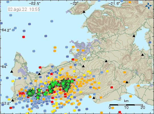
Heavy green stars on Reykjanes peninsula, all over and closest to Reykjavík at Kleifarvatn lake
Heavy earthquake activity on Reykjanes peninsula. Copyright of this image belongs to Icelandic Met Office.

The strong earthquakes during the night where fault earthquakes, that happen because of the inflation that is now taking place north of Fagradalsfjall mountain. GPS data has also been showing a interesting patter. There is now a deflation taking place in Gónhóll and the crater, while that area also seems to be on the move north (?). The 24 GPS data can be viewed here and 8 hours GPS data can be viewed here.

This earthquake activity is going to continue until an eruption starts. When that happens is impossible to know. More stronger earthquakes can be expected in next few hours and days on Reykjanes peninsula.

Donations

Please remember to support my work. That stops me from being broke and I don’t need many donations to stop being broke. Thanks for the support. 🙂

Update on 1-August-2022 on the earthquake swarm in Fagradalsfjall mountain

This is a short update on the earthquake swarm in Fagradalsfjall mountain and nearby area. This is written on 1-August-2022 at 13:47 UTC.

The situation on Reykjanes peninsula is always updating so information in this article can be in part or in whole get obsolete quickly. Largest earthquake during the night had a magnitude of Mw4,7. This might not be the largest earthquake today, since larger earthquakes are always a possibility.

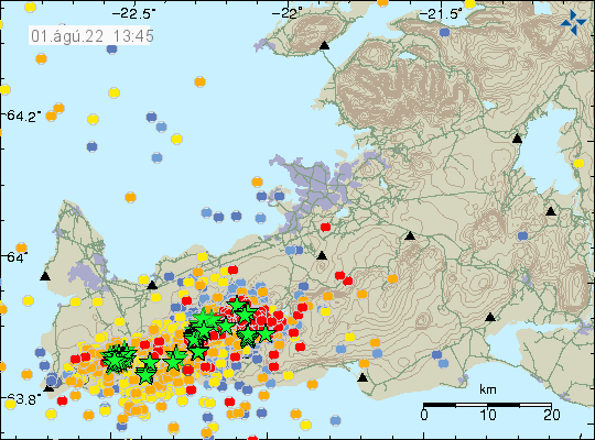
A lot of green stars on Reykjanes peninsula along with red dots that show the heavy earthquake activity that is now happening there
Strong earthquake activity on Reykjanes peninsula. Copyright of this image belongs to Icelandic Met Office.
Time trace of the strong earthquake activity in the last 48 hours. Dark blue dots, blue dots, yellow dots with a magnitude 5,4 earthquake line in it, orange dots and red dots show all the earthquakes. This earthquake activity is really dense
Time trace of the earthquake activity in the last 48 hours. Copyright of this image belongs to Icelandic Met Office.

GPS data have started to show a large displacement over the last 48 hours. The 24 hour GPS displacement can be found here and 8 hour GPS displacement data can be found here (find Reykjanes peninsula). This shows that magma is pushing its way though the crust at fast speed, but has not yet broken up trough the crust. When that happens is impossible to know, but this might not be a long wait based on the speed the magma is going. Current depth of the magma is around 2 to 4 km.

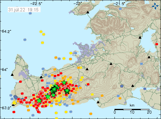
Magnitude Mw5,4 earthquake 3,2 km east of Grindavík town

Today (31-July-2022) at 17:48 UTC an earthquake with magnitude of Mw5,4 took place 3,2 km east of Grindavík town. This earthquake was felt over a wide area of Iceland and all the way to Westfjörd in few towns that are there. Damage has been reported in Grindavík town, with cold water main breaking and damage to house items, damages to houses is unclear at the writing of this article. New news reports show that items in grocery stores have been thrown out of their shelf.

The red dots continue to grow on the Icelandic Met Office earthquake map. Green stars are also many on this same map of Reykjanes peninsula
The earthquake activity on Reykjanes peninsula and close to Grindavík town. Copyright of this image belongs to Icelandic Met Office.

This earthquake is a fault earthquake and as such not directly connected to a magma movement in Fagradalsfjall mountain, however, the magma movement in Fagradalsfjall mountain is the engine that makes this earthquake possible in this location. There is a chance that two magnitude Mw5,4 earthquakes took place at the same time east of Grindavík town. This was mentioned in Rúv news about the earthquake, such earthquakes are a lot more complicated and harder to get correct magnitude for. More earthquakes like this can be expected in this area or closer to Reykjavík city at any time without warning.

Update on the earthquake swarm in Fagradalsfjall mountain (Krýsuvík-Trölladyngja volcano)

This is going to be a short update because the situation is constantly changing. This update is written at 12:07 UTC on 31-July-2022.

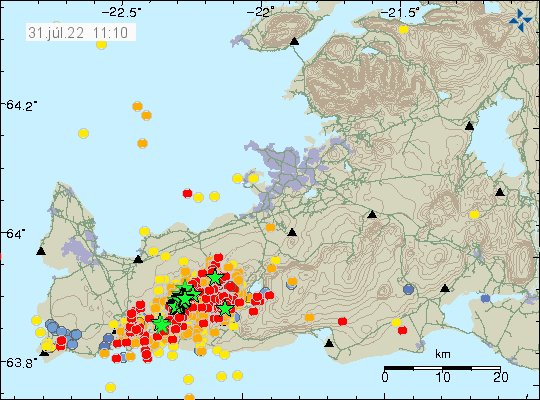
At the writing of this article at 11:32 UTC no eruption has started in Fagradalsfjall mountain or nearby area. Over 3000 earthquakes have been recorded in the last 24 hours in and around Fagradalsfjall mountain since the earthquake activity started yesterday (30-July-2022). There have not been any major changes in the crater in Fagradalsfjall mountain, it does seem to release more gas than normal. That is at least how it appears, if that is real or not I don’t know.

A lot of red dots on Reykjanes peninusla as the heavy earthquake swarm continues. A lot of green stars in a line close to Fagradalsfjall mountain, showing the location of the strongest earthqaukes
Heavy earthquake activity on Reykjanes peninsula. Copyright of this image belongs to Icelandic Met Office.
The time index of the earthquake activity for the last 48 hours. Since 12 yesterday, there have been a continuos earthquake activity. Now the dots are yellow, orange and red after the age of the earthquakes
The earthquake activity in the last 48 hours. Copyright of this image belongs to Icelandic Met Office.

I think this might be a stronger activity than last year, but if that is correct estimate is a wait and see. There has not been any major change in GPS location and that suggest that the area is as inflated as it possibly can be. It is impossible to know when the magma breaks up in the crust, but earthquake activity suggests that it has reached the depth of 2 km, meaning the magma has moved up a lot in the last 24 hours, since this earthquake activity started on the depth of 8 km yesterday.

Donations

Please remember to support my work with donations. Thanks for the support. 🙂

Strong earthquake in Nátthagakriki south-west of Fagradalsfjall volcano

Currently I can only post articles limited. This is going to be the situation until 5th of July when I get internet connection in Denmark.

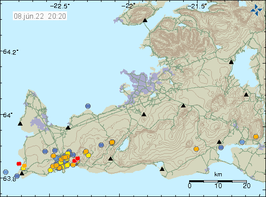
Today (8-June-2022) at 05:04 UTC an earthquake with magnitude of Mw3,0 took place in Nátthagakriki that is south-west of Fagradalsfjall volcano. It has been followed by smaller earthquakes with shallow depth of 2 km. It is unclear what is going on and no changes have been seen on GPS monitoring in the last few days for this area.

Orange, yellow and red dots from Grindavík to Fagradalsfjall volcano show the earthquake activity in Krýsuvík volcano
Earthquake activity in Krýsuvík volcano system and in Fagradalsfjall volcano (mountain). Copyright of this image belongs to Icelandic Met Office.

Older data already shows that magma is flowing into an area of the crust below Fagradalsfjall volcano (mountain). When that might erupt is impossible to know. It is also not possible to know when next cycle of earthquakes and eruptions starts in Krýsuvík-Trölladyngja volcano system.

Donations

Please remember to support my work with donations. Everything helps. Thanks for the support. 🙂

Earthquake swarm north of Grindavík town

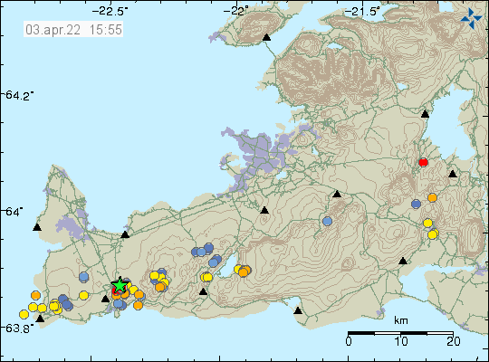
Around 14:00 UTC an earthquake swarm started north of Grindavík town. This look like a tension breaking earthquake swarm and that suggests an inflation is happening again in Fagradalsfjall volcano (mountain). Largest earthquake so far had a magnitude of Mw3,3 and second largest earthquake so far had a magnitude of Mw3,0.

Green star on the map north of Grindavík town shows the main earthquake swarm
Earthquake activity north of Grindavík town. Copyright of this image belongs to Icelandic Met Office.
Red dots north of Grindavík town showing the main area of earthquake activity
Area of earthquake activity. Copyright of this image belongs to Icelandic Met Office.

This earthquake swarm is ongoing, but like with all earthquakes swarms in this area it shows a sign of slowing down for few hours before continuing. There is a chance this earthquake swarm might be over. But I am not yet sure if that is the case.

Donations

Since I am broke in April. Please remember to support my work with donations if you can. Thanks for the support. 🙂

Magma on its way up the crust in Fagradalsfjall mountain, last measurements shows 1600 meters left (1,6km)

According to a news on Vísir.is (linked below) the magma has started to rise in Fagradalsfjall mountain. At the time of the measurement from a satellite the magma had around 1600 meters (1,6km) left until it reached the surface. At the speed the magma was travelling, around 130 meters a day an eruption was expected to happen around 11-January-2022. This is the current estimate, but that might change of the magma increases or slows down the speed it is going up in the crust.

It is unclear what area is going to erupt since the new dyke is more alongside the older eruption dyke. There is more chance than less that new craters are going to open up and start erupting, some of the area is under fresh lava from earlier eruption. Making the area look interesting when this eruption starts.

Icelandic News

Kvikan á uppleið en á enn 1.600 metra eftir (Vísir.is)

Fewer earthquakes close to Keilir, no eruption in Fagradalsfjall mountain for almost one month

Earthquake activity continues close to Keilir mountain. But it remains at depth of 5 to 6 km and doesn’t show any sign that it is about to move to the surface. More than 10000 earthquakes have been recorded and 18 earthquakes have been recorded with magnitude above Mw3,0. This is according to Icelandic Met Office.

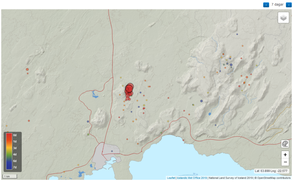
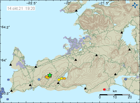
Earthquake activity close to mountain Keilir marked by a green star close to it of the map on Reykjanes peninsula
Earthquake activity close to Keilir mountain on Reykjanes peninsula. Copyright of this image belongs to Icelandic Met Office.

The eruption in Fagradalsfjall mountain (more information at Krýsuvík-Trölladyngja website at Global Volcanism Program) has not been active since 19-September-2021 and there are no signs that the eruption is about to restart soon. Global Volcanism Program no longer updates its information for this volcano as an active eruption. Icelandic scientists in eruptions have not declared the eruption over. It should be expected that the eruption in Fagradalsfjall mountain is over for now, but it can start again at the same location or at new location in few weeks time or maybe even few years from now.

Earthquake activity south of Keilir mountain

On Saturday 25-September-2021 an earthquake swarm started close to Keilir mountain, at the writing of this article this earthquake swarm is ongoing.

Red dots on Reykjanes peninsula show the location of an ongoing earthquake swarm that is now happening.
Earthquake swarm on the Reykjanes peninsula. Copyright of this image belongs to Icelandic Met Office.

The eruption in Fagradalsfjall mountain has been having its longest quiet period since 19-March-2021 and at the writing of this article that is ongoing situation.

This earthquake activity suggest that the eruption time period in this part of the Reykjanes peninsula is not over, even if nothing is happening at the moment.

Krýsuvík-Trölladyngja is a volcano system is currently erupting in this area.

Article updated on 29-September-2021 at 11:49 UTC. Correct date of the earthquake swarm start added to the article.

Massive lava cave opens up, results in lava flood down to Nátthagi

Yesterday (15-September-2021) around 11:10 UTC a large lava cave just south of the crater in Geldingadalir had a roof collapse in a small area or a lava breakup in the surface. This resulted in the lava flow down Geldingadalir into Nátthagi. The flow covered Geldingadalir in less than 20 minutes. After that it did reach the barrier that stops it from going into Nátthagakriki, if that happens both walking path A and B are going to get closed forever or having to be redrawn from their current locations. Lava down that path also allows the lava flow to go in the direction of Grindavík town and nearby roads.

The lava flow yesterday did go down into Nátthagi but didn’t get far into there compared with the older lava it was flowing on top of. This sudden lava flow did put people in danger and shows that the lava field is full of dangerous caves that can collapse or burst open at any time without any warning. The lava flow that started yesterday is ongoing best to my knowledge. But the view has been limited due to fog and bad weather in Fagradalsfjall mountain this evening.

One or two idiots where seen walking on the crater rim yesterday and I think this are the same people that Icelandic coast guard had to transport from Gónhóll since they where unable to get back because of the new lava flow that had happened when they where there.

The crater is now ~334 meters above sea level high. Currently the crater is now growing in height but that can change without warning.

Pictures of this new lava flow are on social media. I can’t use them because of copyright but if searched they can be found and viewed. There are also some amount of videos of this lava flow on YouTube.

Fagradalsfjall mountain is part of Krýsuvík-Trölladyngja volcano system.

Added 10-January-2022

This article can be found in Spanish here.