Friday update on Bárðarbunga volcano 26-September-2014

This is the Friday 26-September-2014 update on Bárðarbunga volcano. This information is going to get outdated quickly.

Current status in Bárðarbunga volcano at 20:31 UTC

  • Largest earthquake today had the magnitude 5,2, it happened at 16:49 UTC. Second largest earthquake today took place at 18:54 UTC and had the magnitude of 4,3. There have so far been fewer larger earthquakes today than in last days.
  • The caldera dropped 30cm in the magnitude 5,2 earthquake. The caldera continues to drop around 50cm/day according to GPS measurements. Total caldera drop is now around 29 meters.
  • Smaller earthquakes have been taking place in Bárðarbunga volcano. This means the drop is continuing during those earthquakes.
  • Magma continues to flow into Bárðarbunga volcano around the same rate as before. This can be seen on GPS data on nearby GPS monitoring stations. For GPS information please check University of Iceland GPS information page here.
  • Bad sandstorm was in Holuhraun today. It was so bad that it was only possible to see 50 – 100 meters in front of people according to Rúv news earlier today.
  • The eruption in Holuhraun continues in the same manner today as yesterday. The lava field is now larger than 40 square kilometres. What the exact size is I don’t know since it is not known today due to weather.
  • Earthquake activity continues under the dyke and that suggests the pressure is increasing in it.
  • Currently there is no eruption under the glacier. If it was it would be visible on SIL stations around Vatnajökull glacier.
  • Nothing more has happened in Bárðarbunga volcano today far as I know. That might change without warning.
  • Storms are expected to take place in Iceland all weekend. There is going to be around three or four storms taking place this weekend with strong winds up to 20m/s and it can go up to 40m/s in wind gusts. This is going to effect SIL stations and my geophones as the storms pass over parts of Iceland.

Current status Saturday 27-September-2014 at 20:30 UTC

  • No major change has taken place today in the eruption in Holuhraun. There is also no sign that is ending. Most of the eruption takes place in one crater at the moment. New fissures might open up without warning in the area where the dyke is located.
  • Bárðarbunga caldera continues to drop around 50cm/day.
  • Largest earthquake today so far is a magnitude 5,2 that took place at 19:31 UTC. Second largest earthquake today was at 02:00 and had the magnitude of 5,0.
  • Due to snowstorm there is almost no visibility to the eruption area in Holuhraun. For the people in the field the visibility today was reported to be 50 to 100 meters.
  • There has been a lot of smaller earthquakes taking place in Bárðarbunga volcano. Some of those earthquakes are taking place due to caldera subsiding. Some of those earthquakes are taking place because the magma inside Bárðarbunga volcano is looking for a new pathway up the surface. It either has not found it or does not have the pressure yet to go up the crust yet.
  • There is less activity today in the dyke. There is however worrying earthquake activity in the dyke at the start of Dyngjujökull glacier. It might mean that magma is trying to get up to the surface. There already have been eruptions under the glacier in this area without any earthquake activity before they started. All of those eruptions lasted for a short period of time.
  • Nothing else is to report so far today (27-September-2014).

Update Sunday 28-September-2014 at 17:17 UTC

  • Largest earthquake today took place at 12:34 UTC. Other earthquakes have been smaller today.
  • Bárðarbunga caldera has dropped 7,4 meter since 12-September-2014 according to GPS measurements in the centre of the caldera. That GPS data can be found here.
  • The lava field is now 44,5 square kilometres wide. It is now larger than Mývatn (around 40 square kilometres wide) for comparison.
  • Harmonic tremor suggest that pressure is increasing in the Bárðarbungu volcano magma chamber. It drops once the magma finds way out, then it starts building up again.
  • No other information have been released today. Other activity is the same as for the past few days.

Storm notice!

Three bad storms are expected in Iceland in next few days. In parts of Iceland wind is expected to go up to 50m/s in wind gusts. This is going to effect all earthquake recording and monitoring of Bárðarbunga volcano.

Next update

Next update is going to be on Monday 28-September-2014. I wish everyone a good weekend.

Article updated at 20:31 UTC on 27-September-2014
Article updated at 17:17 UTC on 28-September-2014

Common questions about Bárðarbunga answered #1

This is my attempt to answer the most common questions about Bárðarbunga volcano. I don’t have time to cover all the questions, so this is just the most common questions that I have seen on this website. Along with few questions that people who are not into geology might want to know the answers too.

Bárðarbunga volcano common questions answered

Why is Bárðarbunga erupting?

This is part of the natural process in Iceland. Since Iceland is on a Mid-Atlantic ridge (MAR) [Mid-Atlantic Ridge]. The drift is 2,5cm/year, but it doesn’t happen evenly over the ridge and it happens in jumps. So over a period of 200 – 700 years nothing happens, until one day the process start and the ground starts opening up and eruption cycle starts that might last for years. That is what happened in Bárðarbunga on 16-August-2014. Day before (15-August-2015) there was nothing suggesting to anyone that an eruption was about to start.

Is the eruption dangerous?

Yes and No. It depends on what it does and what happens. Today it is not dangerous to anything when it comes to lava flows since nothing exists where the eruption is taking place. Since the eruption is taking place in a desert in Iceland, where nothing grows or lives. Most danger at the present time is the SO2 gas, CO and CO2 gas from the eruption. Mostly SO2 since it goes long distances with the wind and is in high density. It has already created problems for people in Iceland closest to the eruption, even if that is distance of 100 – 200 km.

What about eruption under the glacier?

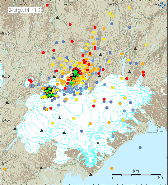
There have already been five (or six) eruption under the glacier since this started on 16-August-2014. None of them were big and did not break up trough the glacier or create large glacier flood. The risk is that new eruption are going to take place under the glacier and are going to create problems due to glacier floods that happen soon after. It is expected that three bridges in north Iceland are going to get lost if an large glacier flood takes place. With large being more than 60,000m³ of water each second (or what they use to calculate that type of flood). In south Iceland there is risk to dams, electric infrastructure, roads, bridges and other things in the path of the glacier flood. Glacier floods are expected to go at least two ways from the glacier in the worst case.

Is it possible to predict when next eruption happens?

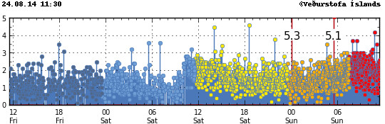
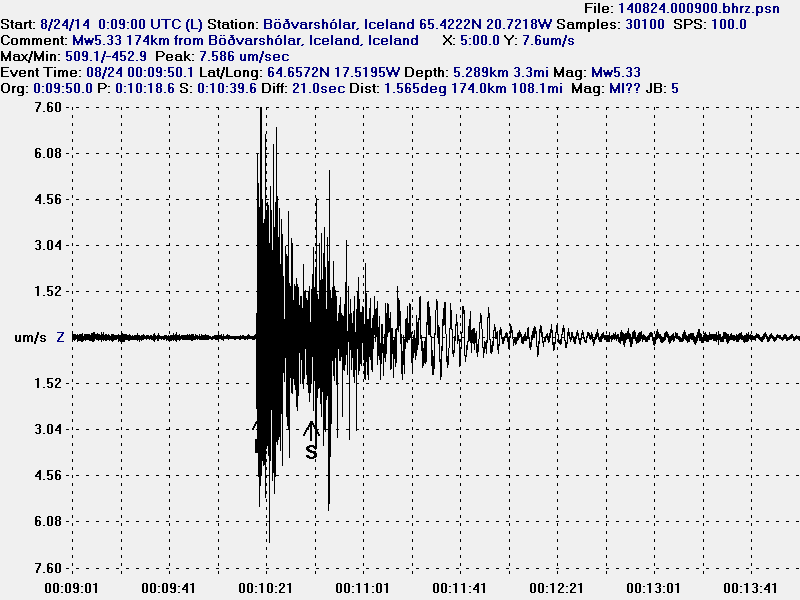
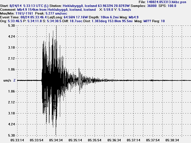
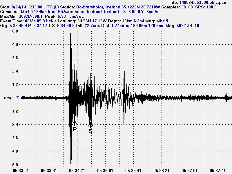
No. It is not. We at best get a warning with earthquakes some hour at best before it. But as this eruption has shown, that is not always the case along the dyke.

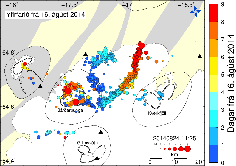
How long is the dyke?

From start to end the dyke is around 45 km long, most of it is under a glacier. It is also creating rift valley above it. That rift valley is going to be filled with new magma as the time goes on. That might not happen in this eruption cycle.

How long is this going to last?

We don’t know for sure. At that shortest some months, at the longest for the next decade or so.

Is this eruption going to create an ash cloud?

Yes, it might. Eruption under the glacier is going to create ash cloud. How big and how high it is going to be depends on the energy of the eruption and where it goes depends on the wind.

Is it going to create a flight chaos as happened with Eyjafjallajökull in 2010?

No, that is unlikely to happen. While disruptions should be expected once an eruption starts under the glacier that appears to be powerful enough to break trough the glacier. The volcano ash from Bárðarbunga volcano is going to be different, since the magma is basalt, it is going to explode on contact with water, creating volcano. No lava is not going to be erupting while water gets into the erupting craters. This also means that the volcano ash that forms is larger and heavier as result. That means it doesn’t stay as long up in the air and does not go long distances.

What is happening to the caldera?

The caldera in Bárðarbunga volcano is collapsing. The older caldera is collapsing into a new caldera. This process seems to be independent of the rifting that is now taking place in the north zone of the Eastern Volcanic Zone (EVZ) in Iceland. For image of the rift zones in Iceland click here. Science paper on the rift zones can be found here.

The caldera is collapsing because a weakness has formed in the magma chamber. This process started some time ago, since I don’t think it is a new one. But the end process seems to be taking place now. The caldera is going to stay up for as long there is magma holding it up. It is not possible to know when the caldera is going to collapse. All we know is that it is going to take place. When and how is not something we know and that might be a problem.

Is it possible to go there?

No, it is not possible to go there. The area is closed for public traffic and for a good reason. The lava is full of dangerous gases that can kill in few moments. Wind can change and bring those gases to people without warning. What is possible is to rent an air plane to fly over the area, that is expensive and not everyone can afford it. When the eruption ends the area is going to be opened up, then it is going to be possible to check out the lava field, if anything is going to be visible after the glacier floods that might take place in this area if an major eruption takes place under the glacier.

What is a fissure eruption?

Fissure eruption is an eruption that happens along a rift in the crust. Often there is a dyke feeding it, as is the case with current Bárðarbunga volcano eruption. The dyke from Bárðarbunga volcano is 45 km long and eruptions can happen along it all the way up the main volcano. After a while, the fissure eruption often ends with just one or two crater erupting. This is now taking place in Holuhraun eruption. That is also increasing the risk of new fissures opening up without warning, both close to the current eruption site and along the 45 km long dyke.

What type of magma is erupting?

Bárðarbunga volcano is erupting magma called Basalt. That means it flows easily and is not explosive. This type of magma only gets explosive when it comes into contact with glacier or water (lakes, oceans, rivers and ground water). More informations about what types of magma that exist can be found in the link below.

Types of magma
Hawaiian eruption
Magma

Short answers about the website

How many people run this website?

It’s just me. One person.

Does it take long to work on it?

Yes. I work on it for up to 10 hours a day this past month due to the eruption in Bárðarbunga. I am always checking for new data and checking what the news says for new information. I can take me up to 6 hours to write a long article, since there is eruption taking place now and information change quickly I try to write everything that I need to write down in about one hour. This article for example has taken me around three hours to write since I started writing it (with some dinner breaks).

Why do updates take so long to appear?

I like to check the data and the news for new information. Since it takes time for me to find and check that information I often cannot update until late in the evening. I update quickly as I can if a new eruption starts or if a large earthquake takes place.

How do you fund this?

With donations, Amazon Advertisements and out of my own pocket. I only have at current just social welfare from Iceland, it is small and so small that I can at times hardly pay my bills here in Denmark.

Is is possible to support your work?

Yes. Use the PayPal button. If you don’t want to use PayPal you can support me directly with a bank transfer. Information for that can be found here.

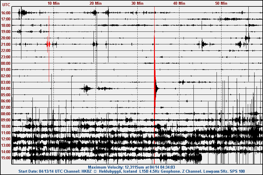
You have your own seismometers?

I don’t have seismometers as such. What I got is called geophone. It is not as sophisticated as seismometer, it gets the job done for me and that is good enough. I plan on one day to buy a Volksmeter, they are however expensive and cost $1995 for dual channel one. My geophone website can be found here. I have been running geophones in Iceland since 2006 when I started my first one in Hvammstangi, Iceland.

What software are you using?

For the moment I am using WinSDR and Winquake for my earthquake recordings. WinSDR comes with the geophone and so did WinQuake since I was buying the hardware. More details can be found here, both on hardware and software. I plan moving to FreeBSD solution once I have learned to program my own software for this. I am going to do so when I am in Iceland. I don’t expect to have anything else to do (besides monitoring eruptions taking place and writing few books and learning German, Portuguese and Spanish).

How long are you going to continue to run your geophone?

I don’t know. I know that I can do so forever. I have already closed down Eyrarbakki geophone station and Skeiðflöt geophone station since the people hosting them where unable to do so any longer. I always have one geophone with me where I live. So I am always going to have one running, along with possible long period seismometers that I might buy at later day.

Are you in Iceland?

No, at the moment I live in Denmark. I am going to move back to Iceland in December for a short period (I hope) since I can’t afford living in Denmark on my social welfare from Iceland. I don’t know for how long I am going to stay there. I don’t expect to last there due to culture issue that I am having, even if I am born in Iceland. I am considering moving to Flores, Azores Island [to Santa Cruz das Flores] next time (the Island is a volcano and on the mid-Atlantic ridge). Even if living there is in technical aspects of it out in the middle of nowhere. I just need to have the income to live there and at the moment I don’t have it. When that is going to happen is something I don’t know at the moment.

Can I use what you write here?

Yes, you can. The only requirement is that you provide link to the source material. Since this website is under Creative Commons Attribution-ShareAlike 3.0 Unported License. This however does not apply to comments and images that I don’t own. More details can be found here on how to share this website properly and in accordance with the licence that I use for it.

Article updated at 20:41 UTC.
Article updated at 21:02 UTC.

Bárðarbunga volcano daily update 22-September-2014

This information is going to get outdated quickly.

Current status in Bárðarbunga volcano at 14:47 UTC

  • The largest earthquake so far is magnitude 4,8 in Bárðarbunga caldera. There is however continued activity in Bárðarbunga volcano caldera so this number is going to change as the day goes on.
  • The eruption in Holuhraun does not show any signs of ending any time soon. The lava field is now around 37 square km in size. It is growing in size every hour. There is no sign of less production of lava coming from the active craters in Holuhraun. The lava field is not getting longer, it is getting wider instead. Since the lava does not have energy to get any further then it already has.
  • There is continued risk of new eruptions in Holuhraun and south of it, including under the glacier.
  • According to Ármann Höskuldsson geologist at University of Iceland both Eyjafjallajökull volcano eruption in 2010 (information here, Wikipedia) and Grímsfjall volcano eruption in 2011 (information here, Wikipedia) were smaller then current eruption in Bárðarbunga volcano and connected events.
  • It is expected that eruption is going to start in Bárðarbunga volcano caldera. When is not known.
  • Bárðarbunga volcano caldera continues to subside at the same rate as before, that rate is currently 50cm/day.
  • More magma is flowing into Bárðarbunga volcano from depth (more than 10 km deep source). It is clear that current eruption and earthquake activity in Bárðarbunga volcano is going to continue for months at shortest. This might go on for years at the longest. With minor breaks as often happen in fissure eruptions.
  • On 1-October-2014 the eruption in Holuhraun has been ongoing for one month.

Current status in Bárðarbunga volcano at 20:24 UTC

  • There has not been any major changes since earlier today. At 13:36 UTC a magnitude 4,7 earthquake took place. Other earthquakes so have been smaller.
  • There was (or is) a quiet period for the past few hours. This might be because more magma is flowing into the magma chamber of Bárðarbunga volcano. Increasing the pressure and at the same time creating fewer earthquakes. That might change at any time without warning.

Update at 23:13 UTC

  • The lava field at Holuhraun is now 0.5 km³. It is now the second largest lava field in Iceland during the past 150 years. Only Hekla lava field from 1947 is larger at the moment, it is 0.8 km³ in size. If the Holuhraun eruption continues as it has, it is going to get Hekla lava field size in about two weeks.

If anything new happens I am going to add that information here.

Article updated at 20:25 UTC on 22-September-2014.
Article updated at 23:13 UTC on 22-September-2014.

Daily Bárðarbunga volcano update on 18-September-2014

This information is going to get outdated quickly.

Current status on Bárðarbunga volcano at 20:36 UTC

  • Largest earthquakes in Bárðarbunga yesterday (17-September-2014) was a magnitude 5,2. Largest earthquake today (18-September-2014) was a magnitude 5,3. Other earthquakes have been smaller.
  • Bárðarbunga volcano caldera continues to drop. When the magnitude 5,3 earthquake happened today at 14:21 UTC the caldera dropped 20 – 30 cm.
  • GPS data (more GPS data can be found here) suggest to me that the dyke at Vonarskarð might be getting ready to erupt or getting re-activated. It formed in the first two weeks when current activity started in Bárðarbunga volcano on 16-August-2014. It is already there, it however failed to start an eruption, but as I say, it might be getting ready to get active again. This has been followed by some minor earthquake activity. There is however a more complicated picture into this. The details can be found later in this article. [Please note that due to licensing issues I only link to the GPS data. This means that data on the link is going to get updated in next few hours and are going to look different from what I have written about them now.]
  • The eruption in Holuhraun continues as before. There has not been any view of the eruption for the past two days due to fog. So I don’t know for sure what is happening there.

Harmonic tremor data

I can see two things in the harmonic tremor data. The pressure is increasing in Bárðarbunga volcano system. I am also seeing pulses of harmonic tremor and that is not good. It means that magma has somewhere found a path to the surface, it just isn’t there yet, but it is working way up. It is impossible to know if this magma gets all the way up or not. Small eruptions are also not impossible, since there signature might simply be lost in the noise on the tremor plots that I am using from Icelandic Met Office.

dyn.svd.18.09.2014.at.19.46.utc
Tremor in Dyngjuháls SIL station. Copyright of this image belongs to Icelandic Met Office.

von.svd.18.09.2014.at.19.46.utc
Tremor on Vonaskarð SIL station. Copyright of this image belongs to Icelandic Met Office.

skr.svd.18.09.2014.at.20.03.utc
Harmonic tremor as it appears on Skrokkalda SIL station. Copyright of this image belongs to Icelandic Met Office.

grf.svd.18.09.2014.at.20.03.utc
Harmonic tremor on Grímsfjall SIL station. Copyright of this image belongs to Icelandic Met Office.

Current status on the cauldrons

According to the news that I have heard some of the cauldrons that are in Dyngjujökull (south of Holuhraun) are still getting deeper. This suggest that there is still a lot of warm under the glacier that is melting the glacier. No glacier flood has happened due this. I don’t know if any new cauldrons have formed in recent days. Most of the cauldrons are located above the dyke, few are located above Bárðarbunga volcan in its slopes.

Tungafellsjökull volcano

I am seeing in the GPS data that Tungafellsjökull volcano might be getting more magma inflow. Since it appears to be inflating. This has not been confirmed so far. Currently there is nothing to suggest that Tungafellsjökull volcano is going to erupt at this point in time. It might simply be responding to the all the noise that Bárðarbunga is making at the moment, along with stress changes in the crust. If it erupts, it would be first documented eruption in the past 8000 years at least (maybe longer).

Next update is going to be tomorrow or sooner if anything major happens. It is possible to watch my webicorders here. They are updated every 5 min.

Article updated at 21:05 UTC.
Article updated at 21:14 UTC.

Short update on Bárðarbunga volcano at 12:07 UTC

This is a short update on Bárðarbunga volcano. Due to the fast change that is now taking place in Bárðarbunga volcano this information is going to get outdated quickly.

  • Earthquake activity now is extremely dense. With 3 to 5 earthquakes taking place every second (best estimate that I have made).
  • Earthquakes have increased in magnitude.
  • General activity appears to have increased in Bárðarbunga volcano. Even if no major eruption has yet taken place.
  • There is currently no signs of this activity stopping any time soon.
  • The dyke in Bárðarbunga volcano continues to get longer and wider, it is now over 40 km long (I think). Formation of this dyke has slowed due to more difficult crust in the area he is now in (that means more earthquakes).


140824_1130
The current earthquake activity in Bárðarbunga. Copyright of this image belongs to Icelandic Met Office.

140824_1130_trace
The extremely dense earthquake activity in Bárðarbunga volcano. Copyright of this image belongs to Icelandic Met Office.

dyn.svd.24.08.2014.at.11.33.utc
Harmonic tremor is getting off the tremor plot that Icelandic Met Office has on its website. This is the harmonic tremor at 11:33 UTC. This is Dyngjuháls SIL station. It is closest to the dyke at the moment. Copyright of this image belongs to Icelandic Met Office.

ask.svd.24.08.2014.at.11.33.utc
The SIL station in Askja volcano is also showing the massive activity in Bárðarbunga volcano. This is the harmonic tremor at 11:33 UTC. Copyright of this image belongs to Icelandic Met Office.

bbbeginman.svd.24.08.2014.at.11.32.utc
Current length of the dyke from Bárðarbunga volcano. Blue dots are the oldest and the red ones are the newest. This shows the earthquakes from 16-August-2014. Copyright of this image belongs to Icelandic Met Office.

The harmonic tremor seems to increase when there is a new flow of magma at depth into the dyke. Large earthquakes happens in Bárðarbunga caldera when it adjust to this flow out of the magma chamber above it. There are clues that magma at depth might have triggered this, but there is a lack of deep earthquakes in Bárðarbunga volcano so it is difficult to say for sure.

140824.000915.hkbz.psn
This is the magnitude 5,3 earthquake that took place today (24-August-2014) at 00:09 UTC. This is my geophone in Heklubyggð. This image is released under Creative Commons Licence. Please see CC Licence page for more details.

140824.000900.bhrz.psn
This is the magnitude 5,3 earthquake that took place today (24-August-2014) at 00:09 UTC. This is my geophone in Böðvarshólar. This image is released under Creative Commons Licence. Please see CC Licence page for more details.

140824.053313.hkbz.psn
This is the magnitude 5,1 earthquake that took place today (24-August-2014) at 05:33 UTC. I use data from EMSC that explains different magnitude in the image. This is my geophone in Heklubyggð. This image is released under Creative Commons Licence. Please see CC Licence page for more details.

140824.053300.bhrz.psn
This is the magnitude 5,1 earthquake that took place today (24-August-2014) at 05:33 UTC. I use data from EMSC that explains different magnitude in the image. This is my geophone in Heklubyggð. This image is released under Creative Commons Licence. Please see CC Licence page for more details.

As explained above the earthquake activity is dense under Dyngjujökull at the moment. The dyke is also now in part on glacier free area, so if any minor eruptions happen they can be seen on the surface. The dyke seems to be under high pressure, but I don’t know yet if that is going to result in an eruption. But I find it highly likely at this point and given current data.

My geophones can be seen here. Some of the activity that is now taking place in Bárðarbunga appears on them. Larger earthquakes (magnitude 3,5 and above) appear always at this distance. Wind appears on my geophones if weather is bad in Iceland.

Updated at 14:12 UTC.

Magnitude 3,2 earthquake in Katla volcano

Today (18-June-2014) at 10:20 UTC a magnitude 3,2 earthquake took place in Katla volcano caldera. A swarm of smaller earthquakes did happen after the main event. Depth of the main earthquake was 2,5 km.

140618_1210
The magnitude 3,1 earthquake in Katla volcano. Copyright of this image belongs to Icelandic Meteorological Office.

Following this earthquake few minor earthquakes appeared. None of them had a magnitude above 1,0. So far things remain quiet in Katla volcano and it is difficult to know for sure if this is something more than just summer earthquake activity in Katla volcano. I am at least going to keep an eye out for activity in Katla volcano.

140618.102000.hkbz.psn
The magnitude 3,1 earthquake as it did appear on my geophone in Heklubyggð. This image is under Creative Commons Licence. Please see CC Licence page for more details.

Donations:
Please remember to donate. Donations help me keep working and writing about earthquake activity in Iceland and Europe. Thanks for the support.

Post updated at 14:45 UTC.

Magnitude 2,5 earthquake south of Hekla volcano

Today (3-June-2014) a magnitude 2,5 earthquake took place south of Hekla volcano. Depth of this earthquake was 9,6 km. It did appear clearly on my geophone in Heklubyggð, it can be viewed on-line here.

140603_1605
The earthquakes south of Hekla volcano. Some minor earthquake activity in Katla volcano also appears on this image. Copyright of this image belongs to Icelandic Meteorological Office.

There was no signs of harmonic tremor or anything suggesting that volcano eruption was about to start following this earthquake. Everything is quiet for now. Some minor aftershock activity took place following the main earthquake. I am expecting minor earthquake activity to continue to take place at this location. Earthquake activity at this location has happened before in similar way as it did today. When eruption do starts in Hekla volcano, there is going to be a lot more earthquake activity then took place today. Until that happens, there is no reason to worry about this. If you are going to hike on Hekla volcano then please do go safe route, since Hekla volcano is well known for sudden eruptions with no warning at all, besides the earthquake swarm in the hour or two before a start of an eruption.

Donations: Please remember to support my work. It helps me keeping people updated on what is happening in Iceland. Thanks!

Magnitude 3,8 earthquake on the Reykjanes Ridge [Updated]

Today (11-May-2014) at 01:57 UTC a magnitude 3,6 earthquake took place in the Reykjanes volcano on the Reykjanes ridge. Depth of this earthquake was 11,6 km and there have not been any reports that this earthquake was felt.

140511_1455
The magnitude 3,6 earthquake is the green star closest to land on this map. Copyright of this image belongs to Icelandic Meteorological Office.

There has been constant earthquake activity in this part of the Reykjanes ridge for the past two weeks (about 17 days so far). This activity has however remained minimal with few earthquakes reaching the magnitude above 2,0. There has been increase and decrease in the during this time as expected. I reported an earthquake swarm in this area on 27-April-2014, on 13-April-2014 an minor earthquake swarm took place on the Reykjanes ridge (no earthquakes above 3,0), I wrote about it here.

Other dates of earthquake activity in this area are 4-April-2014 as can be seen here. There seems to have been close to continues earthquake activity on the Reykjanes ridge during the month of April and May. I am not sure why that it is, but this might be related to magma movements in this area, so far there is nothing to suggest an eruption is going to take place in this area. I expect earthquake activity to continue in this part of the Reykjanes ridge. All larger earthquakes are going to appear clearly on my geophone network, its website can be found here.

Update 1: New magnitude has been issued for the earthquake on the Reykjanes ridge that took place yesterday (11-May-2014). The new magnitude is 3,8 with the depth of 11,5 km. Two magnitude 3,1 earthquake also took place at the same time (01:55 and 01:59 UTC) at the same location.

140512_1655
The green stars show the magnitude 3,8 earthquake, along with the magnitude 3,1 earthquakes at the same location. Copyright of this image belongs to Icelandic Meteorological Office.

New earthquake activity has taken place at Reykjanes ridge today, so far no earthquake has the magnitude above 3,0 according to automatic results from Icelandic Meteorological Office. I am expecting more earthquake activity to take place at this location. Earthquake activity at this location is not continuous and has short and long breaks in them. Earthquakes larger than magnitude 2,5 appear clearly on my webicorders and can be viewed here.

Updated at 17:19 UTC.

Magnitude 3,2 earthquake in south Langjökull volcano

Today (10-May-2014) at 10:42 UTC an magnitude 3,2 earthquake took place in south part of Langjökull volcano. Few aftershocks have taken place following this earthquake, but there are no signs of an earthquake swarm is going to take place. This earthquake does not appear to have been felt in nearby areas.

140510_1525
The earthquake in south Langjökull volcano. The green star marks the location of the magnitude 3,2 earthquake. Copyright of this image belongs to Icelandic Meteorological Office.

140510.104209.bhrz.psn
The magnitude 3,2 earthquake as it did appear on my Böðvarshólar geophone station. This image is released under Creative Commons Licence. Please see CC Licence page for more details.

Earthquakes do happen in this area once in a while. Earthquake swarms are not common in this area. Other then this earthquake, everything appears to be quiet in Langjökull glacier. It is possible to see the earthquake on my webicorders here.

Donation notice: Please remember to donate. I am getting rather broke this month after I paid all my bills. This happens since I am living on minimal income from Iceland. Thanks for the support.

Updated at 16:24 UTC.

Renewed earthquake activity in Hekla volcano

Today (14-April-2014) an earthquake swarm took place in south part of Hekla volcano. The earthquake swarm took place close to Vatnafjöll mountains. This area is made up of crater rows from earlier eruptions. The largest earthquake in this swarm had the magnitude of 2,9 and the depth of 8,6 km. This earthquake did appear clearly on my geophone at Heklubyggð and it can be seen here.

140414_1440
The earthquake swarm in SW Hekla volcano system. The swarm is marked by orange dot (they change colour as they get older). Copyright of this image belongs to Icelandic Meteorological Office.

The largest earthquake did appear clearly on my geophone that is close to Hekla volcano. The magnitude 2,9 earthquake did appear like this on it.

hkbz.svd.14.04.2014.at.15.49.utc
The magnitude 2,9 earthquake in Hekla volcano system. Its the earthquake at the 04:00 UTC line and is clearly visible. This image is released under Creative Commons Licence. See CC Licence page for more details.

There are currently no signs of an eruption is about to start in Hekla volcano. After this earthquake swarm took place everything has remained quiet at present time. That might change, but there are currently no signs of such change. Even if there is earthquake activity taking place in Hekla volcano system.