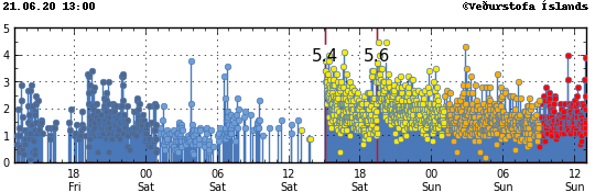
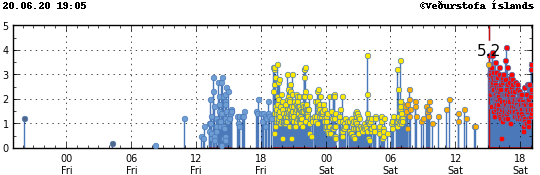
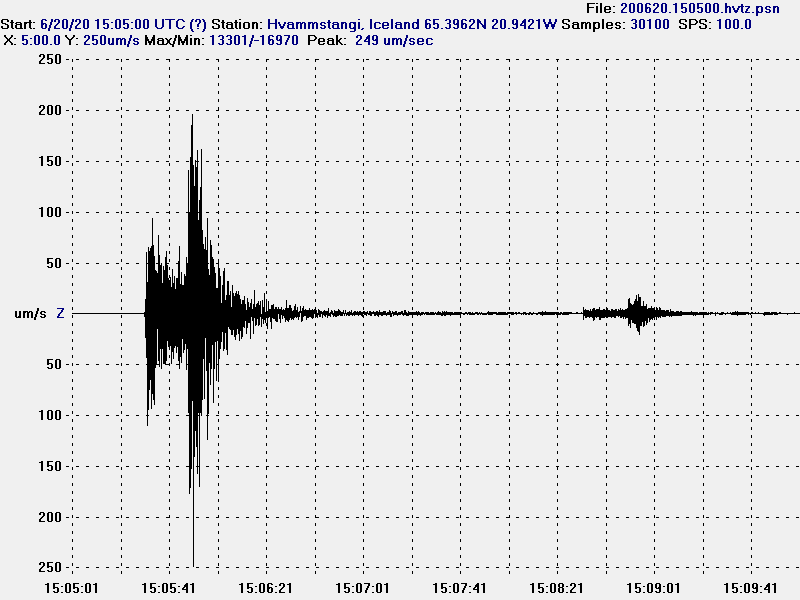
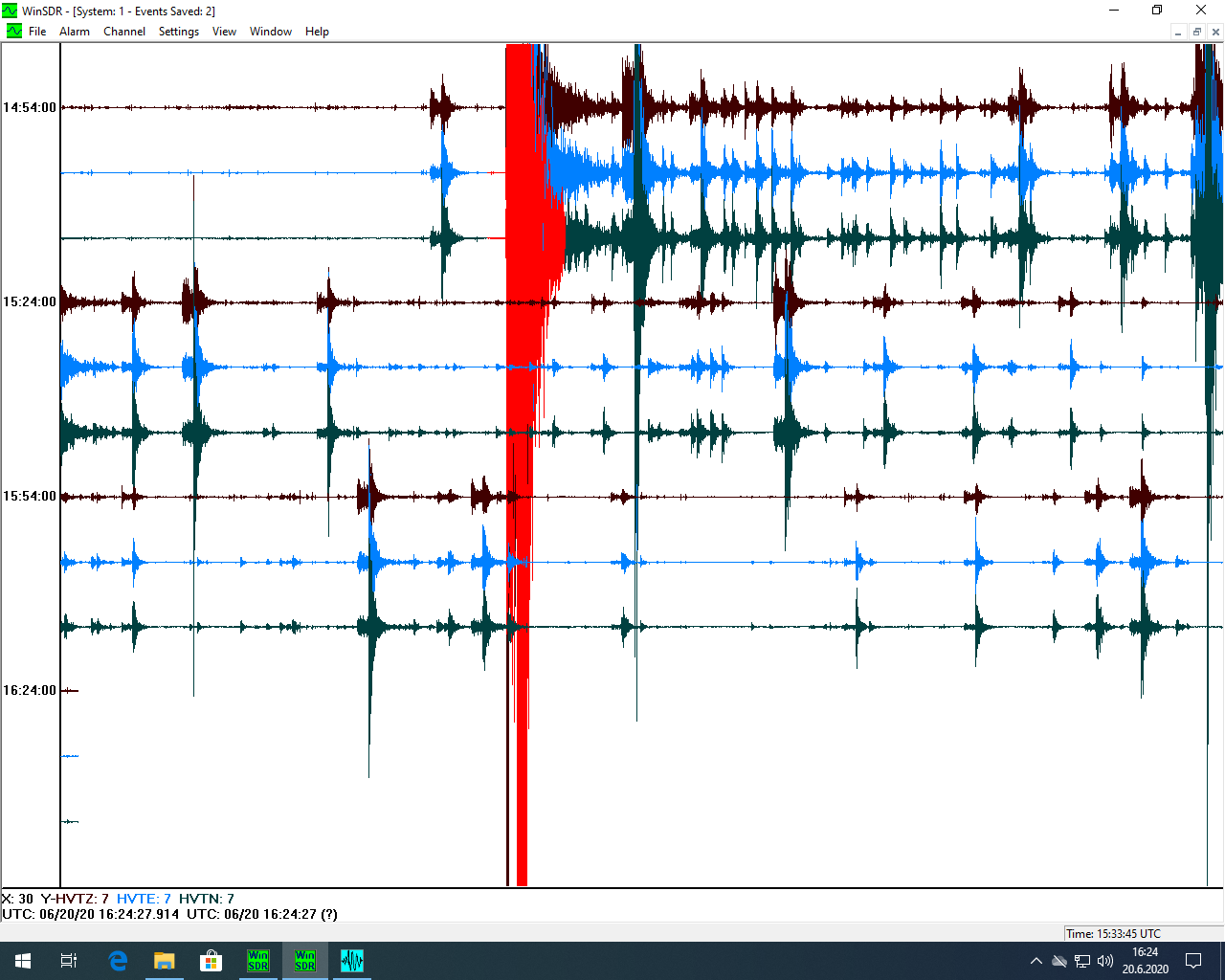
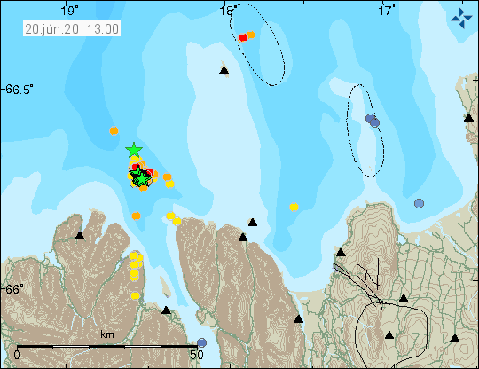
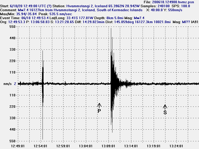
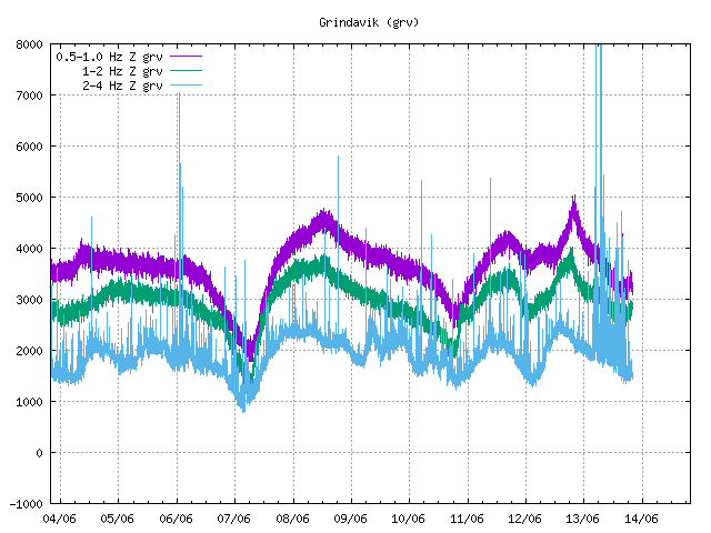
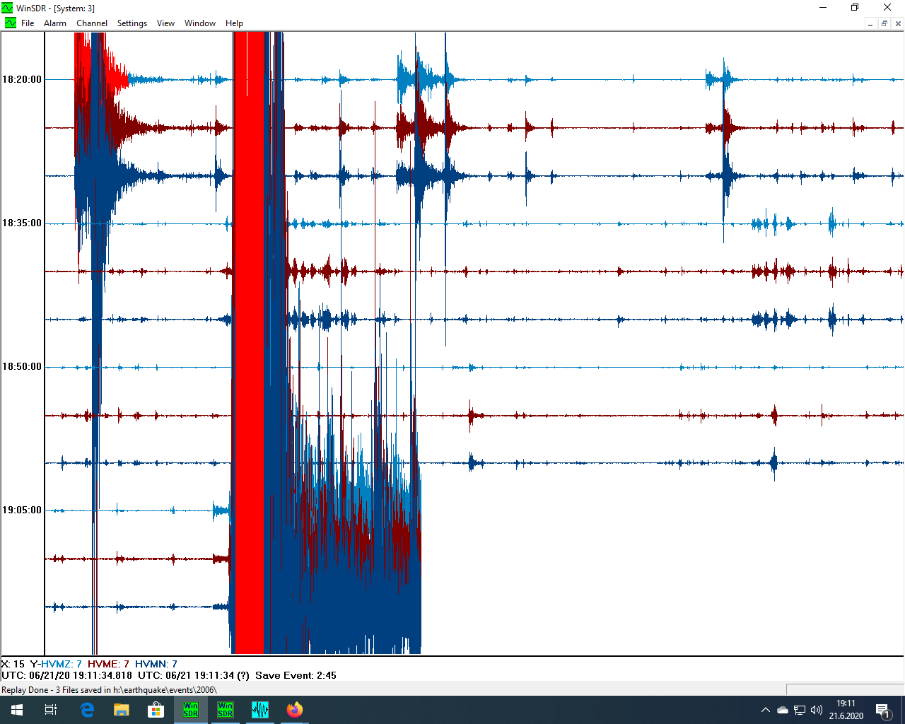
I am waiting on the technical details of the earthquake that happened at 19:06 UTC on 21-June-2020. Those are going to be in a article tomorrow. This article is about pictures of the earthquake that I managed to get as it was happening. There is clearly something going because this trace was different from the Mw5,2 and Mw5,6 earthquake that happened earlier.

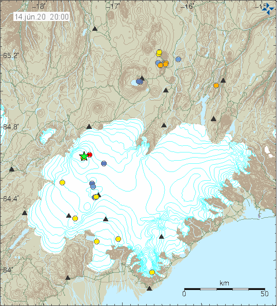
The earthquake as it happened.
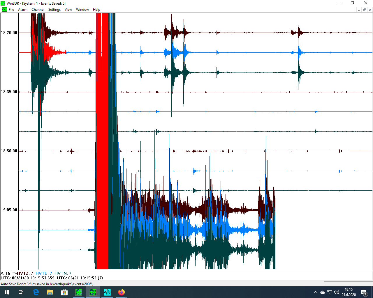
The earthquake as it happened.
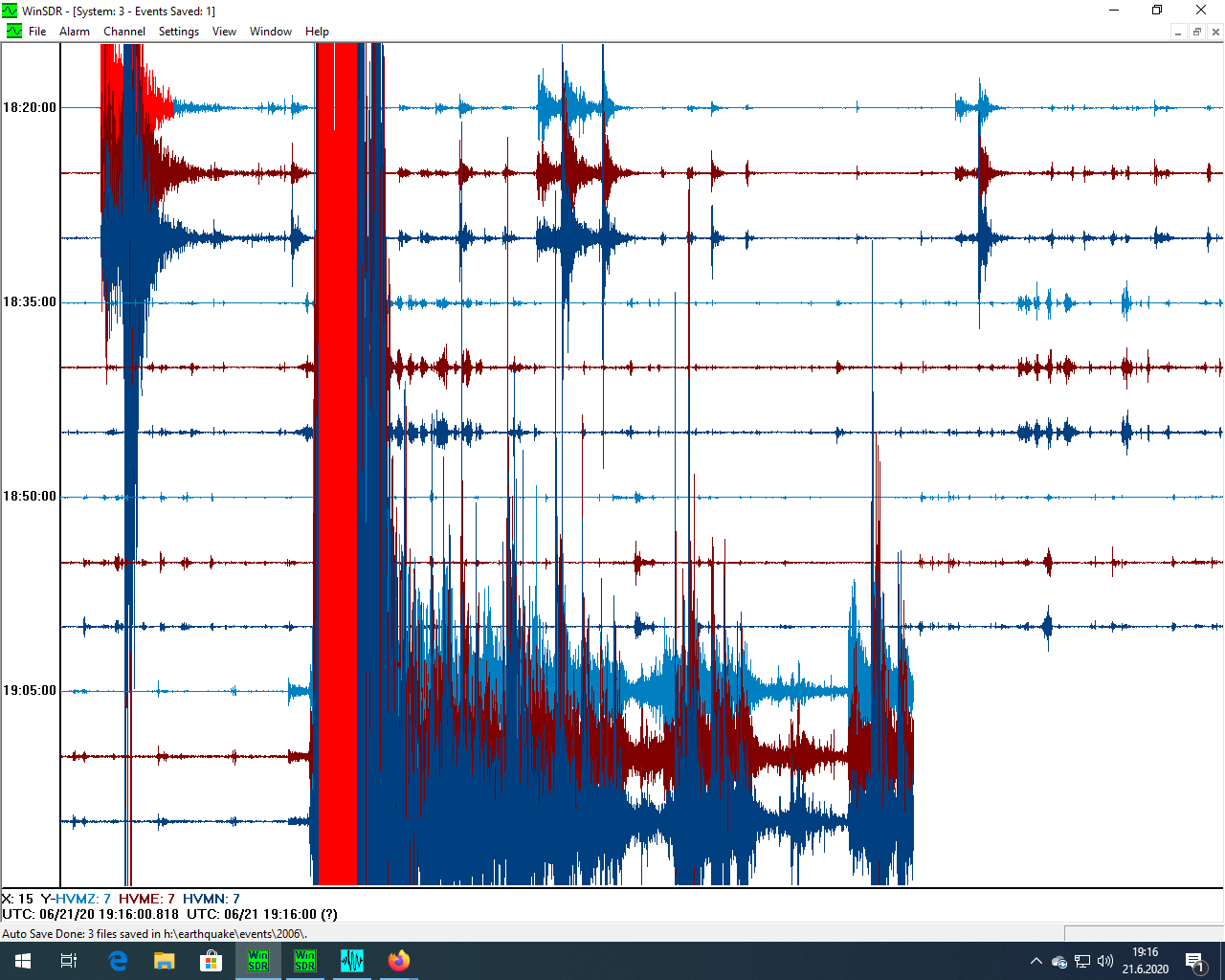
The earthquake as it happened.
The earthquake as it happened.
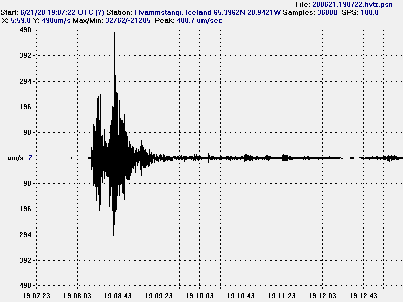
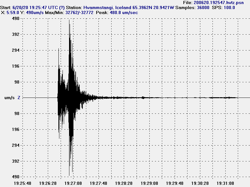
The earthquake on my Hvammstangi 1 station in greater details.
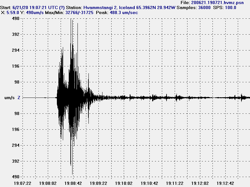
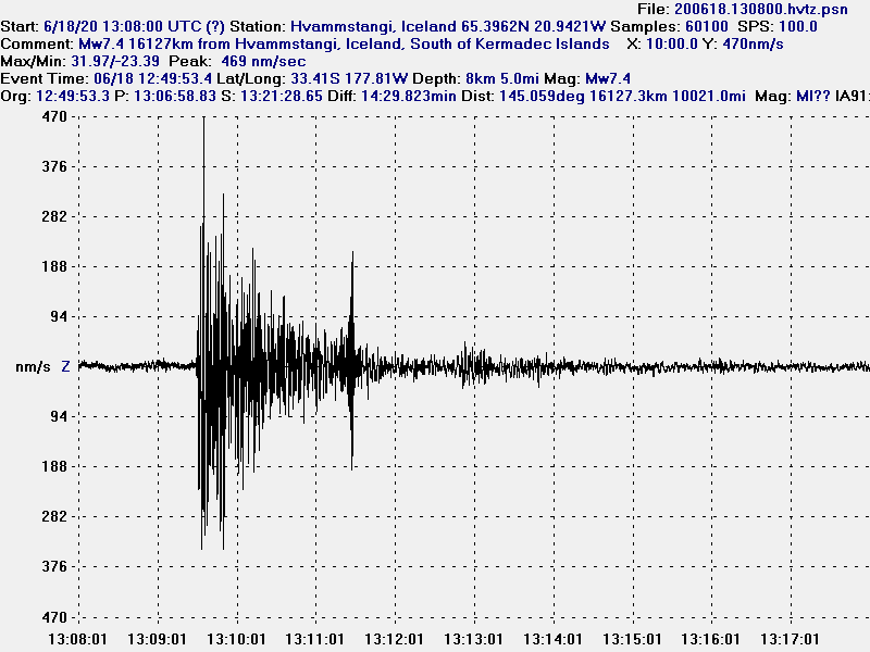
The earthquake on my Hvammstangi 2 station in greater details.
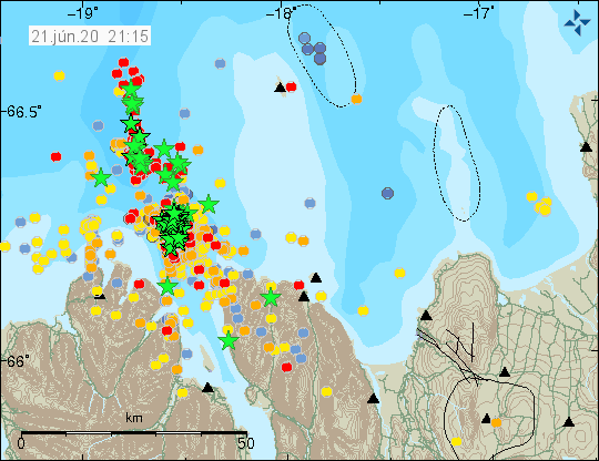
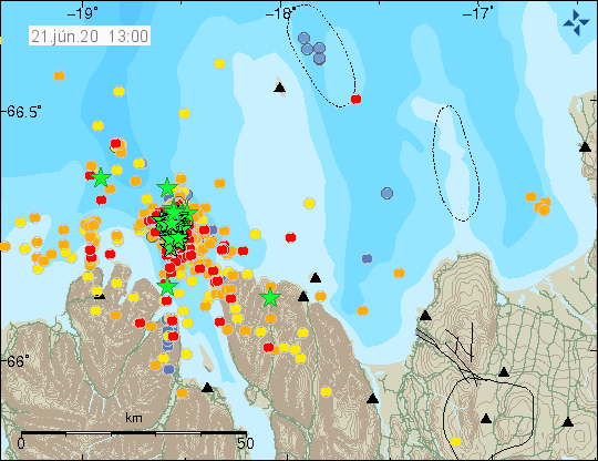
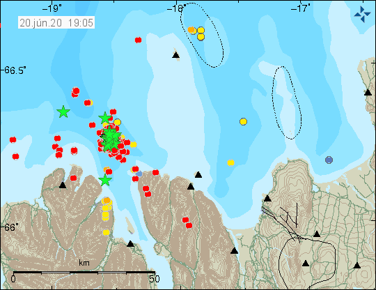
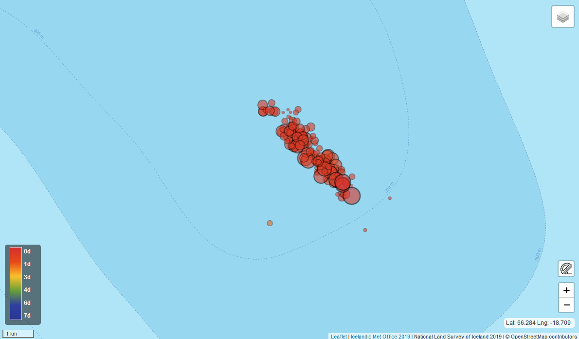
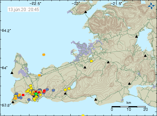
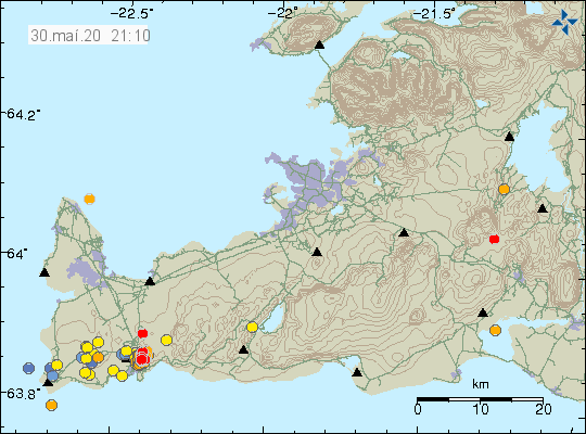
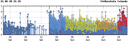
There is real high activity in TFZ currently and over 100 magnitude Mw3,0 earthquakes have happened. Copyright of this image belongs to Icelandic Met Office.
There is real high activity in TFZ currently and over 100 magnitude Mw3,0 earthquakes have happened. Copyright of this image belongs to Icelandic Met Office.
I have a working day tomorrow from 08:00 to 16:00 and that limits my ability to post updates on social media if anything major happens until after 16:00. This earthquake activity is far from over.