Two earthquakes yesterday and ground water heat map of Iceland

Here are two earthquakes that I did record yesterday. The earthquakes took place at Arnarvatns highland and in Krísuvík yesterday. The difference between the earthquakes is that one of them took place where the crust is old and carries the earthquake wave well. The second earthquake(s) took place where the crust is young, fractured and does not carry the earthquake wave that well most of the time. If a fracture area is not in-between the epicentre and the sensor in question.

The earthquake at Arnarvatns highland. The earthquake wave clearly shows what type of crust it has been going trough. In this case a old crust that carries the wave well in my direction. I cannot tell what way the crust fractured in this case, as I need a minimal of three geophones to do so.

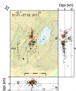
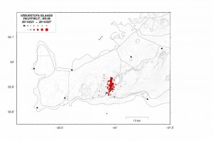
The Krísuvík earthquakes. This is actually a string of many earthquakes. When this happens the SIL system that IMO has major issues with locating the earthquakes. As the S wave often get absorbed by the next P wave that follows the next earthquakes. Sometimes however the waves get separated at some distance. That often helps to figure out how many earthquakes happened at the same minute. What is also interesting about this earthquake is the fact that it is “noisy”. But a normal earthquakes has a clear P wave and clear S wave. But on Reykjanes and Reykjanes Ridge there are often noisy earthquakes. I do not know why that happens and I don’t think the reasons for noisy earthquakes are not at all understood (far as I know anyway).

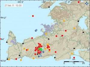
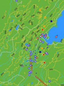
This map here shows how warm the hot water is in Iceland. Where I live the hot water is about 66C warm. It is a deep magma that warms the ground water up to this levels. There is a good article on this process at Wikipedia here.

Text updated at 17:15 UTC on the 11th of December 2010. Spelling error fixed and minor text changes.

The earthquake swarm at Arnarvatns highlands

The earthquake swarm that started two days ago at Arnarvatns highlands continues in similar manner as was seen in the earthquake swarm that took place under Blöndulón lake few weeks ago.This earthquake swarm is taking place in a fracture zone known as West Iceland Fracture Zone (WIFZ). But that fracture zone sits between East Iceland Rift Zone and Snæfellsnes volcano zone. This area is known for strong earthquakes, but in the year 1974 there was a magnitude earthquake that had the size Mb5.5 to Mw6.1 (I am not sure on the exact size of this earthquake). According to news there is speculation that this earthquake swarm is somehow connected to the earthquake swarm that did happen under Blöndulón lake few weeks ago. This area is unpopulated and several tens of km to next farm in this area.


Click on the picture of better resolution. Picture is taken from here (Icelandic).

Explanation for the numbers in the picture. The number account for the fracture direction in the area. 1: Northwest-Southwest fracture. 2: West-East fracture. 3: North-South fracture. 4: Northeast-Southwest fracture.

Where the earthquakes are currently taking place are on the west-east fractures in the area. There are no active volcano where the earthquakes take place that I know of. The active volcanoes are south and west (Snæfellsnes volcanoes) of the current location of the earthquakes.

Currently is unclear if this activity did trigger earthquakes in the rift zone. That is Thingvellir and nearby areas that show earthquakes on IMO maps. This might just be poor locations from the SIL system. It is also a question if this earthquake activity is the reason for earthquakes close to Geysir (volcano) geothermal area.


Click on the picture for a full resolution. Picture is from Icelandic Met Office web site.

The earthquake swarm at 13:10 on the 6th of December 2010. Picture is from the IMO web site.

At current time is remains unclear if this earthquake activity is a pre-events before a bigger earthquake in this area. But about ten years ago there was a earthquake swarm south of this location with many earthquakes reaching ML4.0+ in size. But in any case it is worth keeping tab in this earthquake activity, as it might signal more interesting times ahead in this area. But that is just speculation on my part. Earthquake activity might fall down to nothing (normal for this area) in a short time span.

Due to how fractured this area appears to be. I am not recording the earthquakes in this area properly, as the energy of the earthquake wave appears to vanish rather quickly due to the fractures that are between me and the earthquakes that take place (the wave energy that goes north in this case). But this was not the case with earthquake swarm that took place in Blöndulón lake.

Icelandic News of this earthquake swarm. Use Google Translate at own risk.

Skjálftahrina stendur enn yfir (Rúv.is)
Skjálftavirkni á Arnarvatnsheiði (mbl.is)

Text updated at 13:57 UTC on 6th of December 2010. Minor error fixed.
Text updated at 08:33 UTC on 9th of December 2010. Error fixed.

British Geological Survey costs the set-up of six seismometers around Eyjafjallajökull and Katla

According to Rúv it appears that British Geological Survey did pay for the set-up of six seismometers around Eyjafjallajökull and Katla volcanoes. This seismometers are able to detect lower frequencies better then current seismometers around Eyjafjallajökull and Katla. This type of sensors are normally called broadband seismometers and have frequency range down to 0.001Hz and up to 60Hz. I do not know how far the sensors that BSG did cost. But I am going to assume that they go down a bit farther then IMO sensors in the area. According to Rúv the sensors are already up and where on-line earlier this year.

They are located at following location.
Mælifellssandi not far from Slysaöldu, Rjúpnafell east of Mýrdalsjökul, two are located both sides of Eyjafjallajökull on Ásólfsskálaheiði at south and Smjörgili at north not far from Gígjökli glacier. Fifth sensor is going to be set-up in Pétursey in Mýrdal. The location of the six sensors has not been decided yet.

The cost of this project is about 100.000 pound according to Rúv.

The reason for this is that authorities in UK (and Europe) want to get more warning if there is a big eruption in Katla volcano. Mostly to prevent the air chaos that took place when Eyjafjallajökull erupted earlier this year.

Five sensors where in the area before. The sensor net is going to be really sensitive when the new sensors go on-line at IMO headquarters in Reykjavík. But more sensors give more accurate location of earthquakes, both in depth and location.

The news from Rúv in Icelandic. Use Google Translate at own risk.

Bretar setja upp jarðskjálftamæla (Rúv.is)

Current ongoing earthquake swarms in Iceland

At current time there are two main earthquake swarms taking place in Iceland. The first one is at Krísuvík volcano and has been going on since early this week. Currently there is nothing to suggest that it going to end any time soon. This earthquake swarm however sometimes stops for several hours and up to one to two days at the longest. Most of the earthquakes taking place are less then mag 2.5 in size. It is not clear why this earthquakes are taking place. This might be tectonic process or something to do with the magma intrusion that is taking place in Krísuvík volcano.

The second earthquake swarm is taking place at Herðubreiðartögl with earthquake taking place at Herðubreið at it’s north limits. Several mag 3.0+ earthquakes have taken place. This earthquakes appears to be due to tectonic process in the area. But I have heard theories that this process might have started due to influx of magma into the Askja volcano that is close to earthquake swarms in Herðubreiðartögl. At current time I cannot confirm that this ideas are correct or not. This earthquake swarm is ongoing and does not appear to be ending. But there are breaks in it that last from few hours and up to one day at the longest. Please note that Herðubreiðarfjöll is a central volcano that is active. It is not on the GVP volcano list for the area. This volcano is located inside Askja fissure swarm and has many active fault lines that cross it from north-south.

The newest earthquake swarm that appears to be at slow start is taking place in Esjufjöll volcano. But since activity started there in early October 2010 earthquakes appears to be on the rise in Esjufjöll volcano. It is worth noticing that earthquake swarms in Esjufjöll appear to start slowly but they due appear to peak after 20 to 180 hours after they starts. This earthquake activity is due to new flow of magma into Esjufjöll volcano.

Large earthquake swarm at Herðubreið

A earthquake swarm that started out small earlier today has grown and is now a earthquake swarm with considerable size. According to automatic data from IMO and the SIL network the largest earthquakes have reached ML2.2 in size.

This area is known for a lot of earthquake activity. So this swarm is not a surprise. But this type of activity happens regularly in this area.

A magma related earthquake at Hamarinn volcano

The earthquake that happened this morning at Hamarinn volcano appears to have magma signature in it based on what I see in my own wave data. The size of this earthquake was ML3.5 according to automatic SIL data. The automatic depth of this earthquake is 1.1 km. This data is a subject to a review by Icelandic Met Office.

So far this has been a single event and no aftershocks or other earthquakes have happened in Hamarinn volcano. That might however change. But sometimes large earthquake swarms take place in Hamarinn volcano. But this volcano is known for a lot of earthquake activity at times.

There are no indications of a eruption starting in Hamarinn volcano.

Other earthquake activity

The earthquake at Hamarinn volcano appears to have started a earthquake swarm in Herðurbreiðartögl. But the area must have been at breaking point anyway and the earthquake that happened in Hamarinn volcano might have just acted as a trigger.

There have been earthquake not far from Kolbeinsey island volcano. The strongest earthquake got ML3.3 by the automatic data by the SIL system. But due to the distance this is a underestimate in size of the earthquakes taken place at Kolbeinsey island volcano. I am not sure if the earthquake swarm that was taking place there has stopped or not, as small earthquakes are not detected by the IMO SIL Network.

Quiet time in earthquakes around and in Iceland

Currently there is a quiet time taking place in Iceland. This sometimes happens. It does not mean that all activity has stopped. But it just means that the most of the earthquakes that are taking place are so called microearthquakes and that they are less then ML3.0 in size. But the thing about microearthquakes is that they are not useless, as this (pdf, English) report from Icelandic Met Office shows.

While it is quiet as it is I am going to relax a little. So that I can take on the busy times better.

Continued earthquake activity under Blöndulón and in Esjufjöll volcano

It appears that the earthquake activity at Blöndulón and in Esjufjöll volcano has not stopped completely. The earthquake activity at Esjufjöll volcano started on the 20th of October 2010. The first week there where about 70 earthquakes recorded by Icelandic Met Office, the following week there was continued activity but there where fewer earthquakes taking place in Esjufjöll volcano at that time. But the activity had not stopped completely. When this is written there are clues that there is a new earthquake swarm about to start in Esjufjöll volcano. I must point out that so far the earthquake swarms in Esjufjöll volcano have started out slow before they pick up the in size and numbers of earthquakes.

The earthquake activity under Blöndulón lake (man made lake) continues. The earthquake activity is intermittent since it started. But the largest earthquakes that have happened under Blöndulóni lake have reached ML3.8 in size. But the largest earthquakes where felt in nearby farms (up to 80 km away far as I understand). It seems that the earthquake activity continues at this location. But with long stops in-between each earthquake swarm. I do expect the earthquake activity to continue there for coming months. But sometimes it happens that earthquake swarms in the areas outside the main faults take a long time to finish. The longest earthquake swarm that I know of lasted for almost two months. This earthquake swarm at Blöndulón lake might well do something like that. But only time is going to tell us what is going to happen in that area.

Earthquakes in eastern part of Katla volcano (Mýrdalsjökull)

Last week something interesting started to happen in Katla volcano last week (Week 45). Earthquakes started to appear in the eastern part of the Katla volcano. This is higly unusual and is not the normal earthquake zone in Katla volcano. But normally the earthquakes take place in the western part of the Katla volcano (Goðabungu area) and few earthquakes take place in the caldera it self at regularly.

At 00:45 UTC there was a earthquake in eastern Katla volcano, the automatic SIL size of this earthquake was ML2,5 at the depth of 1,1Km (with a good quality of 90,05). Both figures are subject to a revision by a seismologist at later time, so both size and depth can change. I did manage to record this earthquake on my Hekla geophone, even if there currently is rather high wind noise at my geophone. What I did see on my geophone is interesting. But the earthquake appears to have low frequency component in it, even if it is mostly high-frequency type of earthquake. But those earthquakes are normally created by a fault in the crust, not by magma movement.

I need more data to confirm it. But there are clues that the earthquakes in eastern Katla volcano are due to magma movement, rather then tension changes in the crust not related to magma movement. What is happening there is unclear at the moment, as GPS stations around Katla volcano do not show anything interesting at the moment.

No eruption is imminent in Katla volcano at current time.

More earthquakes at Esjufjöll volcano

It seems that Esjufjöll volcano is not done with the earthquakes. But over the past few weeks since the original earthquakes swarm that started in early October in Esjufjöll volcano.

Like before it appears that the earthquakes have there origin, not tectonic as often is the case is in Iceland. But this means that each time a earthquake happens in Esjufjöll volcano a magma is on the move there. What is interesting about this is the fact the magma that is moving inside Esjufjöll volcano does appears to be moving at fast rate. For instance the earthquakes that are now taking place in Esjufjöll volcano indicate that the magma is moving faster then was the case with Eyjafjallajökull volcano before it erupted earlier this year. According to Week 42 data from Icelandic Met Office there where over 70 earthquake recorded. But in 2002 the earthquakes recorded then was over 90 earthquakes, with the biggest one ML3,5 in size.

The current earthquakes in Esjufjöll volcano are interesting and do signal a more active period ahead in that volcano. When that active period is going to peak with a eruption (?) is unknown at this time. But we at least might end up seeing (?) something like happened in the year 1927 when a small eruption did create a glacier flood from Esjufjöll volcano that did go down Breiðamerkujökull glacier.