New dike intrusion into Katla volcano caldera

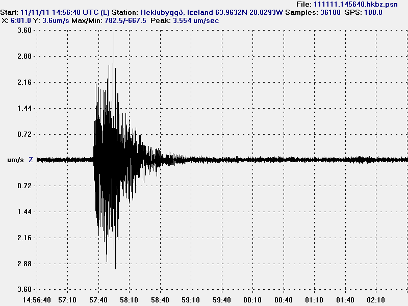
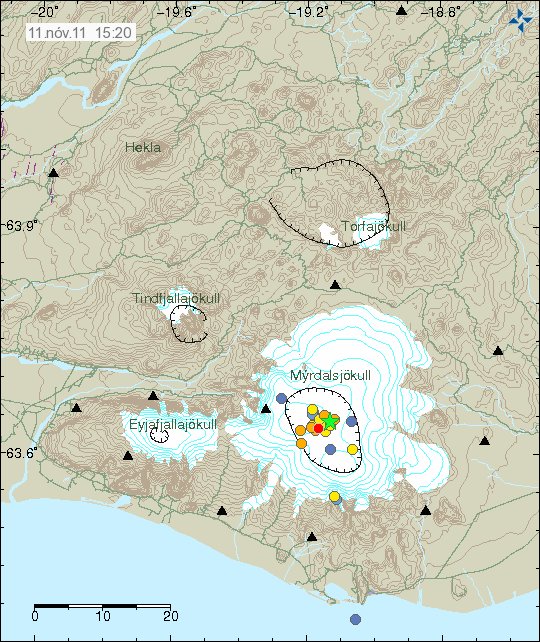
A new dike intrusion has started in Katla volcano caldera. So far only few earthquakes have taken place. But the largest one so far is ML2.8 in size with the depth of 0.8 km (800 meters). It appears clearly on my geophone at Hekla volcano. But it seems that new area in the Katla volcano caldera has been increasing activity during past few weeks. Based on the number of earthquakes that are currently taking place there.


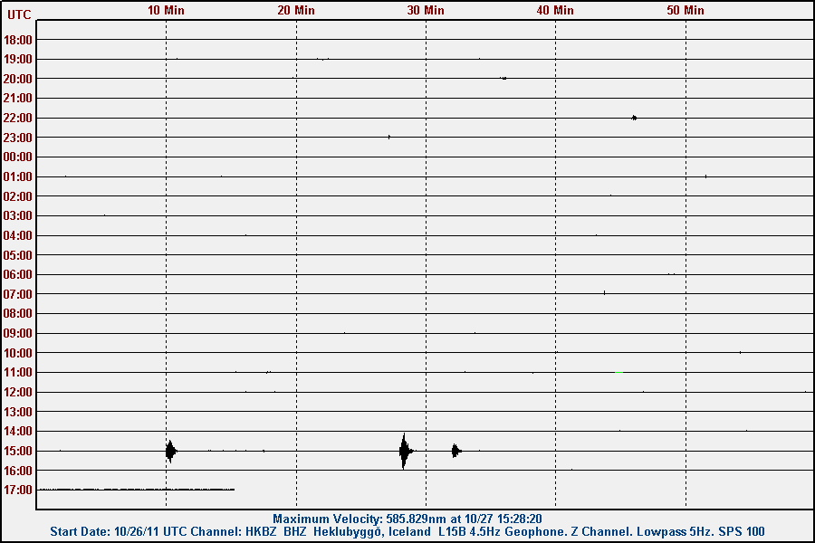
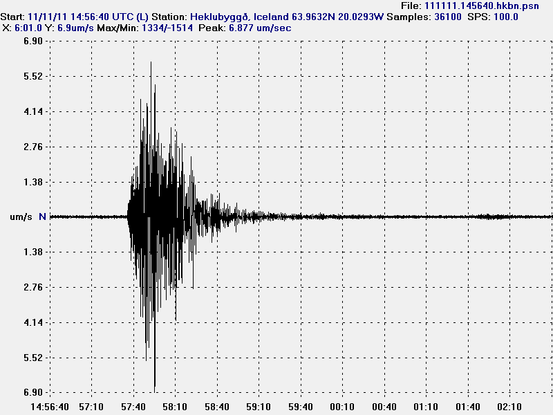
The earthquake as I did record it on my Heklubyggð geophone. This are all the directions on the gephone. This picture is released under Creative Commons licence.


The North-South component of the geophone shows the nature of this earthquake clearly. This picture is released under Creative Commons licence.


The vertical component of the geophone did also show the nature of this earthquake clearly. This picture is released under Creative Commons licence.


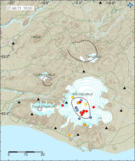
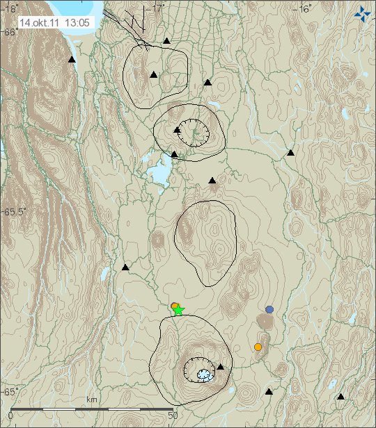
The area inside Katla volcano caldera that is responsible for the current earthquake activity. Copyright of this picture belongs to Iceland Met Office.

The earthquakes in Katla volcano now are created by magma intrusion into the rock layers. There is not a lot of about tectonic earthquakes in Katla volcano today. But they cannot be completely ruled out. But the signature of those earthquakes is different then by earthquakes created by magma movements.

Note: I have been recording earthquakes since the year 2006. I have learned a lot during that time.

A ML3.5 earthquake in Katla volcano

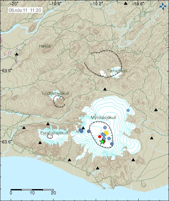
At 09:50 UTC today (8 November, 2011) there was a ML3.5 earthquake in Katla volcano. According to news this earthquake was felt in Vík í Mýrdal town and on nearby farms. No harmonic tremor has been detected following this earthquake.


The earthquake location in Katla volcano. Copyright of this picture belongs to Iceland Met Office.

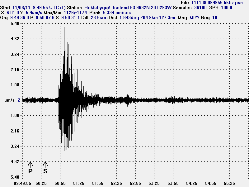
This earthquake was also detected on my geophone network. I currently do not have the data to locate the earthquake in my recording.


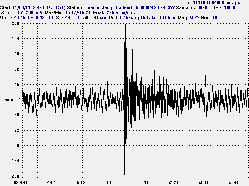
The ML3.5 earthquake in Katla volcano caldera. Please note that this earthquake is un-located, that means the P and S wave markers are unset. This picture is released under Creative Commons licence. See Licence page for more details.


The ML3.5 earthquake in Katla volcano caldera. Please note that this earthquake is un-located, that means the P and S wave markers are unset. This picture is released under Creative Commons licence. See Licence page for more details.

It is impossible to know what this means in terms of activity in Katla volcano. But this was just a normal earthquake for most part from what I can tell. There was no harmonic tremor following this earthquake.

Icelandic News about this earthquake. Icleandic mocks Google Translate every day of the year.

Skjálfti í suðurjaðri Kötluöskju (Rúv.is, Icelandic)
Enginn gosórói sjáanlegur (Vísir.is, Icelandic)
Harður jarðskjálfti í Kötlu (mbl.is, Icelandic)
„Þetta er óþægilegt“ (mbl.is, Icelandic, interview)

Harmonic tremor pulse in Hamarinn volcano

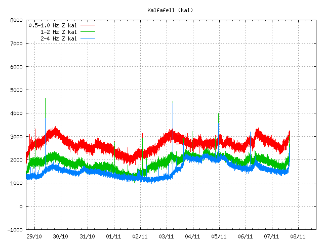
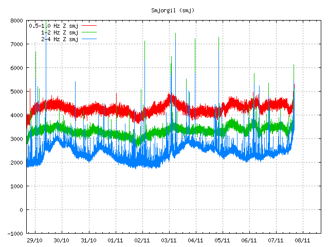
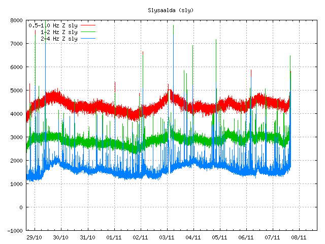
The harmonic tremor in Katla volcano seems to be over. It lasted only short duration after the earthquakes it seems. At least I cannot read anything else out of the data from the SIL station around Katla volcano.

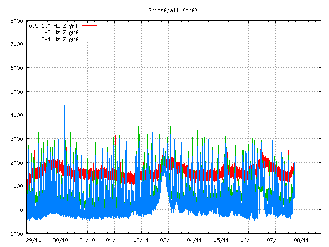
But the harmonic tremor in Hamarinn volcano (part of Bárðarbunga volcano system) seems to be ongoing, as before there is little to no earthquake activity following this harmonic tremor activity. I have no idea why that is. But following this harmonic tremor there was one earthquake with the size ML1.9. But with extremely poor location and size measurement. So the size and depth are subject to a change.


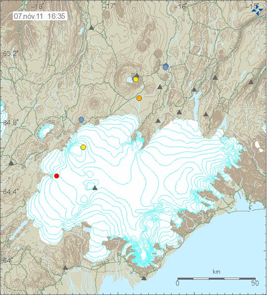
The earthquake in Hamarinn volcano at 16:35 UTC on 7 November, 2011. Copyright of this image belongs to Iceland Met Office.


Harmonic tremor in Hamarinn volcano at 16:44 UTC on 7 November, 2011. Copyright of this image belongs to Iceland Met Office.

Currently the harmonic tremor pulse in Hamarinn volcano is ongoing. So far the harmonic tremor pulse has not reached the level that suggests a eruption is about to start in Hamarinn volcano, as did happen in July this summer (year 2011). But it worth keeping watch on this event in Hamarinn volcano. As more might be coming from that volcano. But its eruption pattern is undocumented so far, as there have been few to none eruptions in Harminn volcano in the 20th century in Iceland.

Update 1: The weather in this area is quite bad from what I can tell. But so far it does not seems to have any effect on the SIL stations. At least I do not see any weather pattern above the normal so far.

Update 2: There seems to have been a minor eruption in Hamarinn volcano. The harmonic tremor looks like that now. But that is almost the same tremor signal that was in July this summer when a minor eruption took place in Hamarinn volcano.


A clear sign in my opinion that a minor eruption took place in Hamarinn volcano. This activity might continue as it did in July. Copyright of this image belongs to Iceland Met Office.


The harmonic tremor sign can also been seen from Grímsfjall SIL station. Not as clear, as this is a small event. Copyright of this image belongs to Iceland Met Office.

A glacier flood should be expected from this event in the next few hours. At least I am assuming that given the glacier cover in the area. It is also a risk that this eruption is going to continue for the next few hours and drop off between as it did in July.

Blog post updated at 16:55 UTC on 7 November, 2011.
Blog post updated at 17:06 UTC on 7 November, 2011.

Harmonic tremor pulse in Katla volcano

This just started few moments ago so I waiting on how this develops. But there is a harmonic tremor spike in Katla volcano.

The harmonic tremor in Katla volcano started with a small earthquake swarm. This is more then just minor event it seems. But at this moment it is hard to know how this is going to develop. But next few hours are going to give clear picture of what is going on in Katla volcano. There is a bad weather in the area, but that makes the observation of what is going on more difficult then in good weather.


The earthquake swarm in Katla volcano. Copyright of this picture belongs to Iceland Met Office.


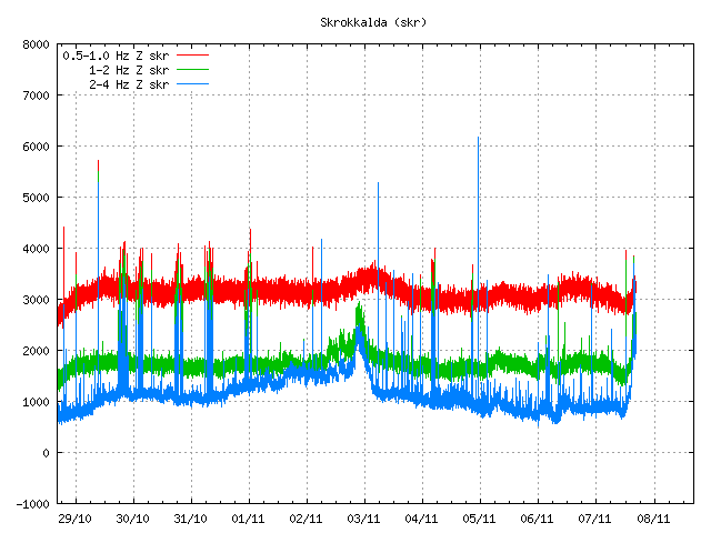
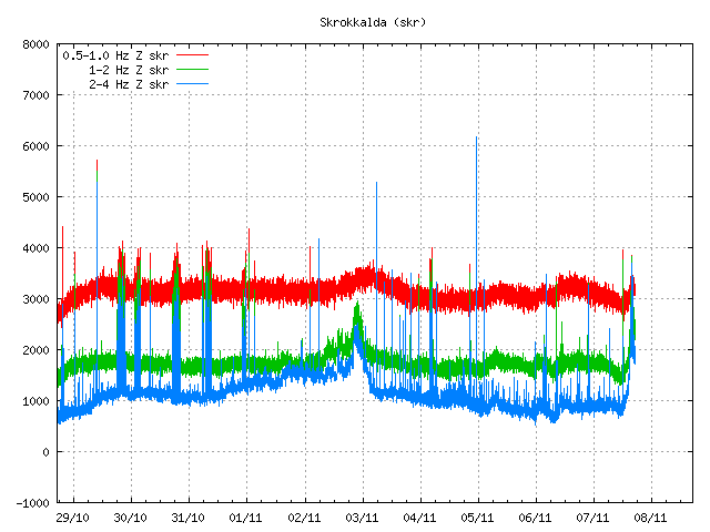
Harmonic tremor pulse in Katla volcano at 16:00 UTC on 7 November, 2011. Copyright of this picture belongs to Iceland Met Office.


Harmonic tremor pulse in Katla volcano at 16:00 UTC on 7 November, 2011. Copyright of this picture belongs to Iceland Met Office.


Harmonic tremor pulse in Katla volcano at 16:16 UTC on 7 November, 2011. Copyright of this picture belongs to Iceland Met Office.

What happens next is impossible to know for sure. But watching what is happening in Katla volcano is the only thing that can be done for the moment. No more earthquakes have happened so far in Katla volcano (at the time when I write this). The harmonic tremor pulse was detected up to Skrokkalda SIL station. But also on Grímsfjall SIL station. There is a harmonic tremor pulse also taking place in Hamarinn volcano, more on in a little bit. This harmonic tremor pulse is because of dike intrusion is taking place in Katla volcano. It is impossible to know how big it is currently.

Blog post updated at 16:26 UTC on 7 November, 2011.

General update for Katla volcano and El Hierro voclano

This is a general update for Katla volcano and El Hierro volcano.

Katla volcano, Iceland

During the weekend there was a minor dike intrusion into Katla volcano caldera. The largest earthquake in this earthquake swarm was a ML2.1 with the depth of 1.4km. This is among the smallest earthquake swarms in Katla volcano since activity started to increase after the small eruption in July 2011. The reason for this earthquake swarms in Katla volcano are dike intrusions (wiki). Sometimes following this are small glacier floods from Mýrdalsjökull glacier that is on top of the caldera. But that does not seems to have this time around, or the last time there was a dike intrusion in Katla volcano (few weeks ago).


The earthquake activity in Katla volcano during the weekend. Copyright of this picture belongs to Icelandic Met Office.

El Hierro volcano, Canary Islands, Spain

The eruption in El Hierro volcano continues as it has been doing for the past four weeks (almost). But the chance of a new island forming has grown somewhat in the past few days. The main reason for that is that eruption did gain some strength during the past two weeks. The increased strength in the eruption was due to a new injection of magma into El Hierro volcano. Both at the main magma sill and what seems to be a new magma intrusion into El Hierro at depth. That magma has so far not been able to reach the surface and remains at the depth of 20 km or so. But there also seems to be some dike intrusion activity been taking place in the same area, as more magma is injected under El Hierro volcano North West of the town of Frontera (IGN name information).

For that reason the risk of new eruption vents open up in this area is high in my opinion and is going to remain that during this eruption. But it remains to be seen if a new eruptions vents open up in this area. But that depends on the amount of magma that is currently injecting into El Hierro volcano at depth. It is impossible to know for how long new magma is going to get supplied into El Hierro volcano. But so far this process has been ongoing since July, so that is already five months (or about that) that new magma has been flowing into El Hierro volcano.

The formation of new Island off the coast of El Hierro Island is now a real chance. As the erupting vent has build up close enough to the surface of the water to start the Surtsey Island process. That process in it self is going to take few weeks to complete, at least until the crater no longer gets water into it. When the water can no longer into the crater the eruptions turns to lava fountain eruption. A Hawaiian style of eruption to be exact. That progress is going to remain to the end of eruption. But this is only going to happen if the eruption lasts long enough to build a small Island off the coast of El Hierro Island. So far that remains unseen. However the chance for this to happen is good in my view.

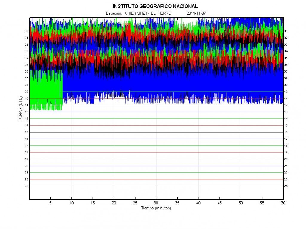
There is also worth noticing that this eruption is a bit variable in eruption strength. This can clearly be seen on the harmonic tremor plots that can be viewed online from El Hierro volcano. This is normal, as the flow of magma from inside El Hierro volcano is not stable and can change suddenly. The risk of new fissures to open up without warning remains high in the area around the current eruption vent is also high. The new fissure have the risk of opening up without any earthquakes and warning. To some extent this has already happened during this eruption. But I am not sure the new eruption vents did stay erupting for a long time. This is however most likely to repeat it self regularly during this eruption.


The harmonic tremor in El Hierro volcano on 7 November, 2011 at 09:32 UTC. Copyright of this picture belongs to Instituto Geográfico Nacional.

Off topic: Small apology

Here is a small apology to my readers. I have been a little bit under the weather in past few weeks. There are many reasons for this. But the biggest one is that my plan to live in Denmark failed this summer. But the chance of me moving back to Denmark has lifted my mood again. But I also found that playing computer games helps me dealing with my current status a bit. Because of this under the weather issue. My blog post have not been that good in my view. For that I want to apology. I can’t promise that this won’t happen again while I am living in Iceland. It is also a factor that the darkest time of the year never goes well with me (Mid October to early March).

New earthquake swarm in Katla volcano

When I just think that Katla volcano had gone quiet. It starts a earthquake swarm to proof that I had it wrong.

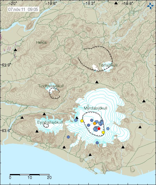
This earthquake swarm in Katla volcano is not big. But the largest earthquakes where up to ML2.6 in size according to Iceland Met Office web page. This earthquake swarm is located in Katla volcano caldera, in the area that have been most active since July 2011. No harmonic tremor has followed this earthquake swarm.


The earthquakes in Katla volcano today. Copyright of this picture belongs to Iceland Met Office.


The tremor plot of the earthquake from Slysaalda SIL station. Copyright of this picture belongs to Iceland Met Office.


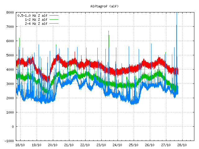
The earthquake swarm on Alftagröf SIL station. Copyright of this picture belongs to Iceland Met Office.


The earthquakes as they did appear on my geophone at Heklubyggð (Hekla volcano). This picture is released under Creative Common Licence. See the Licence page for more details.

This was most likely a small dike intrusion in Katla volcano caldera. But that seems to be the major driving force behind this earthquakes that are currently taking place in Katla volcano caldera. It is hard to know for sure if this earthquake swarm is going to continue or not. But this high earthquake activity in Katla volcano suggests that it is not far away from erupting. But it is impossible to know when a eruption might take place at current time.

Icelandic News about this earthquake swarm.

Smáskjálftar í Mýrdalsjökli (mbl.is, Icelandic)

Earthquake swarm in Askja volcano and Katla volcano

During the night there was a earthquake swarm in Askja volcano and in Katla volcano. The earthquake swarm in Katla volcano might be ongoing, but it is hard to know that for sure at the moment.

The earthquake swarm in Askja volcano are signs that volcano is preparing for a eruption period. But it seems like that magma has been starting to collecting in Askja volcano last year (in March of 2010). This progress also seems to be moving along faster then I did expect last year. But the earthquake swarm that took place during night was because if a possible dike intrusion from Askja volcano that got into the crust inside Askja volcano fissure swarm. So far the pressure of the magma is not high enough to start a eruption and I am unsure how long this progress needs to continue before Askja volcano is ready for a eruption. The largest earthquake that happened during the night was ML3.4 and on around 1 km depth according to the news on Rúv.


The earthquake area in Askja volcano. It is outside the main Askja volcano, but inside Askja volcano fissure swarm, the star marks the location of the ML3.2 earthquake (automatic size). Copyright of this picture belongs to Iceland Met Office.

Earthquake activity continues in Katla volcano as before. Most of the earthquakes are as before just small ones. Currently the earthquakes do not appear to be from dike intrusion as happened last week (5 October, 2011) with the earthquakes that where up to ML3.9 in size (checked data). After this large earthquake swarm activity dropped considerably. But it has been picking up again slowly during the week. But earthquake observation has been difficult due to frequent storms during the past two weeks that have been passing over Iceland. This storms have had wind up to 30m/s and wind gusts up to 56m/s (recorded).


The earthquake swarm in Katla volcano caldera. This area was active this summer when there was a minor eruption in Katla volcano. Copyright of this picture belongs to Iceland Met Office.

For the moment it is hard to know what happens next in Katla volcano or in Askja volcano. But it is clear that Askja volcano is preparing for a eruption (along with Kverkfjöll volcano). It is clear that Katla volcano is continuing to prepare for a eruption. But it is impossible to know when and how big that eruption might be. Until a eruption takes place, more dike intrusions with following earthquake swarms should be expected in Katla volcano.

Note: I am going to write more on El Hierro volcano (Canary Islands, Spain) later today. When I know more on what is going on in that volcano. But information gathering takes a little time when it is in a language that I do not properly understand yet.

News on this from Rúv.is.

Jarðskjálfti við Lokatind (Rúv.is, Icelandic)

Blog post updated at 14:23 UTC on 11 October, 2011

Few points about Iceland geology

Here are few points about geology in Iceland (just because I cannot sleep at the moment). This is also a offshoot of this blog post here.

The basic thing that needs to be known about Iceland is the fact that it is just a island over a hot spot. In every other terms it behaves as expected by a volcanic island on a rift zone. There is a lot known about Iceland geological features and volcanoes. But there is also a lot unknown at the moment. There is nothing mysterious or strange about that. We just don’t know this at the moment, but in the future we hopefully are going to know this. As each eruption or earthquake swarm teaches us more about Iceland and how it works.

I have seen a lot of wrong things about geology in Iceland on this blog in past few days. For instance the claim that energy travels trough a fault zone with N-S bearing (mostly). The volcanoes in question where Hengill volcano and Hekla volcano. This volcano do not exchange energy over SISZ. It simply just does not happen, as law of nature does not allow for it to happen. The following natural laws prohibits this energy transfer (and there is no way around it), Laws of thermodynamics, Inverse-square law, Conservation of mass, Conservation of energy, Momentum, Angular momentum and whole a lot of other physical laws that apply in nature.

I know one of two thing about physics too. As I fully apply that when I am considering what a volcano or a earthquake swarm might be up to in Iceland.

The evolution of Iceland during the past ~20 million years is also a factor in this. As there are many fully formed rift zones, but there is also a lot of failed rift zones in Iceland. There might even be new failed rift zones being formed today. But it impossible to know that for sure at given time. Since we have no way of knowing what is “new” and what is “old”. Research into this matter is going to shed some light on it. But that might take years of hard work of scientists for years to come.


The basic evolution of Iceland from 15milyr ago until the today. Copyright of this image belongs to its owner.


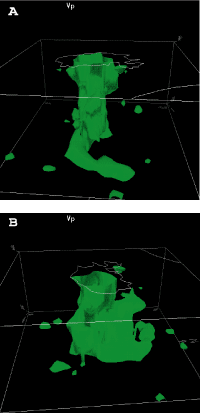
This is the best picture that I know of what they think is the Iceland hotspot. Copyright of this image belongs to its owner.

There is also the thing about the crust in Iceland. But it is believed that part of it might be from a old continent. But majority of it is currently covered with newer layers of rock and sediments. But studies have also suggested (or proved) this. The following papers can be read on this subject.

Older crust underlies Iceland (pdf)
Continental basement under Iceland revealed by old zircons
Continental geochemical signatures in dacites from Iceland and implications for models of early Archaean crust formation (ScienceDirect)

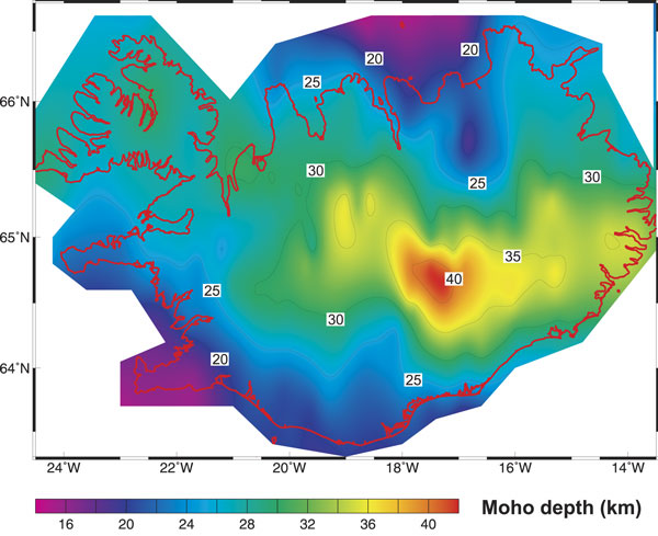
This in part explains the difference in crust thickness when it comes to Iceland.


The thickness of the crust in Iceland. Copyright of this image belongs to its owner.

All pictures above are from this study into the Iceland mantle plume (they are trying to disprove it existence). Iceland & the North Atlantic Igneous Province

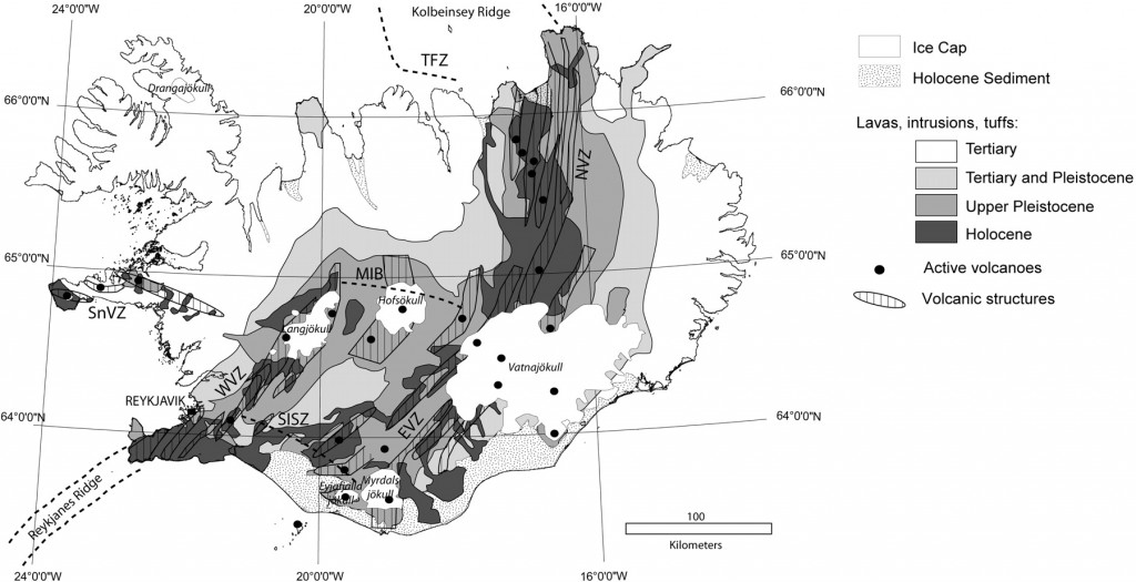
Here is a different map of Iceland volcanoes, fissure swarms and age of the lava fields.


Iceland and its volcanoes. Copyright of this image belongs to its owner. This picture is from this web site here, Post-glacial rebound of Iceland during the Holocene Click on the picture to get full size.


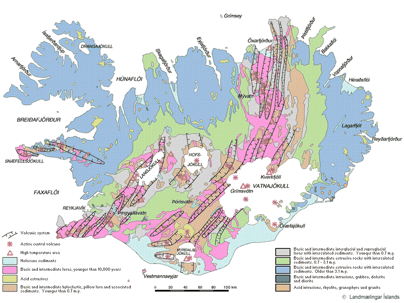
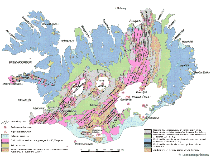
Similar map. But in colour. Copyright of this image belongs to its owner.

I hope that this clear few things up about Iceland and how it works and might work. Since we are still learning and there is a lot of things that we do not know about how Iceland actually functions. But me and professional geologists and scientists are doing there best to learn about how Iceland works.

If there is a claim about Iceland that just sounds crazy, it probably is crazy and not based in any actual fact about Iceland and the geology that makes up Iceland.

Few right and wrong things about geology in Iceland, part 1

I have seen many speculations on how geology works in Iceland. Some of it is good and based on observation and factual basic. Other however is nothing but speculation and far from anything based on factual evidence on how geology works in Iceland.

Few right and wrong things about volcanism in Iceland

Volcano interaction Status: Limited truth to this

Volcano interaction is something of a debated among scientists. But what is not debated is the interaction between volcanoes that lies far apart. That interaction is none by it’s nature. So while I have been seeing discussion in the comments here that there is some connection between activity between Hengill volcano and Hekla volcano. This is untrue. There is no connection between those volcanoes and never has been. The reason is simple. The volcanoes are far apart. They don’t even share the same magma source. But that is evident by the lava that comes from this two volcanoes. But Hekla volcano has mixed types of eruption sometimes. But Hengill volcano only has Hawaii styles eruptions (if not hit by water) when it erupts, in style with other volcanoes on the Reykjanes ridge rift zone.

The only real life examples of volcano interaction are from Bárðarbunga volcano and Torfajökull volcano. The reason for this interaction is quite simple and logical one. Bárðarbunga fissure swarm cuts right trough Torfajökull volcano. When magma travels south-east in the fissure swarm (it last happened in the 15th century) it can hit the magma inside Torfajökull volcano. When this happens there is a big bang in Torfajökull volcano. As the magma in Torfajökull volcano seems to be colder and more Intermediate (andesitic) [link, Wikipedia] in nature. But in Bárðarbunga volcano the magma is Mafic (basaltic) in nature. When the two magmas mix, it ends with a bang and eruption in both volcanoes. But normally the process that starts this is because there is a ongoing eruption in Bárðarbunga volcano. So when Bárðarbunga volcano. I would worry about that rather then anything else.

See, no connection at all between Hekla and Hengill volcano. Copyright belongs too this picture owner. Owner unknown to me.

Iceland is going to have VEI-8 eruption. Status: Not likely.

All volcanoes can do a VEI-8. But the thing is that they are just not likely to do so. As the size of the eruption is directly connected to the inflow of magma it is getting. In the case of Icelandic volcanoes the inflow just seems to be few magnitude too small to make a VEI-8 eruption. The largest VEI eruption known in Iceland was a VEI-6 eruption that took place in Bárðarbunga volcano in the year 1477 (?).

As for VEI-8 eruption. I am not expecting that type of eruption any time soon in Iceland.

Iceland is one volcano. Status: False.

The simple answer is no. The long answer is. Iceland has many volcanoes, not just one. So the answer is no to this.

Geology in Iceland is well understood. Status: False

Geology in Iceland is understood. But far from being fully understood. As it happens geology science is just starting to now understand what complex progress are taking place in Iceland. A lot have been learned. But a lot more needs to be learned about how geology works in Iceland.

Volcano eruptions comes in active cycles. Status: True

This has been observed by actual data. But volcano activity happens in periods of 80 to 160 years. With a quiet period of 50 to 90 years. But numbers are approximation. During the quiet time there are fewer eruptions and they are smaller (hint: Large eruption can still happen however during the quiet period). Last quiet period started in around the year 1870 and did not end until the year 1983. But that year there was a eruption in Grímsfjall volcano. But then Grímsfjall volcano had not erupted since the year 1954, but that break was 29 years long for Grímsfjall volcano.

This graph here also shows this clearly. But this is volcanism in Iceland during the years 1875 and to the year 1993.
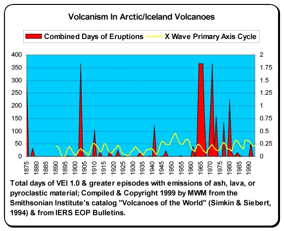

Copyright holder unknown. Copyright of this picture belongs to this owner.

It is impossible to know for sure when the high peak in the current cycle is going to be be. But most geologist are estimating that to be sometimes from the year 2020 and to 2080 or about that. So the years ahead is going to be quite busy in Iceland in the terms of volcano activity.

I am going to write more right and wrongs about Icelandic volcanoes soon. But for now this is good enough.

Sources and other things.

Volcano-tectonic Interaction in the Hengill Region, Iceland during 1993-1998 (pdf)
Volcano geodesy and magma dynamics in Iceland (ScienceDirect)
Interaction between Continental Lithosphere and the Iceland Plume—Sr-Nd-Pb Isotope Geochemistry of Tertiary Basalts, NE Greenland
Tomographic evidence for a narrow whole mantle plume below Iceland (ScienceDirect)
Pdf document on Hengill volcano crustal deformation.
Magma (Wikipedia)
Volcano geodesy and magma dynamics in Iceland (pdf)

Everything has gone quiet again in Iceland

After the eruption in Grímsfjall volcano last week everything has gone quiet again in Iceland. Earthquake activity is currently low and all earthquake activity in volcanoes remains low at current time.

Because of that I am going to take me an little break until I move to Iceland. Unless something of interest happens in Iceland. Part of this time I am going to in the sun here in Denmark and check out the beautiful ladies that populate Denmark (if you are offended by this, then I am sorry for you). 🙂

For those how want to know about my money status. June is going to be rather broke-ish. So all supported is welcomed. But I am not going to request it specially as I have done before. Thanks for the support all. 🙂