There have been rumours that Hekla volcano is about to erupt. This is according to Rúv News, Icelandic Meteorological Office and Icelandic Civil Protection authorities. Currently there are no signs of imminent eruption in Hekla volcano, it’s as quiet as it has been for the past 14 years. That is going to change one day, but at the moment everything is quiet. What is being done now is that Icelandic Authorities are setting up warning signs (new ones) to warn people and provide guidance in advance in the case an eruption starts. Since eruption can and has started with a short notice in Hekla volcano in the past and short notice eruption is going to take place in the future. When that might be is not something that can be predicted at current time.
Geological scientists are also installing more gas monitoring hardware up close to Hekla volcano. They hope to spot changes in gas release some time before an eruption takes place. It is untested if this is going to work. Doing this also has some issues, since weather and wind can make it difficult to detected the gas that comes out from the ground. Along with other issues that I don’t know the details of.
If people want to monitor Hekla volcano them self. They can do so on-line at following internet websites.
Webicorders (The station named Hekla, earthquakes, harmonic tremor appear here)
Web camera Hekla (Heklubyggð, same location as my geophone)
Míla Hekla webcamera (live stream)
Rúv Hekla webcamera (currently not working)
Icelandic Meteorological Office Hekla web-page (Icelandic)
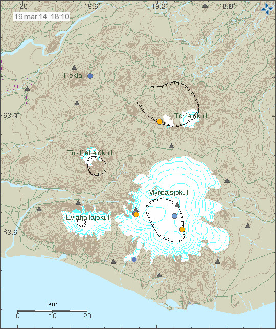
IMO Mýrdalsjökull earthquake map also has Hekla volcano on it (top left). It’s updated every 5. min, and anything that happens in Hekla volcano is going to appear on this page.
If anything happens in Hekla volcano it is going to appear clearly on the above links.
Icelandic Civil Authorities warning sign about what to do if there is an eruption in Hekla volcano. Orignal pdf file can be found here.
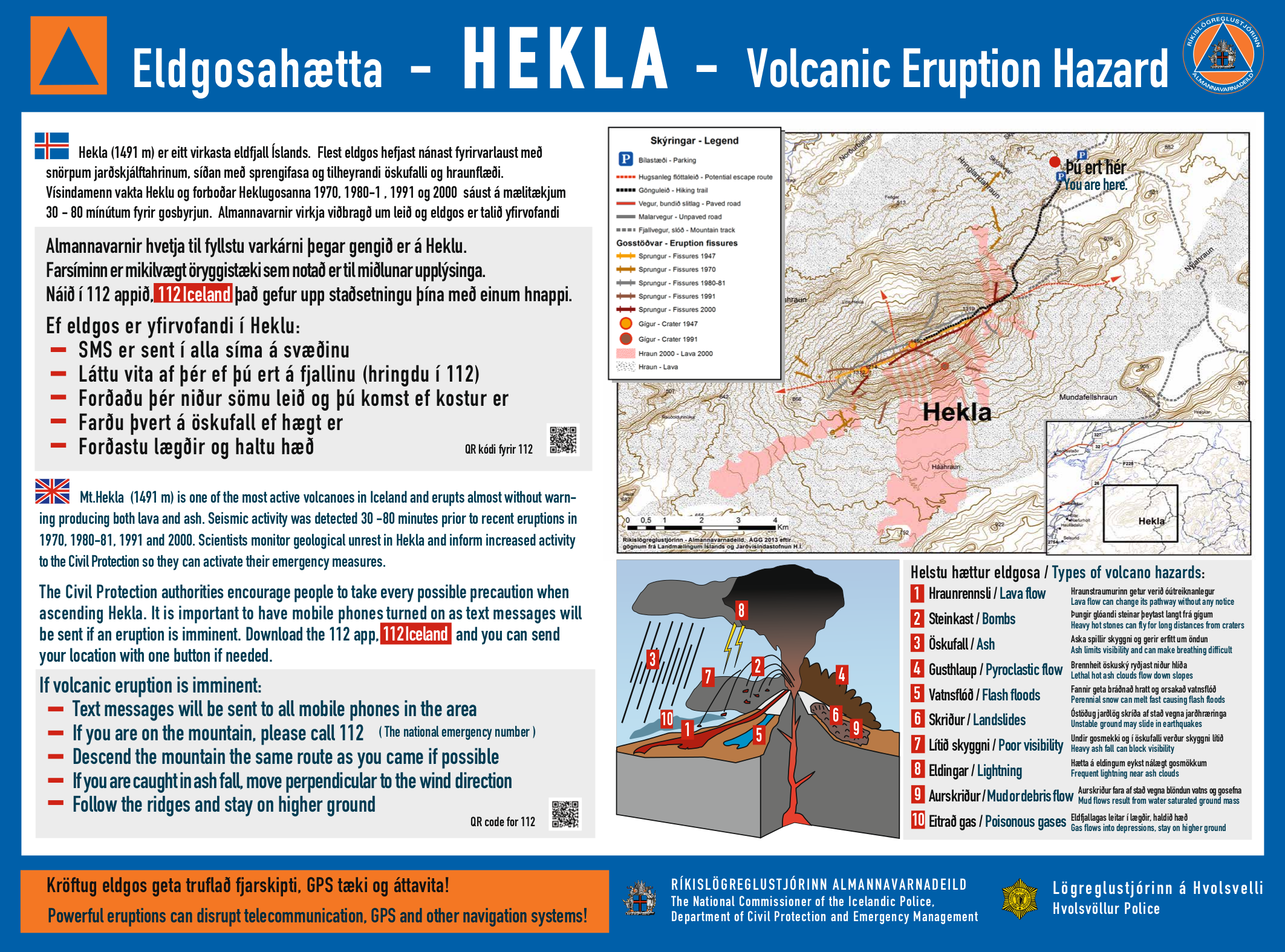
Click on the image for full size. Copyright of this image belongs to Icelandic Civil Authorities (Almannavarnir).
Icelandic and English news of Hekla volcano
Hekla Volcano Eruption Hazard Signs Put Up (Iceland Review)
Engin merki um að Hekla sé að bæra á sér (Rúv.is, Icelandic)
Gasmælingar aukast við Heklu (Visir.is, picture of a gas monitoring station, Icleandic)