This is a short update on Bárðarbunga volcano activity.
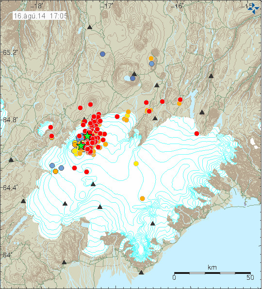
Earthquake activity continues in Bárðarbunga volcano and shows no signs of slowing down. Two swarms have appeared in Bárðarbunga volcano system. One is at location called Kistufell, while the second one is at the south-east part of the Bárðarbunga volcano. Increase in earthquake activity in south-east part of Bárðarbunga volcano seems to increase harmonic tremor. I am not sure why that is. As of now (when this is written) no eruption has been confirmed in Bárðarbunga volcano, the volcano is under glacier so confirmation is difficult at best.
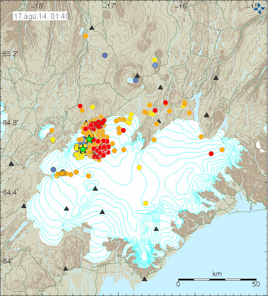
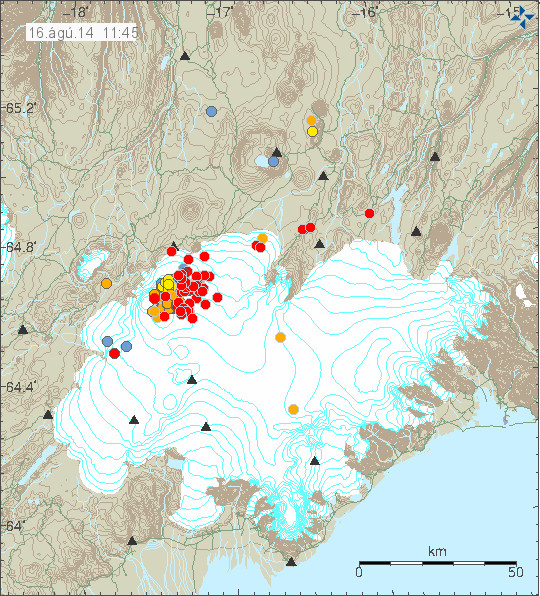
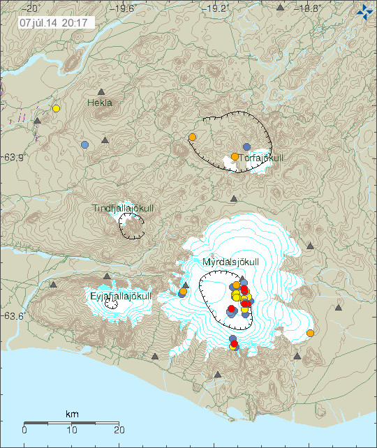
Earthquake activity in Bárðarbunga volcano. The two groups of earthquake swarms are visible on this map. Copyright of this image belongs to Icelandic Met Office.
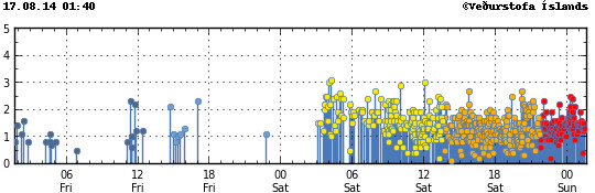
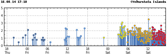
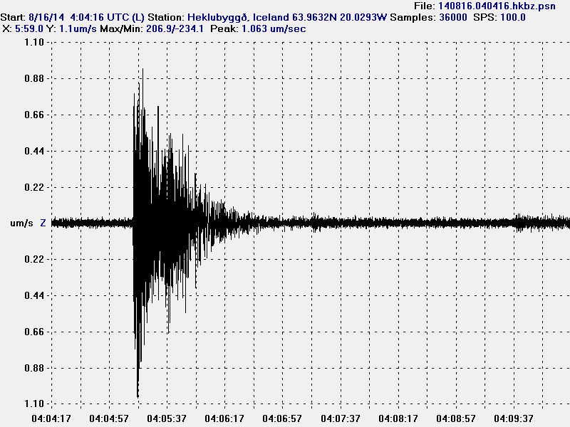
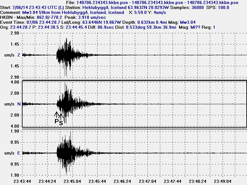
Earthquake activity has been dense as can be seen here. Copyright of this image belongs to Icelandic Met Office.
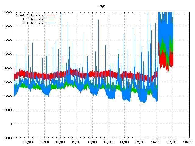
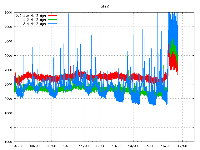
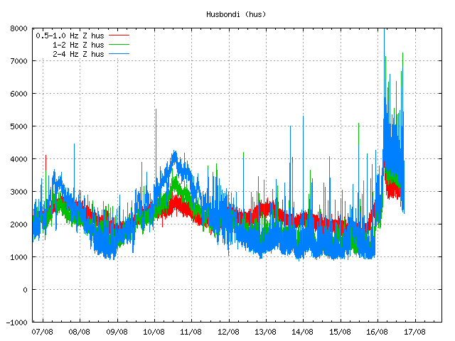
Harmonic tremor remains high on the Dyngjuháls SIL station. Why that is not clear at the moment. Copyright of this image belongs to Icelandic Met Office.
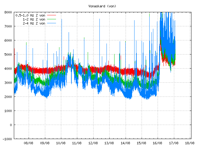
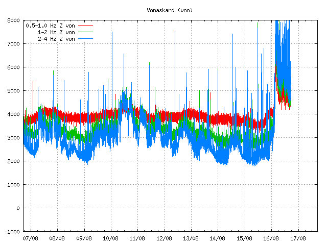
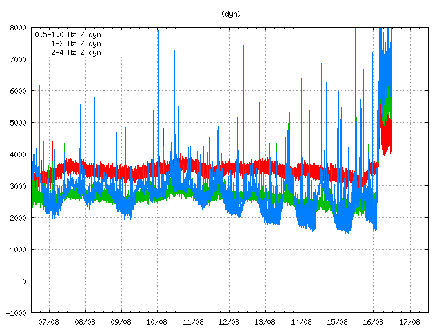
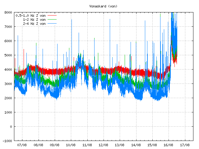
Harmonic tremor remains high at Vonarskarð SIL station. It has dropped little during the day, but it remains constant at current time. Copyright of this image belongs to Icelandic Met Office.
So far no major eruption has started in Bárðarbunga volcano. That might change without warning as this activity continues. There is a risk of large earthquakes taking place before such eruption. Since the crust in this part of Iceland is thick (up to 40 km thick) and last eruption in Bárðarbunga volcano took place in the year 1794. The eruption in the year 1910 took place in a volcano named Hamarinn and is south-west of Bárðarbunga volcano. Fissure eruptions are also a feature that Bárðarbunga volcano has, if this activity is going to result in such eruption is something that is impossible to know at current time.
Current status changes fast. I post new information on this activity as needed and as things get more clearer on what is happening.