This information is going to get outdated quickly.
About how I work my data
I do all my data work in my head. Since I don’t have the computer power or the programming skills do so in normal computer. This is generally refereed as “thought experiments” I think. The data set for Bárðarbunga volcano are now huge and it takes me a while to update them and work out what I am seeing.
Caldera collapse is in progress in Bárðarbunga volcano
I know that scientists in Iceland don’t want to mention this in the news and are still hoping for current sequence of events to stop. That is not going to happen, it was already to late when the magma found a way out of the magma chamber on 16-August-2014, all that can be done now is to plan for the eventual collapse of Bárðarbunga volcano into a new caldera. I don’t expect the mountain to make it based on current earthquake activity. Eruptions should also be expected without warning around the circle that the earthquakes have now formed around the magma chamber that is collapsing in Bárðarbunga volcano.
Bárðarbunga volcano is however not going to collapse quickly, while the eruption once it starts in Bárðarbunga volcano is only going to last 1 week at the longest. This type of events takes several weeks to months from start to end. When Askja volcano collapsed in 1875 it started sometimes in the year 1874 and did not end until October 1875 (Global Volcanism Program says 1. Jan, 1875 to 1875, 17 Oct.). So this might take more than six months from start to end and might not end until sometimes next year (2015). There is also a chance this collapse is going to take just several weeks. There is no way to know for sure how long this is going to take, since it depends on many unknown factors. There is also a factor that no caldera collapse has taken place in Iceland since modern recording and monitoring of volcanoes started in Iceland (around 1970).
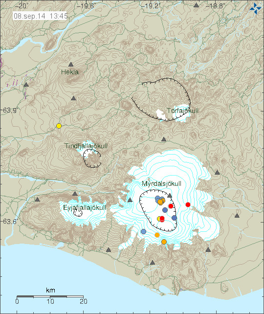
Current status of the Bárðarbunga volcano
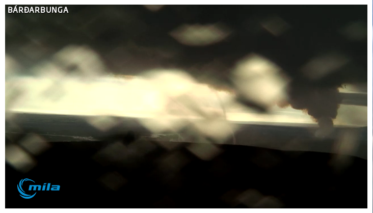
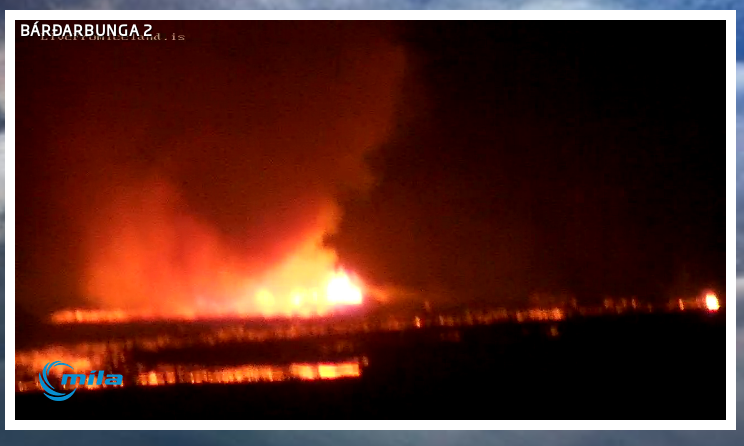
- Eruption continues in Holuhraun lava field. Most of the craters have now stopped erupting and one is now just emitting gas according to latest reports today.
- Power of the eruption in Holuhraun is about the same since it started, even if there are fewer vents erupting lava at the moment.
- Visibility has been limited today due to bad weather in the highland of Iceland.
- SO2 levels in populated areas in east Iceland did go up to 2550µg/m³ around 15:00 UTC in Reyðjarfjöður village. Health warning was issued for the area during the peak of the SO2 pollution.
- Largest earthquakes today had the magnitude of 5,5 at 05:25 UTC, second largest earthquake today had the magnitude of 4,8 at 15:51 UTC. Other earthquakes have been smaller. There is now less earthquake activity taking place since magma is not breaking as much crust as before.
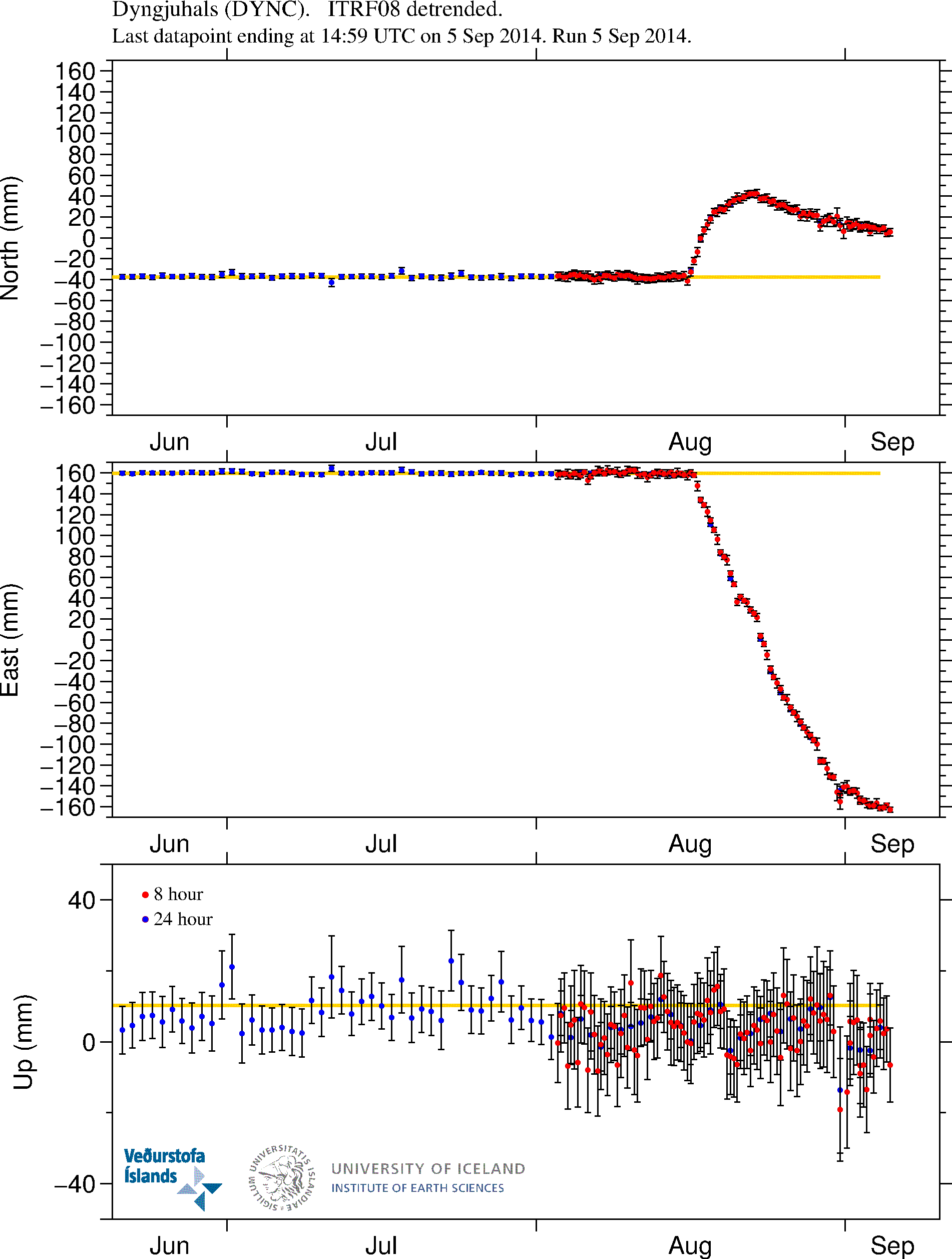
- The caldera has now dropped some 20 meters according to last measurements taken when there was a flight over Bárðarbunga volcano.
- There continues to be earthquake in the dyke, most of it is in area that is covered with glacier.
- Eruption in Hamarinn (Loki-Fögrufjöll) volcano is now a possibility. It might start without warning and without any earthquake activity, or just little earthquake activity.
- Dyke activity might start to go south of Bárðarbunga volcano. It has not happened yet, but there is a high risk of it in my personal view.
- This is creating stress changes around Bárðarbunga volcano. There is a minimal risk of that starting an eruption in other volcano systems that are nearby. It is not likely to happen, but the possibility is there. The reason is that Bárðarbunga volcano is a large volcano, the second biggest in Iceland in my view. With Hofsjökull volcano being the largest in Iceland in my view.
- The lava field continues to block the glacier river Jökulsá á Fjöllum. As this progresses there is going to be a natural dam in this area after few days.
- Seven minor eruptions have been confirmed according to the news today (on Rúv). This is besides the eruptions that where in the glacier free area (and are still ongoing). None of those eruptions seems to have lasted for long.
- Based on harmonic tremor I think pressure is again increasing in Bárðarbunga volcano magma chamber system. This does not appear to be resulting in more powerful eruption in Holuhraun. That is why I think there is increased risk of new dyke to start forming.
- Gas output from the eruption in Holuhraun remains high and it is extremely dangerous to go there. The lava field is also creating a lot of local weather in good weather. That also makes this dangerous. This eruption is no place for tourist.
Updates
Updates go here when they happen.
News bits
I am going to add news here in case anything happens.
References list
Caldera (Wikipedia)
Modelling Caldera Collapse (OSU)
Caldera (Science Daily)