This information is going to get outdated quickly. Minor spelling note. It appears that dike is spelled with a simple “i” not a “y”. Information on what volcano dyke is can be found here on USGS website. Added: That is in U.S English, UK English uses Dyke so I am going to use UK English. Thanks to Squonk to pointing me to this information.
Special note on Askja volcano
There are many people speculating that the dyke might reach into Askja volcano. I find that to be unlikely outcome. That does not appear to have happen in the past and I don’t think the geology setting allows for it. The area is full of old dykes that have cooled into granite type of rock (and other hard types of rock) in the crust (this is a volcano area and I find this to be likely). Given the density and how hard granite is I find it unlikely that this magma is going to break it. It has been crossing softer rock in the crust for the past week. What I can’t rule out is that Bárðarbunga volcano might start an eruption in Askja volcano by some other mechanism that might or might not be well understood. Askja volcano did start to prepare for eruption cycle in the year 2010 (earthquake swarm at 20 km depth was the clue), but the process appears to be slow, at least the volcano doesn’t appear to be ready for an eruption as things look now.
Special note on Tungnafellsjökull volcano
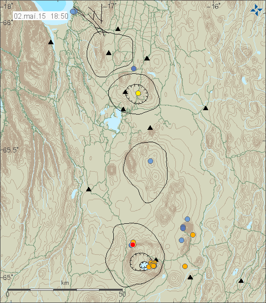
Yesterday (24-August-2014) an magnitude 3,0 earthquake took place in Tungafellsjökull volcano, a small volcano west of Bárðarbunga volcano. There had been few other earthquakes also yesterday, just smaller. Currently there is nothing suggesting that Tungafellsjökull volcano is about to erupt. There has been earthquake activity taking place in Tungafellsjökull volcano during the past year, suggesting that the volcano is experiencing flow of new magma at depth (more then 15 km depth), but there isn’t anything to suggest that an eruption is imminent in it. There is also a good chance that current earthquake activity in Tungafellsjökull volcano is due to stress changes in the crust that are taking place due to the caldera of Bárðarbunga volcano is getting lower (more on that later in this article). I don’t think Bárðarbunga volcano is able to start an eruption in Tungnafellsjökull volcano, but this is also an volcano that has never erupted during historical times and current data suggest it might not have erupted at all during the last 10.000 years (or more). Tungafellsjökull volcano is located west of Bárðarbunga volcano, it has a green star on it currently (as of this writing) on Icelandic Met Office earthquake maps.
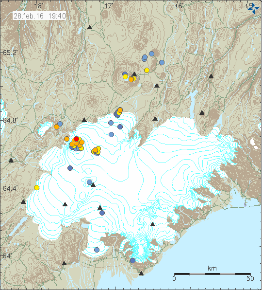
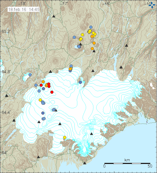
Bárðarbunga volcano update
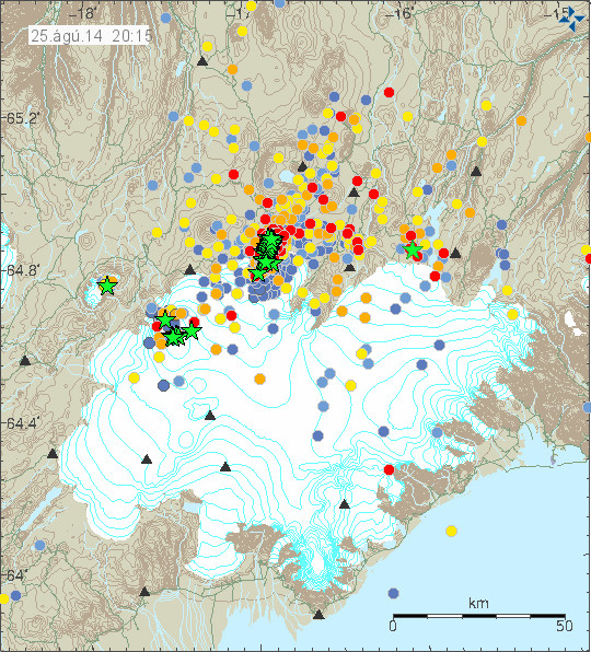
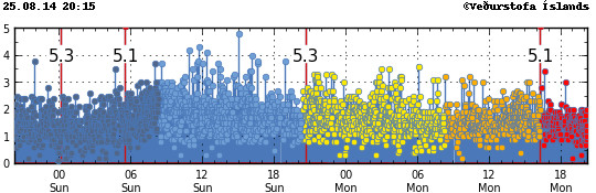
Earthquake activity remains strong in Bárðarbunga volcano. Medium sized (magnitude 5,0 – 5,9) earthquakes (more information here)) have been taking place as the caldera gives away due to outflow of magma from the magma chamber in Bárðarbunga volcano. This appears to be happening due to less inflow of magma from depth (the mantle). The crust in this part of Iceland is up to 46 km thick due the mantle plume beneath it (more information in details here, warning a large pdf file). The lowering of the caldera is creating stress changes in the area. What the end result of that is going to be I don’t know, since the crust is slower to respond, but as more stress is build up in the area this way stronger earthquakes can be expected at later time.
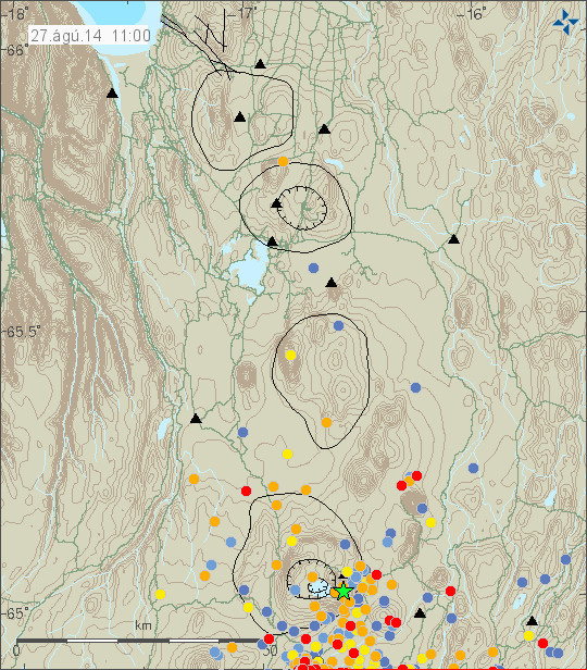
Currently the dyke is now at location that last erupted in the year 1797, it has remained bit unclear if it was Bárðarbunga or Askja that started that eruption. Chemical analyse says the lava is from Bárðarbunga volcano, not Askja volcano. This is according to the news I did hear today. Currently the dike north end is now 20 km east of Trölladyngja. Earthquake activity has been picking up and increasing in that area for the past 24 hours. It however doesn’t appear to be as high as it is on the main area of the dyke (about 20 km ENE of Kistufell, north of Dyngjujökull glacier, just check the earthquake map if you are confused by this).
The earthquake activity for the past 48 hours in Bárðarbunga volcano. Green stars show earthquakes with higher magnitudes then 3,0. Copyright of this image belongs to Icelandic Met Office.
The earthquake activity during the past 48 hours in Bárðarbunga volcano has been dense. Copyright of this image belongs to Icelandic Met Office.
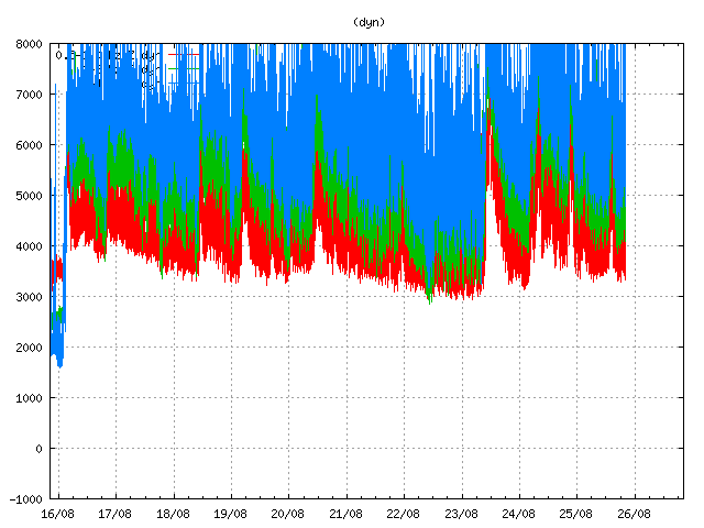
Harmonic tremor remains high on Dyngjuháls SIL station. It goes up and down in accordance with the magma inflow into the dike. Copyright of this image belongs to Icelandic Met Office.
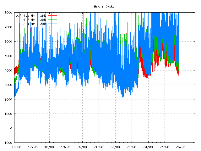
Harmonic tremor is also high on Askja SIL station. Same movement can be seen as on Dyngjuháls SIL station. Copyright of this image belongs to Icelandic Met Office.

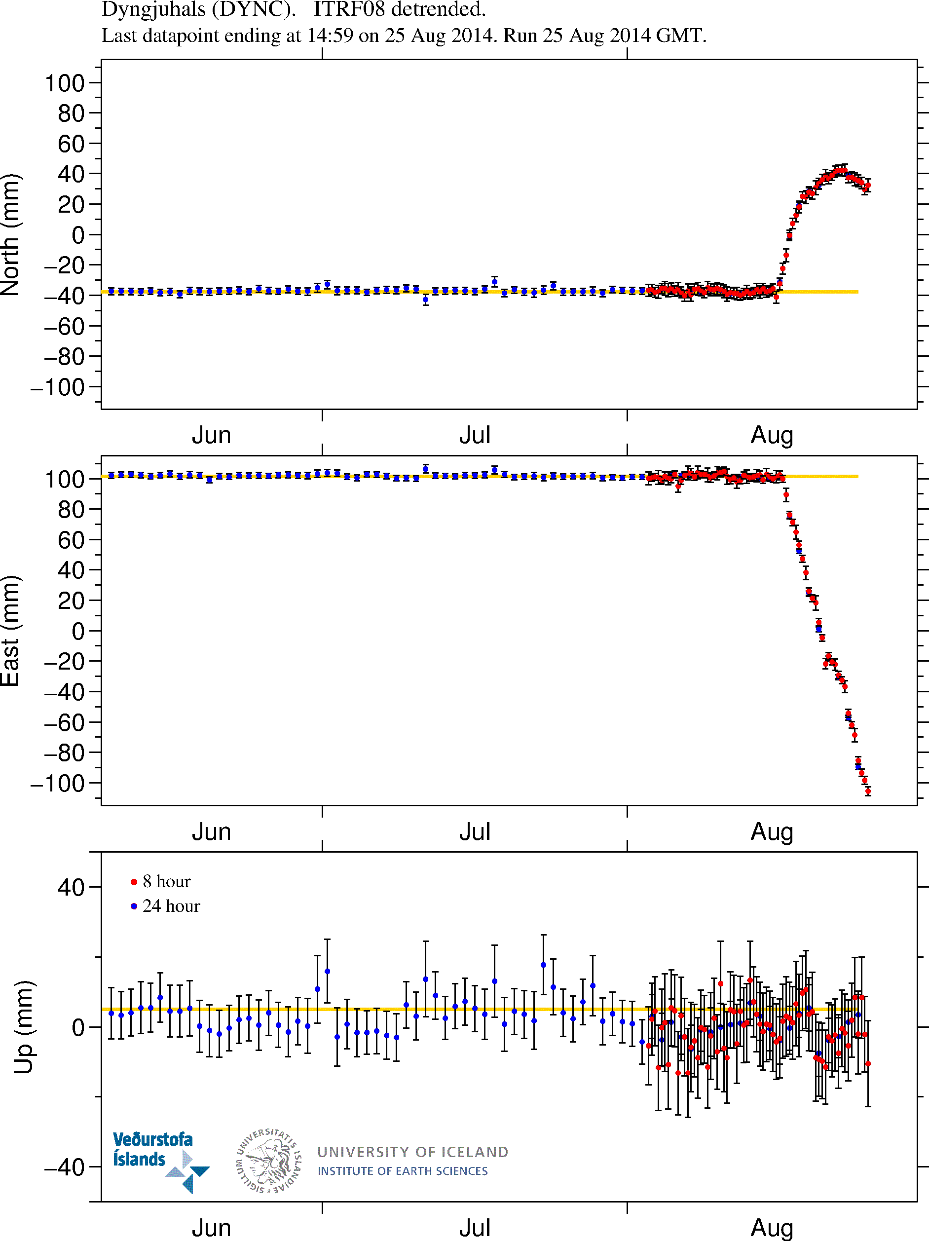
GPS data shows that more magma has flowed into the dyke during the past 24 hour. More GPS stations can be found here. Copyright of this image belongs to University of Iceland.
In the news today in Iceland I have seen that there is now some discussion that this dyke might not erupt at all. Since it appears both to be getting deeper in some areas and there are currently no signs of it going upwards. The problem with this is the idea is in my view based on wrong parameters so I don’t agree with it. This dyke is going to erupt in my view, it is just a matter of time now. It might not erupt, that is always a possibility. I just think it is highly unlikely to be the outcome of all of this. This dyke is going to continue making a path for it self until it hits a resistance in the crust it cannot break after that it is going to go up, since its easier path for it, rather then to go down into the crust where its path has more resistance. When that might happen is something that I do not know.
Article updated at 21:03 UTC.
Article updated at 21:26 UTC.
Article updated at 00:13 UTC on 26-August-2014.
Article updated at 10:35 UTC on 26-August-2014.